Ouse Fen

Downs, Moorland in Cambridgeshire South Cambridgeshire

England

Ouse Fen

St Mary’s Church, Over A Grade I listed building with C13th origins but mainly early C14th, see: <span class="nowrap"><a title="https://britishlistedbuildings.co.uk/101317811-church-of-st-mary-over" rel="nofollow ugc noopener" href="https://britishlistedbuildings.co.uk/101317811-church-of-st-mary-over">Link</a><img style="margin-left:2px;" alt="External link" title="External link - shift click to open in new window" src="https://s1.geograph.org.uk/img/external.png" width="10" height="10"/></span> .
Photo taken during the 2021 sponsored cycle ride in aid of Cambridgeshire Historic Churches Trust (<span class="nowrap"><a title="https://camhct.uk/" rel="nofollow ugc noopener" href="https://camhct.uk/">Link</a><img style="margin-left:2px;" alt="External link" title="External link - shift click to open in new window" src="https://s1.geograph.org.uk/img/external.png" width="10" height="10"/></span> ). Next stop: <a href="https://www.geograph.org.uk/photo/6963611">TL3669 : St Andrew's Church, Swavesey</a>.
St Mary’s Church, Over Credit: Martin Tester

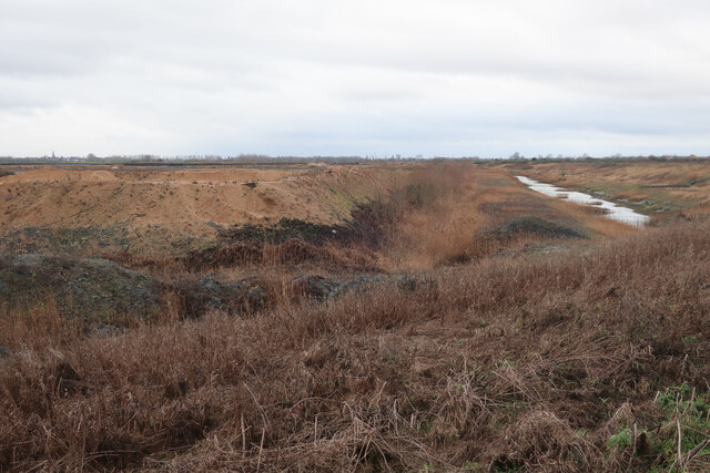
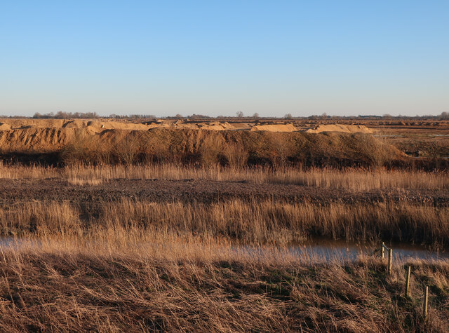
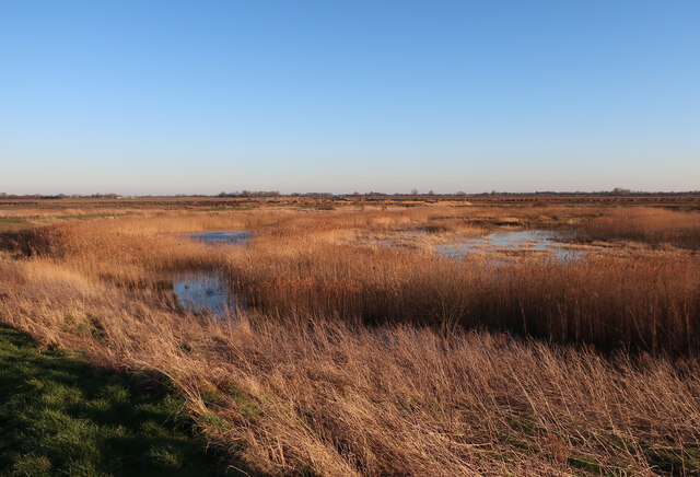
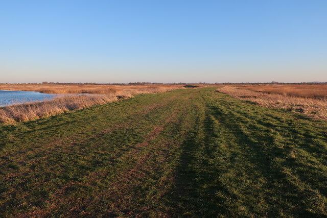
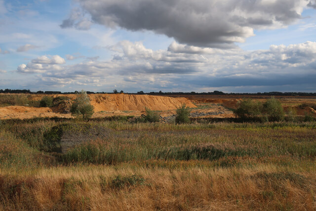
Ouse Fen is a nature reserve located in Cambridgeshire, England. Situated near the village of Needingworth, it is part of the larger Fen Drayton Lakes complex. Ouse Fen covers an area of approximately 500 hectares and is comprised of diverse habitats, including wetlands, grasslands, and scrubland.

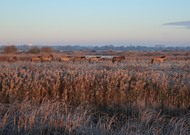
The reserve is renowned for its rich biodiversity and is home to a wide variety of flora and fauna. The wetlands at Ouse Fen provide a breeding ground for numerous bird species, including bitterns, marsh harriers, and bearded tits. These wetlands are carefully managed to maintain the ideal conditions for these species to thrive.

The grasslands and scrubland areas of Ouse Fen are home to a range of reptiles, mammals, and insects. Visitors to the reserve may spot species such as grass snakes, water voles, and butterflies. The management of these habitats is crucial for maintaining the delicate balance of the ecosystem.

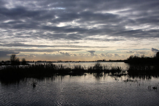
Ouse Fen also plays an important role in flood prevention. The reserve acts as a natural flood storage area, helping to alleviate the risk of flooding in surrounding areas during periods of heavy rainfall.

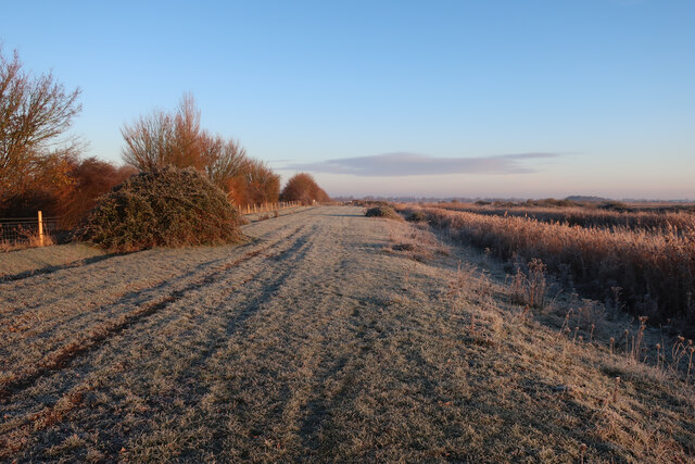
The reserve offers a network of well-maintained footpaths and bird hides, allowing visitors to explore and observe the diverse wildlife. Educational events and guided walks are also organized to enhance visitors' understanding of the reserve's ecological importance.

Overall, Ouse Fen is a valuable natural habitat, providing a sanctuary for a wide range of species and offering visitors the opportunity to experience the beauty and diversity of Cambridgeshire's countryside.

If you have any feedback on the listing, please let us know in the comments section below.

Ouse Fen Images

Images are sourced within 2km of 52.333861/0.017388249 or Grid Reference TL3772. Thanks to Geograph Open Source API. All images are credited.

St Mary’s Church, Over A Grade I listed building with C13th origins but mainly early C14th, see: <span class="nowrap"><a title="https://britishlistedbuildings.co.uk/101317811-church-of-st-mary-over" rel="nofollow ugc noopener" href="https://britishlistedbuildings.co.uk/101317811-church-of-st-mary-over">Link</a><img style="margin-left:2px;" alt="External link" title="External link - shift click to open in new window" src="https://s1.geograph.org.uk/img/external.png" width="10" height="10"/></span> .
Photo taken during the 2021 sponsored cycle ride in aid of Cambridgeshire Historic Churches Trust (<span class="nowrap"><a title="https://camhct.uk/" rel="nofollow ugc noopener" href="https://camhct.uk/">Link</a><img style="margin-left:2px;" alt="External link" title="External link - shift click to open in new window" src="https://s1.geograph.org.uk/img/external.png" width="10" height="10"/></span> ). Next stop: <a href="https://www.geograph.org.uk/photo/6963611">TL3669 : St Andrew's Church, Swavesey</a>.
St Mary’s Church, Over
A Grade I listed building with C13th origins but mainly early C14th, see: LinkExternal link . Photo taken during the 2021 sponsored cycle ride in aid of Cambridgeshire Historic Churches Trust (LinkExternal link ). Next stop: TL3669 : St Andrew's Church, Swavesey.
The porch of St Mary's Church, Over A Grade I listed building with C13th origins but mainly early C14th, see: <span class="nowrap"><a title="https://britishlistedbuildings.co.uk/101317811-church-of-st-mary-over" rel="nofollow ugc noopener" href="https://britishlistedbuildings.co.uk/101317811-church-of-st-mary-over">Link</a><img style="margin-left:2px;" alt="External link" title="External link - shift click to open in new window" src="https://s1.geograph.org.uk/img/external.png" width="10" height="10"/></span> . The porch is remarkably large & ornate. 
Photo taken during the 2021 sponsored cycle ride in aid of Cambridgeshire Historic Churches Trust (<span class="nowrap"><a title="https://camhct.uk/" rel="nofollow ugc noopener" href="https://camhct.uk/">Link</a><img style="margin-left:2px;" alt="External link" title="External link - shift click to open in new window" src="https://s1.geograph.org.uk/img/external.png" width="10" height="10"/></span> ). Next stop: <a href="https://www.geograph.org.uk/photo/6963611">TL3669 : St Andrew's Church, Swavesey</a>.
The porch of St Mary's Church, Over
A Grade I listed building with C13th origins but mainly early C14th, see: LinkExternal link . The porch is remarkably large & ornate. Photo taken during the 2021 sponsored cycle ride in aid of Cambridgeshire Historic Churches Trust (LinkExternal link ). Next stop: TL3669 : St Andrew's Church, Swavesey.
St Mary, Bluntisham: late September 2021
Approaching the junction of the A1123 with Holliday's Road
Fields by Middle Way
Middle Way
Middle Way
Middle Way
Middle Way
Field by West Fen Road
Ditch by West Fen Road
Gravel works by Ouse Fen The Hanson sand and gravel quarry is being turned into wetland habitat by the RSPB after each area is completed.
Gravel works by Ouse Fen
The Hanson sand and gravel quarry is being turned into wetland habitat by the RSPB after each area is completed.
Gravel quarry by Ouse Fen Once the quarrying is done the area will be profiled into a further wetland cell and added to the nature reserve. It was previously arable land <a href="https://www.geograph.org.uk/photo/4134384">TL3973 : Wheat field by Long Holme Drove</a>
Gravel quarry by Ouse Fen
Once the quarrying is done the area will be profiled into a further wetland cell and added to the nature reserve. It was previously arable land TL3973 : Wheat field by Long Holme Drove
Long Holme (Cell 7), Ouse Fen RSPB Former sand and gravel quarry, and arable land before that.
Long Holme (Cell 7), Ouse Fen RSPB
Former sand and gravel quarry, and arable land before that.
Path at Ouse Fen One of the reserve paths from the car park at the north end.
Path at Ouse Fen
One of the reserve paths from the car park at the north end.
Houses at Bluntisham A semi-detached pair at the junction of Holliday's Road with Rectory Road [A1123]. The RH one looks as if it has nest boxes for swifts, or other birds, under the eaves?
Houses at Bluntisham
A semi-detached pair at the junction of Holliday's Road with Rectory Road [A1123]. The RH one looks as if it has nest boxes for swifts, or other birds, under the eaves?
Quarry works by Ouse Fen The sand and gravel quarry is lowering the ground level, with the resilting pits being landscaped into a series of wetland cells. These are handed over to the RSPB who manage them, mostly for reedbeds.
Quarry works by Ouse Fen
The sand and gravel quarry is lowering the ground level, with the resilting pits being landscaped into a series of wetland cells. These are handed over to the RSPB who manage them, mostly for reedbeds.
Konik Ponies at Ouse Fen A relatively recent addition to the reserve. Coming out of the reedbed for a daily check.
Konik Ponies at Ouse Fen
A relatively recent addition to the reserve. Coming out of the reedbed for a daily check.
Cuckoo Fen North Cell 2 in Ouse Fen RSPB, where a gravel quarry is being gradually turned in a reedbed reserve.
Cuckoo Fen North
Cell 2 in Ouse Fen RSPB, where a gravel quarry is being gradually turned in a reedbed reserve.
Path in Ouse Fen
Path in Ouse Fen
Show me another place!

Ouse Fen is located at Grid Ref: TL3772 (Lat: 52.333861, Lng: 0.017388249)

Administrative County: Cambridgeshire

District: South Cambridgeshire

Police Authority: Cambridgeshire

What 3 Words

///marketing.endings.outlined. Near Over, Cambridgeshire

Related Wikis

New Bedford River

The New Bedford River, also known as the Hundred Foot Drain because of the distance between the tops of the two embankments on either side of the river...

Cambridgeshire

Cambridgeshire (abbreviated Cambs.) is a ceremonial county in the East of England and East Anglia. It is bordered by Lincolnshire to the north, Norfolk...

List of Sites of Special Scientific Interest in Cambridgeshire

Cambridgeshire is a county in eastern England, with an area of 339,746 hectares (1,312 sq mi) and a population as of mid-2015 of 841,218. It is crossed...

List of local nature reserves in Cambridgeshire

Cambridgeshire is a county in eastern England, with an area of 1,308 square miles (3,390 km2) and a population as of 2011 of 708,719. It is crossed by...

Bluntisham

Bluntisham is a village and civil parish in Cambridgeshire, England. The population of the civil parish at the 2011 census was 2,003. Bluntisham lies approximately...

Earith

Earith is a village and civil parish in Cambridgeshire, England. Lying approximately 10 miles (16 km) east of Huntingdon, Earith is situated within Huntingdonshire...

Berry Fen

Berry Fen is a 15.3-hectare (38-acre) biological Site of Special Scientific Interest on the western outskirts of Earith in Cambridgeshire.This neutral...

Bluntisham railway station

Bluntisham railway station was a station in Bluntisham, Cambridgeshire on the Ely and St Ives Railway. The station closed for regular passenger services...

Nearby Amenities

Located within 500m of 52.333861,0.017388249
Access: no
Barrier: kissing_gate
Foot: designated
Lat/Long: 52.334701/0.0101768
Crossing: unmarked
Lat/Long: 52.3347779/0.0147886
Waterway: sluice_gate
Lat/Long: 52.3312183/0.0159101
Bird lookout
Tourism: viewpoint
Lat/Long: 52.3316657/0.0217975
Crossing: unmarked
Lat/Long: 52.3342983/0.023366
Barrier: kissing_gate
Bicycle: no
Foot: permissive
Horse: no
Locked: no
Motor Vehicle: no
Lat/Long: 52.3312938/0.0143852
Access: yes
Barrier: kissing_gate
Bicycle: permissive
Foot: permissive
Horse: permissive
Motor Vehicle: no
Lat/Long: 52.3340364/0.014454
Bench
Backrest: no
Material: wood
Lat/Long: 52.3318793/0.0218583
The data included in this document is from www.openstreetmap.org. The data is made available under ODbL.

Have you been to Ouse Fen?

Leave your review of Ouse Fen below (or comments, questions and feedback).