Dyke Moor

Downs, Moorland in Cambridgeshire Fenland

England

Dyke Moor

Barway farm approach road Barway farm approach road
Barway farm approach road Credit: Shaun Ferguson

Dyke Moor is a picturesque area located in Cambridgeshire, England, renowned for its stunning downs and moorland landscapes. Spanning over a vast expanse of approximately 200 acres, it offers a diverse range of habitats and natural features.

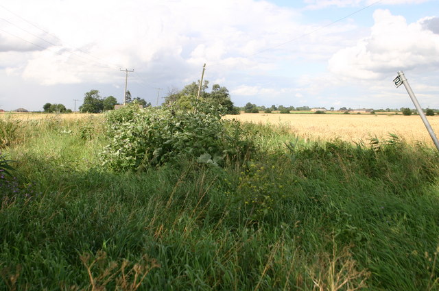
The moorland itself is characterized by its open, treeless terrain, covered in a thick carpet of heather, grasses, and scattered patches of gorse. This unique vegetation provides a perfect habitat for a variety of bird species, including skylarks and stonechats. The moorland is also home to several species of butterflies and insects, adding to its ecological diversity.

The downs, on the other hand, offer a completely different landscape. These rolling hills, covered in lush green grasses and dotted with ancient hedgerows and small woodlands, create a picturesque countryside scene. The downs are not only aesthetically pleasing but also serve as important grazing land for livestock.

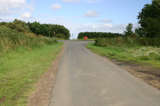
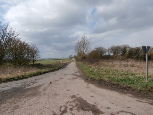
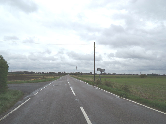
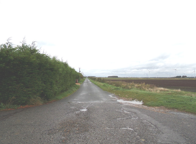
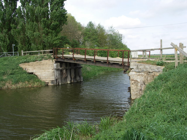
Dyke Moor is crisscrossed by a network of footpaths, allowing visitors to explore the area and appreciate its natural beauty. These paths offer breathtaking views of the surrounding countryside, making it an ideal destination for nature enthusiasts, hikers, and photographers.

The moorland and downs of Dyke Moor are protected areas, ensuring the preservation of their unique ecosystems for future generations. Whether it be the open expanse of the moorland or the rolling hills of the downs, Dyke Moor offers a tranquil and captivating experience for anyone seeking to immerse themselves in the beauty of Cambridgeshire's natural landscapes.

If you have any feedback on the listing, please let us know in the comments section below.

Dyke Moor Images

Images are sourced within 2km of 52.490676/0.018754351 or Grid Reference TL3790. Thanks to Geograph Open Source API. All images are credited.

Barway farm approach road Barway farm approach road
Barway farm approach road
Overgrown public byway off Dykemoor Drove Overgrown public byway off Dykemoor Drove
Overgrown public byway off Dykemoor Drove
Dykemoor Drove junction with Primrose Hill Dykemoor Drove junction with Primrose Hill
Dykemoor Drove junction with Primrose Hill
Beezling pumping station Beezling pumping station
Beezling pumping station
Forty Foot Drain by Beezling Fen Forty Foot Drain by Beezling Fen
Forty Foot Drain by Beezling Fen
Households Farm on Benwick Mere Although still shown as a farm on O.S. mapping all the buildings appear to have been demolished when viewed on Google Earth
Households Farm on Benwick Mere
Although still shown as a farm on O.S. mapping all the buildings appear to have been demolished when viewed on Google Earth
J Everitt and Sons The firm of J Everitt and Sons holds a Royal Warrant from Queen Elizabeth II as 'Supplier of Hay, Straw, Horse Feeds & Bedding'. <span class="nowrap"><a title="https://www.royalwarrant.org/company/j-everitt-sons" rel="nofollow ugc noopener" href="https://www.royalwarrant.org/company/j-everitt-sons">Link</a><img style="margin-left:2px;" alt="External link" title="External link - shift click to open in new window" src="https://s1.geograph.org.uk/img/external.png" width="10" height="10"/></span> The Royal Arms are proudly displayed on the fence.  A wrought iron sign lists some of the products they deal in such as 'Picasso pots'.
J Everitt and Sons
The firm of J Everitt and Sons holds a Royal Warrant from Queen Elizabeth II as 'Supplier of Hay, Straw, Horse Feeds & Bedding'. LinkExternal link The Royal Arms are proudly displayed on the fence. A wrought iron sign lists some of the products they deal in such as 'Picasso pots'.
Dykemoor Drove We're in Fenland, and this means some largely featureless squares.  No wonder all the handful of pictures of this square so far are of Dykemoor Drove, whose junction with Primrose Hill (where this photograph was taken) is almost the only point of interest in it.
Dykemoor Drove
We're in Fenland, and this means some largely featureless squares. No wonder all the handful of pictures of this square so far are of Dykemoor Drove, whose junction with Primrose Hill (where this photograph was taken) is almost the only point of interest in it.
Forty Foot Drain from Leonard Childs Bridge There are precious few landmarks on the road from Doddington to Chatteris.  The almost dead-straight (there is a slight kink at this bridge) Forty Foot Drain is the most notable geographical feature.
Forty Foot Drain from Leonard Childs Bridge
There are precious few landmarks on the road from Doddington to Chatteris. The almost dead-straight (there is a slight kink at this bridge) Forty Foot Drain is the most notable geographical feature.
View west along the Forty Foot Drain at Leonard Childs Bridge
Floods Ferry Road, Ranson Moor, March Approaching the junction with the B1093 Doddington Road at Copalder Corner
Floods Ferry Road, Ranson Moor, March
Approaching the junction with the B1093 Doddington Road at Copalder Corner
B1093 Doddington Road, Ranson Moor, March At the junction with Floods Ferry Road at Copalder Corner
B1093 Doddington Road, Ranson Moor, March
At the junction with Floods Ferry Road at Copalder Corner
Roadsigns on the B1093 Doddington Road At the junction with Floods Ferry Road at Copalder Corner
Roadsigns on the B1093 Doddington Road
At the junction with Floods Ferry Road at Copalder Corner
Floods Ferry Road, Foods Ferry At the junction with the B1093 Doddington Road at Copalder Corner
Floods Ferry Road, Foods Ferry
At the junction with the B1093 Doddington Road at Copalder Corner
B1093 Benwick Road, Doddington At the junction with Dykemoor Drove
B1093 Benwick Road, Doddington
At the junction with Dykemoor Drove
Dykemoor Drove, Doddington At the junction with the B1093 Benwick Road
Dykemoor Drove, Doddington
At the junction with the B1093 Benwick Road
B1093 Benwick Road, Doddington At the junction with Parsons Land Drove
B1093 Benwick Road, Doddington
At the junction with Parsons Land Drove
Parsons Land Drove, Doddington At the junction with the B1093 Benwick Road
Parsons Land Drove, Doddington
At the junction with the B1093 Benwick Road
Show me another place!

Dyke Moor is located at Grid Ref: TL3790 (Lat: 52.490676, Lng: 0.018754351)

Division: Isle of Ely

Administrative County: Cambridgeshire

District: Fenland

Police Authority: Cambridgeshire

What 3 Words

///surfer.newsreel.bluff. Near Doddington, Cambridgeshire

Nearby Locations

Dyke Moor Fields End Pond

Related Wikis

Swingbrow

Swingbrow (sometimes written Swing Brow) is a hamlet near to Chatteris , Cambridgeshire lying alongside the Forty Foot Drain built by Vermuyden. A Neolithic...

Doddington, Cambridgeshire

Doddington is a village and civil parish lying just off the A141 in the Isle of Ely, Cambridgeshire, approximately half way (4 miles (6 km)) between Chatteris...

Benwick

Benwick is a village and civil parish in the Fenland district of Cambridgeshire, England. It is approximately 15 miles (24 km) from Peterborough and 30...

Forty Foot Drain

The Forty Foot or Forty Foot Drain is a name given to several of the principal channels in the drainage schemes of the Fens of Eastern England, the name...

Flood's Ferry

Flood's Ferry and Knight's End are hamlets between Benwick and March, Cambridgeshire, England. Flood's Ferry is the site of a large marina on the old course...

Wimblington

Wimblington is a village in the Isle of Ely, Cambridgeshire, England, with a population of 1700 as of the 2001 census, including Stonea and increasing...

Chatteris railway station

Chatteris railway station was a station in Chatteris, Cambridgeshire on the line between St Ives and March. For much of its history it was run by the Great...

Wimblington railway station

Wimblington railway station was a station in the village of Wimblington, Cambridgeshire. It was closed in 1967 as part of the Beeching Axe.The station...

Nearby Amenities

Located within 500m of 52.490676,0.018754351
Power: pole
Lat/Long: 52.4934825/0.019198
Power: pole
Lat/Long: 52.4941351/0.0195475
Power: pole
Lat/Long: 52.4950655/0.0201327
Power: pole
Lat/Long: 52.4898297/0.0169248
Power: pole
Lat/Long: 52.4890325/0.0168229
Power: pole
Lat/Long: 52.4927367/0.0186844
Power: pole
Lat/Long: 52.4871445/0.0167746
Power: pole
Lat/Long: 52.4918057/0.0178261
Power: pole
Lat/Long: 52.4908913/0.0169463
Power: pole
Lat/Long: 52.4881801/0.0168175
Power: pole
Lat/Long: 52.4917585/0.0231071
Power: pole
Lat/Long: 52.4916394/0.0240754
Building: yes
Lat/Long: 52.4907851/0.0208962
The data included in this document is from www.openstreetmap.org. The data is made available under ODbL.

Have you been to Dyke Moor?

Leave your review of Dyke Moor below (or comments, questions and feedback).