Elkington Cow Pasture
Downs, Moorland in Lincolnshire East Lindsey
England
Elkington Cow Pasture
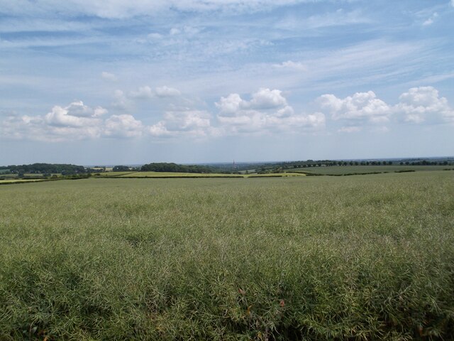
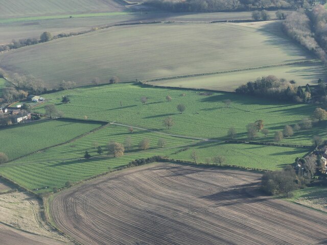
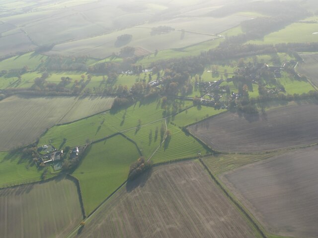
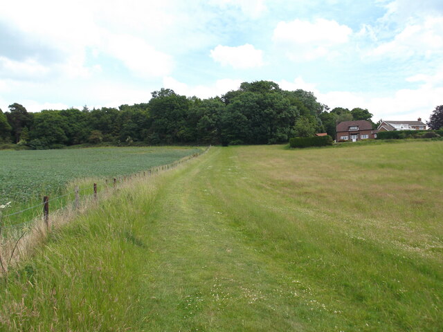
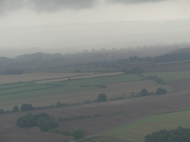
Elkington Cow Pasture is a picturesque and expansive area located in Lincolnshire, England. Situated within the Downs and Moorland region, this vast pastureland spans over several acres, offering a tranquil and idyllic setting for both visitors and the resident wildlife.
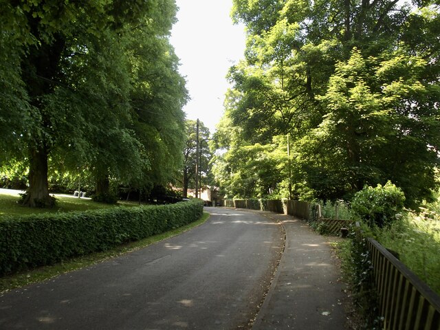
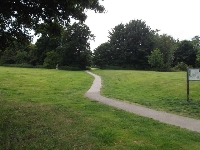
The pastureland is characterized by its gently undulating terrain, adorned with lush green grass and dotted with scattered trees. It is primarily used as grazing land for cows, providing them with ample space to roam and graze on the nutrient-rich grasses. The presence of cows also contributes to the pastoral charm of the area, with their peaceful presence adding to the overall ambiance.
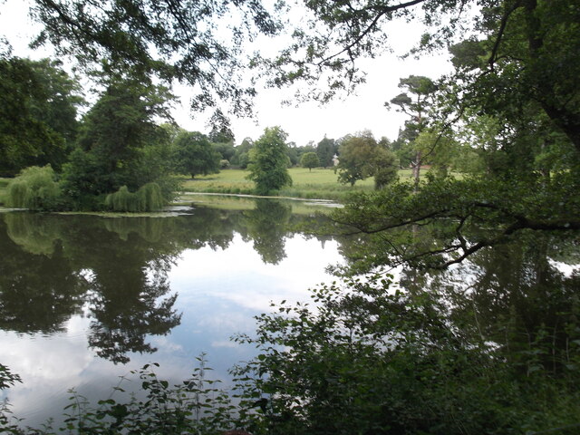
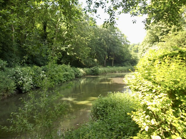
Elkington Cow Pasture is known for its natural beauty and biodiversity. The moorland surrounding the pastureland is home to a wide array of flora and fauna, including various species of birds, insects, and small mammals. This makes it an ideal spot for nature lovers, birdwatchers, and photographers who can appreciate the diverse wildlife that inhabits the area.
Visitors to Elkington Cow Pasture can enjoy leisurely walks or picnics amidst the serene surroundings. The expansive open space allows for uninterrupted views of the surrounding countryside, providing a sense of peace and tranquility. Additionally, the nearby Lincolnshire Downs offer stunning panoramic vistas, making it a popular spot for photographers and nature enthusiasts alike.
Overall, Elkington Cow Pasture in Lincolnshire is a haven for those seeking a peaceful escape in the midst of nature's beauty. With its vast pastureland, diverse wildlife, and breathtaking views, it truly is a gem within the Downs and Moorland region.
If you have any feedback on the listing, please let us know in the comments section below.
Elkington Cow Pasture Images
Images are sourced within 2km of 53.366166/-0.028197263 or Grid Reference TF3187. Thanks to Geograph Open Source API. All images are credited.

![A shop in Louth, Lincolnshire, one of the most brute and beastly [counties] of the whole realm - in Louth (1) As per the famous quote by Henry VIII.](https://s3.geograph.org.uk/geophotos/07/08/86/7088639_2c987aca.jpg)
![A shop in Louth, Lincolnshire, one of the most brute and beastly [counties] of the whole realm - in Louth (2) As per the famous quote by Henry VIII.](https://s0.geograph.org.uk/geophotos/07/08/86/7088644_c3c8c359.jpg)


Elkington Cow Pasture is located at Grid Ref: TF3187 (Lat: 53.366166, Lng: -0.028197263)
Administrative County: Lincolnshire
District: East Lindsey
Police Authority: Lincolnshire
What 3 Words
///bids.carbon.petal. Near Louth, Lincolnshire
Nearby Locations
Related Wikis

Hubbard's Hills
Hubbard's Hills is an area of natural beauty directly to the west of Louth, Lincolnshire, England and is popular for family picnics, school field trips...

King Edward VI Grammar School, Louth
King Edward VI Grammar School (sometimes abbreviated to KEVIGS) is a grammar school located in Louth, Lincolnshire, England. == History == As early as...
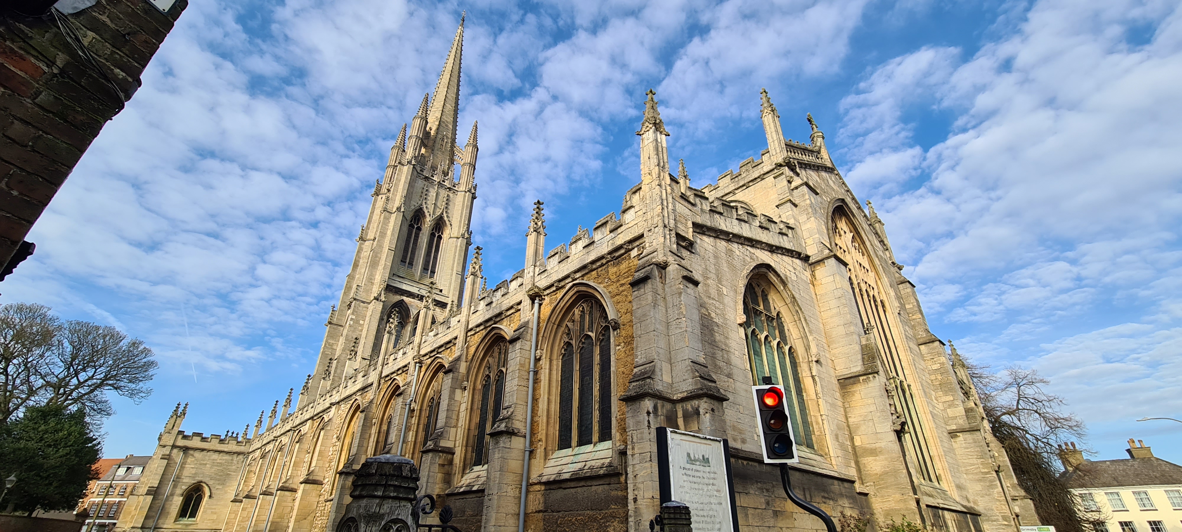
St James' Church, Louth
St James' Church, Louth, is the Anglican parish church of Louth in Lincolnshire, England. It is notable for having the third tallest spire in the whole...

County Hospital Louth
County Hospital Louth is a healthcare facility in High Holme Road, Louth, Lincolnshire, England. It is managed by United Lincolnshire Hospitals NHS Trust...
The Cheese Shop, Louth
The Cheese Shop, Louth is an artisan delicatessen situated in Louth, England, known for its large selection of artisan foods, especially cheese. The Cheese...

Louth, Lincolnshire
Louth ( ) is a market town and civil parish in the East Lindsey district of Lincolnshire, England. Louth serves as an important town for a large rural...

Louth Museum
Louth Museum is a visitor attraction in the historic market town of Louth in Lincolnshire, close to the Lincolnshire Wolds. Located at 4 Broadbank, Louth...
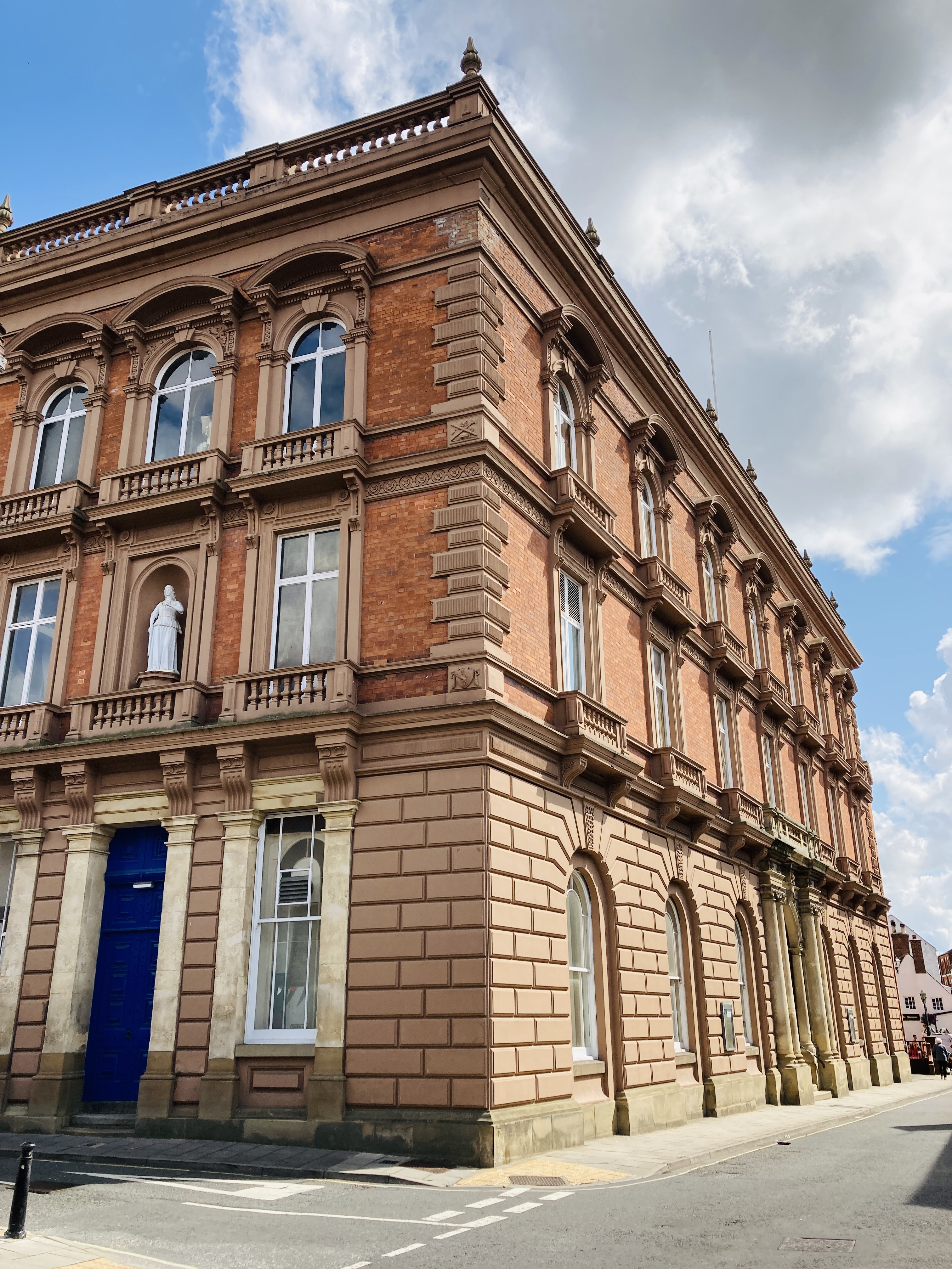
Louth Town Hall
Louth Town Hall is a municipal building in Eastgate in Louth, Lincolnshire, England. The structure, which was the meeting place of Louth Borough Council...
Nearby Amenities
Located within 500m of 53.366166,-0.028197263Have you been to Elkington Cow Pasture?
Leave your review of Elkington Cow Pasture below (or comments, questions and feedback).