Bassenhally Moor

Downs, Moorland in Cambridgeshire

England

Bassenhally Moor

Gate next to Moreton's Leam Drain The Nene Way path runs along the top of the bank on the right.
Gate next to Moreton's Leam Drain Credit: Mat Fascione

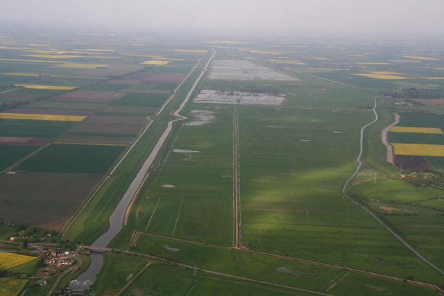
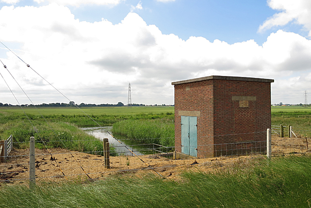
Bassenhally Moor is a picturesque area located in the county of Cambridgeshire, England. Spread across an expansive landscape, it is nestled between the villages of Whittlesey and Coates. The moor is known for its diverse natural beauty, comprising both downs and moorland.

The downs of Bassenhally Moor offer a gently rolling terrain, characterized by lush green grasslands and scattered shrubs. These elevated areas provide stunning panoramic views of the surrounding countryside, making it an ideal spot for nature lovers and hikers. The downs are also home to a variety of wildlife, including rare bird species and small mammals.

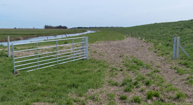
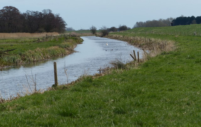
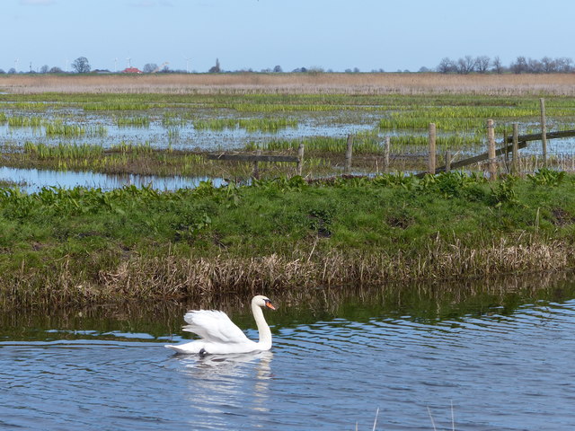
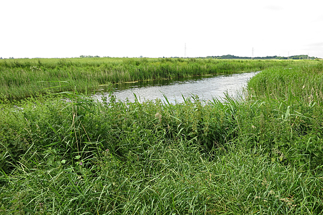
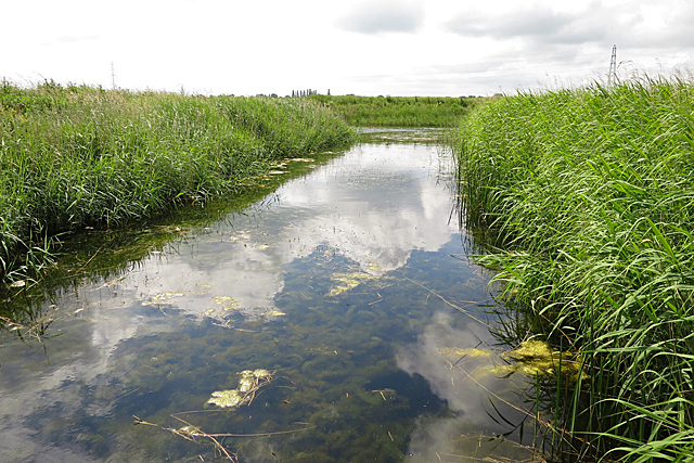
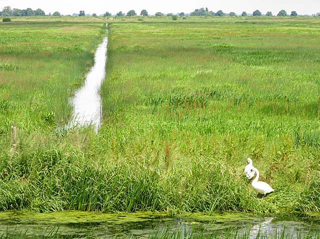
In contrast to the downs, the moorland of Bassenhally Moor presents a more rugged and wild landscape. Blanketed with heather and bracken, it creates a tapestry of rich colors during the summer months. The moorland is interspersed with small ponds and boggy areas, which support a unique ecosystem of plants and insects.

Visitors to Bassenhally Moor can enjoy leisurely walks along its numerous footpaths, immersing themselves in the tranquility of the countryside. The area is also popular among birdwatchers, who can observe a wide array of avian species, including kestrels and lapwings.

Bassenhally Moor is a protected site, managed by environmental organizations to preserve its natural beauty and biodiversity. The conservation efforts have resulted in the moor becoming a designated Site of Special Scientific Interest (SSSI), ensuring the preservation of its unique flora and fauna.

Overall, Bassenhally Moor offers a serene escape into the heart of nature, providing a tranquil haven for wildlife and a peaceful retreat for visitors seeking solace in the beauty of the Cambridgeshire countryside.

If you have any feedback on the listing, please let us know in the comments section below.

Bassenhally Moor Images

Images are sourced within 2km of 52.58873/-0.08710827 or Grid Reference TF2900. Thanks to Geograph Open Source API. All images are credited.

Gate next to Moreton's Leam Drain The Nene Way path runs along the top of the bank on the right.
Gate next to Moreton's Leam Drain
The Nene Way path runs along the top of the bank on the right.
Moreton's Leam Drain on the Nene Washes On the left is a small patch of woodland called Lord's Holt.
Moreton's Leam Drain on the Nene Washes
On the left is a small patch of woodland called Lord's Holt.
Swan on Moreton's Leam Drain In the background is the flooded Nene Washes.
Swan on Moreton's Leam Drain
In the background is the flooded Nene Washes.
River Nene, Morton's Leam, Nene Washes, Popley's Gull: aerial 2016 Nene left, Leam right. Gull is the indent in the Nene (see <a href="https://www.geograph.org.uk/photo/650419">TF2900 : Popley's Gull</a> for explanation). Long Drove parallel and to right of Nene.
River Nene, Morton's Leam, Nene Washes, Popley's Gull: aerial 2016
Nene left, Leam right. Gull is the indent in the Nene (see TF2900 : Popley's Gull for explanation). Long Drove parallel and to right of Nene.
Pumping Station The pumping station stands on an inlet off the Counter Drain. I presume that it pumps water up into Morton's Leam, but will be happy to be corrected.
Pumping Station
The pumping station stands on an inlet off the Counter Drain. I presume that it pumps water up into Morton's Leam, but will be happy to be corrected.
Counter Drain The Counter Drain is to the south of the embankment that is followed by the Nene Way.
Counter Drain
The Counter Drain is to the south of the embankment that is followed by the Nene Way.
Peaceful Inlet This inlet off the Counter Drain, viewed from the front of the pumping station.
Peaceful Inlet
This inlet off the Counter Drain, viewed from the front of the pumping station.
Swans on the Fens There were numerous pairs of Mute Swan in evidence alongside the drains.
Swans on the Fens
There were numerous pairs of Mute Swan in evidence alongside the drains.
Looking from The Nene Way towards Popley's Gull
Nene Washes embankment The Nene Way which runs along the crest of the bank has become overgrown following remedial works on the bank with an accompanying diversion of the path.
Nene Washes embankment
The Nene Way which runs along the crest of the bank has become overgrown following remedial works on the bank with an accompanying diversion of the path.
New Come Over This is the only cross drain on the Nene Washes mapped with a specific name. Morton's Leam in the foreground.
New Come Over
This is the only cross drain on the Nene Washes mapped with a specific name. Morton's Leam in the foreground.
Counter Drain near Feldale Pumping Station This drain collects from the area immediately to the south of the Nene Washes.
Counter Drain near Feldale Pumping Station
This drain collects from the area immediately to the south of the Nene Washes.
Path along the Nene Washes The path on top of the embankment.
Path along the Nene Washes
The path on top of the embankment.
Counter Drain Looking along one of the larger drains on the Nene Washes.
Counter Drain
Looking along one of the larger drains on the Nene Washes.
Towards the pumping station Looking towards the pumping station from Counter Drain. The walk was part of the 2016 Geograph Conference.
Towards the pumping station
Looking towards the pumping station from Counter Drain. The walk was part of the 2016 Geograph Conference.
Towards the pumping station Looking along an embankment on the Nene Washes.
Towards the pumping station
Looking along an embankment on the Nene Washes.
Drainage ditch below the embankment Looking down into one of the drains on the Nene Washes.
Drainage ditch below the embankment
Looking down into one of the drains on the Nene Washes.
Drainage ditches Two swans sit on the bank next to a drainage ditch on the Nene Washes.
Drainage ditches
Two swans sit on the bank next to a drainage ditch on the Nene Washes.
Show me another place!

Bassenhally Moor is located at Grid Ref: TF2900 (Lat: 52.58873, Lng: -0.08710827)

Division: Isle of Ely

Unitary Authority: Peterborough

Police Authority: Cambridgeshire

What 3 Words

///fevered.lurching.ballooned. Near Thorney, Cambridgeshire

Nearby Locations

Bassenhally Moor Thorney

Related Wikis

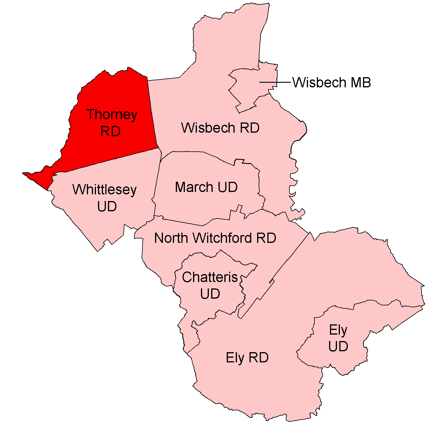
Thorney Rural District

Thorney was a rural district in England from 1894 to 1974, situated to the east of Peterborough. It was created under the Local Government Act 1894, covering...

Nene Washes

Nene Washes is a 1,522-hectare (3,760-acre) biological Site of Special Scientific Interest on the bank of the River Nene east of Peterborough in Cambridgeshire...

Bassenhally Pit

Bassenhally Pit is an 8.6-hectare (21-acre) biological Site of Special Scientific Interest north-east of Whittlesey in Cambridgeshire.This former gravel...

Whittlesey Athletic F.C.

Whittlesey Athletic Football Club is a football club based in Whittlesey, Cambridgeshire, England. They are currently members of the Eastern Counties League...

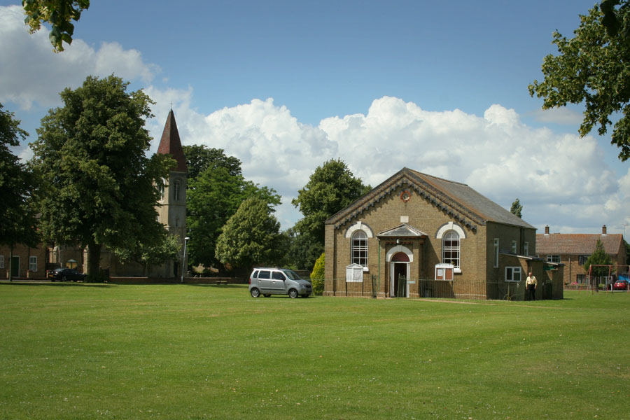
Coates, Cambridgeshire

Coates is a small village close to the town of Whittlesey, in the English county of Cambridgeshire. Coates has a shop which includes a post office. �...

Eastrea

Eastrea is a village in Cambridgeshire, located on the A605 between Whittlesey and Coates. The site has been inhabited since Roman times. The population...

Thorney Abbey

Thorney Abbey, now the Church of St Mary and St Botolph, was a medieval monastic house established on the island of Thorney in The Fens of Cambridgeshire...

Thorney, Cambridgeshire

Thorney is a village in the Peterborough unitary authority in the ceremonial county of Cambridgeshire, England. Located around eight miles (13 km) east...

Nearby Amenities

Located within 500m of 52.58873,-0.08710827
Power: pole
Source: Bing
Lat/Long: 52.5900446/-0.0906654
Power: pole
Source: Bing
Lat/Long: 52.5914488/-0.082889
Power: pole
Source: Bing
Lat/Long: 52.59156/-0.0817765
Power: pole
Source: Bing
Lat/Long: 52.5908887/-0.0879295
Power: pole
Source: Bing
Lat/Long: 52.59114/-0.0856664
Power: pole
Source: Bing
Lat/Long: 52.5907803/-0.0889072
Power: pole
Source: Bing
Lat/Long: 52.5897961/-0.0931504
Power: pole
Source: Bing
Lat/Long: 52.5904104/-0.0897869
Power: pole
Source: Bing
Lat/Long: 52.5912822/-0.0843501
Power: pole
Source: Bing
Lat/Long: 52.5899232/-0.091804
Power: pole
Source: Bing
Lat/Long: 52.5909848/-0.0869586
The data included in this document is from www.openstreetmap.org. The data is made available under ODbL.

Have you been to Bassenhally Moor?

Leave your review of Bassenhally Moor below (or comments, questions and feedback).