Newell Common

Downs, Moorland in Hertfordshire North Hertfordshire

England

Newell Common

A507 at Cumberlow Green Looking North, the A507 winds through Cumberlow Green towards Baldock. The road to the left leads to Cromer. Just out of sight is another junction where a left turn is required to follow the A507. Many an unsuspecting driver has been caught by this where the minor road takes priority.
A507 at Cumberlow Green Credit: Richard Thomas

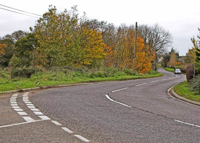
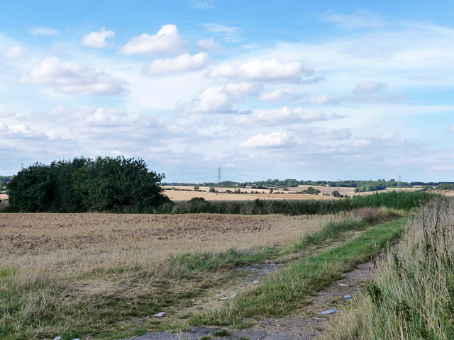
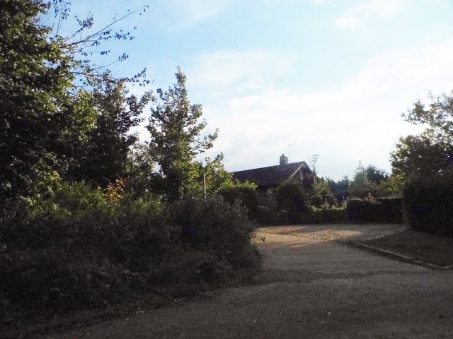
Newell Common is a vast open space located in Hertfordshire, England. Covering an area of approximately 700 acres, it is a picturesque landscape characterized by its rolling downs and moorland. The common is situated on the northern edge of Hertford Heath village, near the town of Hertford.

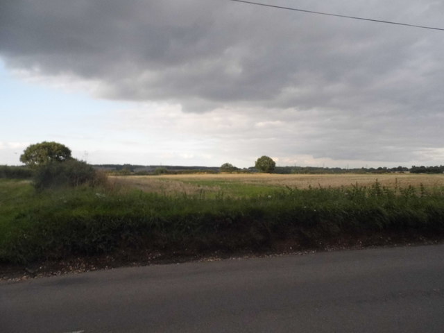
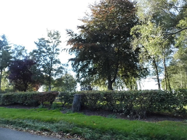
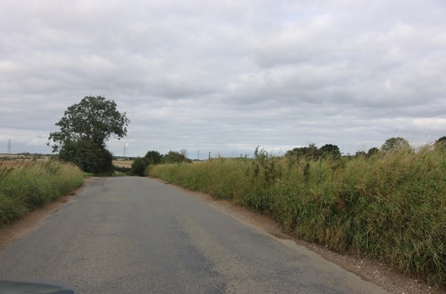
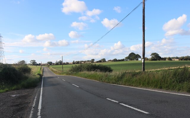
The downs of Newell Common provide sweeping panoramic views of the surrounding countryside, making it a popular destination for nature enthusiasts and walkers. The terrain is predominantly grassy, with patches of heather and gorse adding vibrant splashes of color to the landscape. The area is scattered with grazing sheep, contributing to its idyllic rural charm.

The moorland on Newell Common is characterized by its boggy terrain, dotted with small pools and streams. This unique habitat supports a diverse range of plant and animal species, including rare birds such as the snipe and curlew. The moorland is also home to a variety of wildflowers, creating a beautiful tapestry of colors during the summer months.

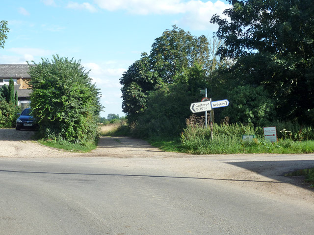
Newell Common is managed by the Hertfordshire County Council, which works to preserve its natural beauty and protect its wildlife. The common is open to the public year-round, offering numerous footpaths and trails for visitors to explore. It is a peaceful and serene location, providing a welcome escape from the hustle and bustle of nearby urban areas.

Overall, Newell Common is a stunning natural landscape, showcasing the beauty of Hertfordshire's countryside. Whether it's the rolling downs or the enchanting moorland, this area offers a tranquil retreat for those seeking to connect with nature.

If you have any feedback on the listing, please let us know in the comments section below.

Newell Common Images

Images are sourced within 2km of 51.943042/-0.11518162 or Grid Reference TL2928. Thanks to Geograph Open Source API. All images are credited.

A507 at Cumberlow Green Looking North, the A507 winds through Cumberlow Green towards Baldock. The road to the left leads to Cromer. Just out of sight is another junction where a left turn is required to follow the A507. Many an unsuspecting driver has been caught by this where the minor road takes priority.
A507 at Cumberlow Green
Looking North, the A507 winds through Cumberlow Green towards Baldock. The road to the left leads to Cromer. Just out of sight is another junction where a left turn is required to follow the A507. Many an unsuspecting driver has been caught by this where the minor road takes priority.
Corner and crossways on B1037 The B road has a right-angled bend from the foreground to the left, Blind Lane joins on the right, and straight on is a public byway called Back Lane on the course of a Roman road.
Corner and crossways on B1037
The B road has a right-angled bend from the foreground to the left, Blind Lane joins on the right, and straight on is a public byway called Back Lane on the course of a Roman road.
View north from B1037 The hedgerow is along the course of a Roman road heading north-west from Braughing to Baldock.
View north from B1037
The hedgerow is along the course of a Roman road heading north-west from Braughing to Baldock.
Pump on green, Ardeley Although looking like an ancient village green surrounded by thatched cottages, according to maps the whole lot appears to be a 20th century creation, including the pump and well. The pump is of the 'mangle' type, a rotating crankshaft moving the piston up and down. It does not work, if it ever did.
Pump on green, Ardeley
Although looking like an ancient village green surrounded by thatched cottages, according to maps the whole lot appears to be a 20th century creation, including the pump and well. The pump is of the 'mangle' type, a rotating crankshaft moving the piston up and down. It does not work, if it ever did.
Blind Lane at the junction of Hare Street
Bend on the B1037 approaching Cottered
Cromer Windmill
Cromer Windmill
Field by the B1037, Cromer
The B1037 by Bancroft Farm, Hare Street The old barn has been totally rebuilt from the wood walls and tin roof previously which was falling apart.
The B1037 by Bancroft Farm, Hare Street
The old barn has been totally rebuilt from the wood walls and tin roof previously which was falling apart.
Little road to Ardeley Bury
Field by Blind Lane, Ardeley
Blind Lane, Hare Street
Garden by the B1037, Hare Street
Unnamed road north of Cromer
Cromer Windmill Nowhere near Cromer on the north Norfolk coast, instead taking its name from a small village nearby.
Cromer Windmill is a post mill dating from the 18th century and fully restored in 1967-1969. It is a Grade II* listed building. <span class="nowrap"><a title="https://britishlistedbuildings.co.uk/101101453-cromer-windmill-ardeley#.XOhhR3dFzwo" rel="nofollow ugc noopener" href="https://britishlistedbuildings.co.uk/101101453-cromer-windmill-ardeley#.XOhhR3dFzwo">Link</a><img style="margin-left:2px;" alt="External link" title="External link - shift click to open in new window" src="https://s1.geograph.org.uk/img/external.png" width="10" height="10"/></span>
Cromer Windmill
Nowhere near Cromer on the north Norfolk coast, instead taking its name from a small village nearby. Cromer Windmill is a post mill dating from the 18th century and fully restored in 1967-1969. It is a Grade II* listed building. LinkExternal link
Minor road in Cromer
The B1037, Cottered
The B1037, Cottered
The A507 before Cumberlow Green
Show me another place!

Newell Common is located at Grid Ref: TL2928 (Lat: 51.943042, Lng: -0.11518162)

Administrative County: Hertfordshire

District: North Hertfordshire

Police Authority: Hertfordshire

What 3 Words

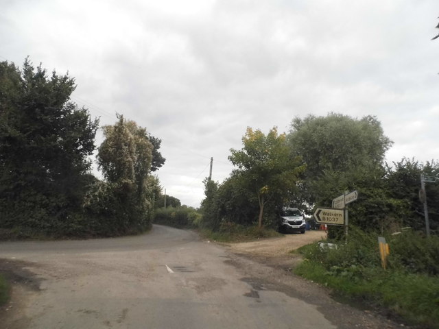
///textiles.crucially.owners. Near Walkern, Hertfordshire

Related Wikis

Cromer, Hertfordshire

Cromer is a hamlet in the civil parish of Ardeley, Hertfordshire, England. It is a small hamlet; however, it is noteworthy for possessing Hertfordshire...

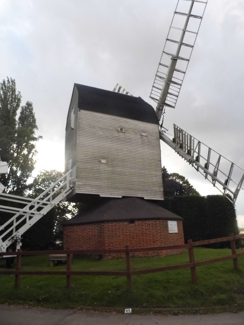
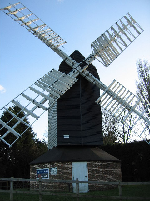
Cromer Windmill, Ardeley

Cromer Windmill, restored in four stages between 1967 and 1998, is a Grade II* listed post mill at Cromer, Ardeley, Hertfordshire, England. == History... ==

Ardeley

Ardeley is a small village and civil parish in East Hertfordshire, England. The parish includes the hamlet of Cromer, as well as Wood End and Moor Green...

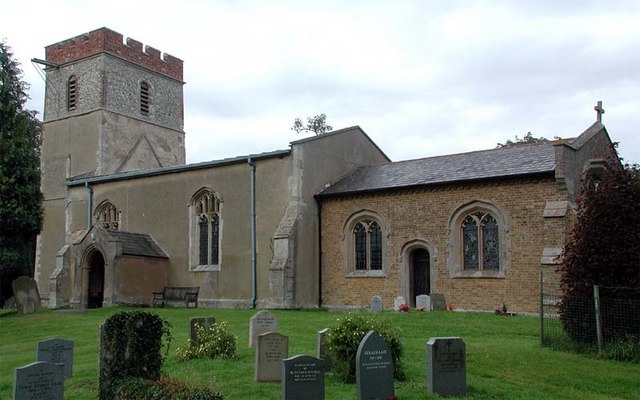
Church of St Mary the Virgin, Walkern

The parish church of St Mary the Virgin in Walkern, Hertfordshire, dates from before the Norman Conquest and has been altered in the succeeding centuries...

Cottered

Cottered is a village and civil parish 3 miles (4.8 km) west of Buntingford and 6 miles (9.7 km) east of Baldock in the East Hertfordshire District of...
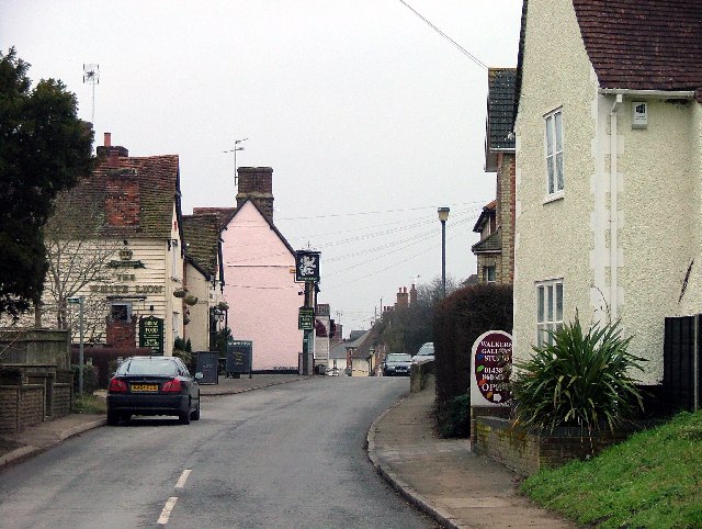
Walkern

Walkern is a village and civil parish in East Hertfordshire, England. It is about two miles (3 km) from Stevenage. The village has several shops, including...

Rushden, Hertfordshire

Rushden is a small village and civil parish which forms part of the grouped parish council of Rushden and Wallington in the North Hertfordshire district...

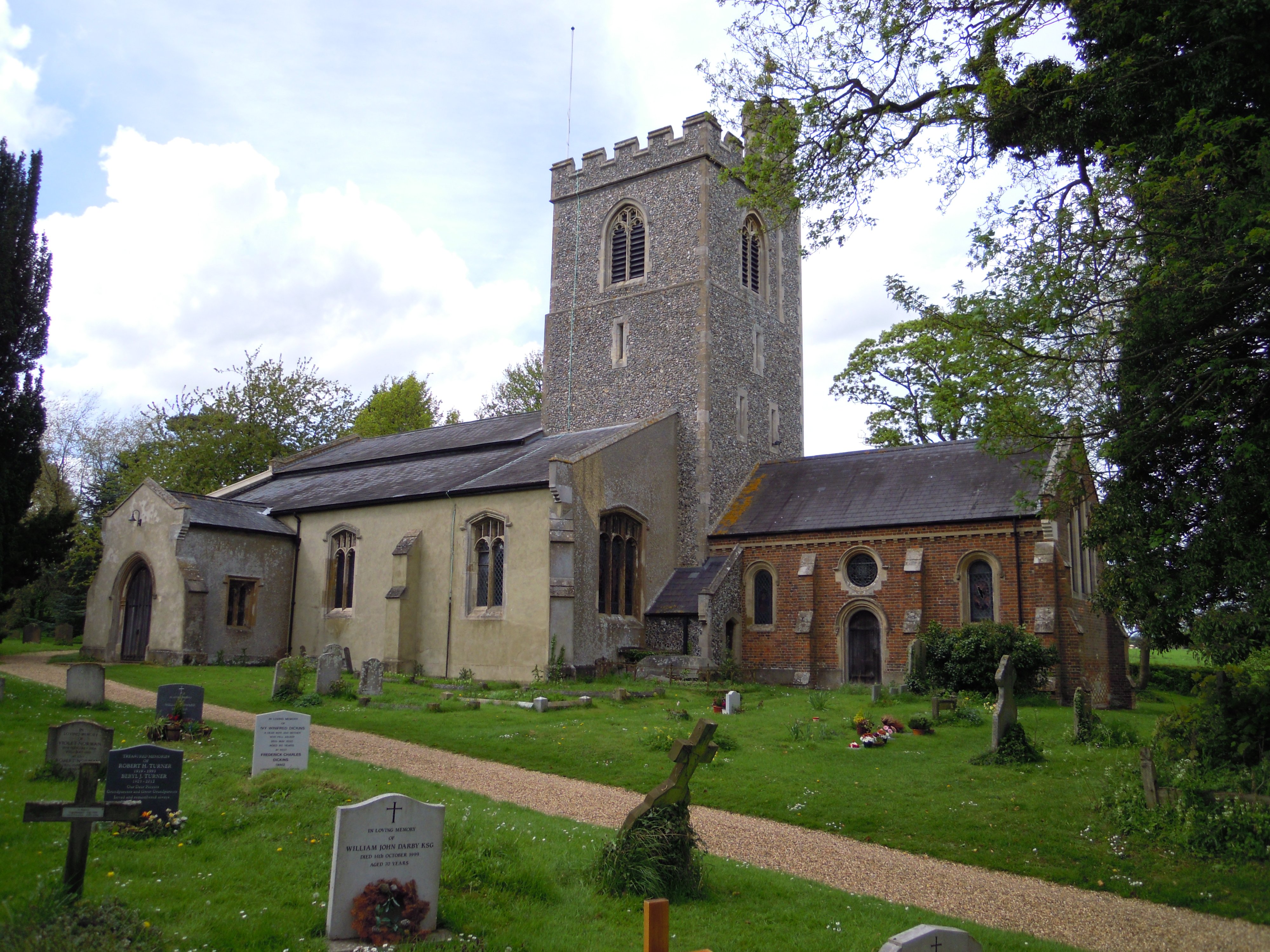
Holy Trinity Church, Weston

Holy Trinity Church is the parish church for the village of Weston in Hertfordshire. The church building stands to the south-east of the village on high...

Nearby Amenities

Located within 500m of 51.943042,-0.11518162
Barrier: kissing_gate
Foot: yes
Source: GPS, observation
Lat/Long: 51.9427791/-0.1162767
Barrier: kissing_gate
Lat/Long: 51.9410362/-0.1182599
Barrier: kissing_gate
Lat/Long: 51.9405164/-0.1183315
Cromer
Place: village
Wikidata: Q5187587
Lat/Long: 51.9403297/-0.1129736
Power: tower
Source: Bing
Lat/Long: 51.9440743/-0.1164576
Post Box
Collection Times: Mo-Fr 16:15; Sa 09:30
Post Box Type: lamp
Ref: SG2 110
Royal Cypher: EIIR
Royal Cypher Wikidata: Q33102113
Lat/Long: 51.9418187/-0.1202635
Power: tower
Source: Bing
Lat/Long: 51.9450845/-0.112674
Power: tower
Source: Bing
Lat/Long: 51.9430019/-0.1202162
Barrier: kissing_gate
Lat/Long: 51.9411941/-0.1176285
Material: wood
Power: pole
Lat/Long: 51.9431852/-0.1169604
Material: wood
Power: pole
Lat/Long: 51.9440562/-0.1171283
Material: wood
Power: pole
Lat/Long: 51.942299/-0.1167566
Material: wood
Power: pole
Lat/Long: 51.9407468/-0.1161198
Material: wood
Power: pole
Lat/Long: 51.9414991/-0.1162432
Material: wood
Power: pole
Lat/Long: 51.9394301/-0.1148898
Material: wood
Power: pole
Lat/Long: 51.9397724/-0.1157145
Material: wood
Power: pole
Lat/Long: 51.938942/-0.1135436
Material: wood
Power: pole
Lat/Long: 51.9390845/-0.1140475
Man Made: mast
Lat/Long: 51.93961/-0.1158422
Barrier: kissing_gate
Lat/Long: 51.9390961/-0.1139642
Barrier: kissing_gate
Foot: yes
Source: GPS, observation
Lat/Long: 51.9431116/-0.1183257
Barrier: kissing_gate
Lat/Long: 51.9390075/-0.1137265
Barrier: kissing_gate
Lat/Long: 51.9394531/-0.115847
Man Made: water_well
Pump: manual
Lat/Long: 51.9405887/-0.1120749
Luffenhall
Place: hamlet
Lat/Long: 51.9443133/-0.1187369
The data included in this document is from www.openstreetmap.org. The data is made available under ODbL.

Have you been to Newell Common?

Leave your review of Newell Common below (or comments, questions and feedback).