Parson's Green

Downs, Moorland in Surrey Reigate and Banstead

England

Parson's Green

View From White Hill As I trekked up the valley, I recalled making a similar journey some years previously and then discovering that the slopes had previously been used for sheepdog trials.

On this occasion, evidence showed that I had again missed out; this time by less than two months.
View From White Hill Credit: Peter Trimming

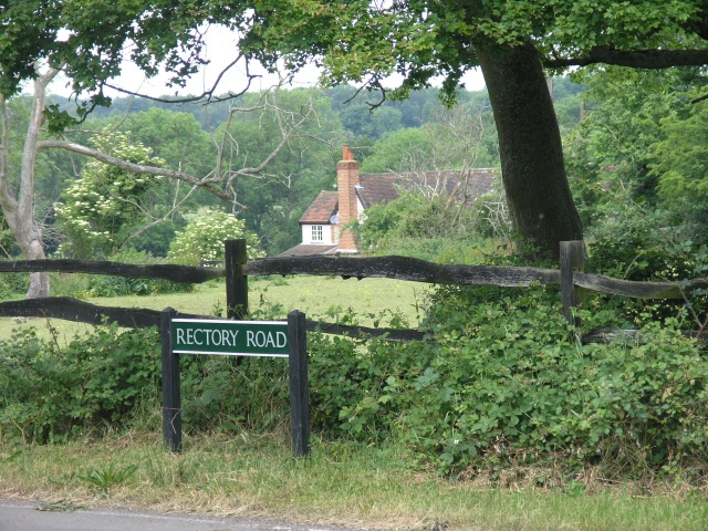
Parson's Green is a charming village located in the county of Surrey, England. Situated within the picturesque landscape of the Surrey Downs, the village is surrounded by rolling hills, verdant meadows, and breathtaking moorlands. It is a rural paradise that offers a peaceful and idyllic escape from the hustle and bustle of city life.

The village itself is small but full of character, with a population of around 1,000 residents. It features a quaint and well-preserved historic center, with traditional cottages and buildings that exude a sense of timeless charm. The village green, after which the village is named, is a focal point and serves as a gathering place for locals and visitors alike.

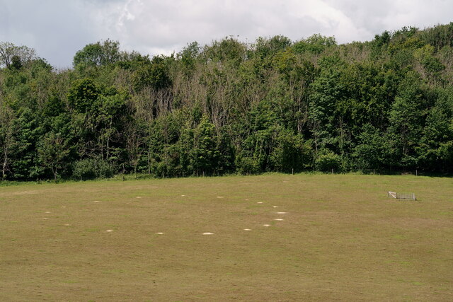
Parson's Green is renowned for its natural beauty and offers numerous opportunities for outdoor activities. The Surrey Downs, renowned for their stunning views, provide ample space for hiking, cycling, and horseback riding. The moorlands surrounding the village are a haven for wildlife enthusiasts, with an array of bird species and other fauna to be observed.

Despite its rural setting, Parson's Green is not isolated from modern amenities. It has a local pub, a village shop, and a post office, ensuring that residents have access to essential services. The village also benefits from good transport connections, with several bus routes connecting it to nearby towns and cities.

Overall, Parson's Green, Surrey, is a charming and picturesque village that offers a tranquil and scenic escape in the heart of the Surrey Downs. With its beautiful landscapes, historic charm, and close-knit community, it is an ideal destination for those seeking a peaceful retreat in a quintessentially English setting.

If you have any feedback on the listing, please let us know in the comments section below.

Parson's Green Images

Images are sourced within 2km of 51.277785/-0.18753082 or Grid Reference TQ2654. Thanks to Geograph Open Source API. All images are credited.

View From White Hill As I trekked up the valley, I recalled making a similar journey some years previously and then discovering that the slopes had previously been used for sheepdog trials.

On this occasion, evidence showed that I had again missed out; this time by less than two months.
View From White Hill
As I trekked up the valley, I recalled making a similar journey some years previously and then discovering that the slopes had previously been used for sheepdog trials. On this occasion, evidence showed that I had again missed out; this time by less than two months.
White Hill Farmhouse near the junction of White Hill and High Road.
White Hill
Farmhouse near the junction of White Hill and High Road.
Shepherd's Lawn
Shepherd's Lawn
Park Farm House
Park Farm House
Rectory Road, looking towards April House Taken from the crossroads that forms the junction where Rectory Road meets Fair Lane and Southerns Lane.
Rectory Road, looking towards April House
Taken from the crossroads that forms the junction where Rectory Road meets Fair Lane and Southerns Lane.
Shabden Park Shabden Park is an area of carefully managed, wildlife friendly land which is being restored after being damaged by intensive farming towards the end of the 20th century.
Shabden Park
Shabden Park is an area of carefully managed, wildlife friendly land which is being restored after being damaged by intensive farming towards the end of the 20th century.
Well House Inn The Well House Inn on Chipstead Lane dates back to the 14th Century. Its garden contains a 100 ft deep well known as St Margaret's Well (or Mag's Well) and is the source of the name of nearby Muggswell.  The well is mentioned in the Domesday Book.
Well House Inn
The Well House Inn on Chipstead Lane dates back to the 14th Century. Its garden contains a 100 ft deep well known as St Margaret's Well (or Mag's Well) and is the source of the name of nearby Muggswell. The well is mentioned in the Domesday Book.
Caravan Park This site is listed as a Caravan Park on the Ordnance Survey map and is a small estate of semi-permanent residential caravans.
Caravan Park
This site is listed as a Caravan Park on the Ordnance Survey map and is a small estate of semi-permanent residential caravans.
The Old Salt House
The Old Salt House
The Third Tee The Third Tee at Surrey Downs Golf Club, with part of Kingswood in the background (housing of this nature occupies most of this square).
The Third Tee
The Third Tee at Surrey Downs Golf Club, with part of Kingswood in the background (housing of this nature occupies most of this square).
The 19th Hole The 19th Hole of Surrey Downs Golf Club
The 19th Hole
The 19th Hole of Surrey Downs Golf Club
Fields of Barley A gentle valley, flanked by fields of barley
Fields of Barley
A gentle valley, flanked by fields of barley
Road Junction A road junction near Gatton.  This would be a typical country road junction were it not for the roaring M25 just beyond.
Road Junction
A road junction near Gatton. This would be a typical country road junction were it not for the roaring M25 just beyond.
Roundabout A roundabout where the A217 dual carriageway joins Babylon Lane and Stubbs Lane.  The photograph was taken from a horse path - several of the roads in this area have special provisions for equine transport as there are several stables in the area.  Just behind where this picture was taken, a special pelican crossing has been provided with a long time-out period to allow groups of horse riders to cross the busy A217.
Roundabout
A roundabout where the A217 dual carriageway joins Babylon Lane and Stubbs Lane. The photograph was taken from a horse path - several of the roads in this area have special provisions for equine transport as there are several stables in the area. Just behind where this picture was taken, a special pelican crossing has been provided with a long time-out period to allow groups of horse riders to cross the busy A217.
The Mugswell Mission Hall This unpretentious shed is the parish hall for the extensive parish of Chipstead (the church itself is nearer Hooley) and was once used for worship.
The Mugswell Mission Hall
This unpretentious shed is the parish hall for the extensive parish of Chipstead (the church itself is nearer Hooley) and was once used for worship.
The Well House Inn, Mugswell The Well House Inn is named after the main feature of the gardens, St. Margaret's Well. The well is apparently mentioned in the Domesday Book of 1086. It is still actively used to this day The Environment Agency constantly monitor the level of water in the well and we understand from them that it is the primary monitoring site for the whole of South London and the south-east of England.
The buildings which make up the present pub, originally three cottages, are believed to date from the mid 1560s.
During the first half of the last century the buildings became tea rooms. In 1955 Bass bought the property and converted it into a public house.
The Well House Inn, Mugswell
The Well House Inn is named after the main feature of the gardens, St. Margaret's Well. The well is apparently mentioned in the Domesday Book of 1086. It is still actively used to this day The Environment Agency constantly monitor the level of water in the well and we understand from them that it is the primary monitoring site for the whole of South London and the south-east of England. The buildings which make up the present pub, originally three cottages, are believed to date from the mid 1560s. During the first half of the last century the buildings became tea rooms. In 1955 Bass bought the property and converted it into a public house.
Monkswell Lane junction with Chipstead Lane View showing Chipstead Lane heading towards Hogden Bottom.
Monkswell Lane junction with Chipstead Lane
View showing Chipstead Lane heading towards Hogden Bottom.
Show me another place!

Parson's Green is located at Grid Ref: TQ2654 (Lat: 51.277785, Lng: -0.18753082)

Administrative County: Surrey

District: Reigate and Banstead

Police Authority: Surrey

What 3 Words

///played.shiny.cool. Near Lower Kingswood, Surrey

Related Wikis

Shabden Park

Shabden Park is a 103-hectare (250-acre) nature reserve in Chipstead in Surrey. It is owned by Surrey County Council and managed by the Surrey Wildlife...

Royal Alexandra and Albert School

The Royal Alexandra and Albert School is an all-through co-educational boarding school near Reigate, Surrey. The headmaster as of 2022 is Morgan Thomas...

Chipstead F.C.

Chipstead Football Club is a football club based in Chipstead, near Banstead, in Surrey, England. Affiliated to the Surrey County Football Association...

Tooting Bec F.C.

Tooting Bec Football Club is a football club based in Tooting Bec, Greater London, England. They are currently members of the Southern Counties East League...

St Andrew's Church, Gatton

The Church of St Andrew, Gatton is a Church of England church in Gatton, near Reigate in Surrey, England. It is a Grade I listed. The earliest record of...

Kingswood, Surrey

Kingswood or Kingswood with Burgh Heath is a residential area on the North Downs in the Borough of Reigate and Banstead in Surrey, England. Part of the...

Margery

Margery is a heavily buffered, lightly populated hamlet in the Reigate and Banstead district in the English county of Surrey. It sits on the North Downs...

Gatton Park

Gatton Park is a country estate set in parkland landscaped by Capability Brown at Gatton, near Reigate in Surrey, England. Now owned by The Royal Alexandra...

Nearby Amenities

Located within 500m of 51.277785,-0.18753082
Barrier: stile
Source: gps
Lat/Long: 51.2805457/-0.1834472
Barrier: kissing_gate
Bicycle: yes
Foot: yes
Lat/Long: 51.2821672/-0.1863834
Barrier: kissing_gate
Lat/Long: 51.2755619/-0.1896538
Barrier: stile
Lat/Long: 51.2795215/-0.1852473
Barrier: kissing_gate
Lat/Long: 51.2756869/-0.1879853
Barrier: kissing_gate
Lat/Long: 51.2782412/-0.193499
Barrier: kissing_gate
Lat/Long: 51.2805133/-0.192509
Barrier: kissing_gate
Lat/Long: 51.2781524/-0.1935263
Barrier: stile
Lat/Long: 51.2822831/-0.1875815
Material: wood
Power: pole
Source: gps
Lat/Long: 51.275576/-0.1884694
Material: wood
Power: pole
Source: gps
Lat/Long: 51.2746154/-0.1884359
Material: wood
Power: pole
Source: gps
Lat/Long: 51.2734408/-0.188672
Power: pole
Source: gps;Bing
Lat/Long: 51.2800793/-0.1821367
Power: pole
Lat/Long: 51.2795668/-0.1831936
Post Box
Collection Times: Mo-Fr 09:00; Sa 07:00; Su off
Drive Through: no
Operator: Royal Mail
Post Box Type: lamp
Ref: CR5 257D
Royal Cypher: EIIR
Royal Cypher Wikidata: Q33102113
Source: survey
Lat/Long: 51.2784595/-0.1891604
Barrier: stile
Lat/Long: 51.2756079/-0.1888
Power: pole
Source: Bing
Lat/Long: 51.279188/-0.1860695
Power: pole
Lat/Long: 51.2797946/-0.1842456
Power: pole
Source: gps;Bing
Lat/Long: 51.2792996/-0.185399
Power: pole
Lat/Long: 51.278787/-0.1864558
Power: pole
Lat/Long: 51.2785773/-0.1879296
Power: pole
Lat/Long: 51.2793579/-0.1846848
Barrier: kissing_gate
Source: gps
Lat/Long: 51.2789176/-0.1867052
The data included in this document is from www.openstreetmap.org. The data is made available under ODbL.

Have you been to Parson's Green?

Leave your review of Parson's Green below (or comments, questions and feedback).