Church Field

Downs, Moorland in Cambridgeshire Fenland

England

Church Field

Hanson's Kings Dyke brickworks, Whittlesey: aerial 2021
Hanson's Kings Dyke brickworks, Whittlesey: aerial 2021 Credit: Simon Tomson

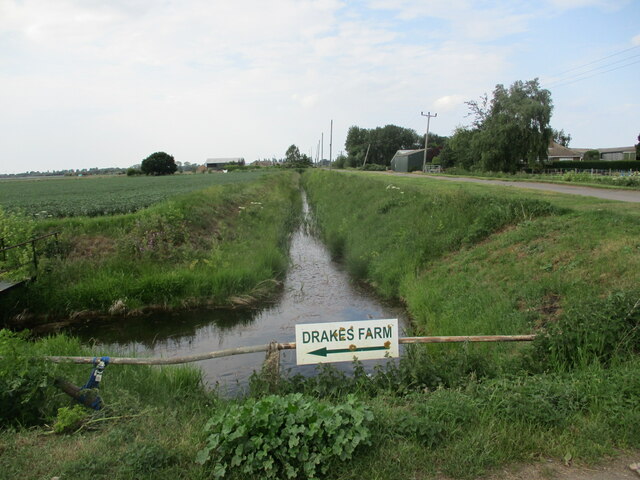
Church Field is a picturesque and expansive tract of land located in Cambridgeshire, England. Spanning across various terrains, including downs and moorland, this area offers a unique blend of natural beauty and historical significance.

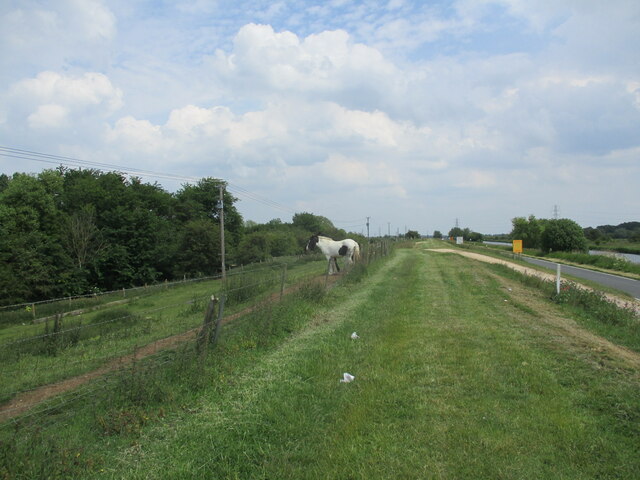
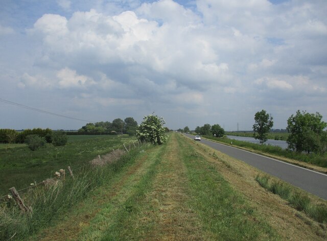
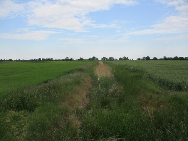
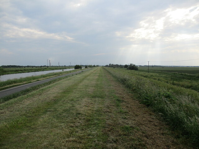
Situated near the village of Church, the field encompasses approximately 100 acres of rolling downs. These downs are characterized by their gently sloping hills, covered in lush green grass and scattered with wildflowers during the summer months. The downs provide a perfect setting for recreational activities such as picnicking, kite flying, and leisurely walks, offering stunning panoramic views of the surrounding countryside.

Adjacent to the downs, Church Field transitions into moorland, characterized by its marshy terrain and heath vegetation. This area is home to a diverse range of flora and fauna, including heather, mosses, and various bird species. The moorland provides an ideal habitat for birdwatching enthusiasts, who can observe species such as curlews, lapwings, and red grouse.

Aside from its natural beauty, Church Field also holds historical significance. The site is home to the remains of an ancient church, which dates back to the medieval period. The ruins serve as a reminder of the area's rich history and provide a tranquil spot for reflection and contemplation.

Overall, Church Field in Cambridgeshire offers visitors a captivating blend of natural landscapes, from the peaceful downs to the wild moorland, making it a must-visit destination for nature lovers and history enthusiasts alike.

If you have any feedback on the listing, please let us know in the comments section below.
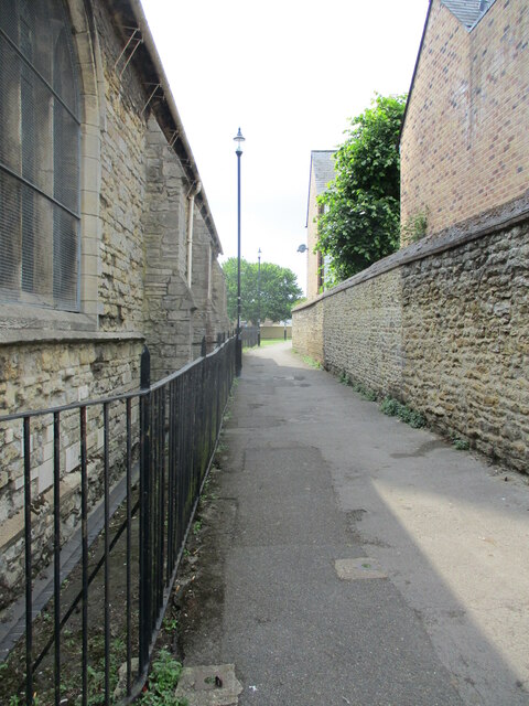
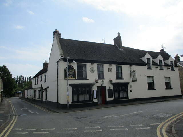
Church Field Images

Images are sourced within 2km of 52.559379/-0.15192544 or Grid Reference TL2597. Thanks to Geograph Open Source API. All images are credited.

Hanson's Kings Dyke brickworks, Whittlesey: aerial 2021
Flood bank near Northey Lodge The River Nene to the right.
Flood bank near Northey Lodge
The River Nene to the right.
The River Nene near Roslyn Farm The three remaining chimney stacks of the Whittlesey brickworks conspicuous in the distance.
The River Nene near Roslyn Farm
The three remaining chimney stacks of the Whittlesey brickworks conspicuous in the distance.
Flood bank near Roslyn Farm The River Nene on the right.
Flood bank near Roslyn Farm
The River Nene on the right.
Cemetery Lodge, Whittlesey Built 1859 <span class="nowrap"><a title="https://historicengland.org.uk/listing/the-list/list-entry/1227875?section=official-list-entry" rel="nofollow ugc noopener" href="https://historicengland.org.uk/listing/the-list/list-entry/1227875?section=official-list-entry">Link</a><img style="margin-left:2px;" alt="External link" title="External link - shift click to open in new window" src="https://s1.geograph.org.uk/img/external.png" width="10" height="10"/></span> Designed by Robert Hutchinson.
Cemetery Lodge, Whittlesey
Built 1859 LinkExternal link Designed by Robert Hutchinson.
The Black Bull Inn. Whittlesey Seventeenth century inn <span class="nowrap"><a title="https://historicengland.org.uk/listing/the-list/list-entry/1228224?section=official-list-entry" rel="nofollow ugc noopener" href="https://historicengland.org.uk/listing/the-list/list-entry/1228224?section=official-list-entry">Link</a><img style="margin-left:2px;" alt="External link" title="External link - shift click to open in new window" src="https://s1.geograph.org.uk/img/external.png" width="10" height="10"/></span>
The Black Bull Inn. Whittlesey
Seventeenth century inn LinkExternal link
Path alongside St. Mary's church, Whittlesey
The Falcon Hotel, Whittlesey Eighteenth century hotel ://historicengland.org.uk/listing/the-list/list-entry/1228085?section=official-list-entry
The Falcon Hotel, Whittlesey
Eighteenth century hotel ://historicengland.org.uk/listing/the-list/list-entry/1228085?section=official-list-entry
Pond at Drakes Farm
Pond at Drakes Farm
Drain off Blackbush Drove
Flood bank near Dog-in-a-Doublet The River Nene on the left.
Flood bank near Dog-in-a-Doublet
The River Nene on the left.
Blackbush Drain
Blackbush Drain
King's Delph Drain
King's Delph Drain
Farm track off Beales' Drove
Beales' Drove and Drakes Farm
Barley field near Drakes Farm
9 Market Street, Whittlesey Seventeenth century house much altered and extended <span class="nowrap"><a title="https://historicengland.org.uk/listing/the-list/list-entry/1228220?section=official-list-entry" rel="nofollow ugc noopener" href="https://historicengland.org.uk/listing/the-list/list-entry/1228220?section=official-list-entry">Link</a><img style="margin-left:2px;" alt="External link" title="External link - shift click to open in new window" src="https://s1.geograph.org.uk/img/external.png" width="10" height="10"/></span>
9 Market Street, Whittlesey
Seventeenth century house much altered and extended LinkExternal link
The Old Coffee Tavern A seventeenth century house, later a bank and now a bar <span class="nowrap"><a title="https://historicengland.org.uk/listing/the-list/list-entry/1228222?section=official-list-entry" rel="nofollow ugc noopener" href="https://historicengland.org.uk/listing/the-list/list-entry/1228222?section=official-list-entry">Link</a><img style="margin-left:2px;" alt="External link" title="External link - shift click to open in new window" src="https://s1.geograph.org.uk/img/external.png" width="10" height="10"/></span>
The Old Coffee Tavern
A seventeenth century house, later a bank and now a bar LinkExternal link
Show me another place!

Church Field is located at Grid Ref: TL2597 (Lat: 52.559379, Lng: -0.15192544)

Division: Isle of Ely

Administrative County: Cambridgeshire

District: Fenland

Police Authority: Cambridgeshire

What 3 Words

///pianists.about.compelled. Near Whittlesey, Cambridgeshire

Related Wikis

Whittlesey Rural District

Whittlesey was a rural district in the Isle of Ely from 1894 to 1926. It was created by the Local Government Act 1894 based on the Whittlesey rural sanitary...

Whittlesey

Whittlesey (also Whittlesea) is a market town and civil parish in the Fenland district of Cambridgeshire, England. Whittlesey is 6 miles (10 km) east of...

Whittlesey Museum

The Whittlesey Museum is a local history museum in Market Street, Whittlesey, Cambridgeshire, England. It is based on the ground floor of Whittlesey Town...

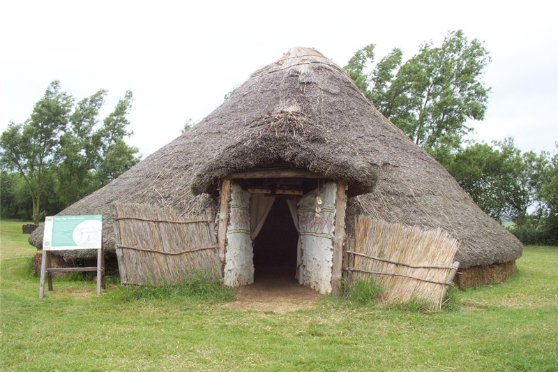
Must Farm Bronze Age settlement

Part of a Bronze Age settlement was uncovered at Must Farm quarry, at Whittlesey, near Peterborough, in Cambridgeshire, England. The site has been described...

Sir Harry Smith Community College

Sir Harry Smith Community College is a secondary school in Whittlesey, Cambridgeshire. Opened in 1953 on the former site of the Whittlesey Workhouse, the...

Whittlesea railway station

Whittlesea railway station is on the Ely–Peterborough line in the East of England and serves the market town of Whittlesey, Cambridgeshire. Whittlesea...

Lattersey Field

Lattersey Field is an 11.9 hectare Local Nature Reserve in Whittlesey in Cambridgeshire. It is owned by Fenland District Council and managed by the Wildlife...

Flag Fen

Flag Fen, east of Peterborough, England, is a Bronze Age site which was constructed about 3500 years ago and consists of more than 60,000 timbers arranged...

Nearby Amenities

Located within 500m of 52.559379,-0.15192544
Bus Stop
Crossway Hand
Bus: yes
Naptan AtcoCode: 0500FWHIY016
Naptan Bearing: E
Naptan CommonName: Crossway Hand
Naptan Indicator: near
Naptan Landmark: Crossway Hand
Naptan NaptanCode: cmbdmdmw
Naptan ShortCommonName: Crossway Hand
Naptan Street: Peterborough Road
Naptan Verified: no
Public Transport: platform
Source: naptan_import
Lat/Long: 52.5611271/-0.145263
Bus Stop
Nurseries
Bus: yes
Naptan AtcoCode: 0500FWHIY021
Naptan Bearing: SW
Naptan CommonName: Nurseries
Naptan Indicator: opp
Naptan Landmark: Nurseries
Naptan NaptanCode: cmbdmdpm
Naptan ShortCommonName: Nurseries
Naptan Street: Peterborough Road
Naptan Verified: no
Public Transport: platform
Source: naptan_import
Lat/Long: 52.5595779/-0.1560243
Bus Stop
Crossway Hand
Bus: yes
Naptan AtcoCode: 0500FWHIY034
Naptan Bearing: W
Naptan CommonName: Crossway Hand
Naptan Indicator: opp
Naptan Landmark: Crossway Hand
Naptan NaptanCode: cmbdmdwj
Naptan ShortCommonName: Crossway Hand
Naptan Street: Peterborough Road
Naptan Verified: no
Public Transport: platform
Source: naptan_import
Lat/Long: 52.5610824/-0.145855
Post Box
Lat/Long: 52.5602289/-0.1527314
Aster Cars
Shop: car
Lat/Long: 52.5601474/-0.1535692
The data included in this document is from www.openstreetmap.org. The data is made available under ODbL.

Have you been to Church Field?

Leave your review of Church Field below (or comments, questions and feedback).