Barnoldby le Beck Park

Downs, Moorland in Lincolnshire

England

Barnoldby le Beck Park

Barnoldby le Beck roundabout, A18: aerial 2022 (1)
Barnoldby le Beck roundabout, A18: aerial 2022 (1) Credit: Chris

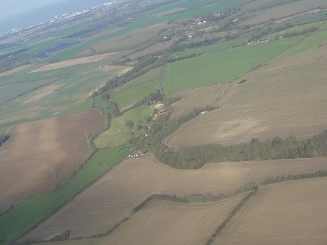
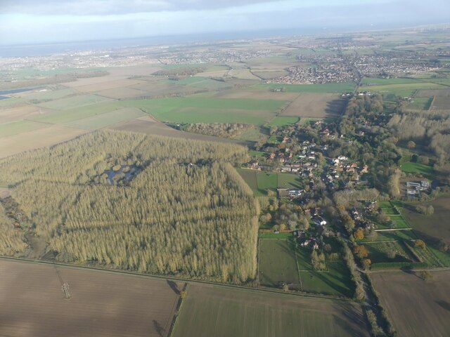
Barnoldby le Beck Park is a picturesque nature reserve located in Lincolnshire, England. Covering an expansive area of downs and moorland, the park offers a diverse range of natural habitats and stunning landscapes for visitors to explore.

The park is characterized by its rolling hills and vast open spaces, making it a popular destination for outdoor enthusiasts and nature lovers. The downs, with their gentle slopes and grassy meadows, provide a perfect setting for picnics, leisurely walks, and birdwatching. Visitors can spot a variety of bird species, including skylarks, kestrels, and meadow pipits, that call the downs their home.

The moorland area of the park is a unique ecosystem, featuring heather-covered hills and peat bogs. This rugged terrain is home to a wide range of flora and fauna, including rare plant species like cotton grass and bilberry. It is also a habitat for several bird species, such as curlews and snipes, as well as small mammals like stoats and weasels.

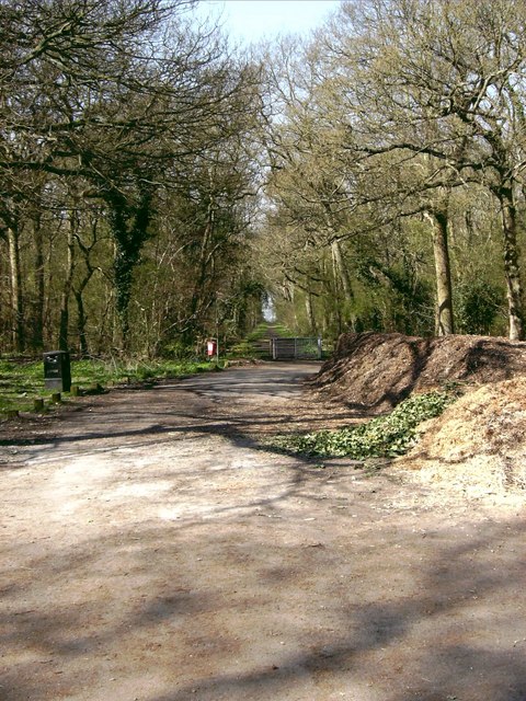
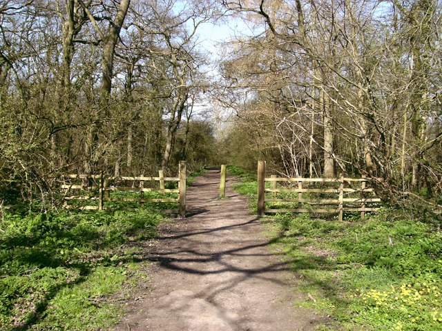
Barnoldby le Beck Park boasts well-maintained walking trails that allow visitors to explore the park at their own pace. These trails offer breathtaking views of the surrounding countryside and provide opportunities for wildlife spotting.

In addition to its natural beauty, the park also offers educational programs and guided tours for visitors interested in learning more about the local flora and fauna. Overall, Barnoldby le Beck Park is a haven for nature enthusiasts, offering a diverse range of natural habitats and stunning landscapes to explore and enjoy.

If you have any feedback on the listing, please let us know in the comments section below.

Barnoldby le Beck Park Images

Images are sourced within 2km of 53.507611/-0.14410407 or Grid Reference TA2302. Thanks to Geograph Open Source API. All images are credited.

Barnoldby le Beck roundabout, A18: aerial 2022 (1)
Barnoldby le Beck roundabout, A18: aerial 2022 (2)
Waithe Beck south of Barnoldby le Beck: aerial 2022
Welbeck Spring: aerial 2022 See <a href="https://www.geograph.org.uk/photo/6825505">TA2204 : Wellbeck Spring and watercress bed (1)</a> and <a href="https://www.geograph.org.uk/photo/7503990">TA2204 : Welbeck spring flows again - June 2023 (2)</a> - the spring runs, and <a href="https://www.geograph.org.uk/photo/6925158">TA2204 : Wellbeck spring is dry again</a> - the spring is dry.
The jury is out as to whether it is running in this shot.

The water runs deep and fast, but not all of the time. It was said by a certain George Oliver in the 19th century: "[Welbeck Spring] which was 'uniformly dry during the winter season, but in the month of February or March, a loud rumbling noise is heard in the ground for several days, and at length the water bursts forth in a hundred places as to fill in a few hours the whole area of the well or enclosure of earth where it is situated...". See <span class="nowrap"><a title="https://en.wikipedia.org/wiki/Welbeck_Hill" rel="nofollow ugc noopener" href="https://en.wikipedia.org/wiki/Welbeck_Hill">Link</a><img style="margin-left:2px;" alt="External link" title="External link - shift click to open in new window" src="https://s1.geograph.org.uk/img/external.png" width="10" height="10"/></span>
Welbeck Spring: aerial 2022
See TA2204 : Wellbeck Spring and watercress bed (1) and TA2204 : Welbeck spring flows again - June 2023 (2) - the spring runs, and TA2204 : Wellbeck spring is dry again - the spring is dry. The jury is out as to whether it is running in this shot. The water runs deep and fast, but not all of the time. It was said by a certain George Oliver in the 19th century: "[Welbeck Spring] which was 'uniformly dry during the winter season, but in the month of February or March, a loud rumbling noise is heard in the ground for several days, and at length the water bursts forth in a hundred places as to fill in a few hours the whole area of the well or enclosure of earth where it is situated...". See LinkExternal link
Welbeck Hill, Anglo Saxon Cemetery site: aerial 2022 Dark Age, mid 5th to late 6th century, cemetery excavated from 1962 to around 1976 following plough disturbance. The cemetery spreads along a gravel spur projecting from the hilltop with two burial alignments predominating; N-S along the spine of the spur and E-W on the Western slopes with cremations on the Eastern slope. Generally the earliest burials are on the Northern slope.

A total of 72 inhumations and 5 cremations have been uncovered with a wide variety of grave goods. The inhumations have pillowing under the heads and one grave was found with bark and bracken fronds. In several graves textiles have been preserved in contact with the metal grave goods

See: <span class="nowrap"><a title="https://www.heritagegateway.org.uk/Gateway/Results_Single.aspx?uid=MNL64&resourceID=1039" rel="nofollow ugc noopener" href="https://www.heritagegateway.org.uk/Gateway/Results_Single.aspx?uid=MNL64&resourceID=1039">Link</a><img style="margin-left:2px;" alt="External link" title="External link - shift click to open in new window" src="https://s1.geograph.org.uk/img/external.png" width="10" height="10"/></span>

Wellbeck Spring bottom left, see <a href="https://www.geograph.org.uk/photo/7144731">TA2204 : Welbeck Spring: aerial 2022</a>.
Welbeck Hill, Anglo Saxon Cemetery site: aerial 2022
Dark Age, mid 5th to late 6th century, cemetery excavated from 1962 to around 1976 following plough disturbance. The cemetery spreads along a gravel spur projecting from the hilltop with two burial alignments predominating; N-S along the spine of the spur and E-W on the Western slopes with cremations on the Eastern slope. Generally the earliest burials are on the Northern slope. A total of 72 inhumations and 5 cremations have been uncovered with a wide variety of grave goods. The inhumations have pillowing under the heads and one grave was found with bark and bracken fronds. In several graves textiles have been preserved in contact with the metal grave goods See: LinkExternal link Wellbeck Spring bottom left, see TA2204 : Welbeck Spring: aerial 2022.
Ploughed field west of Barnoldby le Beck: aerial 2023
Hatcliffe towards Barnoldby le Beck: aerial 2023 Two sides of a potential Medieval or Post Medieval enclosure were seen as earthworks. The possible enclosure is ditch-defined, centred at TA 2228 0133. 

See: <span class="nowrap"><a title="https://www.heritagegateway.org.uk/Gateway/Results_Single.aspx?uid=MNL2515&resourceID=1039" rel="nofollow ugc noopener" href="https://www.heritagegateway.org.uk/Gateway/Results_Single.aspx?uid=MNL2515&resourceID=1039">Link</a><img style="margin-left:2px;" alt="External link" title="External link - shift click to open in new window" src="https://s1.geograph.org.uk/img/external.png" width="10" height="10"/></span>
Hatcliffe towards Barnoldby le Beck: aerial 2023
Two sides of a potential Medieval or Post Medieval enclosure were seen as earthworks. The possible enclosure is ditch-defined, centred at TA 2228 0133. See: LinkExternal link
Welbeck spring flows again - June 2023 (1) Last seen running in May 2021, when the pool by the spring was full of watercress and lush growth.

What looks like water weed waving in the water is in fact grass, which had been growing in peace in the dry stream bed until recently.

For this and full details see <a href="https://www.geograph.org.uk/photo/6825505">TA2204 : Wellbeck Spring and watercress bed (1)</a>.
Welbeck spring flows again - June 2023 (1)
Last seen running in May 2021, when the pool by the spring was full of watercress and lush growth. What looks like water weed waving in the water is in fact grass, which had been growing in peace in the dry stream bed until recently. For this and full details see TA2204 : Wellbeck Spring and watercress bed (1).
Welbeck spring flows again - June 2023 (2) Last seen running in May 2021, when the pool by the spring was full of watercress and lush growth.

For this and full details see <a href="https://www.geograph.org.uk/photo/6825505">TA2204 : Wellbeck Spring and watercress bed (1)</a>.
Welbeck spring flows again - June 2023 (2)
Last seen running in May 2021, when the pool by the spring was full of watercress and lush growth. For this and full details see TA2204 : Wellbeck Spring and watercress bed (1).
Field by Waithe Beck, between Barnoldby le Beck and Hatcliffe Top: aerial 2023
Waithe Beck and Wanderlust Way towards Hatcliffe: aerial 2023
Woodland, Barnoldby le Beck: aerial 2023
St.Helen's church, Barnoldby-le-Beck, Lincs. Much restored with Norman origins and some medieval glass.
St.Helen's church, Barnoldby-le-Beck, Lincs.
Much restored with Norman origins and some medieval glass.
Wanderlust Way The signpost points northwards along the "Wanderlust Way". The obelisk is a monument to William Shaw of Brocklesby .. the plaque reads 'This monument was erected by his many friends as a token of their regard and to mark the spot where William Smith, huntsman to the Earl of Yarborough fell on 11th April 1845. His gallant horsemanship and management of hounds in the kennel and in the field were unsurpassed. His horse falling over a small leap whilst Smith was cheering on his favourite hounds, he was thrown on his head and from the injuries he then received, he died on 16th April 1845 at the house of his friend Richard Nainby of this village esquire, by whom the site for this memorial was given on the 6th day of April 1861'
Wanderlust Way
The signpost points northwards along the "Wanderlust Way". The obelisk is a monument to William Shaw of Brocklesby .. the plaque reads 'This monument was erected by his many friends as a token of their regard and to mark the spot where William Smith, huntsman to the Earl of Yarborough fell on 11th April 1845. His gallant horsemanship and management of hounds in the kennel and in the field were unsurpassed. His horse falling over a small leap whilst Smith was cheering on his favourite hounds, he was thrown on his head and from the injuries he then received, he died on 16th April 1845 at the house of his friend Richard Nainby of this village esquire, by whom the site for this memorial was given on the 6th day of April 1861'
Grange Farm, Barnoldby-Le-Beck
The Road To Beelsby From the A18.
The Road To Beelsby
From the A18.
A Short Ride To Odessa A Public Bridleway to Beelsby and Odessa from Welbeck Hill.
A Short Ride To Odessa
A Public Bridleway to Beelsby and Odessa from Welbeck Hill.
South To The Sun The A18 near Barnoldby le Beck.
South To The Sun
The A18 near Barnoldby le Beck.
Show me another place!

Barnoldby le Beck Park is located at Grid Ref: TA2302 (Lat: 53.507611, Lng: -0.14410407)

Unitary Authority: North East Lincolnshire

Police Authority: Humberside

What 3 Words

///hillside.amounting.songbird. Near Waltham, Lincolnshire

Nearby Locations

Barnoldby le Beck Park

Related Wikis

Grimsby Rural District

Grimsby Rural District was a rural district in Lincolnshire, England, part of the administrative county of Lindsey, from 1894 to 1974. The district covered...

Barnoldby le Beck

Barnoldby le Beck is a village and civil parish in North East Lincolnshire, England, It is situated just east of the A18 and is close to the village of...

Brigsley

Brigsley is a village and civil parish in North East Lincolnshire, England, and on the B1203 road, 1 mile (1.6 km) south from Waltham. According to the...

Beelsby

Beelsby is a village in North East Lincolnshire, England. The village is situated approximately 6 miles (10 km) south-west from Grimsby. Beelsby population...

Black Lady of Bradley Woods

The Black Lady of Bradley Woods is a ghost which reportedly haunts the woods near the village of Bradley, Lincolnshire, England.Alleged eyewitnesses have...

Bradley and Dixon Woods

Bradley and Dixon Woods is a 41.77-hectare (103.2-acre) local nature reserve near the town of Grimsby in North East Lincolnshire. It is owned and managed...

Hatcliffe

Hatcliffe is a small village and civil parish in rural North East Lincolnshire, England. It is situated 6 miles (10 km) south-west from Grimsby and 1.5...

Waltham Windmill

Waltham Windmill is a six-sailed windmill located in the village of Waltham, five miles from Grimsby in North East Lincolnshire, England. It is renowned...

Nearby Amenities

Located within 500m of 53.507611,-0.14410407
Power: tower
Lat/Long: 53.5075321/-0.1506861
Power: tower
Lat/Long: 53.5099603/-0.1495484
Mickling Barf
Place: locality
Source: Bing
Lat/Long: 53.505158/-0.1503652
Barrier: stile
Lat/Long: 53.5083253/-0.1434287
Barrier: stile
Lat/Long: 53.5093229/-0.1406772
The data included in this document is from www.openstreetmap.org. The data is made available under ODbL.

Have you been to Barnoldby le Beck Park?

Leave your review of Barnoldby le Beck Park below (or comments, questions and feedback).