Quadring Low Fen

Downs, Moorland in Lincolnshire South Holland

England

Quadring Low Fen

Looking along Long Drove at Hundred Fen Each of the villages between Bourne and Heckington, a distance of some 15 miles, almost without exception has a road leading out onto the fen named after its village and terminating at the South Forty Foot Drain. These roads are often straight, apart from double-sharp bends to keep them heading in the same direction. The road eastwards from the B1177 between Billingborough and Pointon is an exception as it crosses the South Forty Foot Drain. At first it is known as Neslam Road (after Neslam Fen) and after it crosses the Drain it becomes Long Drove. Unlike some of the other roads which cross the South Forty Foot Drain, this is a fairly quiet, narrow and bumpy road.
Looking along Long Drove at Hundred Fen Credit: Marathon

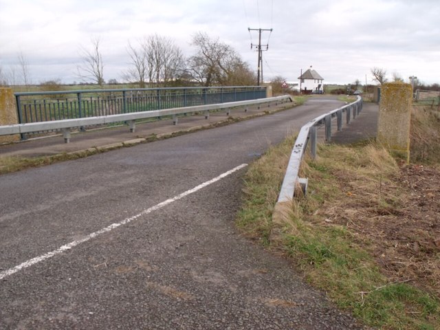
Quadring Low Fen is a small village located in the county of Lincolnshire, England. Situated in the eastern part of the county, it is part of the South Holland district. The village is nestled in a low-lying area known as the fens, characterized by its flat and marshy landscape.

Quadring Low Fen is surrounded by picturesque countryside, offering beautiful views of the Lincolnshire Downs to the west and vast moorland to the east. The village itself is quaint and peaceful, with a population of approximately 500 residents.

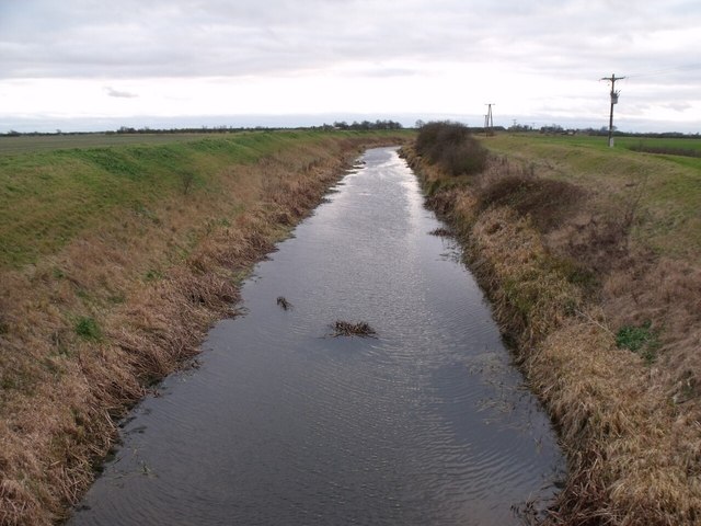
The area is known for its rich agricultural heritage, with many farms dotting the landscape. The fertile soil and abundance of water from the nearby rivers provide ideal conditions for farming. Crops such as potatoes, vegetables, and cereals thrive in this area, contributing to the local economy.

The village is well-connected to nearby towns and cities, with the market town of Spalding located just a few miles to the south. The transport links in the area include well-maintained roads and regular bus services, making it easy to access amenities and services in the surrounding areas.

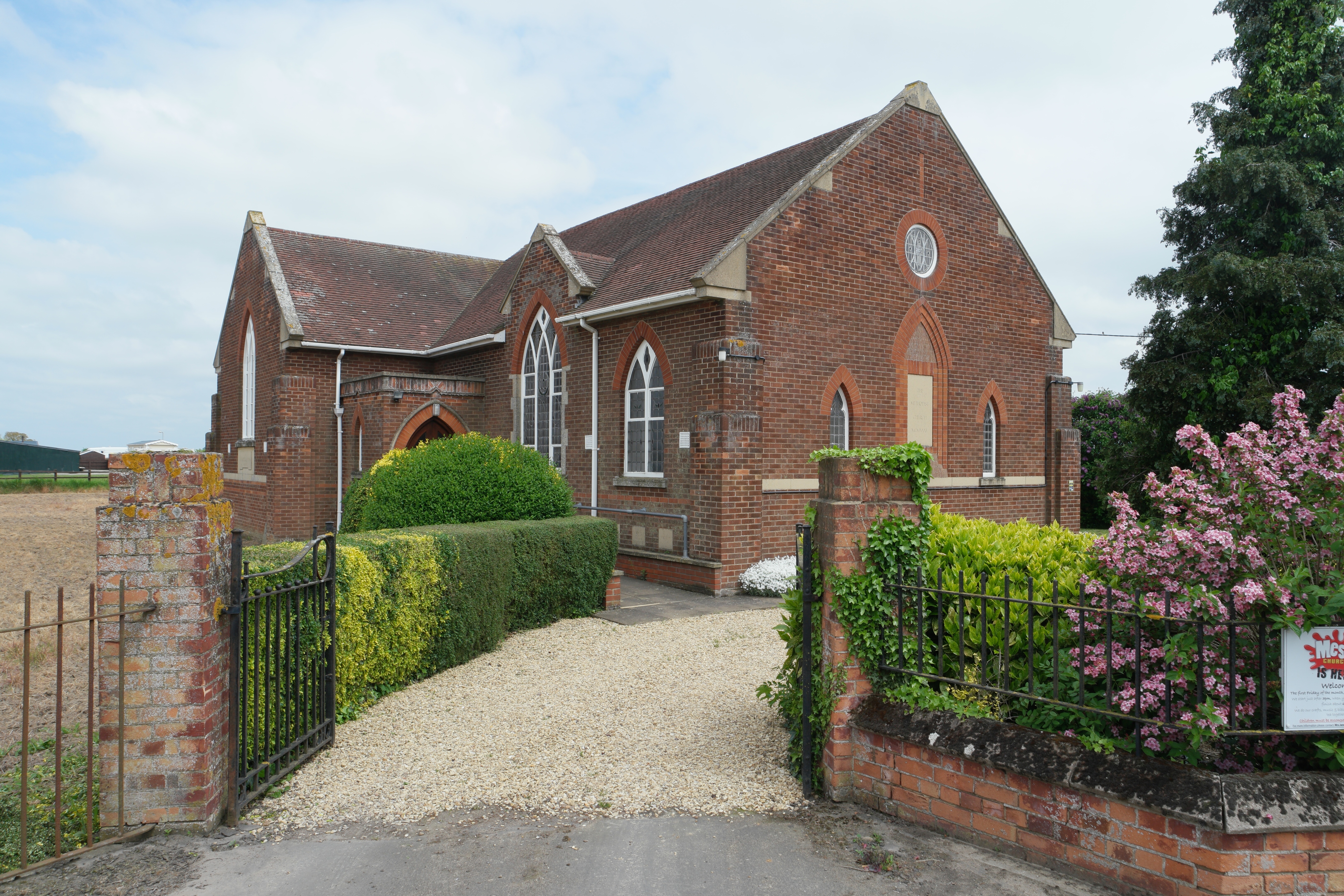
Quadring Low Fen is also home to a number of historic buildings, including the St. Margaret's Church, which dates back to the 13th century. The church is a notable landmark in the village and attracts visitors interested in its architectural and historical significance.

Overall, Quadring Low Fen offers a serene and picturesque setting, making it an attractive place to live or visit for those seeking a peaceful countryside experience.

If you have any feedback on the listing, please let us know in the comments section below.

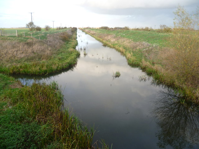
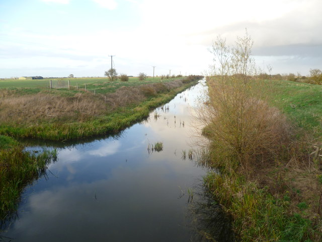
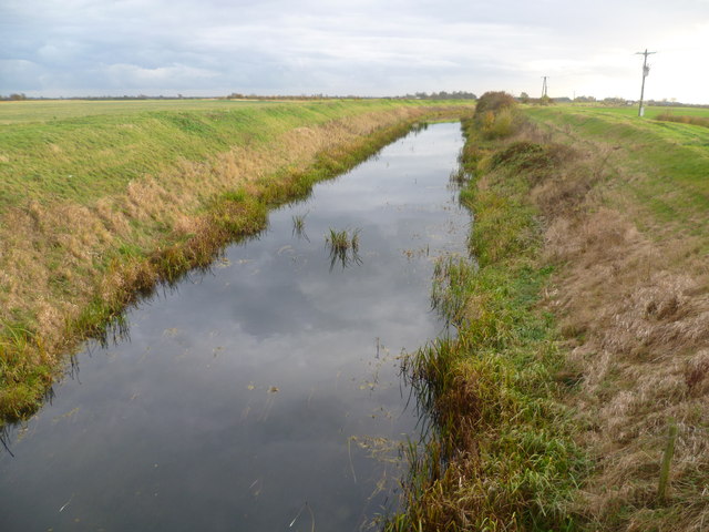
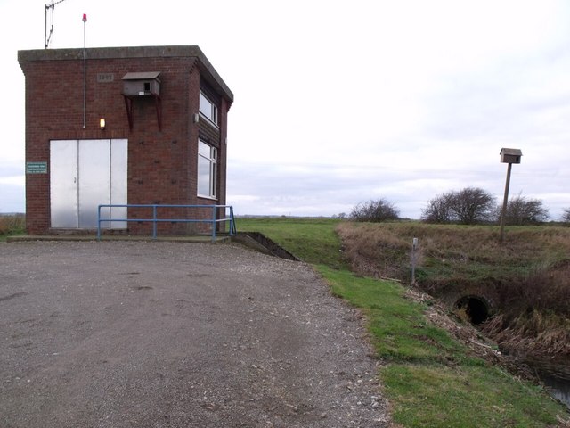
Quadring Low Fen Images

Images are sourced within 2km of 52.882073/-0.25256527 or Grid Reference TF1733. Thanks to Geograph Open Source API. All images are credited.

Looking along Long Drove at Hundred Fen Each of the villages between Bourne and Heckington, a distance of some 15 miles, almost without exception has a road leading out onto the fen named after its village and terminating at the South Forty Foot Drain. These roads are often straight, apart from double-sharp bends to keep them heading in the same direction. The road eastwards from the B1177 between Billingborough and Pointon is an exception as it crosses the South Forty Foot Drain. At first it is known as Neslam Road (after Neslam Fen) and after it crosses the Drain it becomes Long Drove. Unlike some of the other roads which cross the South Forty Foot Drain, this is a fairly quiet, narrow and bumpy road.
Looking along Long Drove at Hundred Fen
Each of the villages between Bourne and Heckington, a distance of some 15 miles, almost without exception has a road leading out onto the fen named after its village and terminating at the South Forty Foot Drain. These roads are often straight, apart from double-sharp bends to keep them heading in the same direction. The road eastwards from the B1177 between Billingborough and Pointon is an exception as it crosses the South Forty Foot Drain. At first it is known as Neslam Road (after Neslam Fen) and after it crosses the Drain it becomes Long Drove. Unlike some of the other roads which cross the South Forty Foot Drain, this is a fairly quiet, narrow and bumpy road.
Hundred Fen from Long Drove Each of the villages between Bourne and Heckington, a distance of some 15 miles, almost without exception has a road leading out onto the fen named after its village and terminating at the South Forty Foot Drain. These roads are often straight, apart from double-sharp bends to keep them heading in the same direction. The road eastwards from the B1177 between Billingborough and Pointon is an exception as it crosses the South Forty Foot Drain. At first it is known as Neslam Road (after Neslam Fen) and after it crosses the Drain it becomes Long Drove. Unlike some of the other roads which cross the South Forty Foot Drain, this is a fairly quiet, narrow and bumpy road. Sometimes, as here, the roads in this largely treeless landscape are lined by trees, whilst on the right is a typical fenland field.
Hundred Fen from Long Drove
Each of the villages between Bourne and Heckington, a distance of some 15 miles, almost without exception has a road leading out onto the fen named after its village and terminating at the South Forty Foot Drain. These roads are often straight, apart from double-sharp bends to keep them heading in the same direction. The road eastwards from the B1177 between Billingborough and Pointon is an exception as it crosses the South Forty Foot Drain. At first it is known as Neslam Road (after Neslam Fen) and after it crosses the Drain it becomes Long Drove. Unlike some of the other roads which cross the South Forty Foot Drain, this is a fairly quiet, narrow and bumpy road. Sometimes, as here, the roads in this largely treeless landscape are lined by trees, whilst on the right is a typical fenland field.
Looking across Hundred Fen This is a typical fenland scene with a flat landscape, large hedgeless fields, often isolated trees and lonely farms. The most noticeable feature is often the skies as here. This was a day of sunshine and heavy showers - towering clouds in the distance promise more rain.
Looking across Hundred Fen
This is a typical fenland scene with a flat landscape, large hedgeless fields, often isolated trees and lonely farms. The most noticeable feature is often the skies as here. This was a day of sunshine and heavy showers - towering clouds in the distance promise more rain.
Long Drove near Neslam Bridge Each of the villages between Bourne and Heckington, a distance of some 15 miles, almost without exception has a road leading out onto the fen named after its village and terminating at the South Forty Foot Drain. These roads are often straight, apart from double-sharp bends to keep them heading in the same direction. The road eastwards from the B1177 between Billingborough and Pointon is an exception as it crosses the South Forty Foot Drain at Neslam Bridge. At first it is known as Neslam Road (after Neslam Fen) and after it crosses the Drain it becomes Long Drove. Unlike some of the other roads which cross the South Forty Foot Drain, this is a fairly quiet, narrow and bumpy road. This is a typical fenland scene with a flat landscape, large fields, often isolated trees and very isolated farms.
Long Drove near Neslam Bridge
Each of the villages between Bourne and Heckington, a distance of some 15 miles, almost without exception has a road leading out onto the fen named after its village and terminating at the South Forty Foot Drain. These roads are often straight, apart from double-sharp bends to keep them heading in the same direction. The road eastwards from the B1177 between Billingborough and Pointon is an exception as it crosses the South Forty Foot Drain at Neslam Bridge. At first it is known as Neslam Road (after Neslam Fen) and after it crosses the Drain it becomes Long Drove. Unlike some of the other roads which cross the South Forty Foot Drain, this is a fairly quiet, narrow and bumpy road. This is a typical fenland scene with a flat landscape, large fields, often isolated trees and very isolated farms.
South Forty Foot Drain from Neslam Bridge Each of the villages between Bourne and Heckington, a distance of some 15 miles, almost without exception has a road leading out onto the fen named after its village and terminating at the South Forty Foot Drain. The road eastwards from the B1177 between Billingborough and Pointon is an exception as it crosses the South Forty Foot Drain at Neslam Bridge. This is the view from Neslam Bridge looking north along the South Forty Foot Drain, which is the main drainage channel for the whole area.
South Forty Foot Drain from Neslam Bridge
Each of the villages between Bourne and Heckington, a distance of some 15 miles, almost without exception has a road leading out onto the fen named after its village and terminating at the South Forty Foot Drain. The road eastwards from the B1177 between Billingborough and Pointon is an exception as it crosses the South Forty Foot Drain at Neslam Bridge. This is the view from Neslam Bridge looking north along the South Forty Foot Drain, which is the main drainage channel for the whole area.
Looking along the South Forty Foot Drain from Neslam Bridge Each of the villages between Bourne and Heckington, a distance of some 15 miles, almost without exception has a road leading out onto the fen named after its village and terminating at the South Forty Foot Drain. The road eastwards from the B1177 between Billingborough and Pointon is an exception as it crosses the South Forty Foot Drain at Neslam Bridge. This is the view from Neslam Bridge looking north along the South Forty Foot Drain, which is the main drainage channel for the whole area.
Looking along the South Forty Foot Drain from Neslam Bridge
Each of the villages between Bourne and Heckington, a distance of some 15 miles, almost without exception has a road leading out onto the fen named after its village and terminating at the South Forty Foot Drain. The road eastwards from the B1177 between Billingborough and Pointon is an exception as it crosses the South Forty Foot Drain at Neslam Bridge. This is the view from Neslam Bridge looking north along the South Forty Foot Drain, which is the main drainage channel for the whole area.
South Forty Foot Drain from Neslam Bridge Each of the villages between Bourne and Heckington, a distance of some 15 miles, almost without exception has a road leading out onto the fen named after its village and terminating at the South Forty Foot Drain. The road eastwards from the B1177 between Billingborough and Pointon is an exception as it crosses the South Forty Foot Drain at Neslam Bridge. This is the view from Neslam Bridge looking south along the South Forty Foot Drain, which is the main drainage channel for the whole area.
South Forty Foot Drain from Neslam Bridge
Each of the villages between Bourne and Heckington, a distance of some 15 miles, almost without exception has a road leading out onto the fen named after its village and terminating at the South Forty Foot Drain. The road eastwards from the B1177 between Billingborough and Pointon is an exception as it crosses the South Forty Foot Drain at Neslam Bridge. This is the view from Neslam Bridge looking south along the South Forty Foot Drain, which is the main drainage channel for the whole area.
Footpath and drain from Bull Bridge
Long Drove and drain
South Drove at Quadring Low Fen
Bend in North Drove, near Machin's farm The road sign warns of uneven surface. The adjacent drain continues straight on.
Bend in North Drove, near Machin's farm
The road sign warns of uneven surface. The adjacent drain continues straight on.
Quadring Fen Pumping Station Pumps from Quadring Low fen into the South Forty-foot drain. Built 1967 - with its own nesting box?
See <span class="nowrap"><a title="http://en.wikipedia.org/wiki/South_Forty-Foot_Drain" rel="nofollow ugc noopener" href="http://en.wikipedia.org/wiki/South_Forty-Foot_Drain">Link</a><img style="margin-left:2px;" alt="External link" title="External link - shift click to open in new window" src="https://s1.geograph.org.uk/img/external.png" width="10" height="10"/></span> for more information.
Quadring Fen Pumping Station
Pumps from Quadring Low fen into the South Forty-foot drain. Built 1967 - with its own nesting box? See LinkExternal link for more information.
Neslam road crossing Neslam Bridge The bridge crosses the south Forty Foot Drain
Neslam road crossing Neslam Bridge
The bridge crosses the south Forty Foot Drain
South Forty Foot Drain More info <span class="nowrap"><a title="http://en.wikipedia.org/wiki/South_Forty-Foot_Drain" rel="nofollow ugc noopener" href="http://en.wikipedia.org/wiki/South_Forty-Foot_Drain">Link</a><img style="margin-left:2px;" alt="External link" title="External link - shift click to open in new window" src="https://s1.geograph.org.uk/img/external.png" width="10" height="10"/></span>
South Forty Foot Drain
More info LinkExternal link
South Drove runs over Calf bridge
North Drove near Shoff Farm
Drain running north from South Drove Who knows if that puddle in the foreground will drain into it!
Drain running north from South Drove
Who knows if that puddle in the foreground will drain into it!
Track to Mallard House Farm From Mallard Drove
Track to Mallard House Farm
From Mallard Drove
Show me another place!

Quadring Low Fen is located at Grid Ref: TF1733 (Lat: 52.882073, Lng: -0.25256527)

Administrative County: Lincolnshire

District: South Holland

Police Authority: Lincolnshire

What 3 Words

///softest.plums.microfilm. Near Donington, Lincolnshire

Nearby Locations

Quadring Low Fen

Related Wikis

Quadring Fen

Quadring Fen is a hamlet in the South Holland district of Lincolnshire, England. It is situated 2 miles (3.2 km) south from the A52 road, 5 miles (8.0...

Donington Road railway station

Donington Road railway station was a station in Lincolnshire on the line between Spalding and Sleaford. == References == == External links == Donington...

South Forty-Foot Drain

The South Forty-Foot Drain, also known as the Black Sluice Navigation, is the main channel for the land-drainage of the Black Sluice Level in the Lincolnshire...

Gosberton Clough

Gosberton Clough is a village in the civil parish of Gosberton and the South Holland district of Lincolnshire, England. It is 30 miles (50 km) south-east...

Donington, Lincolnshire

Donington is a large village and civil parish in the South Holland district of Lincolnshire, England. It is 8 miles (13 km) north from the market town...

Cowley Academy

Cowley Academy (formally The Thomas Cowley High School) is a mixed secondary school with Academy status, in Donington, Lincolnshire, England. As of 1 September...

Bridgend Priory

Bridgend Priory was a monastic house in Horbling, Lincolnshire, England. The priory was founded around 1199 by Godwin the Rich of Lincoln, a benefactor...

Westhorpe, Lincolnshire

Westhorpe is a hamlet in the civil parish of Gosberton and the South Holland district of Lincolnshire, England. It is 30 miles (50 km) south-east from...

Nearby Amenities

Located within 500m of 52.882073,-0.25256527
Machin's Farm
Place: farm
Source: Bing
Lat/Long: 52.8846264/-0.2542665
Quadring Low Fen
Place: locality
Source: Bing
Lat/Long: 52.8803637/-0.2517734
Willowtree Farm
Place: farm
Source: Bing
Lat/Long: 52.8832713/-0.2574211
Place: isolated_dwelling
Source: Bing
Lat/Long: 52.8843288/-0.2466911
Dane Lodge
Place: isolated_dwelling
Source: Bing
Lat/Long: 52.8845242/-0.2527548
The data included in this document is from www.openstreetmap.org. The data is made available under ODbL.

Have you been to Quadring Low Fen?

Leave your review of Quadring Low Fen below (or comments, questions and feedback).