Backside Field

Downs, Moorland in Lincolnshire South Kesteven

England

Backside Field

Deeping Lakes Nature Reserve Flooded gravel pits near Deeping St. James which are now owned by the Lincolnshire Wildlife Trust and are run as a Nature Reserve open to the public (hence the 15mph sign!)
Deeping Lakes Nature Reserve Credit: James

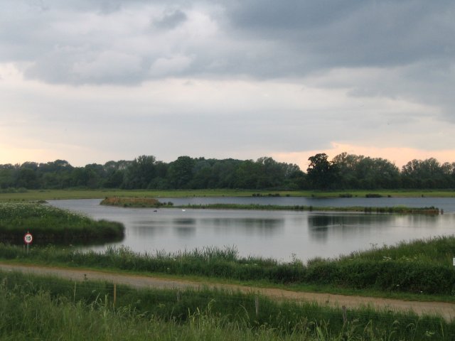
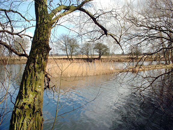
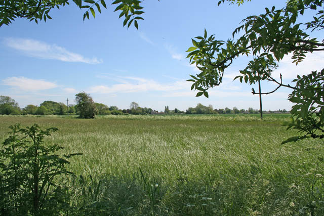
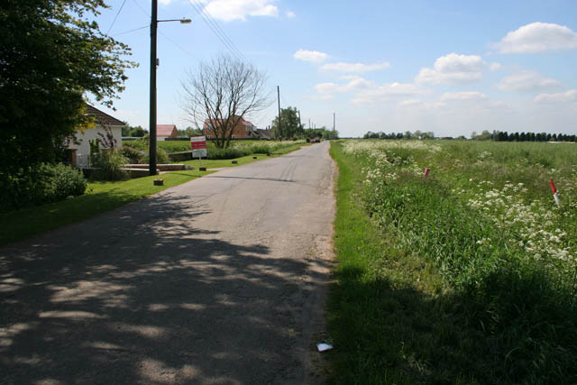
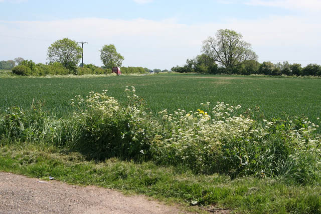
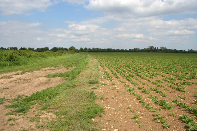
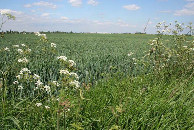
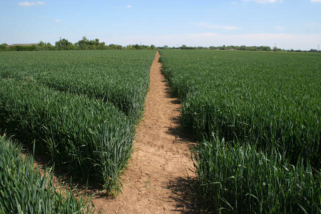
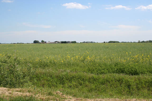
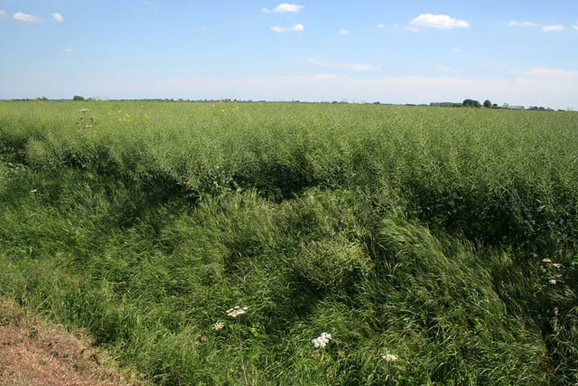
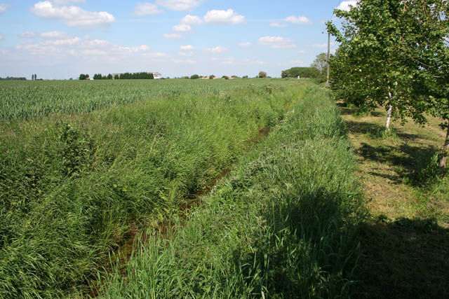
Backside Field is a vast expanse of open land located in Lincolnshire, England. It is known for its diverse landscape, comprising of downs and moorland. The field stretches over several miles, covering an area of approximately 200 acres.

The downs in Backside Field are characterized by rolling hills and gentle slopes, providing stunning panoramic views of the surrounding countryside. These areas are covered in lush green grass, dotted with clusters of wildflowers during the spring and summer months. The downs are a popular spot for hikers, offering numerous walking trails that wind through the picturesque landscape.

Adjacent to the downs is the moorland, which is a unique feature of Backside Field. This area is characterized by its rugged terrain, with rocky outcrops and patches of heather dominating the landscape. Moorland is home to a variety of wildlife, including birds of prey, such as kestrels and buzzards, as well as small mammals like rabbits and voles.

Backside Field is also known for its rich history, with traces of ancient settlements and burial mounds scattered throughout the area. Archaeological excavations have revealed artifacts dating back thousands of years, offering a glimpse into the lives of early inhabitants.

Overall, Backside Field is a natural haven, offering a tranquil escape from urban life. Its diverse landscape, comprising of downs and moorland, provides a unique setting for outdoor enthusiasts and nature lovers alike.

If you have any feedback on the listing, please let us know in the comments section below.

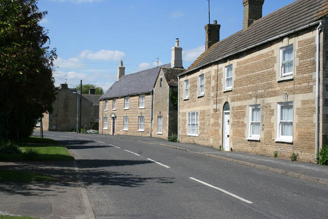
Backside Field Images

Images are sourced within 2km of 52.667512/-0.27279118 or Grid Reference TF1609. Thanks to Geograph Open Source API. All images are credited.

Deeping Lakes Nature Reserve Flooded gravel pits near Deeping St. James which are now owned by the Lincolnshire Wildlife Trust and are run as a Nature Reserve open to the public (hence the 15mph sign!)
Deeping Lakes Nature Reserve
Flooded gravel pits near Deeping St. James which are now owned by the Lincolnshire Wildlife Trust and are run as a Nature Reserve open to the public (hence the 15mph sign!)
Deeping Lakes NR near Peterborough Opened in September 2004, Deeping Lakes Nature Reserve is a complex of old flooded gravel pits in an area of Fen landscape in south Lincolnshire.
Deeping Lakes NR near Peterborough
Opened in September 2004, Deeping Lakes Nature Reserve is a complex of old flooded gravel pits in an area of Fen landscape in south Lincolnshire.
The Priory Church of Deeping St James Larger than your average Parish Church because it was a priory until the reformation. Norman arches, a graveside shelter and 12th C font to be found inside.
The Priory Church of Deeping St James
Larger than your average Parish Church because it was a priory until the reformation. Norman arches, a graveside shelter and 12th C font to be found inside.
Deeping St James village In the middle of the road area stands the old lock up. Notice the faint outline of an AWAC plane in the sky.
Deeping St James village
In the middle of the road area stands the old lock up. Notice the faint outline of an AWAC plane in the sky.
Arable farmland off Sutton's Lane It looks like wheat but it's difficult to tell this time of the year.
Arable farmland off Sutton's Lane
It looks like wheat but it's difficult to tell this time of the year.
Rippon's Drove Many of the lanes, tracks and country roads through the Fens carry the name "Drove", an old name given to routes that were used to move livestock.
Rippon's Drove
Many of the lanes, tracks and country roads through the Fens carry the name "Drove", an old name given to routes that were used to move livestock.
North Fen Looking towards Peakirk Road from Rippon's Drove.
North Fen
Looking towards Peakirk Road from Rippon's Drove.
Cottages on Eastgate, Deeping St James The main street through Deeping St James follows the contours of the River Welland. The houses on the right are mainly post war and back onto the river. When these stone cottages were built they would have had a clear view of the water.
Cottages on Eastgate, Deeping St James
The main street through Deeping St James follows the contours of the River Welland. The houses on the right are mainly post war and back onto the river. When these stone cottages were built they would have had a clear view of the water.
Giddeon's Drove One of many tracks that go nowhere in particular. The trees on the horizon follow the River Welland in Deeping St James.
Giddeon's Drove
One of many tracks that go nowhere in particular. The trees on the horizon follow the River Welland in Deeping St James.
Cottage on Station Road This cottage is halfway between Deeping St James and the Lakeside Caravan Park. It looks idyllic but there is a sewage treatment works directly opposite.
Cottage on Station Road
This cottage is halfway between Deeping St James and the Lakeside Caravan Park. It looks idyllic but there is a sewage treatment works directly opposite.
House on a bend This is the last house as you leave Deeping St James. Station Road to the right and Eastgate to the left. The bend is really sharp, almost a hairpin bend.
House on a bend
This is the last house as you leave Deeping St James. Station Road to the right and Eastgate to the left. The bend is really sharp, almost a hairpin bend.
River Welland The gardens on the southwest side of the main street through Deeping St James go right down to the river. The Welland isquite narrow at this point. In <a href="https://www.geograph.org.uk/gridref/TF1707">TF1707</a> the Maxey Cut, the Fally River Drain and the South Drain flow into the river making it much wider.
River Welland
The gardens on the southwest side of the main street through Deeping St James go right down to the river. The Welland isquite narrow at this point. In TF1707 the Maxey Cut, the Fally River Drain and the South Drain flow into the river making it much wider.
Eastgate, Deeping St James Deeping St. James is a village lying next to Market Deeping, along the banks of the River Welland. The village grew up around a Benedictine Priory and stones from the ruined Priory were used in several 17th century buildings. These cottages look younger than that, probably early 19th Century. They show some fine detailing in the stonework. Originally they would have faced the river but 20th century development has taken place between the road and the Welland.
Eastgate, Deeping St James
Deeping St. James is a village lying next to Market Deeping, along the banks of the River Welland. The village grew up around a Benedictine Priory and stones from the ruined Priory were used in several 17th century buildings. These cottages look younger than that, probably early 19th Century. They show some fine detailing in the stonework. Originally they would have faced the river but 20th century development has taken place between the road and the Welland.
Prior's Meadow, Deeping St James Off Stowgate Road, this large field must have originally attached to the Benedictine Priory. The Priory was founded at Deeping St James in 1139 by Baldwin Fitzgilbert, a junior member of the Clare family, much favoured by King Henry I.
See <span class="nowrap"><a title="http://www.users.zetnet.co.uk/mwarrick/history/index.htm" rel="nofollow ugc noopener" href="http://www.users.zetnet.co.uk/mwarrick/history/index.htm">Link</a><img style="margin-left:2px;" alt="External link" title="External link - shift click to open in new window" src="https://s1.geograph.org.uk/img/external.png" width="10" height="10"/></span> for information about the Priory and church.
Prior's Meadow, Deeping St James
Off Stowgate Road, this large field must have originally attached to the Benedictine Priory. The Priory was founded at Deeping St James in 1139 by Baldwin Fitzgilbert, a junior member of the Clare family, much favoured by King Henry I. See LinkExternal link for information about the Priory and church.
Public footpath off Stowgate Road Well maintained footpaths on this farmland next to Priors Meadow Riding School.
Public footpath off Stowgate Road
Well maintained footpaths on this farmland next to Priors Meadow Riding School.
Farmland off Cranmore Drove The crop is oilseed rape: this field was a sea of yellow two weeks ago but now the all important seedpods are forming. The buildings in the distance are in <a href="https://www.geograph.org.uk/gridref/TF1809">TF1809</a>.
Farmland off Cranmore Drove
The crop is oilseed rape: this field was a sea of yellow two weeks ago but now the all important seedpods are forming. The buildings in the distance are in TF1809.
Cranmore Looking diagonally across the square.
Typical Fens landscape near Market Deeping: flat farmland with dykes and drains instead of hedges giving the impression of an endless field. The Peterborough to Spalding railway crosses the picture on the horizon, the track being on an embankment above the surrounding land which is about 3 metres above sea level.
Cranmore
Looking diagonally across the square. Typical Fens landscape near Market Deeping: flat farmland with dykes and drains instead of hedges giving the impression of an endless field. The Peterborough to Spalding railway crosses the picture on the horizon, the track being on an embankment above the surrounding land which is about 3 metres above sea level.
Farmland off Station Road Between Deeping Common and Cranmore. The Peterborough to Spalding railway runs just in front of the trees far centre left and the farm towards the left is Cranmore Farm.
Farmland off Station Road
Between Deeping Common and Cranmore. The Peterborough to Spalding railway runs just in front of the trees far centre left and the farm towards the left is Cranmore Farm.
Show me another place!

Backside Field is located at Grid Ref: TF1609 (Lat: 52.667512, Lng: -0.27279118)

Administrative County: Lincolnshire

District: South Kesteven

Police Authority: Lincolnshire

What 3 Words

///poetic.defaults.defend. Near Northborough, Cambridgeshire

Nearby Locations

Backside Field

Related Wikis

St James Deeping railway station

St James Deeping is a former railway station which served the village of Deeping St James and town of Market Deeping in Lincolnshire, England. It was on...

Frognall

Frognall is a small village in the South Kesteven district of Lincolnshire, England. It is situated just north-east of Deeping St James , to which it is...

Deeping St James Priory

Deeping St James Priory was a priory in Deeping St James, Lincolnshire, England. It was a dependency of Thorney Abbey. == History == In 1139 Baldwin Fitz...

The Deepings School

The Deepings School is a coeducational secondary school and sixth form with academy status, located on Park Road in Deeping St James (near Peterborough...

Deeping Gate

Deeping Gate is a village and civil parish, lying on the River Welland in Cambridgeshire. Traditionally, the area was part of the Soke of Peterborough...

Deeping St James

Deeping St James is a large village in the South Kesteven district of Lincolnshire, England. The population of the civil parish (including Frognall) was...

The Deepings

The Deepings (grid reference TF150094) are a series of settlements close to the River Welland near the borders of southern Lincolnshire and north western...

Deeping Lakes Nature Reserve

Deeping Lakes Nature Reserve, also known as Deeping Gravel Pits is a local nature reserve with an area of over 160 acres located south-east of Deeping...

Nearby Amenities

Located within 500m of 52.667512,-0.27279118
Post Box
Lat/Long: 52.6669659/-0.2797253
Priors Meadow
Place: locality
Source: Bing
Lat/Long: 52.6709165/-0.270983
Backside Field
Place: locality
Source: Bing
Lat/Long: 52.668572/-0.2759204
Generator Method: photovoltaic
Generator Output Electricity: yes
Generator Source: solar
Generator Type: solar_photovoltaic_panel
Location: roof
Power: generator
Lat/Long: 52.6675066/-0.2786091
Generator Method: photovoltaic
Generator Output Electricity: yes
Generator Source: solar
Generator Type: solar_photovoltaic_panel
Location: roof
Power: generator
Lat/Long: 52.6647462/-0.2773646
Generator Method: photovoltaic
Generator Output Electricity: yes
Generator Source: solar
Generator Type: solar_photovoltaic_panel
Location: roof
Power: generator
Lat/Long: 52.6646568/-0.2772975
The data included in this document is from www.openstreetmap.org. The data is made available under ODbL.

Have you been to Backside Field?

Leave your review of Backside Field below (or comments, questions and feedback).