Balgonar

Settlement in Fife

Scotland

Balgonar

The B914 in Saline With the Ochils in the background.
The B914 in Saline Credit: David Purchase

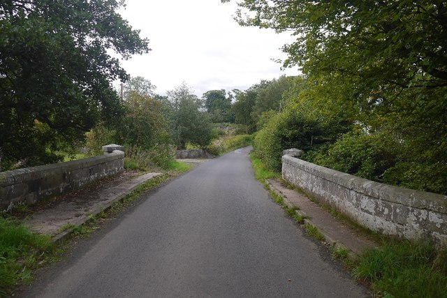
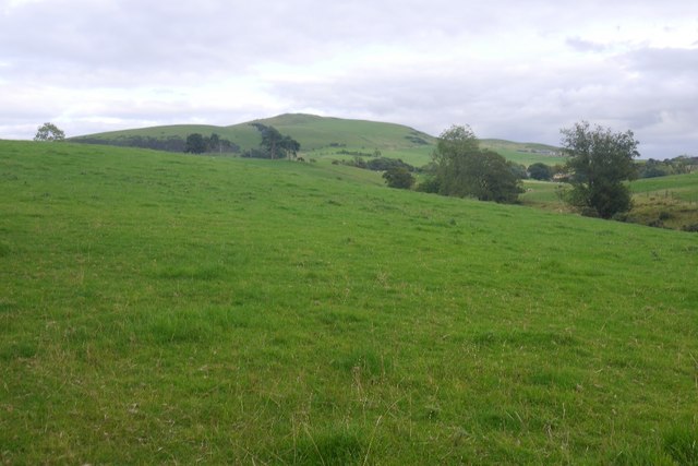
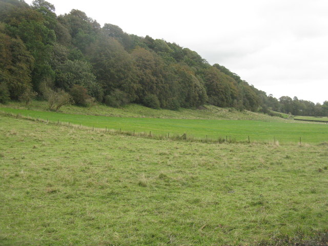
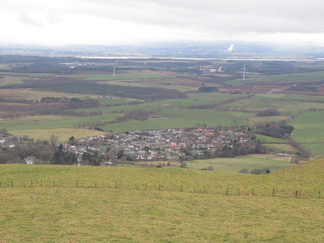
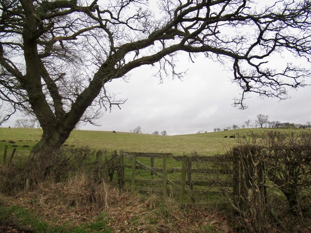
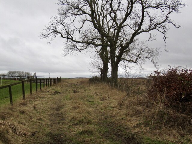
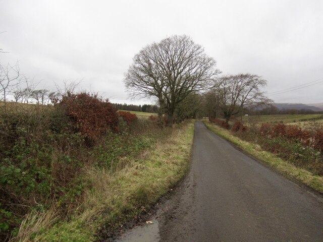
Balgonar is a small village located in the county of Fife, Scotland. Situated approximately 4 miles northeast of the town of Cowdenbeath, Balgonar is nestled amidst the picturesque countryside, offering its residents a tranquil and scenic environment.

The village has a rich history, with its origins dating back to the early 19th century when it served as a mining community. The presence of coal mines in the area boosted the local economy, attracting workers from nearby towns and villages. Today, remnants of the mining industry can still be seen in the form of old mine shafts and buildings.

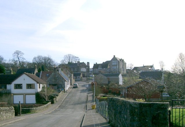
Balgonar is primarily a residential area, characterized by charming cottages and a close-knit community. The village boasts a peaceful atmosphere, making it an ideal place for those seeking a quiet and peaceful lifestyle away from the hustle and bustle of larger towns.

While Balgonar itself may be small, it benefits from its proximity to the nearby towns of Cowdenbeath and Lochgelly. Residents have access to a range of amenities and services, including schools, shops, and healthcare facilities, all within a short distance.

Nature enthusiasts will appreciate the village's proximity to the scenic Fife countryside, providing ample opportunities for outdoor activities such as walking, hiking, and cycling. The area is also home to several golf courses, offering enthusiasts a chance to perfect their swing.

Overall, Balgonar is a charming village that combines a rich history, picturesque surroundings, and a strong sense of community, making it an attractive place to live for those seeking a peaceful and idyllic lifestyle.

If you have any feedback on the listing, please let us know in the comments section below.

Balgonar Images

Images are sourced within 2km of 56.119649/-3.5778096 or Grid Reference NT0293. Thanks to Geograph Open Source API. All images are credited.

The B914 in Saline With the Ochils in the background.
The B914 in Saline
With the Ochils in the background.
Burnside Bridge Crossing the Black Devon near Saline.
Burnside Bridge
Crossing the Black Devon near Saline.
Pasture near Saline Looking towards Saline Hill.
Pasture near Saline
Looking towards Saline Hill.
Loanhead Poultry Farm, Saline A large enterprise south of Saline.
Loanhead Poultry Farm, Saline
A large enterprise south of Saline.
Farmland near Kinneddar Cattle at pasture and field margin trees.
Farmland near Kinneddar
Cattle at pasture and field margin trees.
Just chilling out! Cattle across the road from Loanhead Poultry Farm.
Just chilling out!
Cattle across the road from Loanhead Poultry Farm.
'The Views' at Saline New housing on a 2-3-year old development on the south side of the village.
'The Views' at Saline
New housing on a 2-3-year old development on the south side of the village.
Saline Post Office In a new location since recorded by Paul McIlroy in 2006 <a href="https://www.geograph.org.uk/photo/124249">NT0292 : Saline Post Office</a>. In Google Earth imagery of 2009 this was just a general store, and this makeover looks fairly recent.
Saline Post Office
In a new location since recorded by Paul McIlroy in 2006 NT0292 : Saline Post Office. In Google Earth imagery of 2009 this was just a general store, and this makeover looks fairly recent.
Trees on an escarpment near Saline Overlooking grass fields at Langfauld.
Trees on an escarpment near Saline
Overlooking grass fields at Langfauld.
Saline Hill A top to top view of Mid Cairn from Easter Cairn.
Saline Hill
A top to top view of Mid Cairn from Easter Cairn.
Summit, Mid Cairn The highpoint of Saline Hill with a cairn nearby.
Summit, Mid Cairn
The highpoint of Saline Hill with a cairn nearby.
Clouds pass - Sheardrum Plantation The exposed edge of the woodland seen from the summit of Saline Hill.
Clouds pass - Sheardrum Plantation
The exposed edge of the woodland seen from the summit of Saline Hill.
Saline seen from Saline Hill
South side of Saline Hill There is a small native tree plantation here with a helpfully marked path through.
South side of Saline Hill
There is a small native tree plantation here with a helpfully marked path through.
Gate near Shieldbank On the Saline to Blairingone road
Gate near Shieldbank
On the Saline to Blairingone road
Field access track, Shieldbank
Saline to Blairingone road
Show me another place!

Balgonar is located at Grid Ref: NT0293 (Lat: 56.119649, Lng: -3.5778096)

Unitary Authority: Fife

Police Authority: Fife

What 3 Words

///manicured.seats.lazy. Near Saline, Fife

Nearby Locations

Balgonar

Related Wikis

Saline, Fife

Saline is a village and parish in Fife, Scotland, situated 5 miles (8.0 km) to the north-west of Dunfermline. It lies in an elevated position on the western...

Steelend

Steelend is a former mining village in West Fife, Scotland, located on the B914 road approximately three-quarters of a mile east of the village of Saline...

Dunfermline (district)

Dunfermline (Scottish Gaelic: Dùn Phàrlain, Scots: Dunfaurlin) was a local government district in the Fife region of Scotland from 1975 to 1996, lying...

Oakley United F.C.

Oakley United Football Club are a Scottish football club based in Oakley, Fife. Formed in 1964, they play their home games at Blairwood Park. The club...

Nearby Amenities

Located within 500m of 56.119649,-3.5778096
Created By: Kyle Gordon
Lat/Long: 56.1157822/-3.5757353
Turning Circle
Lat/Long: 56.117085/-3.5783319
Generator Method: photovoltaic
Generator Output Electricity: yes
Generator Source: solar
Generator Type: solar_photovoltaic_panel
Power: generator
Lat/Long: 56.1160226/-3.5770638
Generator Method: photovoltaic
Generator Output Electricity: yes
Generator Source: solar
Generator Type: solar_photovoltaic_panel
Power: generator
Lat/Long: 56.1169361/-3.5781226
Generator Method: photovoltaic
Generator Output Electricity: yes
Generator Source: solar
Generator Type: solar_photovoltaic_panel
Power: generator
Lat/Long: 56.1159448/-3.5811155
Generator Method: photovoltaic
Generator Output Electricity: yes
Generator Source: solar
Generator Type: solar_photovoltaic_panel
Power: generator
Lat/Long: 56.115952/-3.5810166
Power: pole
Lat/Long: 56.1191842/-3.5746365
Generator Method: photovoltaic
Generator Output Electricity: yes
Generator Source: solar
Generator Type: solar_photovoltaic_panel
Power: generator
Lat/Long: 56.1162138/-3.5818269
Generator Method: photovoltaic
Generator Output Electricity: yes
Generator Source: solar
Generator Type: solar_photovoltaic_panel
Power: generator
Lat/Long: 56.1162171/-3.581634
Power: pole
Lat/Long: 56.1189456/-3.5710904
Power: pole
Lat/Long: 56.1190326/-3.5723274
Power: pole
Lat/Long: 56.1191206/-3.5735398
Power: pole
Lat/Long: 56.1209446/-3.5854679
Power: pole
Lat/Long: 56.1217508/-3.5849407
The data included in this document is from www.openstreetmap.org. The data is made available under ODbL.

Have you been to Balgonar?

Leave your review of Balgonar below (or comments, questions and feedback).