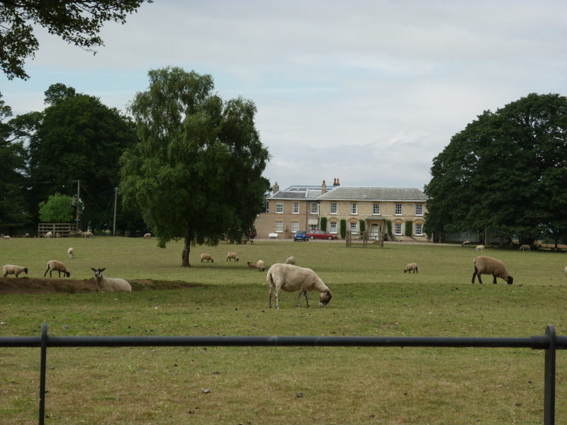
West Field

Downs, Moorland in Yorkshire

England

West Field

Balk Lane, Arnold, East Yorkshire
Balk Lane, Arnold, East Yorkshire Credit: Ian S

The requested URL returned error: 429 Too Many Requests

If you have any feedback on the listing, please let us know in the comments section below.

West Field Images

Images are sourced within 2km of 53.840135/-0.27737869 or Grid Reference TA1339. Thanks to Geograph Open Source API. All images are credited.

Balk Lane, Arnold, East Yorkshire
The way to Rowton Farm, Skirlaugh
Rowton Farm near Skirlaugh
A bridleway to Black Tup Lane
A road sign on Black Tup Lane
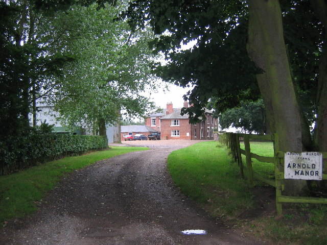
Farm buildings on Woodhouse Lane
Arnold Carrs Carrs are low lying, frequently (before draining) flooded lands. This wet winter Arnold Carr has lived up to its name .
Arnold Carrs
Carrs are low lying, frequently (before draining) flooded lands. This wet winter Arnold Carr has lived up to its name .
Arnold Carrs (2) Carrs are low lying, frequently (before draining) flooded lands. This wet winter Arnold Carr has lived up to its name .
Arnold Carrs (2)
Carrs are low lying, frequently (before draining) flooded lands. This wet winter Arnold Carr has lived up to its name .
Bridleway to Rowton Farm A grassy track between two ploughed and sown fields.
Bridleway to Rowton Farm
A grassy track between two ploughed and sown fields.
View towards West Field and Arnold
Black  Tup  Lane  toward  Woodhouse  Farm
Black Tup Lane toward Woodhouse Farm
Black  Tup  Lane  entering  Arnold
Black Tup Lane entering Arnold
Bay  Horse  Arnold
Bay Horse Arnold
Wet  field  toward  North  Skirlaugh  Farm From the footpath from Skirlaugh to Cony Hill, the farm can just be seen behind the group of trees in the centre.
Wet field toward North Skirlaugh Farm
From the footpath from Skirlaugh to Cony Hill, the farm can just be seen behind the group of trees in the centre.
Ridge  and  Furrow.  North  Skirlaugh  Farm. This long narrow field looks to have been left under grass and retaining its shape.
Ridge and Furrow. North Skirlaugh Farm.
This long narrow field looks to have been left under grass and retaining its shape.
The Bay Horse, Arnold
Show me another place!

West Field is located at Grid Ref: TA1339 (Lat: 53.840135, Lng: -0.27737869)

Division: East Riding

Unitary Authority: East Riding of Yorkshire

Police Authority: Humberside

What 3 Words

///educated.heavy.bead. Near Burton Constable, East Yorkshire

Nearby Locations

Gall Plantation West Field

Related Wikis

Skirlaugh

Skirlaugh is a village and civil parish in the East Riding of Yorkshire, England, in an area known as Holderness. It is situated approximately 7 miles...

Benningholme

Benningholme is a hamlet in the East Riding of Yorkshire, England, in an area known as Holderness. It is situated approximately 6 miles (10 km) north of...

Arnold, East Riding of Yorkshire

Arnold is a hamlet in the East Riding of Yorkshire, England in an area known as Holderness. It is situated approximately 9 miles (14 km) north of Hull...

Skirlaugh railway station

Skirlaugh railway station was a railway station that served the village of Skirlaugh in the East Riding of Yorkshire, England. It was on the Hull and Hornsea...

Nearby Amenities

Located within 500m of 53.840135,-0.27737869
Bus Stop
Skirlaugh Main Road
Layby: yes
Naptan AtcoCode: 2200YEA00751
Naptan Bearing: NE
Naptan CommonName: Skirlaugh Main Road
Naptan Street: Vicarage Lane
Note: no code on sign;bearing should be SE
Shelter: yes
Source: naptan + survey
Lat/Long: 53.8421248/-0.2707061
Bus Stop
Skirlaugh Main Road
Naptan AtcoCode: 2200YEA00752
Naptan Bearing: SE
Naptan CommonName: Skirlaugh Main Road
Naptan Landmark: Skirlaugh Council Offices
Naptan Street: Main Road
Note: no code on sign
Shelter: no
Source: naptan + survey
Lat/Long: 53.8425017/-0.2713574
Man Made: tower
Tower Type: communication
Lat/Long: 53.8390628/-0.2751947
Ford: yes
Lat/Long: 53.8388812/-0.2729539
The data included in this document is from www.openstreetmap.org. The data is made available under ODbL.

Have you been to West Field?

Leave your review of West Field below (or comments, questions and feedback).