Subury Park

Downs, Moorland in Middlesex Spelthorne

England

Subury Park

Sunbury Lock
Sunbury Lock Credit: Alex McGregor

Sunbury Park is a charming suburban area located in the county of Middlesex, England. This picturesque park is nestled between the Downs and Moorland regions, offering a diverse range of natural landscapes for visitors to explore and enjoy.

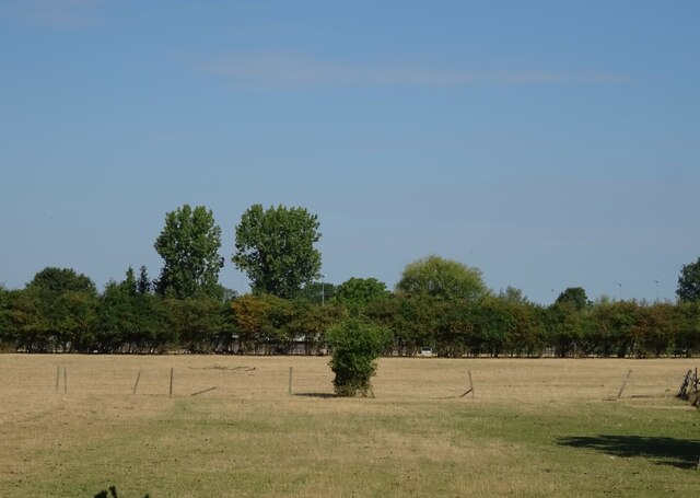
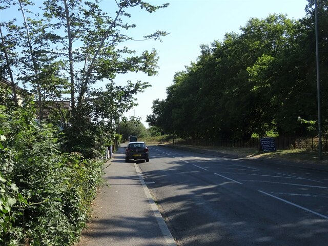
Covering an expansive area of approximately 250 acres, Sunbury Park boasts an array of recreational facilities and scenic spots. The park is renowned for its well-maintained grasslands, woodlands, and meadows, providing ample space for recreational activities such as walking, jogging, and picnicking. The Downs section of the park features gently rolling hills, offering panoramic views of the surrounding countryside.

Moorland, on the other hand, is characterized by its vast open spaces and heathland vegetation. Visitors can immerse themselves in the tranquility of the moors, observing the diverse wildlife that calls this area home.

Sunbury Park also offers an array of amenities to enhance visitors' experiences. There are playgrounds for children, perfect for family outings, as well as tennis courts and a skate park for those seeking more active pursuits. The park also features well-maintained paths for cycling enthusiasts.

Additionally, Sunbury Park hosts various events throughout the year, including community festivals, fairs, and outdoor concerts. These events provide opportunities for residents and visitors to come together and celebrate the vibrant spirit of the community.

Overall, Sunbury Park in Middlesex offers a harmonious blend of natural beauty, recreational activities, and community spirit. Whether one seeks tranquility amidst nature or an active day out, this park has something to offer for everyone.

If you have any feedback on the listing, please let us know in the comments section below.
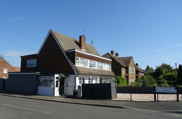
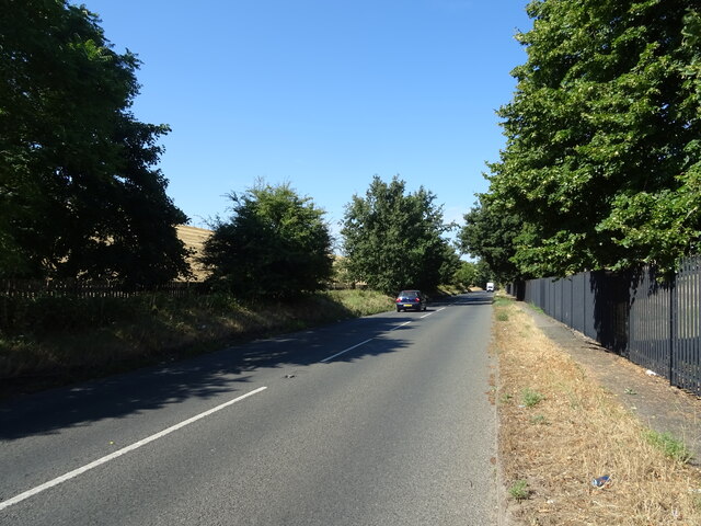
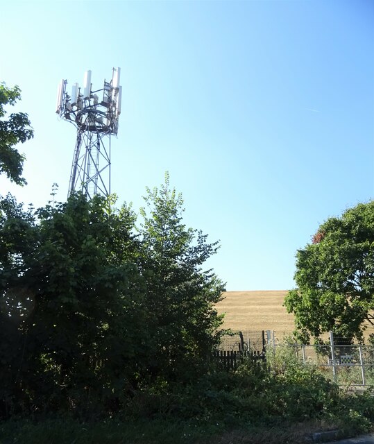
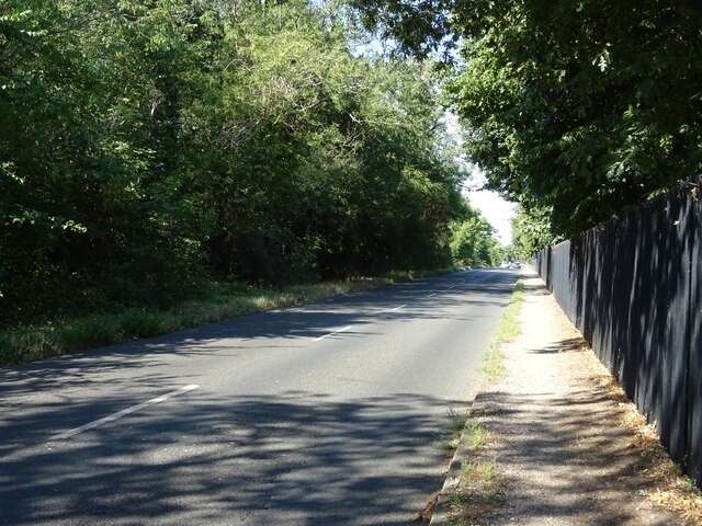
Subury Park Images

Images are sourced within 2km of 51.406918/-0.41182079 or Grid Reference TQ1068. Thanks to Geograph Open Source API. All images are credited.

Sunbury Lock
Sunbury Lock
The Grove, Walton-on-Thames
Houses on Terrace Road, Walton-on-Thames
Terrace Road, Walton-on-Thames (A3050)
Grazing off Terrace Road
Terrace Road (A3050)
Houses on Terrace Road
Walton Road (B369) Beside Knight Reservoir.
Walton Road (B369)
Beside Knight Reservoir.
Communications mast and reservoir bank
Walton Road (B369) Beside Bessborough Reservoir.
Walton Road (B369)
Beside Bessborough Reservoir.
Elizabeth II postbox on Terrace Road, Walton-on-Thames Postbox No. KT12 110.
See <a href="https://www.geograph.org.uk/photo/7259170">TQ1067 : Shops on Terrace Road, Walton-on-Thames</a> for context.
Elizabeth II postbox on Terrace Road, Walton-on-Thames
Postbox No. KT12 110. See TQ1067 : Shops on Terrace Road, Walton-on-Thames for context.
Shops on Terrace Road, Walton-on-Thames Showing position of Postbox No. KT12 110.
See <a href="https://www.geograph.org.uk/photo/7259168">TQ1067 : Elizabeth II postbox on Terrace Road, Walton-on-Thames</a> for postbox.
Shops on Terrace Road, Walton-on-Thames
Showing position of Postbox No. KT12 110. See TQ1067 : Elizabeth II postbox on Terrace Road, Walton-on-Thames for postbox.
George VI postbox on Terrace Road, Walton-on-Thames Postbox No. KT12 111.
George VI postbox on Terrace Road, Walton-on-Thames
Postbox No. KT12 111.
Railway towards Upper Halliford station From the bridge on Charlton Lane.
Railway towards Upper Halliford station
From the bridge on Charlton Lane.
Garages and flats, Upper Halliford
A244 Upper Halliford Bypass
The Goat, Upper Halliford On Upper Halliford Road.
See <a href="https://www.geograph.org.uk/photo/7298184">TQ0968 : Sign for the Goat, Upper Halliford </a> for sign.
The Goat, Upper Halliford
On Upper Halliford Road. See TQ0968 : Sign for the Goat, Upper Halliford for sign.
Sign for the Goat, Upper Halliford  See <a href="https://www.geograph.org.uk/photo/7298182">TQ0968 : The Goat, Upper Halliford</a> for context.
Sign for the Goat, Upper Halliford
Show me another place!

Subury Park is located at Grid Ref: TQ1068 (Lat: 51.406918, Lng: -0.41182079)

Administrative County: Surrey

District: Spelthorne

Police Authority: Surrey

What 3 Words

///meant.reply.spice. Near Sunbury-on-Thames, Surrey

Related Wikis

Church of St Mary the Virgin, Sunbury-on-Thames

The Church of St Mary the Virgin is a Grade II* listed church of the Church of England in the village of Sunbury next to the river Thames. == History... ==

Sunbury Lock Ait

Sunbury Lock Ait is the ait (island) in the River Thames in England adjacent to Sunbury Lock between Walton-on-Thames, and Sunbury-on-Thames, Surrey. It...
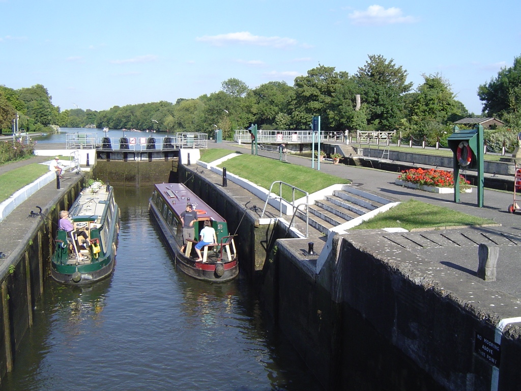
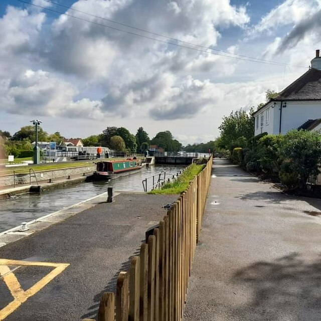
Sunbury Lock

Sunbury Lock is a lock complex of the River Thames in England near Walton-on-Thames in north-west Surrey, the third lowest of forty four on the non-tidal...

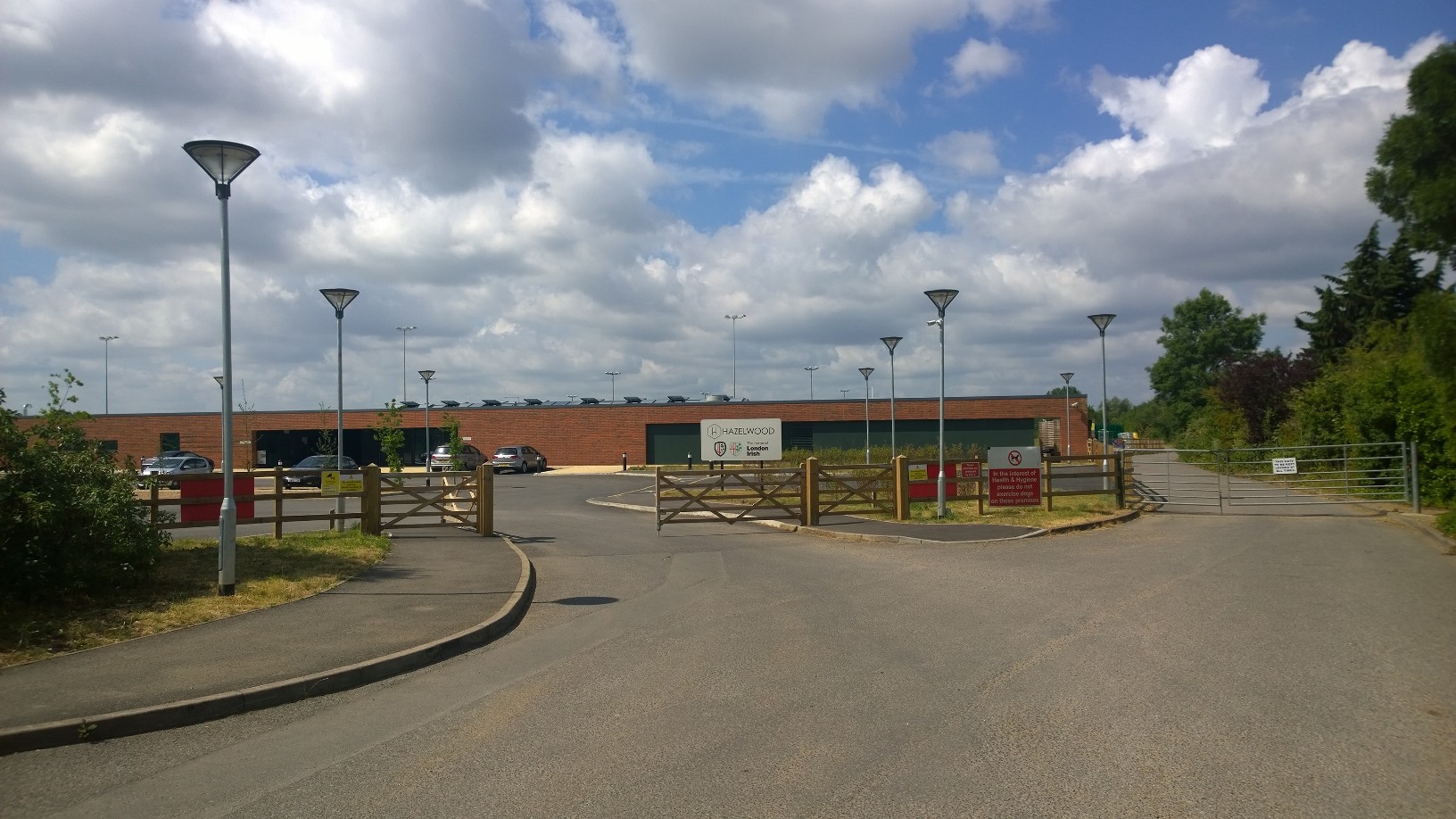
Hazelwood (rugby ground)

The Hazelwood Centre is a rugby union ground and sports facility in Sunbury-on-Thames in the English county of Surrey. The facility served as the home...

Nearby Amenities

Located within 500m of 51.406918,-0.41182079
Traffic Calming: hump
Lat/Long: 51.4039763/-0.4122689
Mini Roundabout
Direction: clockwise
Lat/Long: 51.4038948/-0.4124767
Traffic Calming: hump
Lat/Long: 51.4063923/-0.4057323
Bus Stop
The Avenue
Bench: no
Bin: yes
Bus: yes
Departures Board: timetable
Lit: no
Naptan AtcoCode: 40004402030A
Naptan Bearing: SW
Naptan CommonName: Orchard Meadow
Naptan Indicator: Just after
Naptan Landmark: The Avenue
Naptan NaptanCode: surdgdag
Naptan Street: Thames Street
Naptan Verified: no
Network: 216
Operator: London Buses
Public Transport: platform
Shelter: no
Source: naptan_import
Tactile Paving: no
Lat/Long: 51.4059862/-0.4070844
Bus Stop
The Avenue
Bench: yes
Bin: yes
Lit: no
Naptan AtcoCode: 40004402030B
Naptan Bearing: NE
Naptan CommonName: Orchard Meadow
Naptan Indicator: Just Before
Naptan Landmark: The Avenue
Naptan NaptanCode: surdgdgj
Naptan Street: Thames Street
Naptan Verified: no
Public Transport: platform
Shelter: no
Source: naptan_import
Tactile Paving: no
Lat/Long: 51.4062031/-0.4067734
Bus Stop
Church Street
Bus: yes
Naptan AtcoCode: 40004402052A
Naptan Bearing: SW
Naptan CommonName: St Marys Church
Naptan Indicator: Just Before
Naptan Landmark: St Marys Church
Naptan NaptanCode: surdgtjt
Naptan Street: Thames Street
Public Transport: platform
Ref: 5Z09
Source: naptan_import
Lat/Long: 51.4049429/-0.4099366
Bus Stop
Church Street
Bench: no
Bin: no
Bus: yes
Lit: yes
Naptan AtcoCode: 40004402053A
Naptan Bearing: SE
Naptan CommonName: St Marys Church
Naptan Indicator: adj
Naptan Landmark: St Marys Church
Naptan NaptanCode: surdgtjw
Naptan Street: Church Street
Naptan Verified: no
Public Transport: platform
Shelter: no
Source: naptan_import
Tactile Paving: no
Lat/Long: 51.4047865/-0.411254
Bus Stop
Three Fishes
Bus: yes
Naptan AtcoCode: 40004402054A
Naptan Bearing: NW
Naptan CommonName: Three Fishes
Naptan Indicator: O/s
Naptan Landmark: Three Fishes
Naptan NaptanCode: surdgtma
Naptan Street: Green Street
Public Transport: platform
Ref: 51096
Source: naptan_import
Lat/Long: 51.405795/-0.4135928
Bus Stop
Three Fishes
Bench: yes
Bin: no
Bus: yes
Lit: yes
Naptan AtcoCode: 40004402054C
Naptan Bearing: SE
Naptan CommonName: Three Fishes
Naptan Indicator: Just Before
Naptan Landmark: Three Fishes
Naptan NaptanCode: surdjapg
Naptan Street: Green Street
Public Transport: platform
Ref: 74722
Shelter: yes
Source: naptan_import
Tactile Paving: no
Lat/Long: 51.4061696/-0.4137336
Bus Stop
Croysdale Avenue
Bus: yes
Naptan AtcoCode: 40004402055A
Naptan Bearing: NW
Naptan CommonName: Croysdale Avenue
Naptan Indicator: adj
Naptan Landmark: Croysdale Avenue
Naptan NaptanCode: surdjapj
Naptan Street: Green Street
Public Transport: platform
Ref: 55689
Shelter: yes
Source: naptan_import
Lat/Long: 51.4086065/-0.4157427
Bus Stop
Croysdale Avenue
Bus: yes
Naptan AtcoCode: 40004402055B
Naptan Bearing: SE
Naptan CommonName: Croysdale Avenue
Naptan Indicator: Just after
Naptan Landmark: Croysdale Avenue
Naptan NaptanCode: surdjapm
Naptan Street: Green Street
Naptan Verified: no
Public Transport: platform
Ref: 56745
Source: naptan_import
Lat/Long: 51.4082481/-0.4153648
Bus Stop
Manor Lane
Bus: yes
Naptan AtcoCode: 40004402056B
Naptan Bearing: SE
Naptan CommonName: Manor Lane
Naptan Indicator: Nr
Naptan Landmark: Manor Lane
Naptan NaptanCode: surdjapw
Naptan Street: Green Street
Naptan Verified: no
Public Transport: platform
Ref: 47628
Source: naptan_import
Lat/Long: 51.4102035/-0.4165447
Addr Housenumber: 125
Addr Street: Green Street
Lat/Long: 51.4092906/-0.4160668
Addr Housename: Kulu Cottage
Addr Housenumber: 20
Addr Street: Green Street
Lat/Long: 51.4049718/-0.4130052
Addr Housenumber: 22
Addr Street: Green Street
Lat/Long: 51.4049934/-0.4130216
Addr Housenumber: 2
Addr Street: Green Street
Lat/Long: 51.4061102/-0.4140255
Addr Housenumber: 50
Lat/Long: 51.4060368/-0.4070144
Addr Housenumber: 79
Addr Street: Green Street
Lat/Long: 51.4065138/-0.4141463
Addr Housenumber: 46
Lat/Long: 51.4061385/-0.4066735
Addr Housenumber: 67
Addr Street: Green Street
Lat/Long: 51.4064615/-0.4141135
Addr Housenumber: 57
Addr Street: Green Street
Lat/Long: 51.4062772/-0.4139713
Addr Housenumber: 121
Addr Street: Green Street
Lat/Long: 51.4091456/-0.4159733
Addr Housenumber: 22B
Lat/Long: 51.4064247/-0.4055688
Addr Housenumber: 8
Addr Street: Green Street
Lat/Long: 51.404418/-0.4127445
Addr Housenumber: 59
Addr Street: Green Street
Lat/Long: 51.4063079/-0.4139932
Addr Housenumber: 1
Addr Street: Green Street
Lat/Long: 51.4060157/-0.4137489
Dexters
Addr City: Sunbury-on-Thames
Addr Housename: Ground Floor
Addr Housenumber: 22A
Addr Street: Thames Street
Shop: estate_agent
Lat/Long: 51.4063079/-0.4058323
Addr Housename: Sunmead Cottage
Lat/Long: 51.4094412/-0.4161556
Addr Housenumber: 30
Lat/Long: 51.4063234/-0.4059533
Addr Housenumber: 70
Lat/Long: 51.4057985/-0.407795
Addr Housenumber: 12
Addr Street: Green Street
Lat/Long: 51.4047682/-0.4129067
Pub
The Three Fishes
Addr City: Sunbury-on-Thames
Addr Country: GB
Addr County: Surrey
Addr Housenumber: 35
Addr Postcode: TW16 6RE
Addr Street: Green Street
Fhrs Authority: Spelthorne
Fhrs Id: 899471
Wikidata: Q26280880
Lat/Long: 51.4056891/-0.4135296
Fast Food
Red Herring
Addr City: Sunbury-on-Thames
Addr Country: GB
Addr County: Surrey
Addr Housenumber: 37a
Addr Postcode: TW16 6RE
Addr Street: Green Street
Fhrs Authority: Spelthorne
Fhrs Id: 1049052
Fhrs Name: Red Herring Fish And Chips
Lat/Long: 51.4058372/-0.4137063
Sunbury-on-Thames
Place: town
Short Name: Sunbury
Source: OS_OpenData_StreetView
Wikidata: Q2194010
Wikipedia: en:Sunbury-on-Thames
Lat/Long: 51.4077066/-0.4118589
Turning Circle
Lat/Long: 51.404747/-0.4147558
Traffic Calming: hump
Lat/Long: 51.404741/-0.4105303
Barrier: kissing_gate
Bicycle: yes
Foot: yes
Lat/Long: 51.4088633/-0.4103637
Turning Circle
Lat/Long: 51.40894/-0.4175296
Traffic Calming: cushion
Lat/Long: 51.4041712/-0.412685
Traffic Calming: cushion
Lat/Long: 51.4052578/-0.4131393
Barrier: kissing_gate
Bicycle: yes
Foot: yes
Lat/Long: 51.4069771/-0.4069958
Restaurant
Café Cappriccio
Addr City: Sunbury-on-Thames
Addr Country: GB
Addr County: Surrey
Addr Housenumber: 97
Addr Postcode: TW16 6RD
Addr Street: Green Street
Cuisine: italian
Fhrs Authority: Spelthorne
Fhrs Id: 555253
Lat/Long: 51.4071181/-0.4147922
Best-one
Addr City: Sunbury-on-Thames
Addr Country: GB
Addr County: Surrey
Addr Housenumber: 91-93
Addr Postcode: TW16 6RD
Addr Street: Green Street
Brand: Best-one
Brand Wikidata: Q4896532
Contact Website: https://stores.best-one.co.uk/pankhania-and-co-best-one-5aed558c396e
Fhrs Authority: Spelthorne
Fhrs Id: 278110
Shop: convenience
Lat/Long: 51.4070654/-0.4147529
Pricecutter Food & Wine
Addr City: Sunbury-on-Thames
Addr Country: GB
Addr County: Surrey
Addr Housenumber: 99
Addr Postcode: TW16 6RD
Addr Street: Green Street
Fhrs Authority: Spelthorne
Fhrs Id: 956604
Shop: alcohol
Lat/Long: 51.4072327/-0.4148574
Shop: hairdresser
Lat/Long: 51.4069879/-0.4147181
Pub
The Magpie
Addr City: Sunbury-on-Thames
Addr Country: GB
Addr Housenumber: 64
Addr Postcode: TW16 6AF
Addr Street: Thames Street
Air Conditioning: yes
Brewery: yes;various
Contact Facebook: https://www.facebook.com/MagpieSunbury
Contact Instagram: http://www.instagram.com/magpiesunbury
Contact Twitter: http://www.twitter.com/magpiesunbury
Fhrs Authority: Spelthorne
Fhrs Id: 277822
Phone: +44 1932 782024
Smoking: no
Website: https://www.magpiesunbury.com/
Lat/Long: 51.4056956/-0.4077703
Pub
The Flower pot
Addr City: Sunbury-on-Thames
Addr Country: GB
Addr County: Surrey
Addr Postcode: TW16 6AA
Addr Street: Thames Street
Fhrs Authority: Spelthorne
Fhrs Id: 899472
Wikidata: Q26483219
Lat/Long: 51.4040771/-0.4123023
Leisure: playground
Lat/Long: 51.4040525/-0.4168086
Homecare D.I.Y
Addr Housenumber: 12
Phone: +44 1932 783596
Shop: doityourself
Website: rajhomecarediy.co.uk
Lat/Long: 51.4072043/-0.4062841
Shop: florist
Lat/Long: 51.4070903/-0.4057219
Bench
Lat/Long: 51.4047363/-0.4102388
Bench
Lat/Long: 51.4045522/-0.4106921
Bench
Lat/Long: 51.4036071/-0.4124179
Bench
Lat/Long: 51.4046375/-0.4104989
Bench
Lat/Long: 51.4035595/-0.412507
Bench
Lat/Long: 51.4035156/-0.4126159
Bench
Lat/Long: 51.4053068/-0.4089406
Bench
Lat/Long: 51.4052232/-0.409241
Bench
Lat/Long: 51.4050609/-0.4094824
Toilets
Lat/Long: 51.4058373/-0.4087609
Post Box
Collection Times: Mo-Fr 17:00; Sa 11:30
Operator: Royal Mail
Operator Type: private
Operator Wikidata: Q638098
Post Box Type: pillar
Ref: TW16 255
Royal Cypher: EIIR
Royal Cypher Wikidata: Q33102113
Source: survey
Lat/Long: 51.4082066/-0.4153265
Post Box
Brand: Royal Mail
Brand Wikidata: Q638098
Brand Wikipedia: en:Royal Mail
Collection Times: Mo-Fr 09:00; Sa 07:00
Operator: Royal Mail
Operator Wikidata: Q638098
Post Box Type: pillar
Ref: TW16 257D
Royal Cypher: EIIR
Royal Cypher Wikidata: Q33102113
Source: survey
Lat/Long: 51.4107097/-0.4128479
Post Box
Collection Times: Mo-Fr 09:00; Sa 07:00
Operator: Royal Mail
Post Box Type: pillar
Ref: TW16 266D
Royal Cypher: EIIR
Royal Cypher Wikidata: Q33102113
Source: survey
Lat/Long: 51.4084009/-0.4051448
Check Date: 2023-04-29
Traffic Calming: hump
Lat/Long: 51.4060753/-0.4069814
Recycling
Recycling Type: centre
Lat/Long: 51.4064901/-0.4134548
Traffic Calming: hump
Lat/Long: 51.4064411/-0.4059957
Traffic Calming: hump
Lat/Long: 51.4032154/-0.4133184
Note: gate was mapped here - old?
Lat/Long: 51.4044235/-0.4130163
Traffic Calming: cushion
Lat/Long: 51.4045043/-0.4128686
Crossing
Crossing: uncontrolled
Crossing Ref: zebra
Lat/Long: 51.4043913/-0.4113534
Budgens
Addr City: Sunbury
Addr Country: GB
Addr County: Surrey
Addr Housenumber: 6-7
Addr Postcode: TW16 5HS
Addr Street: Avenue Parade
Alt Name: Budgens of Lower Sunbury
Brand: Budgens
Brand Wikidata: Q4985016
Fhrs Authority: Spelthorne
Fhrs Id: 278121
Shop: convenience
Website: https://www.budgens.co.uk/our-stores/lower-sunbury
Lat/Long: 51.4069725/-0.40607
Coral
Addr Housenumber: 2
Brand: Coral
Brand Wikidata: Q54621344
Brand Wikipedia: en:Coral (bookmaker)
Shop: bookmaker
Lat/Long: 51.4067574/-0.4059761
Dappers Formal Wear
Addr Housenumber: 5
Phone: +44 1932 781900
Shop: tailor
Website: dappersformalwear.co.uk
Lat/Long: 51.4068518/-0.4060411
E. Bennett Estate Offices
Addr Housenumber: 15
Lat/Long: 51.4070823/-0.4065681
Lauras
Addr Housenumber: 1
Shop: hairdresser
Lat/Long: 51.4067051/-0.40594
Cafe
Little Italy
Lat/Long: 51.4063708/-0.4060703
Pharmacy
Lloyds Pharmacy
Addr Housenumber: 8
Lat/Long: 51.4070287/-0.4061148
Restaurant
Moon in Moon
Cuisine: chinese
Phone: +44 1932 789500
Lat/Long: 51.4065573/-0.4061937
PH property
Addr Housenumber: 3
Phone: +44 1932 781911
Shop: estate_agent
Website: https://philip-hodges.co.uk/
Lat/Long: 51.4067941/-0.4060013
Post Office
Skinners News
Addr City: Sunbury-on-Thames
Addr Country: GB
Addr County: Surrey
Addr Housenumber: 5
Addr Parentstreet: The Avenue
Addr Postcode: TW16 5HS
Addr Street: Avenue Parade
Fhrs Authority: Spelthorne
Fhrs Id: 278107
Opening Hours: Mo-Fr 07:30-17:00; Sa 07:00-16:45; Su 07:00-12:00
Ref Pol Id: 18398
Website: https://www.postoffice.co.uk/branch-finder/0810258/thames-street
Lat/Long: 51.4069081/-0.4060187
The Avenue Optical
Addr Housenumber: 9
Phone: +44 1932 770977
Shop: optician
Lat/Long: 51.4070767/-0.4061961
Van Wonderen Flowers
Addr Housenumber: 10
Shop: florist
Lat/Long: 51.407119/-0.4062253
Villager
Addr Housenumber: 4
Shop: dry_cleaning
Lat/Long: 51.4068294/-0.4060257
Barrier: kissing_gate
Bicycle: yes
Foot: yes
Lat/Long: 51.4071436/-0.4080986
Barrier: kissing_gate
Bicycle: yes
Foot: yes
Lat/Long: 51.4072062/-0.4081136
1st Stop
Addr City: Sunbury-on-Thames
Addr Country: GB
Addr County: Surrey
Addr Housenumber: 11
Addr Postcode: TW16 5HS
Addr Street: Avenue Parade
Fhrs Authority: Spelthorne
Fhrs Id: 277632
Shop: alcohol
Lat/Long: 51.4071668/-0.4062583
Crossing: informal
Lat/Long: 51.4060888/-0.4138857
Sunbury Lock
Ref: Lock 4
Wikidata: Q7638997
Wikipedia: en:Sunbury Lock
Lat/Long: 51.4051461/-0.4061394
Sunbury Lock Boat Rollers
Leisure: slipway
Lat/Long: 51.4052034/-0.4067813
Social Facility
Sunbury Nursing Home
Addr City: Sunbury-on-Thames
Addr Country: GB
Addr County: Surrey
Addr Postcode: TW16 6AJ
Addr Street: Thames Street
Fhrs Authority: Spelthorne
Fhrs Id: 278135
Social Facility: nursing_home
Lat/Long: 51.4036132/-0.4134437
Post Box
Collection Times: Mo-Fr 17:00; Sa 11:45
Operator: Royal Mail
Post Box Type: pillar
Ref: TW16 240
Royal Cypher: EIIR
Royal Cypher Wikidata: Q33102113
Source: survey
Lat/Long: 51.4068951/-0.406132
Post Box
Collection Times: Mo-Fr 16:45; Sa 11:30
Operator: Royal Mail
Operator Type: private
Operator Wikidata: Q638098
Post Box Type: pillar
Ref: TW16 245
Royal Cypher: EIIR
Royal Cypher Wikidata: Q33102113
Source: survey
Lat/Long: 51.4034404/-0.4132198
Coal tax post
Historic: boundary_stone
Inscription: 24 & 25 VICT CAP 42
Material: iron
Note: Coal tax boundary marker 95
Lat/Long: 51.4049512/-0.4074122
Crossing
Lat/Long: 51.407338/-0.4061211
Barrier: height_restrictor
Maxheight Signed: 2.1
Lat/Long: 51.4065/-0.4139133
Addr Housenumber: 2
Addr Street: Green Street
Lat/Long: 51.4060235/-0.4139288
Crossing
Crossing: marked
Crossing Island: no
Tactile Paving: yes
Traffic Calming: table
Lat/Long: 51.4086141/-0.4156563
Information: guidepost
Tourism: information
Lat/Long: 51.4038665/-0.4123618
Bus Stop
Forge Lane
Naptan AtcoCode: 40004402188A
Naptan NaptanCode: surdwmgp
Public Transport: platform
Lat/Long: 51.40534/-0.4159816
Barrier: kissing_gate
Motor Vehicle: no
Lat/Long: 51.4069822/-0.414309
Bus Stop
Bus: yes
Public Transport: platform
Shelter: yes
Lat/Long: 51.4089217/-0.4158797
Barrier: bollard
Foot: yes
Height: 1
Material: concrete
Motor Vehicle: no
Lat/Long: 51.4062808/-0.4046899
Barrier: bollard
Foot: yes
Height: 1
Material: concrete
Motor Vehicle: no
Lat/Long: 51.4060984/-0.4056646
Barrier: bollard
Foot: yes
Height: 1
Material: concrete
Motor Vehicle: no
Lat/Long: 51.4061041/-0.4056284
Give Way
Direction: forward
Lat/Long: 51.4045522/-0.4110891
Defibrillator
Emergency: defibrillator
Indoor: no
Lat/Long: 51.4048244/-0.4065651
The data included in this document is from www.openstreetmap.org. The data is made available under ODbL.

Have you been to Subury Park?

Leave your review of Subury Park below (or comments, questions and feedback).