Heath and Reach

Settlement in Bedfordshire

England

Heath and Reach

Stockgrove Country Park The (artificial) lake was excavated in the 1920s and the boathouse was built soon afterwards.  The boathouse used to have a room above with a thatched roof - but it burned down in the 1960s.  Part of the drawbridge mechanism remains on the left hand side.
Stockgrove Country Park Credit: Peter Roberts

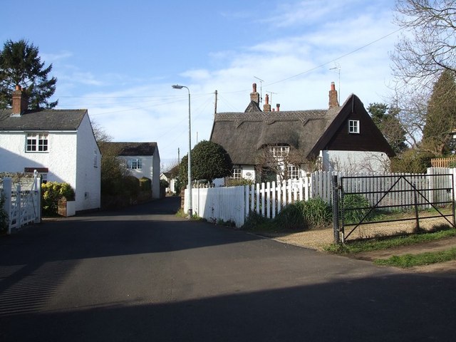
Heath and Reach is a small village located in the county of Bedfordshire, England. Situated approximately four miles south of Leighton Buzzard, it is surrounded by picturesque countryside and offers a tranquil and charming setting for its residents.

The village itself has a population of around 2,500 people and is known for its strong sense of community. It has a range of amenities including a village hall, a primary school, a church, and a selection of local shops and pubs. The village also benefits from a regular bus service, providing easy access to nearby towns and cities.

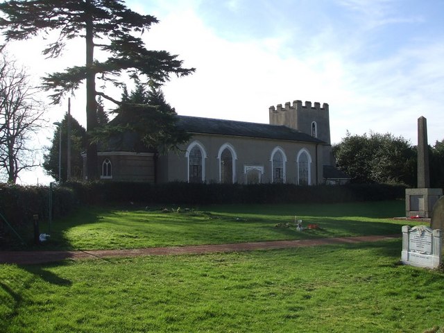
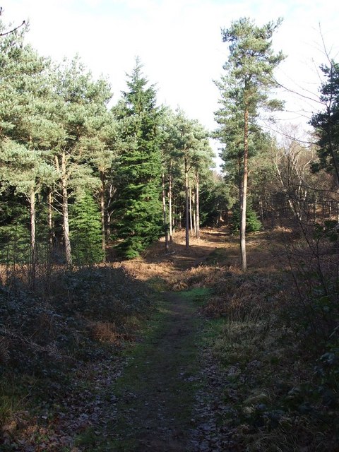
Heath and Reach is rich in history and heritage, with evidence of human habitation dating back to the Neolithic era. The village is home to several listed buildings, such as All Saints' Church, which dates back to the 13th century. The surrounding area offers opportunities for outdoor activities, with numerous walking and cycling trails to explore.

The village hosts various events throughout the year, including a summer fete and a Christmas market, which bring the community together. Additionally, there are several local clubs and societies catering to a range of interests, from sports clubs to music and arts groups.

Heath and Reach is well-connected to surrounding areas, with easy access to major road networks, including the A5 and M1 motorway. The nearby town of Leighton Buzzard offers further amenities, including a train station with direct links to London and Milton Keynes.

Overall, Heath and Reach is a charming village with a strong community spirit, offering a peaceful and idyllic setting for its residents.

If you have any feedback on the listing, please let us know in the comments section below.

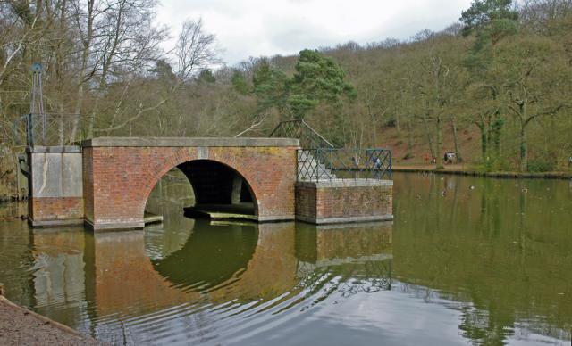
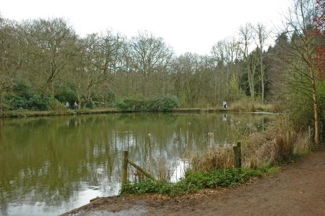
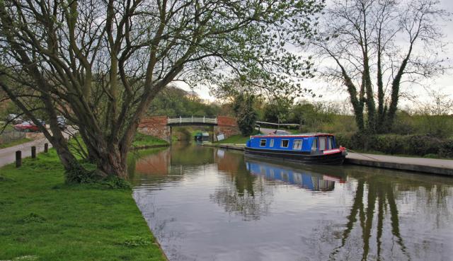
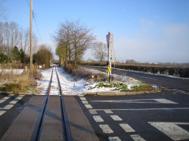
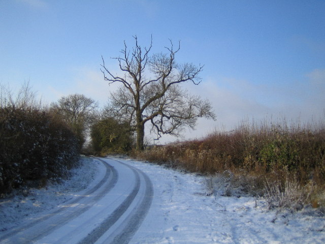
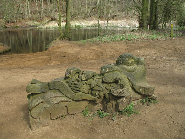
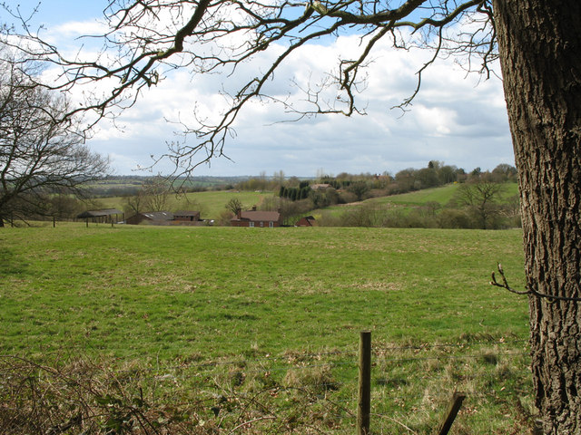
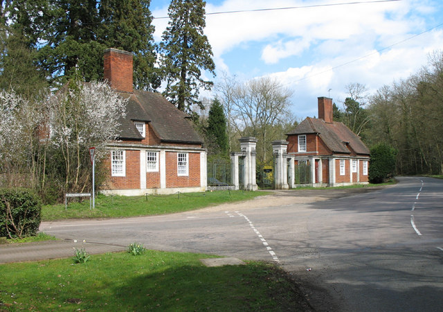
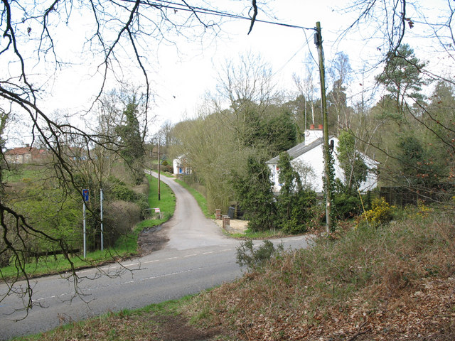
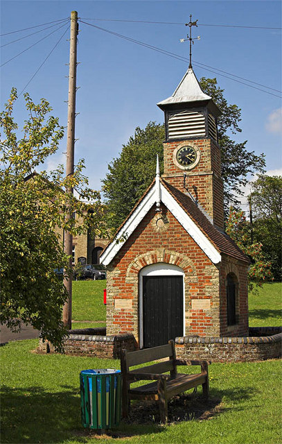
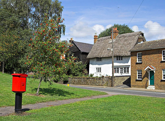
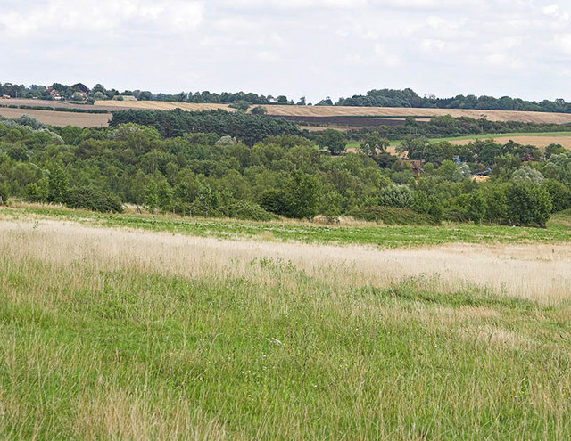
Heath and Reach Images

Images are sourced within 2km of 51.945431/-0.657296 or Grid Reference SP9228. Thanks to Geograph Open Source API. All images are credited.

Stockgrove Country Park The (artificial) lake was excavated in the 1920s and the boathouse was built soon afterwards.  The boathouse used to have a room above with a thatched roof - but it burned down in the 1960s.  Part of the drawbridge mechanism remains on the left hand side.
Stockgrove Country Park
The (artificial) lake was excavated in the 1920s and the boathouse was built soon afterwards. The boathouse used to have a room above with a thatched roof - but it burned down in the 1960s. Part of the drawbridge mechanism remains on the left hand side.
Stockgrove Country Park The southern end of the artificial lake.
Stockgrove Country Park
The southern end of the artificial lake.
Grand Union Canal Looking West
Grand Union Canal
Looking West
Leighton Buzzard: Narrow gauge railway The railway was originally built in 1919 to carry sand from nearby quarries to the now dismantled Leighton Buzzard to Dunstable standard gauge railway line close to Page's Park. It closed as an industrial line in 1969, but was taken over by volunteers to be run as a heritage railway. The railway has a very informative website here <span class="nowrap"><a title="http://www.buzzrail.co.uk/" rel="nofollow ugc noopener" href="http://www.buzzrail.co.uk/">Link</a><img style="margin-left:2px;" alt="External link" title="External link - shift click to open in new window" src="https://s1.geograph.org.uk/img/external.png" width="10" height="10"/></span> This view was taken, with a light dusting of snow on the ground, looking north eastwards across the Shenley Hill Road level crossing, with Mile Tree Road running parallel to the railway to the right.
Leighton Buzzard: Narrow gauge railway
The railway was originally built in 1919 to carry sand from nearby quarries to the now dismantled Leighton Buzzard to Dunstable standard gauge railway line close to Page's Park. It closed as an industrial line in 1969, but was taken over by volunteers to be run as a heritage railway. The railway has a very informative website here LinkExternal link This view was taken, with a light dusting of snow on the ground, looking north eastwards across the Shenley Hill Road level crossing, with Mile Tree Road running parallel to the railway to the right.
Leighton Buzzard: Narrow gauge railway Stonehenge Works on the railway viewed looking southwards with Mile Tree Road on the left. This is the current northern terminus of the railway although the track does continue for about another 500 metres northwards. The railway was originally built in 1919 to carry sand from nearby quarries to the now dismantled Leighton Buzzard to Dunstable standard gauge railway line close to Page's Park. It closed as an industrial line in 1969, but was taken over by volunteers to be run as a heritage railway. The railway has a very informative website here <span class="nowrap"><a title="http://www.buzzrail.co.uk/" rel="nofollow ugc noopener" href="http://www.buzzrail.co.uk/">Link</a><img style="margin-left:2px;" alt="External link" title="External link - shift click to open in new window" src="https://s1.geograph.org.uk/img/external.png" width="10" height="10"/></span>
Leighton Buzzard: Narrow gauge railway
Stonehenge Works on the railway viewed looking southwards with Mile Tree Road on the left. This is the current northern terminus of the railway although the track does continue for about another 500 metres northwards. The railway was originally built in 1919 to carry sand from nearby quarries to the now dismantled Leighton Buzzard to Dunstable standard gauge railway line close to Page's Park. It closed as an industrial line in 1969, but was taken over by volunteers to be run as a heritage railway. The railway has a very informative website here LinkExternal link
Leighton Buzzard: Double Arches quarry Sand despatching silos at the Double Arches quarry site on Eastern Way, managed by WBB Minerals.
Leighton Buzzard: Double Arches quarry
Sand despatching silos at the Double Arches quarry site on Eastern Way, managed by WBB Minerals.
Heath and Reach: Near Overendgreen Farm The lane between Heath and Reach and Overendgreen Farm viewed looking westwards with a light covering of snow on the ground.
Heath and Reach: Near Overendgreen Farm
The lane between Heath and Reach and Overendgreen Farm viewed looking westwards with a light covering of snow on the ground.
Live life gently Carved seat beside the Three Locks / Great Brickhill circular walk.  The seat faces a woodland lake.  The carving includes acorns at the front whilst the face on the back tells us 'This life is good. Live it gently with fire and always with hope'.
Live life gently
Carved seat beside the Three Locks / Great Brickhill circular walk. The seat faces a woodland lake. The carving includes acorns at the front whilst the face on the back tells us 'This life is good. Live it gently with fire and always with hope'.
Kiln Farm View from the Three Locks / Great Brickhill circular walk.  Kiln Farm nestles in the valley, whilst the village of Bragenham is visible amongst the trees behind.
Kiln Farm
View from the Three Locks / Great Brickhill circular walk. Kiln Farm nestles in the valley, whilst the village of Bragenham is visible amongst the trees behind.
Rushmere Park Gated entrance to Rushmere Park on Old Linslade Road.  The side road on the left is Bragenham Lane.
Rushmere Park
Gated entrance to Rushmere Park on Old Linslade Road. The side road on the left is Bragenham Lane.
Lane to Nares Gladley Farm A white cottage stands on the corner of the lane which branches off the Old Linslade Road.   The farm buildings can be seen behind the trees on the left.
Lane to Nares Gladley Farm
A white cottage stands on the corner of the lane which branches off the Old Linslade Road. The farm buildings can be seen behind the trees on the left.
River Ouzel At Old Linslade, the original course of River Ouzel is reduced to little more than a stream, with much of the river's flow being diverted to feed Grange Mill to the north.
River Ouzel
At Old Linslade, the original course of River Ouzel is reduced to little more than a stream, with much of the river's flow being diverted to feed Grange Mill to the north.
1873 Pump House and Clock Tower The unusual building is located on Heath Green in Heath and Reach. 1873. It is a grade 2 listed structure listed as: One storey brick shed with gable end, the sides with cambered headed archways filled by iron railings. Gable ends. Tile roof. One gable end has plain door with cambered arch. Rising above the roof at the opposite end is a 2 stage square brick turrett with clock dial surmounted by louvred belfry. Pyramid roof and vane with cardinal points. Iron pumping machinery inside. A prominent feature of the village green.
1873 Pump House and Clock Tower
The unusual building is located on Heath Green in Heath and Reach. 1873. It is a grade 2 listed structure listed as: One storey brick shed with gable end, the sides with cambered headed archways filled by iron railings. Gable ends. Tile roof. One gable end has plain door with cambered arch. Rising above the roof at the opposite end is a 2 stage square brick turrett with clock dial surmounted by louvred belfry. Pyramid roof and vane with cardinal points. Iron pumping machinery inside. A prominent feature of the village green.
Heath Green Heath Green in Heath and Reach with period cottages and a modern Post box!
Heath Green
Heath Green in Heath and Reach with period cottages and a modern Post box!
Abandoned Gravel and Sand Pits Abandoned Gravel and Sand Pit workings almost fill this grid square.Some have now been recovered as grass land, as seen here.
Abandoned Gravel and Sand Pits
Abandoned Gravel and Sand Pit workings almost fill this grid square.Some have now been recovered as grass land, as seen here.
St. Leonard's, Heath & Reach This little church serves the village of Heath & Reach on the outskirts of Leighton Buzzard. Apparently the building's origins are somewhat uncertain, though the stubby tower was apparently added in the 16th century. However the nave was substantially rebuilt in the early 19th century - which gives the whole building a late Georgian or early Victorian appearance.
St. Leonard's, Heath & Reach
This little church serves the village of Heath & Reach on the outskirts of Leighton Buzzard. Apparently the building's origins are somewhat uncertain, though the stubby tower was apparently added in the 16th century. However the nave was substantially rebuilt in the early 19th century - which gives the whole building a late Georgian or early Victorian appearance.
Looking into King's Wood King's Wood is a large wooded area to the north of Heath & Reach. It is a National Nature Reserve which adjoins Stockgrove Country Park which is on the opposite side of the lane.
Looking into King's Wood
King's Wood is a large wooded area to the north of Heath & Reach. It is a National Nature Reserve which adjoins Stockgrove Country Park which is on the opposite side of the lane.
Heath and Reach - Lane's End Heath and Reach has some lovely buildings, these cottages on Lane's End being examples. Heath and Reach is a quite sought-after village to the north of Leighton Buzzard, but it does rather suffer from the busy road that cuts through it.
Heath and Reach - Lane's End
Heath and Reach has some lovely buildings, these cottages on Lane's End being examples. Heath and Reach is a quite sought-after village to the north of Leighton Buzzard, but it does rather suffer from the busy road that cuts through it.
Show me another place!

Heath and Reach is located at Grid Ref: SP9228 (Lat: 51.945431, Lng: -0.657296)

Unitary Authority: Central Bedfordshire

Police Authority: Bedfordshire

What 3 Words

///jokes.woke.rail. Near Heath and Reach, Bedfordshire

Related Wikis

Heath and Reach

Heath and Reach is a village and civil parish near the Chiltern Hills in Bedfordshire, England. It is 2 miles (3.2 km) north of Leighton Buzzard and 3...

Leighton Buzzard Golf Club

Leighton Buzzard Golf Club is a golf club near the village of Heath and Reach, north of Leighton Buzzard in Bedfordshire, England. The club was founded...

Stockgrove Country Park

Stockgrove Country Park is located in England on the Bedfordshire/Buckinghamshire border in the parish of Heath and Reach. Stockgrove Park's 80 acres is...

Vandyke Upper School

Vandyke Upper School and Community College is an academy school and sixth form in Leighton Buzzard, Bedfordshire, England. As of 2022, there are approximately...

Nearby Amenities

Located within 500m of 51.945431,-0.657296
Turning Circle
Lat/Long: 51.9455835/-0.6557203
Barrier: lift_gate
Bicycle: unknown
Foot: yes
Horse: unknown
Lift Gate Type: single
Motor Vehicle: unknown
Lat/Long: 51.946315/-0.662088
Heath and Reach
Is In: Bedfordshire
Place: village
Population: 1350
Wikidata: Q1520045
Wikipedia: en:Heath and Reach
Lat/Long: 51.9460303/-0.6571036
Bus Stop
Bus: yes
Naptan AtcoCode: 021014100
Naptan NaptanCode: ahladwgd
Public Transport: platform
Shelter: yes
Source: survey
Lat/Long: 51.9426388/-0.6551995
Bench
Lat/Long: 51.9440597/-0.6556114
Clock
Lat/Long: 51.9430623/-0.655482
Crossing
Crossing: unmarked
Crossing Island: no
Tactile Paving: yes
Traffic Calming: table
Lat/Long: 51.9432169/-0.6553385
Post Box
Ref: LU7 58
Lat/Long: 51.9431249/-0.6555741
Bus Stop
Bus: yes
Naptan AtcoCode: 021014102
Naptan NaptanCode: ahladwgm
Public Transport: platform
Shelter: yes
Source: survey
Lat/Long: 51.9453296/-0.656982
Bus Stop
Bus: yes
Naptan AtcoCode: 021014902
Naptan NaptanCode: ahlatjaj
Public Transport: platform
Shelter: no
Source: survey
Lat/Long: 51.9430184/-0.6553597
Bus Stop
Bus: yes
Naptan AtcoCode: 021014103
Naptan NaptanCode: ahladwgp
Public Transport: platform
Shelter: no
Source: survey
Lat/Long: 51.9455147/-0.6575467
Bench
Backrest: yes
Material: metal
Lat/Long: 51.9444461/-0.6556358
Post Box
Collection Times: Mo-Fr 16:45; Sa 10:00
Ref: LU7 91
Royal Cypher: EIIR
Royal Cypher Wikidata: Q33102113
Source: survey
Lat/Long: 51.9441677/-0.6600955
Post Box
Collection Times: Mo-Fr 17:15; Sa 10:30
Ref: LU7 60
Source: survey
Lat/Long: 51.9453031/-0.6569406
Post Box
Collection Times: Mo-Fr 17:00; Sa 10:00
Ref: LU7 3
Source: survey
Lat/Long: 51.9479421/-0.6565138
Post Office
Heath And Reach Post Office
Addr Country: GB
Addr Postcode: LU7 0AQ
Brand: Post Office
Brand Wikidata: Q1783168
Contact Website: https://www.postoffice.co.uk/branch-finder/1051342/heath-and-reach
Ref Pol Id: 1413
Lat/Long: 51.9453546/-0.6566879
Direction: 160
Generator Method: photovoltaic
Generator Output Electricity: yes
Generator Solar Modules: 10
Generator Source: solar
Generator Type: solar_photovoltaic_panel
Location: roof
Power: generator
Lat/Long: 51.9422293/-0.6556285
Direction: 125
Generator Method: photovoltaic
Generator Output Electricity: yes
Generator Solar Modules: 21
Generator Source: solar
Generator Type: solar_photovoltaic_panel
Location: roof
Power: generator
Lat/Long: 51.9430314/-0.6572241
Parking
Lat/Long: 51.9417866/-0.6585898
Direction: 295
Generator Method: photovoltaic
Generator Output Electricity: yes
Generator Solar Modules: 15
Generator Source: solar
Generator Type: solar_photovoltaic_panel
Location: roof
Power: generator
Lat/Long: 51.9485957/-0.65566
Turning Circle
Turning Circle: knuckle
Lat/Long: 51.9472428/-0.6553853
Direction: 220
Generator Method: photovoltaic
Generator Output Electricity: yes
Generator Solar Modules: 16
Generator Source: solar
Generator Type: solar_photovoltaic_panel
Location: roof
Power: generator
Lat/Long: 51.9472104/-0.6582245
Crossing
Crossing: marked
Crossing Island: no
Lat/Long: 51.9451474/-0.656804
Direction: 135
Generator Method: photovoltaic
Generator Output Electricity: yes
Generator Solar Modules: 14
Generator Source: solar
Generator Type: solar_photovoltaic_panel
Location: roof
Power: generator
Lat/Long: 51.9447717/-0.6567768
Turning Circle
Turning Circle: knuckle
Lat/Long: 51.9443331/-0.6578119
Crossing
Crossing: marked
Lat/Long: 51.9453027/-0.6586827
Turning Circle
Turning Circle: knuckle
Lat/Long: 51.9436331/-0.658765
Turning Circle
Turning Circle: knuckle
Lat/Long: 51.9440852/-0.6592782
Turning Circle
Turning Circle: knuckle
Lat/Long: 51.9433848/-0.659967
Turning Circle
Turning Circle: knuckle
Lat/Long: 51.9436933/-0.6595866
Direction: 220
Generator Method: photovoltaic
Generator Output Electricity: yes
Generator Solar Modules: 12
Generator Source: solar
Generator Type: solar_photovoltaic_panel
Location: roof
Power: generator
Lat/Long: 51.9437263/-0.6598364
Direction: 215
Generator Method: photovoltaic
Generator Output Electricity: yes
Generator Solar Modules: 8
Generator Source: solar
Generator Type: solar_photovoltaic_panel
Location: roof
Power: generator
Lat/Long: 51.9426157/-0.6597047
Turning Circle
Turning Circle: knuckle
Lat/Long: 51.9423781/-0.6590353
Thrift Road Recreation Area Basketball court
Access: yes
Hoops: 1
Leisure: pitch
Sport: basketball
Surface: grass
Lat/Long: 51.9454907/-0.662279
Access: no
Barrier: kissing_gate
Bicycle: no
Foot: permissive
Horse: no
Locked: no
Material: wood
Motor Vehicle: no
Wheelchair: no
Lat/Long: 51.9465943/-0.6636128
Shire Oak Heath Restoration Project
Board Type: nature
Information: board
Operator: Greensand Trust
Tourism: information
Lat/Long: 51.9468771/-0.6638472
The data included in this document is from www.openstreetmap.org. The data is made available under ODbL.

Have you been to Heath and Reach?

Leave your review of Heath and Reach below (or comments, questions and feedback).