The Meadows
Downs, Moorland in Hertfordshire St. Albans
England
The Meadows
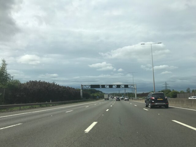
The Meadows, Hertfordshire is a picturesque area located in the county of Hertfordshire, England. It is characterized by its rolling hills, vast downs, and expansive moorland. Covering a significant area, The Meadows offers a diverse and stunning landscape that attracts both locals and tourists alike.
The Downs of The Meadows are known for their gently sloping hills, which provide breathtaking views of the surrounding countryside. These downs are covered in lush green grass and dotted with wildflowers, creating a vibrant and colorful scene during the warmer months. The area is popular among hikers and nature enthusiasts who can explore the numerous walking trails that wind through the downs.
The Moorland, on the other hand, presents a different atmosphere altogether. With its vast expanse of open land, the moorland is a haven for wildlife and a treat for birdwatchers. The area is home to a variety of bird species, including falcons, kestrels, and skylarks, making it a prime location for bird spotting. The moorland is also dotted with heather and gorse, adding a touch of purple and yellow hues to the landscape.
The Meadows, Hertfordshire is not only a natural beauty but also holds historical significance. It is believed to have been inhabited since ancient times, and remnants of ancient settlements and burial sites can still be found in the area, adding an element of intrigue to its charm.
Overall, The Meadows, Hertfordshire offers a stunning combination of downs and moorland, providing visitors with a serene and idyllic escape from the hustle and bustle of city life. Whether it is hiking, birdwatching, or simply enjoying the beauty of nature, The Meadows offers something for everyone to appreciate.
If you have any feedback on the listing, please let us know in the comments section below.
The Meadows Images
Images are sourced within 2km of 51.783827/-0.41614758 or Grid Reference TL0910. Thanks to Geograph Open Source API. All images are credited.


The Meadows is located at Grid Ref: TL0910 (Lat: 51.783827, Lng: -0.41614758)
Administrative County: Hertfordshire
District: St. Albans
Police Authority: Hertfordshire
What 3 Words
///putty.topped.traps. Near Redbourn, Hertfordshire
Nearby Locations
Related Wikis
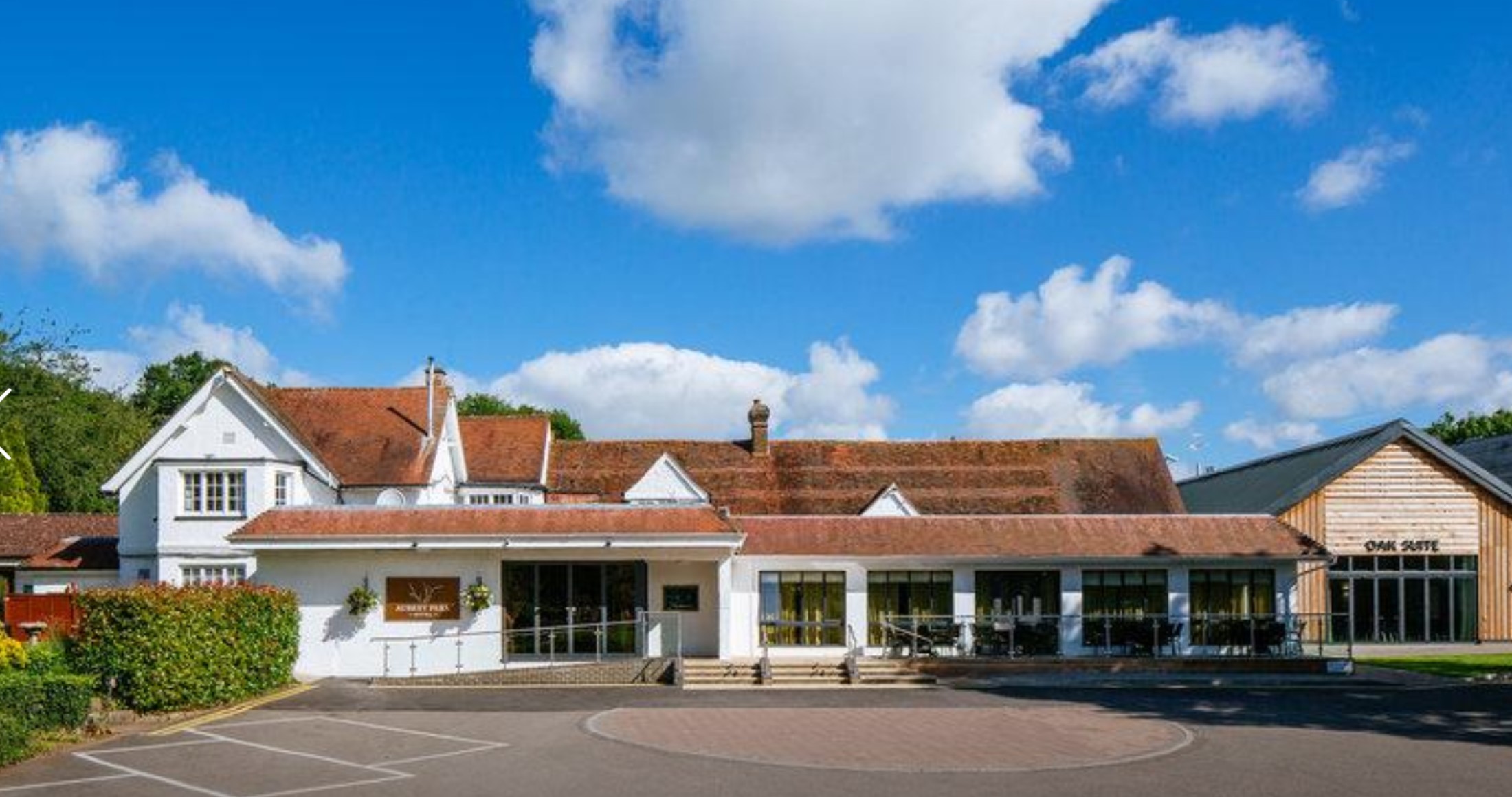
Aubrey Park Hotel
Aubrey Park, Redbourn in Hertfordshire is a building of historical significance and is listed on the English Heritage Register. Parts of the building date...

Beaumont's Halt railway station
Beaumont's Halt railway station was in Hertfordshire, England from 1905 to 1963 on the Nickey Line. == History == The station opened on 9 August 1905...
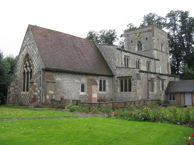
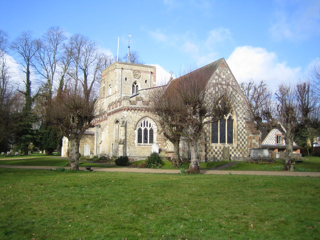
St Mary's Church, Redbourn
St Mary's Church is an active Grade I listed parish church in the Church of England in Redbourn, Hertfordshire, England. The building is Grade I listed...
Redbourn railway station
Redbourn railway station served the village of Redbourn, Hertfordshire, England from 1887 to 1964 on the Nickey Line. == History == The station opened...
Redbourn
Redbourn is a village and civil parish in Hertfordshire, England, lying on Watling Street, three miles (4.8 km) from Harpenden, four miles (6.4 km) from...

Buncefield oil depot
Buncefield oil depot is operated by Hertfordshire Oil Storage Ltd (HOSL) and officially known as the Hertfordshire Oil Storage Terminal. It is an oil depot...

Buncefield fire
The Buncefield fire was a major fire at an oil storage facility that started at 06:01 UTC on Sunday 11 December 2005 at the Hertfordshire Oil Storage Terminal...
The Astley Cooper School
The Astley Cooper School is an English 11–18 comprehensive school on the edge of Hemel Hempstead in Hertfordshire, England. == History == The school was...
Nearby Amenities
Located within 500m of 51.783827,-0.41614758Have you been to The Meadows?
Leave your review of The Meadows below (or comments, questions and feedback).