Chatley Heath

Downs, Moorland in Surrey Elmbridge

England

Chatley Heath

Ploughed field next to Chilbrook Farm
Ploughed field next to Chilbrook Farm Credit: James Emmans

Chatley Heath is a picturesque area located in Surrey, England. It is a part of the larger Surrey Hills Area of Outstanding Natural Beauty. The heath is situated on the North Downs, offering stunning views of the surrounding countryside.

Covering an area of approximately 100 hectares, Chatley Heath is predominantly characterized by heathland and moorland habitats. The landscape is a mix of open heath, scattered trees, and patches of acidic grassland. The heath is home to a variety of plant species, including heather, gorse, and bracken, which add vibrant colors to the area throughout the year.

The diverse wildlife found in Chatley Heath is another highlight of this natural haven. It provides a habitat for numerous bird species, such as stonechat, linnet, and nightjar. Additionally, reptiles like common lizards and adders can be spotted sunbathing on the heathland. The area also supports a range of insects, including butterflies and dragonflies.

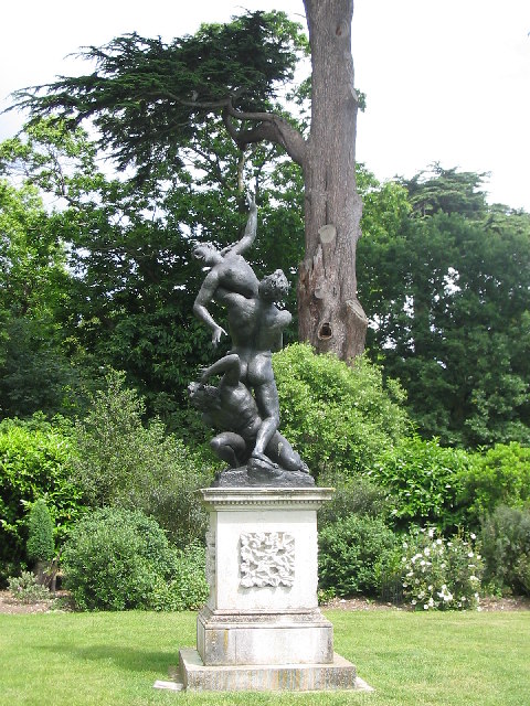
For outdoor enthusiasts, Chatley Heath offers plenty of recreational opportunities. Visitors can explore the heath through the network of footpaths and enjoy leisurely walks or hikes. The tranquil atmosphere and stunning vistas make it an ideal location for nature lovers and photographers. Picnic areas are also available, allowing visitors to relax and soak in the beauty of the surroundings.

In conclusion, Chatley Heath in Surrey is a beautiful and natural landscape that offers a diverse range of flora and fauna. It provides a peaceful escape from the hustle and bustle of everyday life, making it a popular destination for both locals and tourists alike.

If you have any feedback on the listing, please let us know in the comments section below.

Chatley Heath Images

Images are sourced within 2km of 51.317246/-0.44260053 or Grid Reference TQ0858. Thanks to Geograph Open Source API. All images are credited.

Ploughed field next to Chilbrook Farm
Statue in Painshill Park, Cobham Painshill Park is a fascinating place to visit, full of follies and its very own grotto.
Statue in Painshill Park, Cobham
Painshill Park is a fascinating place to visit, full of follies and its very own grotto.
Gothic Temple, Painshill Park One of many interesting features in this huge park created by Charles Hamilton in the 18th century, the Gothic Temple is in fact made of wood and rendered to look like stone. It sits on a hill overlooking a serpentine lake.
Gothic Temple, Painshill Park
One of many interesting features in this huge park created by Charles Hamilton in the 18th century, the Gothic Temple is in fact made of wood and rendered to look like stone. It sits on a hill overlooking a serpentine lake.
Pain's Hill The lake from the Gothic Temple
Pain's Hill
The lake from the Gothic Temple
The Wey near Byfleet A quiet stretch of the River Wey at Park Barn Farm, south of the former Byfleet Mill.
The Wey near Byfleet
A quiet stretch of the River Wey at Park Barn Farm, south of the former Byfleet Mill.
Approaching Park Barn Farm Narrow footpath with a good clay surface for walkers. The farm is hidden on the right behind a high fence. Beyond, the path goes along the bank of the River Wey for a short stretch.
Approaching Park Barn Farm
Narrow footpath with a good clay surface for walkers. The farm is hidden on the right behind a high fence. Beyond, the path goes along the bank of the River Wey for a short stretch.
The lake at Painshill Park Viewed from the Gothic Temple, the 14 acre lake forms a large part of the restored 18th century park.
The lake at Painshill Park
Viewed from the Gothic Temple, the 14 acre lake forms a large part of the restored 18th century park.
Geese and goslings by the north side of the lake in Painshill Park
1950s Vauxhall Cresta on Redhill Road
Halfpenny Cross The T-junction of Ockham lane, Plough Lane and Pointers Road. In the Pointers Road corner are grassy islands with a bench and an unusual hay trough. There are stables in this area.
Halfpenny Cross
The T-junction of Ockham lane, Plough Lane and Pointers Road. In the Pointers Road corner are grassy islands with a bench and an unusual hay trough. There are stables in this area.
Poynters Riding Centre Brick-built stables on the north side of Ockham Lane, by Poynters Farm.
Poynters Riding Centre
Brick-built stables on the north side of Ockham Lane, by Poynters Farm.
Where There's Muck, There's Brass Dung hill on Plough Lane at Downside, below a prosperous mock Tudor house on the hilltop.
Where There's Muck, There's Brass
Dung hill on Plough Lane at Downside, below a prosperous mock Tudor house on the hilltop.
Flooding by Plough Lane The field edge is very wet after heavy spells of rain. The soil is poor draining clay and is adjacent to the River Mole.
Flooding by Plough Lane
The field edge is very wet after heavy spells of rain. The soil is poor draining clay and is adjacent to the River Mole.
Chilbrook Road The road is more of a country lane. Here it joins Plough Lane at a grassy triangle.
Chilbrook Road
The road is more of a country lane. Here it joins Plough Lane at a grassy triangle.
M25 footbridge at Goose Green The footbridge links to Cold Norton, south of the motorway, whilst beyond it is the bridge carrying the Horsley Road.
M25 footbridge at Goose Green
The footbridge links to Cold Norton, south of the motorway, whilst beyond it is the bridge carrying the Horsley Road.
M25, footbridge near Goose Green The M25 is a 117 mile orbital motorway that encircles London. It was constructed between 1975 and 1986.
The motorway is not a continuous loop as a section to the East of London at The Dartford Crossing is an A-Road.
Wikipedia; <span class="nowrap"><a title="http://en.wikipedia.org/wiki/M25_motorway" rel="nofollow ugc noopener" href="http://en.wikipedia.org/wiki/M25_motorway">Link</a><img style="margin-left:2px;" alt="External link" title="External link - shift click to open in new window" src="https://s1.geograph.org.uk/img/external.png" width="10" height="10"/></span>
M25, footbridge near Goose Green
The M25 is a 117 mile orbital motorway that encircles London. It was constructed between 1975 and 1986. The motorway is not a continuous loop as a section to the East of London at The Dartford Crossing is an A-Road. Wikipedia; LinkExternal link
M25 - 1 mile to junction 10 On the clockwise carriageway.
M25 - 1 mile to junction 10
On the clockwise carriageway.
Show me another place!

Chatley Heath is located at Grid Ref: TQ0858 (Lat: 51.317246, Lng: -0.44260053)

Administrative County: Surrey

District: Elmbridge

Police Authority: Surrey

What 3 Words

///await.paths.hotels. Near Cobham, Surrey

Related Wikis

Chatley Heath

Chatley Heath is part of 336 hectare reserve including Wisley Common, Ockham and parts of Hatchford. It is an area with a mixed habitats including heathland...

Ockham and Wisley Commons

Ockham and Wisley Commons is a 266-hectare (660-acre) biological Site of Special Scientific Interest east of Woking in Surrey. It is also a Local Nature...

Foxwarren Park

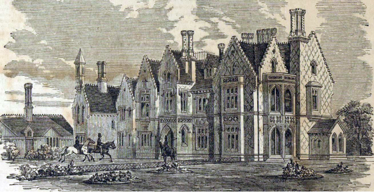
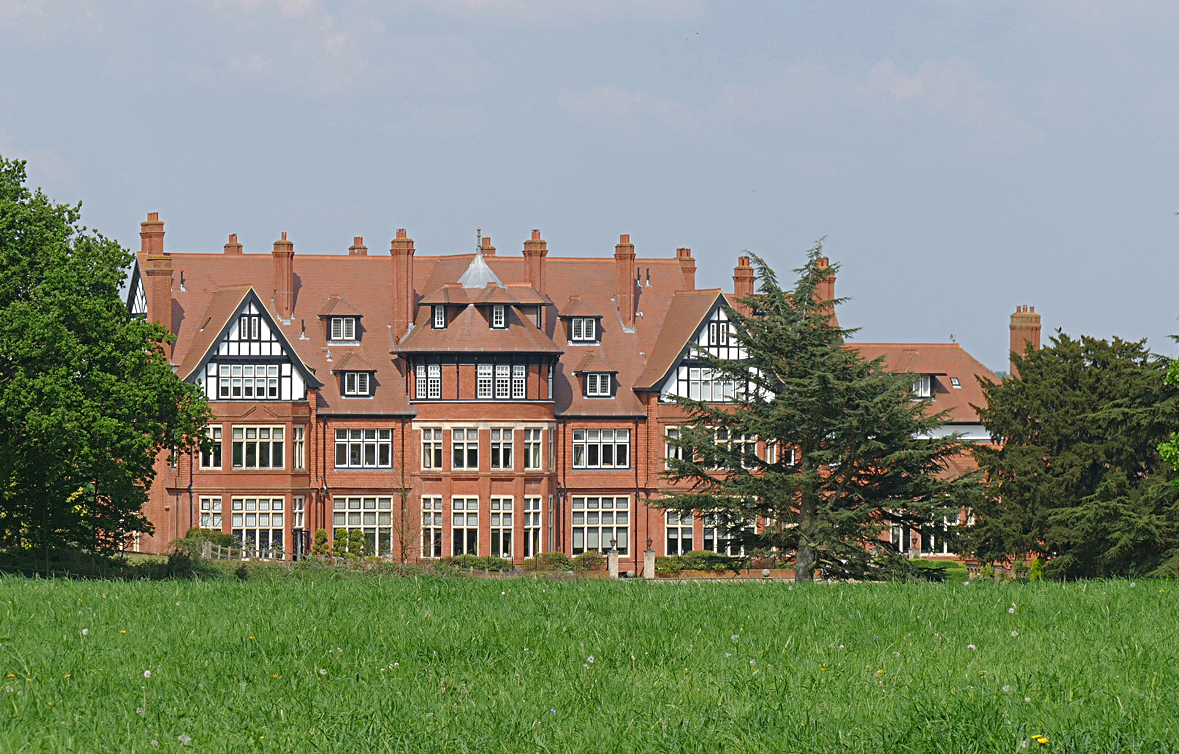
Foxwarren Park, at Wisley in Surrey, is a Victorian country house and estate. On sandstone Ockham and Wisley Commons, it was designed in 1860 by the railway...

Hatchford

Hatchford is a hamlet in the English county of Surrey outside the town of Cobham (its former civil and ecclesiastical parish); it traditionally includes...
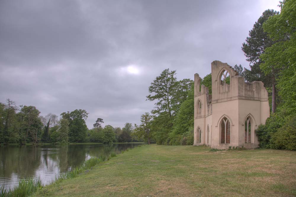
Painshill

Painshill (also referred to as "Pains Hill" in some 19th-century texts), near Cobham, Surrey, England, is one of the finest remaining examples of an 18th...

Wisley Airfield

Wisley Airfield is a former wartime airfield located in the Parish of Ockham near Wisley in Surrey, England. Originally a grass airstrip, the runway was...

Feltonfleet School

Feltonfleet School is a preparatory school for boys and girls from 3 to 13 years old, based in Cobham, Surrey in a Grade II listed building. The school...

Silvermere

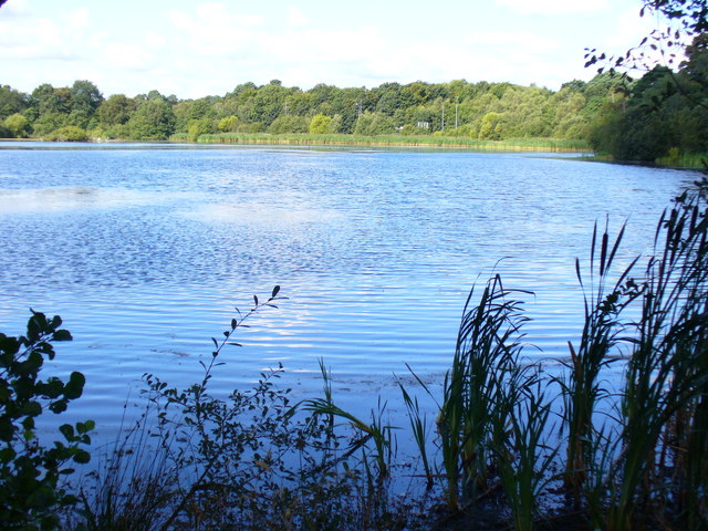
Silvermere is an estate in Surrey, England named after its mere – a shallow lake of about ten acres which has a silvery appearance when seen from the surrounding...

Nearby Amenities

Located within 500m of 51.317246,-0.44260053
Motorway Junction
Wisley
Ref: 10
Lat/Long: 51.3195976/-0.4437347
Telegraph Hill
Natural: peak
Place: locality
Source: npe
Lat/Long: 51.3159267/-0.4383387
Created By: Merkaartor 0.13
Lat/Long: 51.3165589/-0.4476015
Created By: Merkaartor 0.13
Lat/Long: 51.3164746/-0.4470769
Created By: Merkaartor 0.13
Lat/Long: 51.316397/-0.4465671
Created By: Merkaartor 0.13
Lat/Long: 51.3153292/-0.4389662
Created By: Merkaartor 0.13
Lat/Long: 51.3159555/-0.4429196
Created By: Merkaartor 0.13
Lat/Long: 51.3159887/-0.4427831
Created By: Merkaartor 0.13
Lat/Long: 51.3160333/-0.442653
Created By: Merkaartor 0.13
Lat/Long: 51.3160844/-0.4425292
Created By: Merkaartor 0.13
Lat/Long: 51.3161434/-0.4423973
Created By: Merkaartor 0.13
Lat/Long: 51.3162058/-0.44225
Created By: Merkaartor 0.13
Lat/Long: 51.3162409/-0.4421056
Created By: Merkaartor 0.13
Lat/Long: 51.3162636/-0.4419312
Created By: Merkaartor 0.13
Lat/Long: 51.3157409/-0.4412268
Created By: Merkaartor 0.13
Lat/Long: 51.3193845/-0.445159
Phone
Emergency: phone
Operator: National Highways
Operator Wikidata: Q5760006
Lat/Long: 51.3163735/-0.4373432
Phone
Emergency: phone
Operator: National Highways
Operator Wikidata: Q5760006
Lat/Long: 51.3166639/-0.4369537
Man Made: tower
Tower Type: communication
Lat/Long: 51.3211326/-0.4438993
Covered: no
Leisure: picnic_table
Lat/Long: 51.3149371/-0.4382889
Bench
Backrest: yes
Material: wood
Seats: 3
Lat/Long: 51.31514/-0.4382883
Check Date: 2022-07-24
Covered: no
Leisure: picnic_table
Lat/Long: 51.315176/-0.4382233
Waste Basket
Waste: trash
Lat/Long: 51.3151182/-0.4385862
Wisley & Ockham Commons
Check Date: 2022-07-24
Information: map
Tourism: information
Lat/Long: 51.3152674/-0.4383708
Street Lamp
Lamp Model: Urbis ZX3
Lamp Type: SON
Source: Mapillary (2019-02-15)
Lat/Long: 51.3160238/-0.4360279
Street Lamp
Lamp Model: Urbis ZX3
Lamp Type: SON
Source: Mapillary (2019-02-15)
Lat/Long: 51.3162368/-0.4365242
Street Lamp
Lamp Model: Urbis ZX3
Lamp Type: SON
Source: Mapillary (2019-02-15)
Lat/Long: 51.3164513/-0.4370043
Street Lamp
Lamp Model: Philips SGS204
Lamp Type: SON
Source: Mapillary (2019-02-15)
Lat/Long: 51.3182401/-0.4407701
Street Lamp
Lamp Model: Philips SGS204
Lamp Type: SON
Source: Mapillary (2019-02-15)
Lat/Long: 51.3179802/-0.4402497
Street Lamp
Lamp Model: Philips SGS204
Lamp Type: SON
Source: Mapillary (2019-02-15)
Lat/Long: 51.3177472/-0.4397777
Street Lamp
Lamp Model: Philips SGS204
Lamp Type: SON
Source: Mapillary (2019-02-15)
Lat/Long: 51.317536/-0.4393244
Street Lamp
Lamp Model: Philips SGS204
Lamp Type: SON
Source: Mapillary (2019-02-15)
Lat/Long: 51.3173147/-0.4388657
Street Lamp
Lamp Model: Philips SGS204
Lamp Type: SON
Source: Mapillary (2019-02-15)
Lat/Long: 51.3171035/-0.4384205
Street Lamp
Lamp Model: Philips SGS204
Lamp Type: SON
Source: Mapillary (2019-02-15)
Lat/Long: 51.3168956/-0.4379699
Street Lamp
Lamp Model: Philips SGS204
Lamp Type: SON
Source: Mapillary (2019-02-15)
Lat/Long: 51.316671/-0.4374898
Street Lamp
Lamp Model: Philips SGS204
Lamp Type: SON
Source: Mapillary (2019-02-15)
Lat/Long: 51.3185049/-0.4412878
Street Lamp
Lamp Model: Philips SGS204
Lamp Type: SON
Source: Mapillary (2019-02-15)
Lat/Long: 51.3187581/-0.4417706
Street Lamp
Lamp Model: Philips SGS204
Lamp Type: SON
Source: Mapillary (2019-02-15)
Lat/Long: 51.3189827/-0.4422373
Street Lamp
Lamp Model: Philips SGS204
Lamp Type: SON
Source: Mapillary (2019-02-15)
Lat/Long: 51.3194571/-0.4431814
Street Lamp
Lamp Model: Philips SGS204
Lamp Type: SON
Source: Mapillary (2019-02-15)
Lat/Long: 51.3192224/-0.4427201
Street Lamp
Lamp Model: Philips SGS204
Lamp Type: SON
Source: Mapillary (2019-02-15)
Lat/Long: 51.3196666/-0.4436266
Street Lamp
Lamp Model: Philips SGS204
Lamp Type: SON
Source: Mapillary (2019-02-15)
Lat/Long: 51.3198644/-0.4440612
Street Lamp
Lamp Model: Philips SGS204
Lamp Type: SON
Source: Mapillary (2019-02-15)
Lat/Long: 51.3200589/-0.4445118
Street Lamp
Lamp Model: Philips SGS204
Lamp Type: SON
Source: Mapillary (2019-02-15)
Lat/Long: 51.32026/-0.4449597
Street Lamp
Lamp Model: Philips SGS204
Lamp Type: SON
Source: Mapillary (2019-02-15)
Lat/Long: 51.3204662/-0.4454613
Street Lamp
Lamp Model: Philips SGS204
Lamp Type: SON
Source: Mapillary (2019-02-15)
Lat/Long: 51.3206707/-0.4459655
Street Lamp
Lamp Model: Philips SGS204
Lamp Type: SON
Source: Mapillary (2019-02-15)
Lat/Long: 51.3208702/-0.4464644
Covered: no
Leisure: picnic_table
Lat/Long: 51.3148734/-0.4383416
Covered: no
Leisure: picnic_table
Lat/Long: 51.3149497/-0.4387467
Covered: no
Leisure: picnic_table
Lat/Long: 51.314873/-0.4386584
Bench
Backrest: no
Material: wood
Lat/Long: 51.3158533/-0.4431933
Bench
Backrest: no
Material: wood
Lat/Long: 51.3158595/-0.4432691
Bench
Backrest: no
Material: wood
Lat/Long: 51.3162343/-0.4457134
Bench
Backrest: no
Material: wood
Lat/Long: 51.3163675/-0.4457537
Bench
Backrest: no
Material: wood
Lat/Long: 51.3166852/-0.4484166
Hiking: yes
Information: guidepost
Source: GPS
Tourism: information
Lat/Long: 51.3141747/-0.4417196
Camera Mount: pole
Camera Type: panning
Height: 8
Man Made: surveillance
Surveillance: public
Surveillance Type: camera
Surveillance Zone: traffic
Lat/Long: 51.3163426/-0.4361871
Traffic Sign: variable_message
Variable Message Model: MS2
Lat/Long: 51.3160098/-0.4365582
Power: transformer
Lat/Long: 51.3212272/-0.4437822
Bench
Backrest: yes
Material: wood
Lat/Long: 51.3173486/-0.4461003
Traffic Sign: variable_message
Variable Message Model: AMI
Lat/Long: 51.3162792/-0.4362591
Traffic Sign: variable_message
Variable Message Model: AMI
Lat/Long: 51.3162531/-0.436288
Traffic Sign: variable_message
Variable Message Model: AMI
Lat/Long: 51.3162297/-0.436314
Traffic Sign: variable_message
Variable Message Model: AMI
Lat/Long: 51.3161988/-0.4363482
Traffic Sign: variable_message
Variable Message Model: AMI
Lat/Long: 51.3203819/-0.4458738
Traffic Sign: variable_message
Variable Message Model: AMI
Lat/Long: 51.3204083/-0.4458466
Traffic Sign: variable_message
Variable Message Model: MS2
Lat/Long: 51.3204419/-0.4458121
Traffic Sign: variable_message
Variable Message Model: AMI
Lat/Long: 51.3204827/-0.4457701
Traffic Sign: variable_message
Variable Message Model: AMI
Lat/Long: 51.3205106/-0.4457415
Traffic Sign: variable_message
Variable Message Model: AMI
Lat/Long: 51.3205385/-0.4457128
Traffic Sign: variable_message
Variable Message Model: MS2
Lat/Long: 51.3186295/-0.4419813
Traffic Sign: variable_message
Variable Message Model: AMI
Lat/Long: 51.3186621/-0.4419388
Traffic Sign: variable_message
Variable Message Model: AMI
Lat/Long: 51.318694/-0.4418972
Traffic Sign: variable_message
Variable Message Model: AMI
Lat/Long: 51.3187185/-0.4418653
Traffic Sign: variable_message
Variable Message Model: AMI
Lat/Long: 51.3187425/-0.441834
Traffic Sign: variable_message
Variable Message Model: AMI
Lat/Long: 51.3160622/-0.4364999
Traffic Sign: variable_message
Variable Message Model: AMI
Lat/Long: 51.3160902/-0.4364689
Traffic Sign: variable_message
Variable Message Model: AMI
Lat/Long: 51.3161208/-0.4364349
Traffic Sign: variable_message
Variable Message Model: AMI
Lat/Long: 51.3161446/-0.4364085
Traffic Sign: variable_message
Variable Message Model: MS2
Lat/Long: 51.3163315/-0.4362009
Board Title: The Semaphore Tower, Chatley Heath
Board Type: history
Information: board
Operator: The Landmark Trust
Tourism: information
Lat/Long: 51.3151449/-0.4385252
The data included in this document is from www.openstreetmap.org. The data is made available under ODbL.

Have you been to Chatley Heath?

Leave your review of Chatley Heath below (or comments, questions and feedback).