Green

Downs, Moorland in Lincolnshire North Kesteven

England

Green

Buildings in the market place, Sleaford An awkward situation where buildings face a pay-and-display car park.
Buildings in the market place, Sleaford Credit: Humphrey Bolton

Green, Lincolnshire is a picturesque village nestled in the heart of the county. Known for its stunning countryside scenery, the village offers a peaceful and idyllic setting for both residents and visitors alike. Green is located on the edge of the Lincolnshire Wolds, an Area of Outstanding Natural Beauty, which provides ample opportunities for outdoor activities and exploration.

The village is characterized by its rolling hills, lush green fields, and charming stone cottages. The Lincolnshire Downs, a series of hills that stretch across the area, offer breathtaking views of the surrounding landscape. The area is also dotted with quaint villages and hamlets, each with its own unique character and charm.

In addition to its natural beauty, Green is also home to a variety of wildlife. The moorland areas attract a diverse range of bird species, making it a paradise for birdwatchers. Visitors can spot species such as the skylark, lapwing, and red kite, among others.

For those seeking a taste of history, Green is located near several historical sites. The nearby Lincoln Cathedral, one of the finest Gothic cathedrals in Europe, is a must-visit for history enthusiasts. The village itself also has a rich history, with evidence of human settlement dating back thousands of years.

Overall, Green, Lincolnshire offers a serene and picturesque escape from the hustle and bustle of city life. Whether it's exploring the stunning countryside, spotting wildlife, or immersing oneself in history, this village has something for everyone.

If you have any feedback on the listing, please let us know in the comments section below.
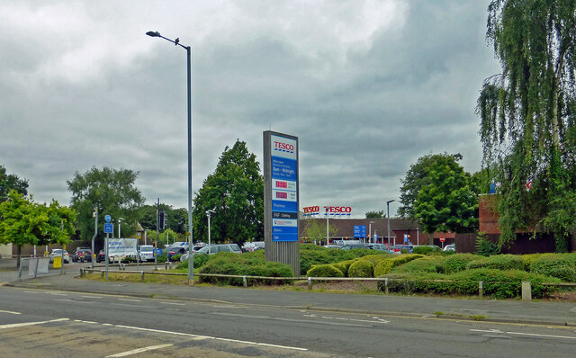
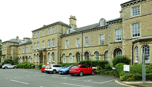
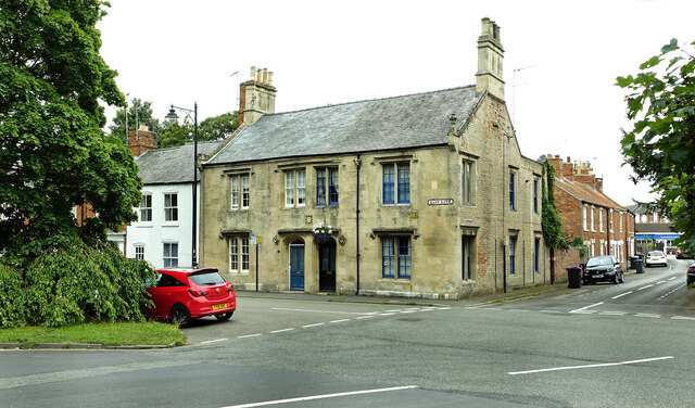
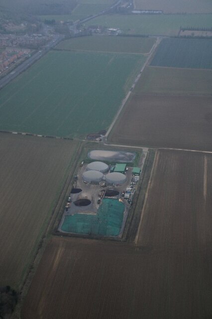
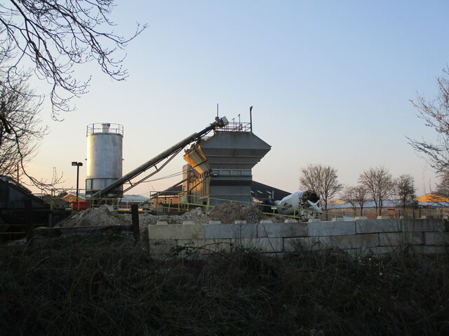
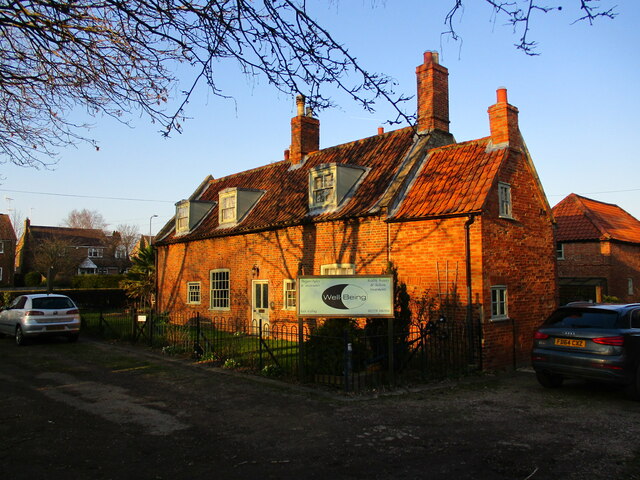
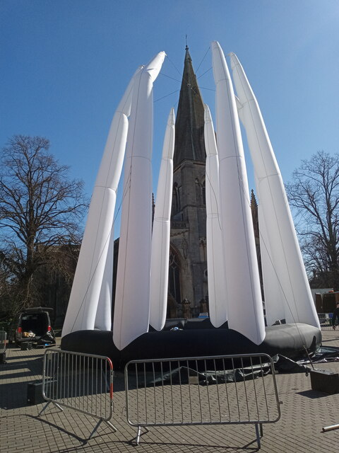
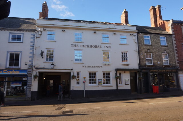
Green Images

Images are sourced within 2km of 53.010514/-0.42127159 or Grid Reference TF0647. Thanks to Geograph Open Source API. All images are credited.

Buildings in the market place, Sleaford An awkward situation where buildings face a pay-and-display car park.
Buildings in the market place, Sleaford
An awkward situation where buildings face a pay-and-display car park.
Window, St Denys, Sleaford This is one of the windows with "flowing tracery" that Nikolaus Pevsner remembered the church for. It is similar in style to the east window of the chancel of Boston church.
Window, St Denys, Sleaford
This is one of the windows with "flowing tracery" that Nikolaus Pevsner remembered the church for. It is similar in style to the east window of the chancel of Boston church.
Café, shops and war memorial, Market Place, Sleaford
The River Slea Viewed on a disappointingly dull summer day.
The River Slea
Viewed on a disappointingly dull summer day.
Tesco at Sleaford Located on North Gate.
Tesco at Sleaford
Located on North Gate.
Council offices at Lafford Terrace See <a href="https://www.geograph.org.uk/photo/5574532">TF0745 : Lafford Terrace</a> for information about this lovely old building.
Council offices at Lafford Terrace
See TF0745 : Lafford Terrace for information about this lovely old building.
East Gate, Sleaford Viewed on the edge of the square on a disappointingly dull summer day.
East Gate, Sleaford
Viewed on the edge of the square on a disappointingly dull summer day.
Holdingham Biogas: aerial 2022 Commercial anaerobic digestion facility. See <span class="nowrap"><a title="https://www.holdinghambiogas.co.uk/" rel="nofollow ugc noopener" href="https://www.holdinghambiogas.co.uk/">Link</a><img style="margin-left:2px;" alt="External link" title="External link - shift click to open in new window" src="https://s1.geograph.org.uk/img/external.png" width="10" height="10"/></span>
Holdingham Biogas: aerial 2022
Commercial anaerobic digestion facility. See LinkExternal link
Breedon concrete plant, Sleaford
Slea Bridge Carries the Sleaford Avoiding Line over the River Slea. The bridge has  recently been rebuilt, compare with <a href="https://www.geograph.org.uk/photo/627455">TF0746 : Railway bridge of the River Slea</a>
Slea Bridge
Carries the Sleaford Avoiding Line over the River Slea. The bridge has recently been rebuilt, compare with TF0746 : Railway bridge of the River Slea
Black shed A once common sight. Now most have been replaced or are in poor condidtion. A candidate for listing?
Black shed
A once common sight. Now most have been replaced or are in poor condidtion. A candidate for listing?
Coggesford Lock The remains of Coggesford Lock on the Sleaford Navigation.
Coggesford Lock
The remains of Coggesford Lock on the Sleaford Navigation.
Coggesford Mill, Sleaford Mid eighteenth century water powered corn mill <span class="nowrap"><a title="https://historicengland.org.uk/listing/the-list/list-entry/1062115?section=official-list-entry" rel="nofollow ugc noopener" href="https://historicengland.org.uk/listing/the-list/list-entry/1062115?section=official-list-entry">Link</a><img style="margin-left:2px;" alt="External link" title="External link - shift click to open in new window" src="https://s1.geograph.org.uk/img/external.png" width="10" height="10"/></span>
Coggesford Mill, Sleaford
Mid eighteenth century water powered corn mill LinkExternal link
Coggesford Mill Farmhouse Mid eighteenth century house <span class="nowrap"><a title="https://historicengland.org.uk/listing/the-list/list-entry/1360438?section=official-list-entry" rel="nofollow ugc noopener" href="https://historicengland.org.uk/listing/the-list/list-entry/1360438?section=official-list-entry">Link</a><img style="margin-left:2px;" alt="External link" title="External link - shift click to open in new window" src="https://s1.geograph.org.uk/img/external.png" width="10" height="10"/></span>
Coggesford Mill Farmhouse
Mid eighteenth century house LinkExternal link
Grass field and housing, Sleaford The grass field lies between the old and present courses of the River Slea.
Grass field and housing, Sleaford
The grass field lies between the old and present courses of the River Slea.
Mill pool above Coggesford Mill
RiverLight Festival installation One of a number of things to see at the RiverLight (sic) festival held over the weekend of 19th/20th March 2022.  St Deny's church spire behind takes it all in its stride.

This particular installation is called 'Octo', by Dream Engine and features an acrobat 'inside' during an aerial performance.
RiverLight Festival installation
One of a number of things to see at the RiverLight (sic) festival held over the weekend of 19th/20th March 2022. St Deny's church spire behind takes it all in its stride. This particular installation is called 'Octo', by Dream Engine and features an acrobat 'inside' during an aerial performance.
The Packhorse Inn, North Gate, Sleaford
Show me another place!

Green is located at Grid Ref: TF0647 (Lat: 53.010514, Lng: -0.42127159)

Administrative County: Lincolnshire

District: North Kesteven

Police Authority: Lincolnshire

What 3 Words

///affords.polished.etchings. Near Sleaford, Lincolnshire

Nearby Locations

Green

Related Wikis

Carre's Grammar School

Carre's Grammar School is a selective secondary school for boys in Sleaford, a market town in Lincolnshire, England. Founded on 1 September 1604 by an...
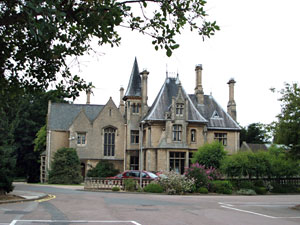
Westholme House

Westholme House is a historic building in the English market town of Sleaford in Lincolnshire, set in 32 acres of parkland and school grounds. Built around...

St George's Academy

St George's Academy is a co-educational comprehensive secondary school based in the English market town of Sleaford in Lincolnshire, with a satellite school...

Manor House, Sleaford

The Manor House is a set of connected buildings located on Northgate in the English town of Sleaford, Lincolnshire. A complex arrangement, parts of the...
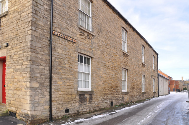
Playhouse, Sleaford

The Playhouse is a theatre in Sleaford, Lincolnshire, England. It is a Grade II listed Georgian building dating from 1820. The building became a school...

Sessions House, Sleaford

The Sessions House, also known as Sleaford Town Hall, is a judicial structure in the Market Place, Sleaford, Lincolnshire, England. The structure, which...

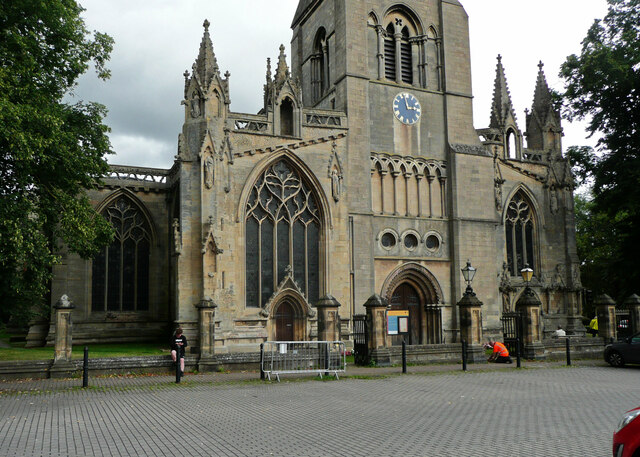
St Denys' Church, Sleaford

St Denys' Church is a medieval Anglican parish church in Sleaford, Lincolnshire, England. While a church and a priest have probably been present in the...

Leasingham

Leasingham is a village and civil parish in the North Kesteven district of Lincolnshire, England. It is situated less than 2 miles (3 km) north from Sleaford...

Nearby Amenities

Located within 500m of 53.010514,-0.42127159
Holdingham
Is In: Lincolnshire, England, UK
Place: neighbourhood
Source: NPE
Lat/Long: 53.0121583/-0.4233293
Bus Stop
St Denys Avenue
Bus: yes
Naptan AtcoCode: 270000008360
Naptan Bearing: NW
Naptan CommonName: St Denys Avenue
Naptan Indicator: adj
Naptan Landmark: St Denys Avenue
Naptan NaptanCode: lingptgm
Naptan Street: North Parade
Naptan Verified: no
Public Transport: platform
Source: naptan_import
Lat/Long: 53.0068607/-0.4207157
Bus Stop
York Road
Bus: yes
Naptan AtcoCode: 270000008362
Naptan Bearing: SE
Naptan CommonName: York Road
Naptan Indicator: adj
Naptan Landmark: York Road
Naptan NaptanCode: lingptgt
Naptan Street: Lincoln Road
Naptan Verified: no
Public Transport: platform
Source: naptan_import
Lat/Long: 53.007938/-0.4172184
Bus Stop
The Jolly Scotchman PH
Bus: yes
Naptan AtcoCode: 270000008363
Naptan Bearing: NW
Naptan CommonName: The Jolly Scotchman PH
Naptan Indicator: opp
Naptan Landmark: The Jolly Scotchman PH
Naptan NaptanCode: lingptgw
Naptan Street: Lincoln Road
Naptan Verified: no
Public Transport: platform
Source: naptan_import
Lat/Long: 53.0114891/-0.4233043
Bus Stop
1 Chapman Road
Bus: yes
Naptan AtcoCode: 270002701580
Naptan Bearing: NW
Naptan CommonName: 1 Chapman Road
Naptan Indicator: o/s
Naptan Landmark: Number 1
Naptan NaptanCode: linadwdw
Naptan Street: Chapman Road
Naptan Verified: no
Public Transport: platform
Source: naptan_import
Lat/Long: 53.0085994/-0.4236929
Bus Stop
2 Covel Road
Bus: yes
Naptan AtcoCode: 270002701581
Naptan Bearing: E
Naptan CommonName: 2 Covel Road
Naptan Indicator: o/s
Naptan Landmark: Number 2
Naptan NaptanCode: linadwgj
Naptan Street: Covel Road
Naptan Verified: no
Public Transport: platform
Source: naptan_import
Lat/Long: 53.0096348/-0.421777
Bus Stop
The Jolly Scotchman PH
Bus: yes
Naptan AtcoCode: 2700LHJSP214
Naptan Bearing: SE
Naptan CommonName: The Jolly Scotchman PH
Naptan Indicator: adj
Naptan Landmark: The Jolly Scotchman PH
Naptan NaptanCode: linadgwt
Naptan Street: Lincoln Road
Naptan Verified: no
Public Transport: platform
Source: naptan_import
Lat/Long: 53.0111169/-0.4226249
Bus Stop
York Road
Bus: yes
Naptan AtcoCode: 2700LSSC6172
Naptan Bearing: NW
Naptan CommonName: York Road
Naptan Indicator: opp
Naptan Landmark: York Road
Naptan NaptanCode: lingapgp
Naptan Street: Lincoln Road
Naptan Verified: no
Public Transport: platform
Source: naptan_import
Lat/Long: 53.0080412/-0.4175425
Bus Stop
St Annes Close
Bus: yes
Naptan AtcoCode: 2700LSSD1733
Naptan Bearing: NE
Naptan CommonName: St Annes Close
Naptan Indicator: adj
Naptan Landmark: St Annes Close
Naptan NaptanCode: linamjpt
Naptan Street: St Denys Avenue
Naptan Verified: no
Public Transport: platform
Source: naptan_import
Lat/Long: 53.0081232/-0.4182997
Bus Stop
Exeter Drive
Bus: yes
Naptan AtcoCode: 2700LSYR1946
Naptan Bearing: NE
Naptan CommonName: Exeter Drive
Naptan Indicator: adj
Naptan Landmark: Exeter Drive
Naptan NaptanCode: linamwtg
Naptan Street: York Road
Naptan Verified: no
Public Transport: platform
Source: naptan_import
Lat/Long: 53.0085889/-0.4154655
Traffic Signals
Lat/Long: 53.0132726/-0.4238385
Traffic Signals
Lat/Long: 53.0126645/-0.4243055
Crossing
Check Date Crossing: 2021-12-28
Crossing: unmarked
Crossing Markings: no
Lat/Long: 53.0132137/-0.4236129
Traffic Signals
Lat/Long: 53.0138537/-0.4245643
Traffic Signals
Lat/Long: 53.0132359/-0.423556
Traffic Signals
Lat/Long: 53.0128538/-0.4255696
Traffic Signals
Lat/Long: 53.012815/-0.4243215
Traffic Signals
Lat/Long: 53.0128161/-0.4258242
Traffic Signals
Lat/Long: 53.0136925/-0.4246518
Post Office
Woodside Post Office
Addr Postcode: NG34 8AD
Brand: Post Office
Brand Wikidata: Q1783168
Ref Pol Id: 6992
Source: OS_OpenData_StreetView
Lat/Long: 53.0069753/-0.4172081
Crossing
Crossing Island: yes
Tactile Paving: yes
Lat/Long: 53.0075407/-0.4168093
Crossing
Crossing: unmarked
Crossing Markings: no
Lat/Long: 53.0119938/-0.4234598
Crossing
Crossing: unmarked
Crossing Markings: no
Tactile Paving: yes
Lat/Long: 53.0112059/-0.4227087
Crossing
Crossing: unmarked
Crossing Markings: no
Tactile Paving: yes
Lat/Long: 53.0111875/-0.422833
Crossing
Crossing: unmarked
Crossing Markings: no
Tactile Paving: yes
Lat/Long: 53.0115857/-0.4230936
Crossing
Crossing: unmarked
Crossing Markings: no
Tactile Paving: yes
Lat/Long: 53.0115249/-0.4225901
Crossing
Crossing: unmarked
Crossing Markings: no
Tactile Paving: yes
Lat/Long: 53.0112885/-0.4231783
Crossing
Crossing: unmarked
Crossing Markings: no
Tactile Paving: yes
Lat/Long: 53.0113483/-0.4232143
Barrier: bollard
Bicycle: yes
Foot: yes
Horse: yes
Lat/Long: 53.0117531/-0.4207579
Crossing
Crossing: unmarked
Crossing Markings: no
Tactile Paving: yes
Lat/Long: 53.0114491/-0.4225369
Crossing
Crossing: unmarked
Crossing Markings: no
Tactile Paving: yes
Lat/Long: 53.0115173/-0.423199
Northfield and Poplars Farm
Fixme: Is this still a farm? Its enclosed by urban areas now.
Place: farm
Source: Bing
Lat/Long: 53.0112116/-0.4194893
Post Box
Collection Times: Mo-Fr 17:00; Sa 11:30
Operator: Royal Mail
Operator Wikidata: Q638098
Post Box Type: pillar
Ref: NG34 16
Royal Cypher: EIIR
Royal Cypher Wikidata: Q33102113
Lat/Long: 53.0072154/-0.4169365
Crossing
Crossing: unmarked
Crossing Markings: no
Lat/Long: 53.0072768/-0.4166466
Crossing
Crossing: unmarked
Crossing Markings: no
Lat/Long: 53.0075822/-0.4170205
Crossing
Crossing: unmarked
Crossing Markings: no
Lat/Long: 53.0076209/-0.4170674
Crossing
Crossing Island: yes
Tactile Paving: yes
Lat/Long: 53.0082139/-0.4176424
Barrier: bollard
Lat/Long: 53.0091074/-0.4187187
Barrier: cycle_barrier
Lat/Long: 53.0098279/-0.4203971
Post Box
Collection Times: Mo-Fr 09:00; Sa 07:00
Post Box Type: pillar
Ref: NG34 37D
Royal Cypher: EIIR
Royal Cypher Wikidata: Q33102113
Lat/Long: 53.0105244/-0.4165127
Barrier: stile
Material: wood
Step Count: 2
Stile: stepover
Lat/Long: 53.0107642/-0.419409
Barrier: cycle_barrier
Lat/Long: 53.0108208/-0.4182179
Barrier: bollard
Lat/Long: 53.0110038/-0.4225845
Waste Basket
Waste: dog_excrement
Lat/Long: 53.011029/-0.4209114
Barrier: bollard
Lat/Long: 53.0111059/-0.4226216
Post Box
Collection Times: Mo-Fr 09:00; Sa 07:00
Operator: Royal Mail
Operator Wikidata: Q638098
Post Box Mounting: pier
Post Box Type: lamp
Ref: NG34 35D
Royal Cypher: EIIR
Royal Cypher Wikidata: Q33102113
Lat/Long: 53.0111313/-0.4225761
Power: pole
Lat/Long: 53.0127855/-0.4271659
Fast Food
Burger King
Addr City: Sleaford
Addr Place: Holdingham Services
Addr Postcode: NG34 8NP
Brand: Burger King
Brand Wikidata: Q177054
Brand Wikipedia: en:Burger King
Cuisine: burger
Fhrs Id: 578304
Source Addr: FHRS Open Data
Takeaway: yes
Website: https://locations.burgerking.co.uk/sleaford/a15/a17-holdingham-roundabout
Lat/Long: 53.0139135/-0.4257823
Fast Food
KFC
Addr City: Sleaford
Addr Place: Holdingham Services
Addr Postcode: NG34 8NP
Alt Name: Kentucky Fried Chicken
Brand: KFC
Brand Wikidata: Q524757
Brand Wikipedia: en:KFC
Contact Website: https://www.kfc.co.uk/kfc-near-me/sleaford-holdingham-roundabout
Cuisine: chicken
Drive Through: yes
Fhrs Id: 295712
Source Addr: FHRS Open Data
Takeaway: yes
Lat/Long: 53.0138294/-0.4257293
Fast Food
Domino's
Addr Country: GB
Brand: Domino's
Brand Wikidata: Q839466
Brand Wikipedia: en:Domino's Pizza
Contact Website: https://www.dominos.co.uk/pizza-near-me/sleaford/unit-4-lincoln-road
Cuisine: pizza
Takeaway: yes
Lat/Long: 53.0073298/-0.4171992
Barrier: bollard
Bicycle: yes
Foot: yes
Horse: yes
Lat/Long: 53.0145654/-0.4210719
Bench
Lat/Long: 53.0140264/-0.4210491
Addr Housenumber: 2
Lat/Long: 53.01118/-0.4238303
Addr Housename: Orchard Cottage
Addr Housenumber: 1
Addr Street: Holdingham
Lat/Long: 53.0111384/-0.4231598
Addr Housenumber: 5
Addr Street: Croft Close
Lat/Long: 53.011817/-0.4222067
Addr Housenumber: 4a
Lat/Long: 53.0117419/-0.4258771
Addr Housenumber: 2
Addr Street: Snow Close
Lat/Long: 53.0119455/-0.4178761
Addr Housenumber: 2
Addr Street: Whittle Road
Lat/Long: 53.0115878/-0.4194475
Addr Housenumber: 2
Lat/Long: 53.0122746/-0.4155662
Addr Housenumber: 14
Lat/Long: 53.0125951/-0.4154493
Addr Housenumber: 26
Lat/Long: 53.0126494/-0.4159031
Addr Housenumber: 49
Lat/Long: 53.0125196/-0.4193915
Addr Housenumber: 71
Lat/Long: 53.0126811/-0.4200786
Addr Housenumber: 1
Addr Street: Whittle Road
Lat/Long: 53.0117863/-0.4180937
Addr Housenumber: 3
Addr Street: Whittle Road
Lat/Long: 53.0121252/-0.4175155
Addr Housenumber: 5
Addr Street: Whittle Road
Lat/Long: 53.0121743/-0.4173302
Addr Housenumber: 17
Lat/Long: 53.0111981/-0.4168757
Addr Housenumber: 12
Lat/Long: 53.0113267/-0.4143698
Addr Housenumber: 82
Lat/Long: 53.0126854/-0.4191341
Addr Housenumber: 7
Lat/Long: 53.0117166/-0.4224353
Addr Housenumber: 16
Lat/Long: 53.0117284/-0.4230809
Addr Housenumber: 14
Lat/Long: 53.0118152/-0.4230394
Addr Housenumber: 2
Lat/Long: 53.0122361/-0.4224972
Addr Housenumber: 2
Addr Street: Peake Close
Lat/Long: 53.0121406/-0.4145912
Crossing
Check Date Crossing: 2022-05-28
Crossing: unmarked
Crossing Markings: no
Tactile Paving: yes
Lat/Long: 53.013481/-0.4236589
The data included in this document is from www.openstreetmap.org. The data is made available under ODbL.

Have you been to Green?

Leave your review of Green below (or comments, questions and feedback).