Bishopshall

Downs, Moorland in Lincolnshire South Kesteven

England

Bishopshall

Swinstead
Swinstead Credit: Tim Heaton

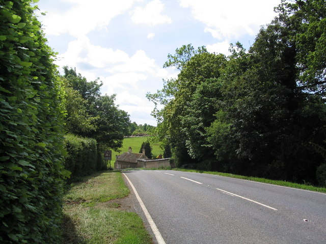
Bishopshall is a small village located in the county of Lincolnshire, England. Situated in the northern part of the county, Bishopshall is nestled within the picturesque Downs and Moorland region. The village is known for its tranquil and idyllic surroundings, making it a popular destination for nature enthusiasts and those seeking a peaceful retreat.

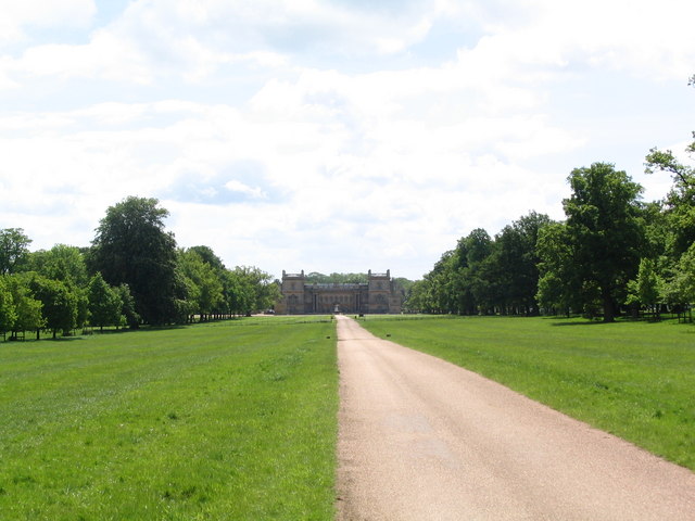
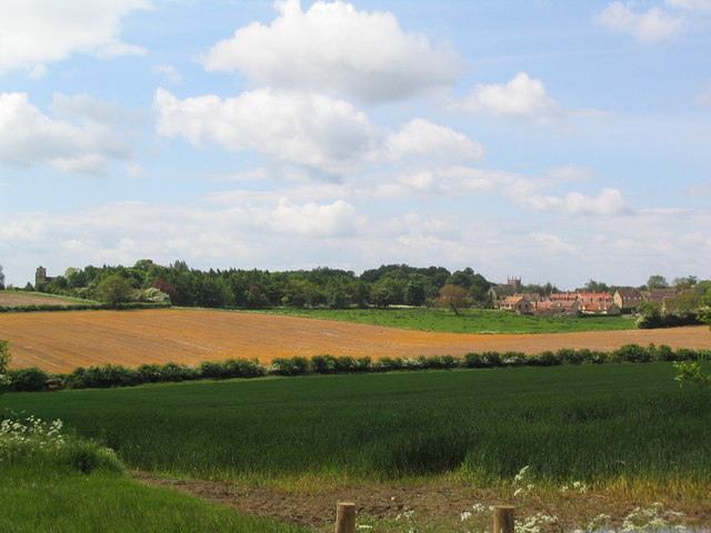
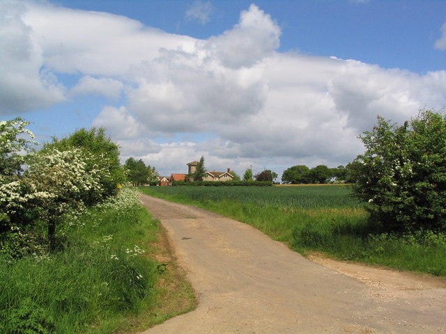
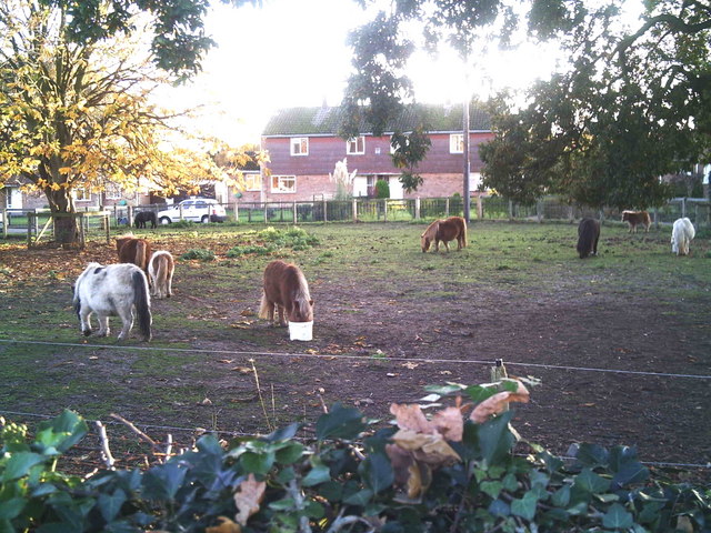
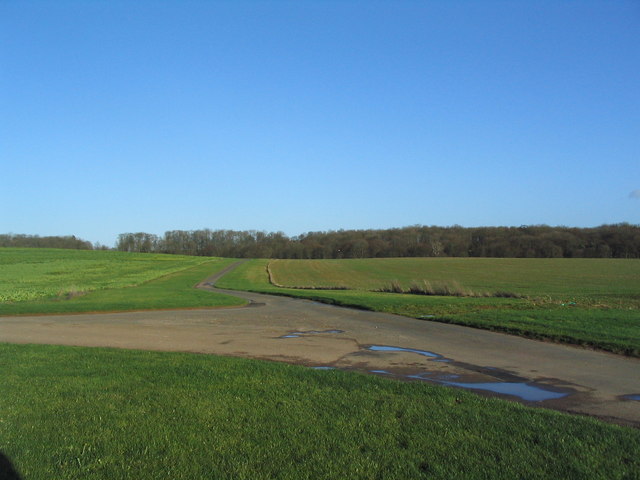
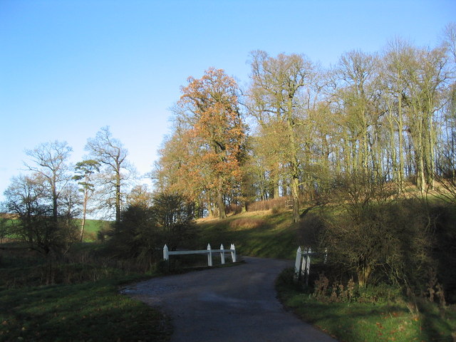
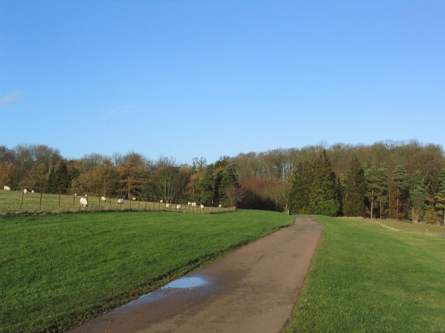
The landscape of Bishopshall is characterized by rolling hills, vast open fields, and patches of dense woodland. The area is dotted with charming cottages and farmhouses, giving it a quaint and traditional feel. The village is surrounded by an abundance of natural beauty, with numerous walking trails and pathways that allow visitors to explore the stunning countryside.

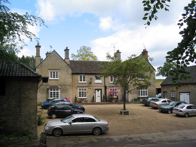
Despite its small size, Bishopshall has a strong sense of community and a rich history. The local church, St. Mary's, stands as a testament to this history, with its beautiful architecture and ancient gravestones. The village also boasts a few amenities, including a cozy pub and a small convenience store, catering to the needs of residents and visitors alike.

In terms of attractions, Bishopshall is within easy reach of various points of interest. The nearby Lincolnshire Wolds, an Area of Outstanding Natural Beauty, offers breathtaking views and opportunities for outdoor activities such as hiking and cycling. Additionally, the historic city of Lincoln is just a short drive away, providing access to cultural landmarks such as Lincoln Cathedral and Lincoln Castle.

Overall, Bishopshall is a charming village set amidst the stunning Downs and Moorland region of Lincolnshire, offering a peaceful and picturesque retreat for visitors and residents alike.

If you have any feedback on the listing, please let us know in the comments section below.

Bishopshall Images

Images are sourced within 2km of 52.786981/-0.46730754 or Grid Reference TF0322. Thanks to Geograph Open Source API. All images are credited.

Swinstead
Swinstead
Church of St Mary, Swinstead
Grimsthorpe Castle Looking down North Avenue
Grimsthorpe Castle
Looking down North Avenue
Swinstead from Forstedd Hill
Track to Tower Farm
Track to Tower Farm
The Black Horse, Grimsthorpe Now open for business again
The Black Horse, Grimsthorpe
Now open for business again
Entering Grimsthorpe
Shetland ponies in a paddock Shetland ponies.
Shetland ponies in a paddock
Shetland ponies.
Mistletoe in lime trees; Steel's Riding, Grimsthorpe Park The track running west-east through the southern part of Grimsthorpe Park is lined with lime trees, heavily infested with mistletoe. The trees look rather sick - but I've only seen them in their leaf-free, winter months.
Mistletoe in lime trees; Steel's Riding, Grimsthorpe Park
The track running west-east through the southern part of Grimsthorpe Park is lined with lime trees, heavily infested with mistletoe. The trees look rather sick - but I've only seen them in their leaf-free, winter months.
Western end of 'Steel's Riding', Grimsthorpe Park With one of the many mistletoe-infested lime trees.
Western end of 'Steel's Riding', Grimsthorpe Park
With one of the many mistletoe-infested lime trees.
View north towards Park House, Grimsthorpe Park
Farm buildings, Grimsthorpe Park The track runs north-west towards Swinstead.
Farm buildings, Grimsthorpe Park
The track runs north-west towards Swinstead.
Road running east into Grimsthorpe Park Much of the central part of this large Park estate is farmed, but the remainder is attractive woodland.
Road running east into Grimsthorpe Park
Much of the central part of this large Park estate is farmed, but the remainder is attractive woodland.
Road junction, Grimsthorpe Park The main road through the Park. Running from Chestnut Avenue to the south (bottom right), towards the castle at the north end of the Park (top).
Road junction, Grimsthorpe Park
The main road through the Park. Running from Chestnut Avenue to the south (bottom right), towards the castle at the north end of the Park (top).
'Pots and Pans', Grimsthorpe Park Bumpy ground marking former quarry. Extraction of good quality limestone remains an important activity in the area.
'Pots and Pans', Grimsthorpe Park
Bumpy ground marking former quarry. Extraction of good quality limestone remains an important activity in the area.
Bridge leading to 'The Vaudey', Grimsthorpe Park The stream leaving from the lake south of Grimsthorpe Castle runs through a valley named 'Vallis Dei' (Valley of God, now 'Vaudey') by Cistercian monks who founded an abbey here in the 12th century.
Bridge leading to 'The Vaudey', Grimsthorpe Park
The stream leaving from the lake south of Grimsthorpe Castle runs through a valley named 'Vallis Dei' (Valley of God, now 'Vaudey') by Cistercian monks who founded an abbey here in the 12th century.
Grimsthorpe Park
Grimsthorpe Park
Grimsthorpe Lake The southern end of the lake, with Grimsthorpe Castle in the distance
Grimsthorpe Lake
The southern end of the lake, with Grimsthorpe Castle in the distance
Show me another place!

Bishopshall is located at Grid Ref: TF0322 (Lat: 52.786981, Lng: -0.46730754)

Administrative County: Lincolnshire

District: South Kesteven

Police Authority: Lincolnshire

What 3 Words

///marketing.sidelined.searcher. Near Corby Glen, Lincolnshire

Related Wikis

Vaudey Abbey

Vaudey Abbey , also known as Vandy Abbey or Vandey Abbey, was an English Cistercian abbey. It was founded in 1147 by William, Count of Aumale, Earl of...
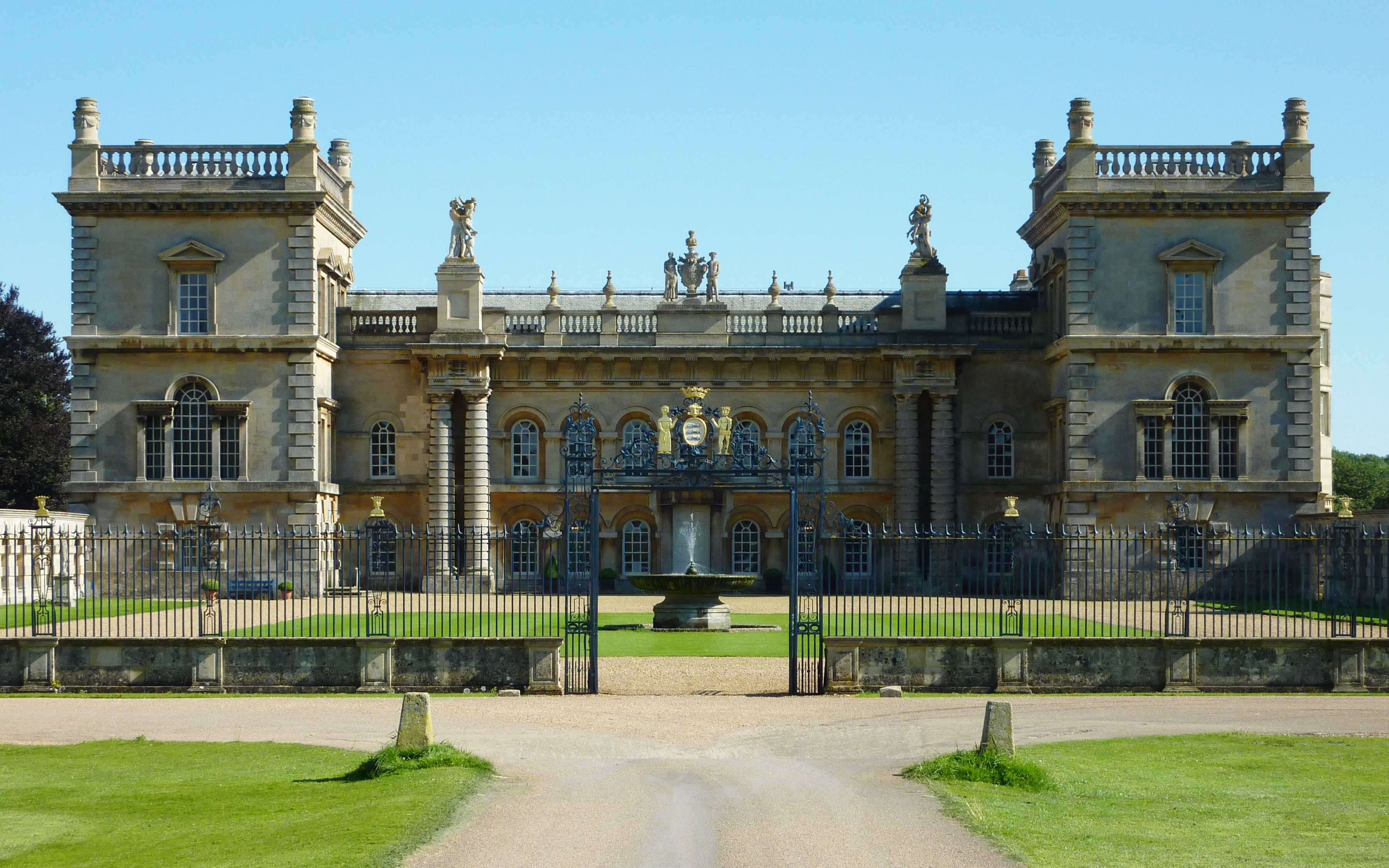
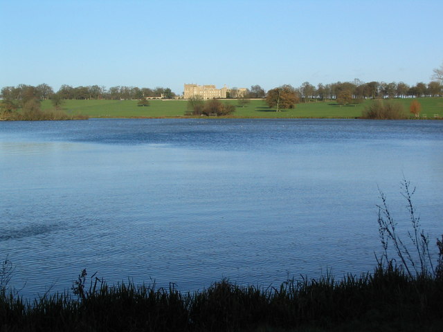
Grimsthorpe Castle

Grimsthorpe Castle is a country house in Lincolnshire, England 4 miles (6.4 km) north-west of Bourne on the A151. It lies within a 3,000 acre (12 km2)...

South Kesteven Rural District

South Kesteven was a rural district in Lincolnshire, Parts of Kesteven in England from 1931 to 1974. It was formed under a County Review Order in 1931...

Grimsthorpe

Grimsthorpe is a hamlet in the South Kesteven district of Lincolnshire, England. It is situated on the A151 road, and 3 miles (5 km) north-west from Bourne...

Swinstead

Swinstead is a village and civil parish in the South Kesteven district of Lincolnshire, England. It is situated 5 miles (8.0 km) west from Bourne, 9 miles...

Edenham railway station

Edenham railway station was a station in Edenham, Lincolnshire. It was the terminus of a four-mile branch line from the Great Northern Railway at Little...

South Kesteven

South Kesteven is a local government district in Lincolnshire, England, forming part of the traditional Kesteven division of the county. Its council is...

Grantham and Stamford (UK Parliament constituency)

Grantham and Stamford is a constituency in Lincolnshire represented in the House of Commons of the UK Parliament since 2019 by Gareth Davies, a Conservative...

Nearby Amenities

Located within 500m of 52.786981,-0.46730754
Ele: 40.0000000
Lat/Long: 52.7855424/-0.4609117
Ele: 40.0000000
Lat/Long: 52.7856452/-0.4609913
Ele: 41.0000000
Lat/Long: 52.7857361/-0.4611614
Ele: 41.0000000
Lat/Long: 52.7857833/-0.4613296
Ford: yes
Lat/Long: 52.7855615/-0.4610475
Ele: 40.0000000
Lat/Long: 52.7857077/-0.4610925
Ele: 43.0000000
Lat/Long: 52.7858535/-0.4620399
Ele: 46.0000000
Lat/Long: 52.7865841/-0.464966
Ele: 49.0000000
Lat/Long: 52.7870864/-0.4674176
Ele: 57.0000000
Lat/Long: 52.7879188/-0.4715354
Ele: 57.0000000
Lat/Long: 52.7878001/-0.4715242
Ele: 63.0000000
Lat/Long: 52.7874418/-0.4736013
Bishopshall
Place: locality
Source: Bing
Lat/Long: 52.7885946/-0.4676668
Red Bridge
Place: locality
Source: Bing
Lat/Long: 52.7900906/-0.4653063
The data included in this document is from www.openstreetmap.org. The data is made available under ODbL.

Have you been to Bishopshall?

Leave your review of Bishopshall below (or comments, questions and feedback).