East Ayton Moor

Downs, Moorland in Yorkshire Scarborough

England

East Ayton Moor

Sea Cut and the Tabular Hills walk southeast of Holly Wood
Sea Cut and the Tabular Hills walk southeast of Holly Wood Credit: Colin Park

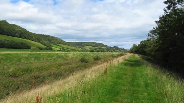
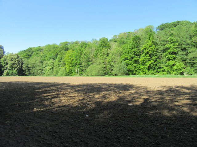
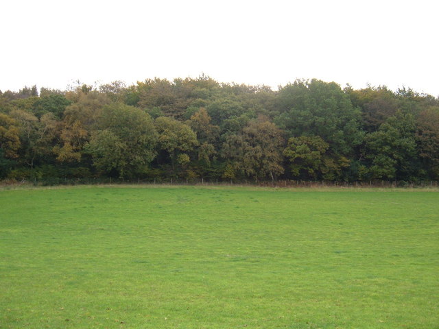
East Ayton Moor is a picturesque area located in the county of Yorkshire, England. Situated within the North York Moors National Park, it spans over vast expanses of rolling hills, moorland, and grassy meadows. Offering breathtaking views and a tranquil atmosphere, this area is a haven for nature lovers and outdoor enthusiasts.

The moorland of East Ayton Moor is characterized by its rugged terrain, covered in heather, bracken, and scattered with rocky outcrops. It is home to a diverse range of flora and fauna, with species such as curlews, lapwings, and red grouse flourishing in its open spaces. The moorland is also dotted with ancient burial mounds, evidence of the area's rich history.

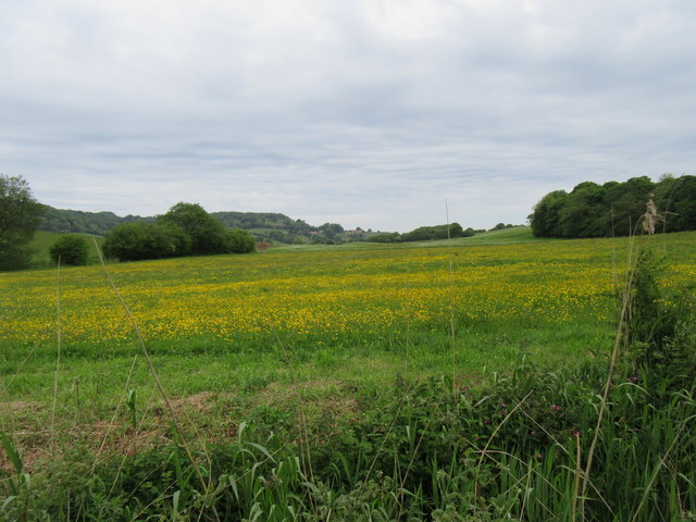
The Downs in East Ayton Moor provide a stark contrast to the moorland, comprising gently sloping grassy hills that create a serene and pastoral landscape. These Downs are often used for grazing livestock, and visitors can often spot sheep peacefully grazing among the rolling hills.

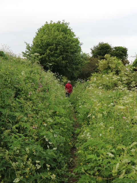
East Ayton Moor offers numerous walking and hiking trails, allowing visitors to explore its natural beauty at their own pace. The popular Ayton Banks walk takes visitors through the heart of the moorland, providing panoramic views of the surrounding countryside.

With its untouched beauty and peaceful ambiance, East Ayton Moor is a must-visit destination for those seeking a retreat into nature. Its combination of moorland and Downs provides a varied landscape that captivates visitors and showcases the diverse natural wonders of Yorkshire.

If you have any feedback on the listing, please let us know in the comments section below.

East Ayton Moor Images

Images are sourced within 2km of 54.270909/-0.46876329 or Grid Reference SE9987. Thanks to Geograph Open Source API. All images are credited.

Sea Cut and the Tabular Hills walk southeast of Holly Wood
A170 Racecourse Road looking east
Stream discharging from Forge Valley Woods There are many springs in the slopes of Forge Valley Woods which make small streams down to the road. The recent heavy rain has caused massive amounts of water to come down. This one discharges into a trough which is of some antiquity as it is shown on the 6" map of 1852.
Stream discharging from Forge Valley Woods
There are many springs in the slopes of Forge Valley Woods which make small streams down to the road. The recent heavy rain has caused massive amounts of water to come down. This one discharges into a trough which is of some antiquity as it is shown on the 6" map of 1852.
Water collection point The various springs on the slopes of Forge Valley Woods have been tapped for use to be made of the water either at the forge which existed here or as in this case to supply water to the nearby twin villages of East and West Ayton.
Water collection point
The various springs on the slopes of Forge Valley Woods have been tapped for use to be made of the water either at the forge which existed here or as in this case to supply water to the nearby twin villages of East and West Ayton.
Water collection point detail This is the manhole covering the water collection point shown in <a href="https://www.geograph.org.uk/photo/4790681">SE9887 : Water collection point</a>.
Water collection point detail
This is the manhole covering the water collection point shown in SE9887 : Water collection point.
Courtyard at Betton Farm See <span class="nowrap"><a title="http://www.bettonfarm.co.uk/" rel="nofollow ugc noopener" href="http://www.bettonfarm.co.uk/">Link</a><img style="margin-left:2px;" alt="External link" title="External link - shift click to open in new window" src="https://s1.geograph.org.uk/img/external.png" width="10" height="10"/></span> for details of the farm and the facilities it offers. The gridline runs along the far side of the courtyard, so not only is the farm shop in the next square, it is also in the next hectad and the next myriad! (If this makes no sense to you, see <a title="https://www.geograph.org.uk/help/squares)" href="https://www.geograph.org.uk/help/squares)">Link</a>
Courtyard at Betton Farm
See LinkExternal link for details of the farm and the facilities it offers. The gridline runs along the far side of the courtyard, so not only is the farm shop in the next square, it is also in the next hectad and the next myriad! (If this makes no sense to you, see Link
Land girls 1942 near Scarborough This one is of historical interest, a digital restoration of an end print group of three land girls circa March 1942. The middle one is my wife's mother Betty Lowe who had vivid memories of WW2 and the Land Army. She was working on a farm near Scarborough from 1942 till the end of 1944. The location is as accurate as I can make it; she had told us once as she drove down the A170 that the farm worked on was there, not far from the road.
Land girls 1942 near Scarborough
This one is of historical interest, a digital restoration of an end print group of three land girls circa March 1942. The middle one is my wife's mother Betty Lowe who had vivid memories of WW2 and the Land Army. She was working on a farm near Scarborough from 1942 till the end of 1944. The location is as accurate as I can make it; she had told us once as she drove down the A170 that the farm worked on was there, not far from the road.
Clearing in Raincliffe Woods
Middle Road Track, Raincliffe Woods
Meadow Drive, East Ayton Two classic, and rather elegant, 1960s concrete street light columns photographed just before their removal and replacement by modern steel columns
Meadow Drive, East Ayton
Two classic, and rather elegant, 1960s concrete street light columns photographed just before their removal and replacement by modern steel columns
Bridleway East Ayton This track is a public bridleway which runs off Moor Lane up on to East Ayton Moor. Although it runs alongside a shallow valley, at this point it forms a hollow way and may be an extension of Skell Dykes at SE9987;. It is one of the ancient routes on to this moor, possibly for droving
Bridleway East Ayton
This track is a public bridleway which runs off Moor Lane up on to East Ayton Moor. Although it runs alongside a shallow valley, at this point it forms a hollow way and may be an extension of Skell Dykes at SE9987;. It is one of the ancient routes on to this moor, possibly for droving
Moor Lane, Irton Moor The road rises from East Ayton to Riggs Head.
Moor Lane, Irton Moor
The road rises from East Ayton to Riggs Head.
The Tongues Bridleway at The Tongues.
The Tongues
Bridleway at The Tongues.
Lady Grace's Ride Bridleway in Raincliffe Woods.
Lady Grace's Ride
Bridleway in Raincliffe Woods.
Near the Sea Cut Looking towards the coast.
Near the Sea Cut
Looking towards the coast.
Forge Valley boardwalk Falling apart in places.
Forge Valley boardwalk
Falling apart in places.
Forge Valley Just south of the boardwalk, looking north.
Forge Valley
Just south of the boardwalk, looking north.
Show me another place!

East Ayton Moor is located at Grid Ref: SE9987 (Lat: 54.270909, Lng: -0.46876329)

Division: North Riding

Administrative County: North Yorkshire

District: Scarborough

Police Authority: North Yorkshire

What 3 Words

///trade.saving.mistaking. Near East Ayton, North Yorkshire

Related Wikis

Raincliffe Woods

Raincliffe Woods are situated to the north-west of Scarborough, North Yorkshire, England. They form an "L" shape with Forge Valley Woods and the River...
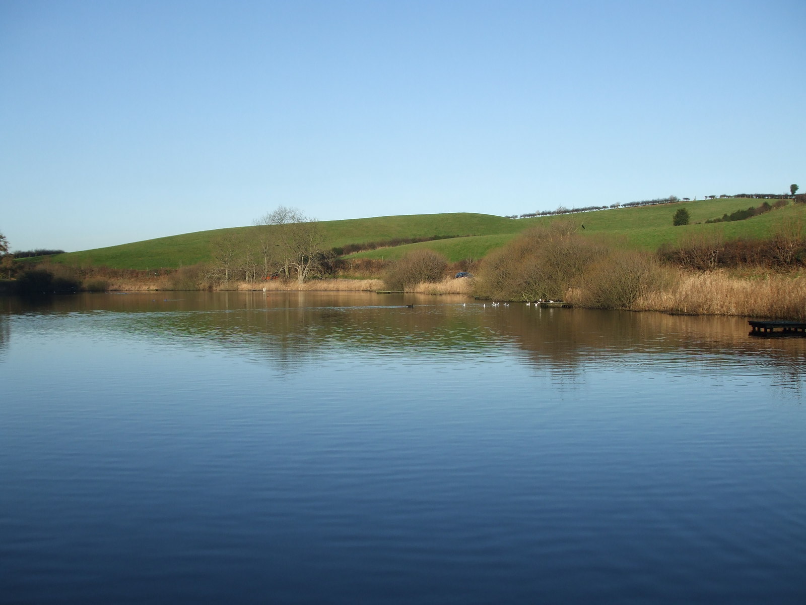
Forge Valley

Forge Valley is a national nature reserve in the Scarborough district of North Yorkshire, England, located within the North York Moors National Park on...
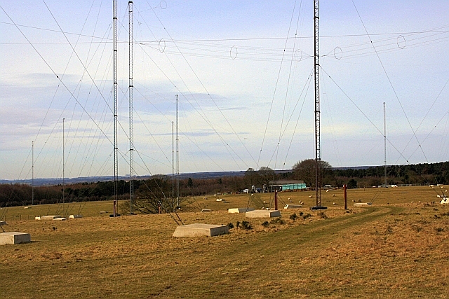
GCHQ Scarborough

GCHQ Scarborough is a satellite ground station located on Irton Moor, on the outskirts of Scarborough in North Yorkshire, England, operated by the British...

Suffield-cum-Everley

Suffield-cum-Everley is a civil parish in the Scarborough district of North Yorkshire, England. According to the 2011 UK census, the parish (including...

East Ayton

East Ayton is a village and civil parish in the Scarborough district of North Yorkshire, England. According to the 2011 UK census, East Ayton parish...

Graham School

Graham School is a coeducational secondary school in the west of Scarborough in North Yorkshire, England. It is situated to the west of the town within...

Raincliffe School

Raincliffe School was a comprehensive secondary school, with Business and Enterprise College status, in Scarborough, North Yorkshire, England. On 31 August...

Throxenby

Throxenby is a suburb of Scarborough, in North Yorkshire, England. Historically the settlement of Throxenby was a hamlet, separated from Scarborough by...

Nearby Amenities

Located within 500m of 54.270909,-0.46876329
Building: yes
Lat/Long: 54.2674838/-0.4688401
East Ayton Moor
Place: locality
Source: OD Streetview
Lat/Long: 54.2710992/-0.4701053
The data included in this document is from www.openstreetmap.org. The data is made available under ODbL.

Have you been to East Ayton Moor?

Leave your review of East Ayton Moor below (or comments, questions and feedback).