Fulbeck Heath
Downs, Moorland in Lincolnshire South Kesteven
England
Fulbeck Heath

Fulbeck Heath is a picturesque area located in Lincolnshire, England. Spanning across a vast expanse, it encompasses both downs and moorland, offering a diverse landscape that attracts nature enthusiasts and outdoor adventurers alike.
The downs of Fulbeck Heath showcase rolling hills covered in lush greenery, providing a serene and tranquil atmosphere. The area is dotted with vibrant wildflowers during the spring and summer months, adding bursts of color to the landscape. Visitors can enjoy leisurely walks or hikes along the well-maintained trails, taking in the panoramic views of the surrounding countryside.
On the other hand, the moorland of Fulbeck Heath presents a more rugged and untamed environment. Here, heather-covered expanses stretch as far as the eye can see, creating a captivating sight. This unique habitat provides a home for a variety of wildlife, including birds such as curlews, lapwings, and red grouse. Keen birdwatchers can spot these beautiful creatures in their natural habitat.
Fulbeck Heath also boasts several archaeological sites, including ancient burial mounds and prehistoric settlements. These remnants of the past offer a glimpse into the rich history of the area, attracting history enthusiasts and researchers.
Overall, Fulbeck Heath in Lincolnshire is a haven for nature lovers and history buffs. With its stunning downs and untamed moorland, this area offers a diverse and captivating landscape that is well worth exploring.
If you have any feedback on the listing, please let us know in the comments section below.
Fulbeck Heath Images
Images are sourced within 2km of 53.041658/-0.54337156 or Grid Reference SK9750. Thanks to Geograph Open Source API. All images are credited.

![Ermine Street [High Dike] heading south from Long Lane This part of the Roman road between London, Lincoln and York is now the route of the Viking Way footpath. A civil parish boundary runs along Ermine Street here.](https://s0.geograph.org.uk/geophotos/07/22/04/7220416_88df9f7a.jpg)


Fulbeck Heath is located at Grid Ref: SK9750 (Lat: 53.041658, Lng: -0.54337156)
Administrative County: Lincolnshire
District: South Kesteven
Police Authority: Lincolnshire
What 3 Words
///cure.agent.conspired. Near Caythorpe, Lincolnshire
Nearby Locations
Related Wikis
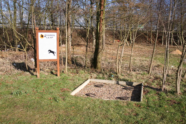
Byard's Leap
Byard's Leap is a hamlet in the North Kesteven district of Lincolnshire, England. It is situated approximately 3 miles (5 km) west from Cranwell, and is...

Royal Air Force College Cranwell
The Royal Air Force College (RAFC) is the Royal Air Force academy which provides initial training to all RAF personnel who are preparing to become commissioned...

Claypole Rural District
Claypole was a rural district in Lincolnshire, Parts of Kesteven from 1894 to 1931. It was formed under the Local Government Act 1894 from that part of...
Fulbeck
Fulbeck is a small village and civil parish in the South Kesteven district of Lincolnshire, England. The population (including Byards Leap) taken at the...
Nearby Amenities
Located within 500m of 53.041658,-0.54337156Have you been to Fulbeck Heath?
Leave your review of Fulbeck Heath below (or comments, questions and feedback).