Hartsholme Country Park

Downs, Moorland in Lincolnshire Lincoln

England

Hartsholme Country Park

St. George's church, Swallow Beck Designed 1960 by Bond and Read.
St. George's church, Swallow Beck Credit: Jonathan Thacker

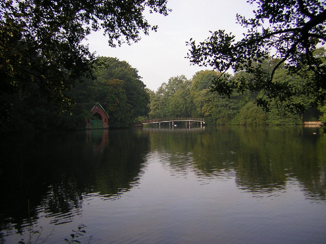
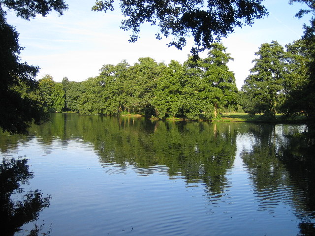
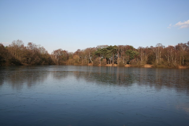
Hartsholme Country Park is a picturesque green space located in Lincolnshire, England. Spanning over 200 acres, it offers a diverse range of landscapes, including downs and moorland. The park is situated on the outskirts of Lincoln, making it easily accessible for both locals and tourists.

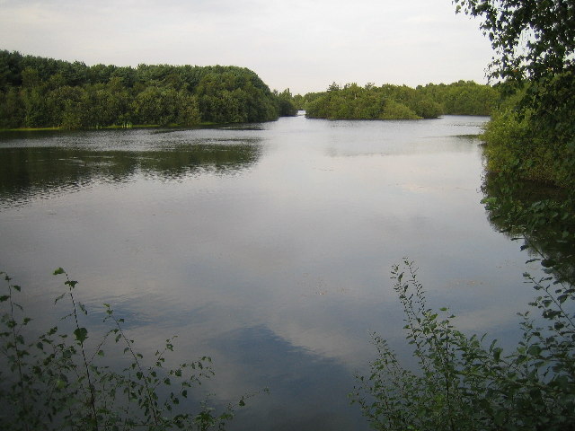
The downs area of the park is characterized by rolling hills and expansive meadows. Visitors can enjoy leisurely walks or picnics in this tranquil setting while taking in the panoramic views of the surrounding countryside. The downs are also home to a variety of flora and fauna, making it a popular spot for nature enthusiasts and bird watchers.

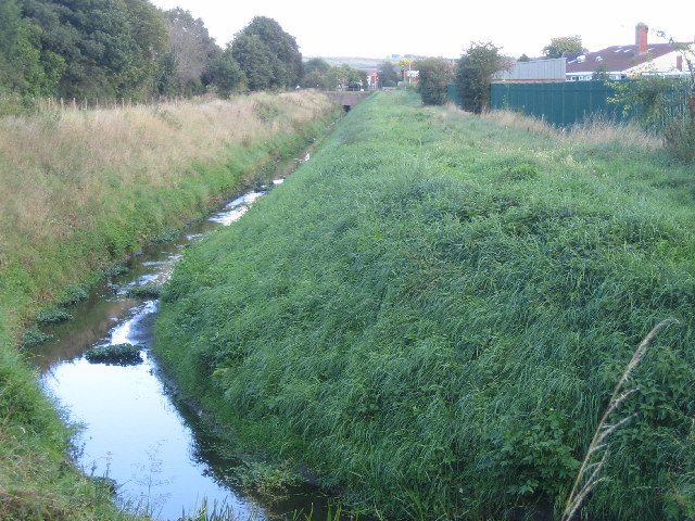
The moorland section of the park provides a contrasting landscape, with its rugged terrain and heather-covered hills. This area offers a unique experience for visitors, who can embark on adventurous hikes or bike rides along the designated trails. The moorland is particularly stunning during the blooming season when the vibrant colors of the heather create a breathtaking sight.

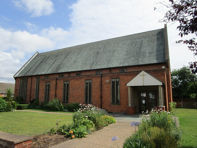
In addition to its natural beauty, Hartsholme Country Park also boasts a range of amenities for visitors. There is a visitor center where guests can learn more about the park's history and wildlife. The park also features a cafe, picnic areas, and a children's play area, making it a great place for families to spend a day outdoors.

Overall, Hartsholme Country Park is a haven for nature lovers, offering a diverse range of landscapes and activities. Whether one seeks a peaceful stroll through the downs or an adventurous hike on the moorland, this park has something to offer for everyone.

If you have any feedback on the listing, please let us know in the comments section below.

Hartsholme Country Park Images

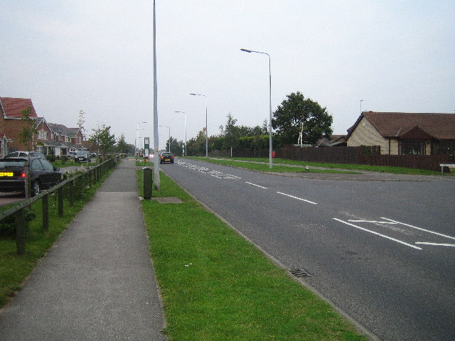
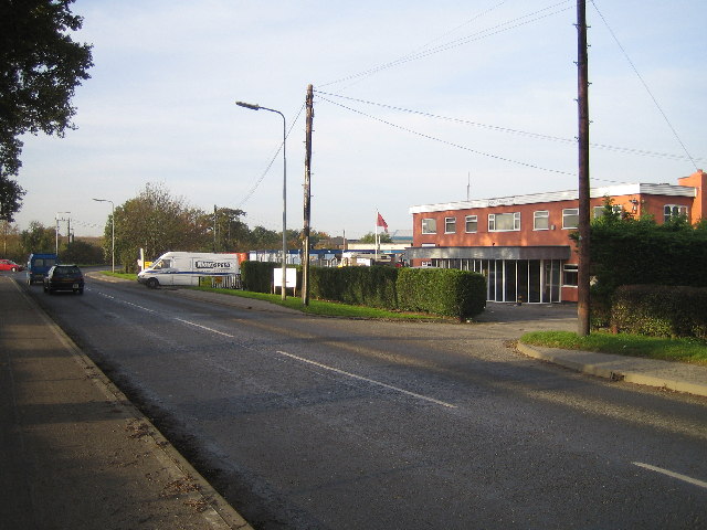
Images are sourced within 2km of 53.213589/-0.58762516 or Grid Reference SK9469. Thanks to Geograph Open Source API. All images are credited.

St. George's church, Swallow Beck Designed 1960 by Bond and Read.
St. George's church, Swallow Beck
Designed 1960 by Bond and Read.
Hartsholme Lake The Boat House and White Bridge in Hartsholme Park. The lake was constructed by the Lincoln Waterworks Company in 1848 as a water supply for Lincoln. In 1868 local industrialist Joseph Shuttleworth built Hartsholme Hall overlooking the Lake. The hall was pulled down in 1951 and the park became a country park in 1978.
Hartsholme Lake
The Boat House and White Bridge in Hartsholme Park. The lake was constructed by the Lincoln Waterworks Company in 1848 as a water supply for Lincoln. In 1868 local industrialist Joseph Shuttleworth built Hartsholme Hall overlooking the Lake. The hall was pulled down in 1951 and the park became a country park in 1978.
Swanholme Lakes Gravel pits dug in the 1960's, now a nature reserve.
Swanholme Lakes
Gravel pits dug in the 1960's, now a nature reserve.
Radio Mast at Tritton Road / Skellingthorpe Road Junction Radio mast that used to be part of East Midlands Electricity Board depot. The area is now home to a dozen car showrooms.
Radio Mast at Tritton Road / Skellingthorpe Road Junction
Radio mast that used to be part of East Midlands Electricity Board depot. The area is now home to a dozen car showrooms.
The Lake in Boultham Park
Pike Drain The Pike Drain between Newark Road and Hykeham Road.
Pike Drain
The Pike Drain between Newark Road and Hykeham Road.
Birchwood Leisure Centre Leisure centre in the heart of Lincolns biggest housing estate.
Birchwood Leisure Centre
Leisure centre in the heart of Lincolns biggest housing estate.
Moorland Avenue, Lincoln Moorland Avenue is the main road through the residential area that dominates this square. The trees on the left of the picture are part of a small wooded area called Boulthan Moor Wood. It is mainly used for fly-tipping and off road motorcycle activity.
Moorland Avenue, Lincoln
Moorland Avenue is the main road through the residential area that dominates this square. The trees on the left of the picture are part of a small wooded area called Boulthan Moor Wood. It is mainly used for fly-tipping and off road motorcycle activity.
Birchwood Avenue Birchwood Avenue is the main road through the largest housing estate in Lincoln. The estate was started in the early 1980's and is still being built today.
Birchwood Avenue
Birchwood Avenue is the main road through the largest housing estate in Lincoln. The estate was started in the early 1980's and is still being built today.
Whisby Road The area around Whisby Road contains light industrial factories and units and also houses the local landfill site.
Whisby Road
The area around Whisby Road contains light industrial factories and units and also houses the local landfill site.
Starmers Pit Fishing pond near Sainsbury's store
Starmers Pit
Fishing pond near Sainsbury's store
Walking on water A pair of ducks on a frozen fishing pond
Walking on water
A pair of ducks on a frozen fishing pond
New housing on Epsom Drive More new homes being built on Epsom Drive, Birchwood
New housing on Epsom Drive
More new homes being built on Epsom Drive, Birchwood
St.Helen's graveyard The area west of St.Helen's church
St.Helen's graveyard
The area west of St.Helen's church
Fire at Sansford Green Firecrew attending to a blaze in a ground floor flat.
Fire at Sansford Green
Firecrew attending to a blaze in a ground floor flat.
2 Westwood Close Part of the pretty Westwood Close horseshoe, Swanpool Garden Suburb a secluded collection of 14 individual houses.
2 Westwood Close
Part of the pretty Westwood Close horseshoe, Swanpool Garden Suburb a secluded collection of 14 individual houses.
Westwood Close / Hartsholme Drive Standing on the green in the middle of Westwood Close, looking out onto Hartsholme Drive.
Westwood Close / Hartsholme Drive
Standing on the green in the middle of Westwood Close, looking out onto Hartsholme Drive.
Swanholme Lakes Sunset I saw a nice sunset developing while walking in Hartsholme Park. I decided to move swiftly down to Swanholme Lakes where I hoped to get some nice colours reflected in the water. I tried to attract some waterfowl as foreground interest, but to no avail. However, I noticed the nice ripple patterns caused by my pebble throwing, so at the height of the afterglow I threw a nice big one in and took this photo.
Swanholme Lakes Sunset
I saw a nice sunset developing while walking in Hartsholme Park. I decided to move swiftly down to Swanholme Lakes where I hoped to get some nice colours reflected in the water. I tried to attract some waterfowl as foreground interest, but to no avail. However, I noticed the nice ripple patterns caused by my pebble throwing, so at the height of the afterglow I threw a nice big one in and took this photo.
Show me another place!

Hartsholme Country Park is located at Grid Ref: SK9469 (Lat: 53.213589, Lng: -0.58762516)

Administrative County: Lincolnshire

District: Lincoln

Police Authority: Lincolnshire

What 3 Words

///sparrows.flattery.discusses. Near Skellingthorpe, Lincolnshire

Related Wikis

Hartsholme Country Park

Hartsholme Country Park lies about 3 miles (5 km) southwest of the city centre of Lincoln in the East Midlands of England. Access is from the Skellingthorpe...

Ashby Avenue (stadium)

Ashby Avenue is a football stadium in Lincoln, Lincolnshire, England. It is the home ground of Lincoln United of the Northern Premier South east division...

Swanpool, Lincoln

Swanpool is a suburb of Lincoln, Lincolnshire, England. It was built in the interwar period as a garden suburb. == Archaeology == An industrial pottery...

Birchwood, Lincolnshire

Birchwood is a housing estate in the south of Lincoln, Lincolnshire, England. The population of the Birchwood Ward of Lincoln City Council at the 2011...

The Priory City of Lincoln Academy

The Priory City of Lincoln Academy (abbreviated as Lincoln Academy and formerly The City of Lincoln Community College) is a co-educational secondary academy...

RAF Skellingthorpe

Royal Air Force Skellingthorpe or more simply RAF Skellingthorpe is a former Royal Air Force station which was operational during the Second World War...

The Priory Witham Academy

The Priory Witham Academy is a mixed all-through school and sixth form located in Lincoln in the English county of Lincolnshire. The school educates pupils...

Boultham Moor

Boultham Moor is a suburb (and former village) in the district of the City of Lincoln, Lincolnshire, England. == Geography == The suburb lies within the...

Nearby Amenities

Located within 500m of 53.213589,-0.58762516
Bus Stop
Park Avenue
Naptan AtcoCode: 2700LLAA2711
Naptan Bearing: NE
Naptan CommonName: Park Avenue
Naptan Indicator: adj
Naptan Landmark: Park Avenue
Naptan NaptanCode: linatmdp
Naptan PlusbusZoneRef: LINCLNC
Naptan Street: Ashby Avenue
Naptan Verified: no
Source: naptan_import
Lat/Long: 53.2145292/-0.5810795
Bus Stop
Park Avenue
Naptan AtcoCode: 2700LLAA2713
Naptan Bearing: SW
Naptan CommonName: Park Avenue
Naptan Indicator: opp
Naptan Landmark: Park Avenue
Naptan NaptanCode: linatmdt
Naptan PlusbusZoneRef: LINCLNC
Naptan Street: Ashby Avenue
Naptan Verified: no
Source: naptan_import
Lat/Long: 53.2141712/-0.5812112
Bus Stop
Jarvis House
Naptan AtcoCode: 2700LLAA2716
Naptan Bearing: NE
Naptan CommonName: Jarvis House
Naptan Indicator: adj
Naptan Landmark: Jarvis House
Naptan NaptanCode: linatmga
Naptan PlusbusZoneRef: LINCLNC
Naptan Street: Ashby Avenue
Naptan Verified: no
Source: naptan_import
Lat/Long: 53.2126407/-0.5825347
Bus Stop
Ashby Court Nursing Home
Naptan AtcoCode: 2700LLAA2721
Naptan Bearing: S
Naptan CommonName: Ashby Court Nursing Home
Naptan Indicator: o/s
Naptan Landmark: Ashby Court Nursing Home
Naptan NaptanCode: linatmgt
Naptan PlusbusZoneRef: LINCLNC
Naptan Street: Ashby Avenue
Naptan Verified: no
Source: naptan_import
Lat/Long: 53.2112785/-0.5828941
Bus Stop
Sycamore Crescent
Naptan AtcoCode: 2700LLBF1366
Naptan Bearing: N
Naptan CommonName: Sycamore Crescent
Naptan Indicator: opp
Naptan Landmark: Sycamore Crescent
Naptan NaptanCode: linajpwm
Naptan PlusbusZoneRef: LINCLNC
Naptan Street: Fulmar Road
Naptan Verified: no
Source: naptan_import
Lat/Long: 53.2146797/-0.5937746
Bus Stop
Sycamore Crescent
Naptan AtcoCode: 2700LLBF1368
Naptan Bearing: S
Naptan CommonName: Sycamore Crescent
Naptan Indicator: adj
Naptan Landmark: Sycamore Crescent
Naptan NaptanCode: linajpwp
Naptan PlusbusZoneRef: LINCLNC
Naptan Street: Fulmar Road
Naptan Verified: no
Source: naptan_import
Lat/Long: 53.2135335/-0.5933928
Bus Stop
Staffordshire Crescent
Naptan AtcoCode: 2700LLDP2632
Naptan Bearing: N
Naptan CommonName: Staffordshire Crescent
Naptan Indicator: adj
Naptan Landmark: Staffordshire Crescent
Naptan NaptanCode: linatjdg
Naptan PlusbusZoneRef: LINCLNC
Naptan Street: Fulmar Road
Naptan Verified: no
Source: naptan_import
Lat/Long: 53.2114973/-0.593774
Bus Stop
Staffordshire Crescent
Naptan AtcoCode: 2700LLDP2633
Naptan Bearing: S
Naptan CommonName: Staffordshire Crescent
Naptan Indicator: opp
Naptan Landmark: Staffordshire Crescent
Naptan NaptanCode: linatjdj
Naptan PlusbusZoneRef: LINCLNC
Naptan Street: Fulmar Road
Naptan Verified: no
Source: naptan_import
Lat/Long: 53.2115045/-0.593624
Crossing
Bicycle: yes
Crossing: traffic_signals
Crossing Island: no
Crossing Ref: toucan
Kerb: lowered
Tactile Paving: yes
Lat/Long: 53.2155612/-0.5812539
Crossing
Crossing: traffic_signals
Crossing Ref: zebra
Kerb: lowered
Tactile Paving: yes
Lat/Long: 53.213861/-0.5935252
Barrier: bollard
Lat/Long: 53.2151799/-0.5812802
Cafe
hartsholme cafe
Lat/Long: 53.2148031/-0.5835341
Hartsholme Campsite
Tourism: camp_site
Lat/Long: 53.2141341/-0.58337
Hartsholme
Is In: Lincolnshire, England, UK
Place: suburb
Source: Bing
Lat/Long: 53.2092646/-0.5872423
Barrier: lift_gate
Bicycle: yes
Foot: yes
Horse: yes
Motor Vehicle: yes
Lat/Long: 53.2153759/-0.5820772
Tourism: picnic_site
Lat/Long: 53.2147621/-0.5844214
Generator Method: photovoltaic
Generator Output Electricity: yes
Generator Source: solar
Generator Type: solar_photovoltaic_panel
Location: roof
Power: generator
Lat/Long: 53.2153998/-0.5910869
Generator Method: photovoltaic
Generator Output Electricity: yes
Generator Source: solar
Generator Type: solar_photovoltaic_panel
Location: roof
Power: generator
Lat/Long: 53.2126918/-0.5819889
Generator Method: photovoltaic
Generator Output Electricity: yes
Generator Source: solar
Generator Type: solar_photovoltaic_panel
Location: roof
Power: generator
Lat/Long: 53.2124589/-0.5822973
Generator Method: photovoltaic
Generator Output Electricity: yes
Generator Source: solar
Generator Type: solar_photovoltaic_panel
Location: roof
Power: generator
Source: Maxar imagery
Lat/Long: 53.2141006/-0.5931148
Noexit: yes
Lat/Long: 53.2141208/-0.5805578
Noexit: yes
Lat/Long: 53.2167287/-0.5829241
Noexit: yes
Lat/Long: 53.2161336/-0.5818781
Noexit: yes
Lat/Long: 53.2135026/-0.5804706
Noexit: yes
Lat/Long: 53.2134789/-0.5805414
Noexit: yes
Lat/Long: 53.2133314/-0.5810758
Noexit: yes
Lat/Long: 53.2140972/-0.5806286
Noexit: yes
Lat/Long: 53.2133092/-0.5811474
Generator Method: photovoltaic
Generator Output Electricity: yes
Generator Source: solar
Generator Type: solar_photovoltaic_panel
Location: roof
Power: generator
Lat/Long: 53.2139654/-0.582734
Generator Method: photovoltaic
Generator Output Electricity: yes
Generator Source: solar
Generator Type: solar_photovoltaic_panel
Location: roof
Power: generator
Lat/Long: 53.2139702/-0.5826791
The data included in this document is from www.openstreetmap.org. The data is made available under ODbL.

Have you been to Hartsholme Country Park?

Leave your review of Hartsholme Country Park below (or comments, questions and feedback).