Hartsholme

Settlement in Lincolnshire Lincoln

England

Hartsholme

St. George's church, Swallow Beck Designed 1960 by Bond and Read.
St. George's church, Swallow Beck Credit: Jonathan Thacker

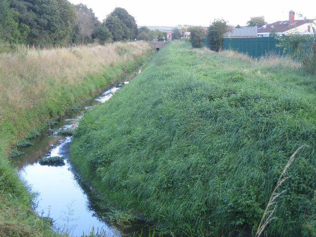
Hartsholme is a charming suburb located on the western outskirts of Lincoln, in the county of Lincolnshire, England. Situated near the picturesque Swanholme Lakes and Nature Reserve, this serene residential area offers a peaceful retreat from the hustle and bustle of the city.

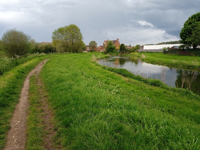
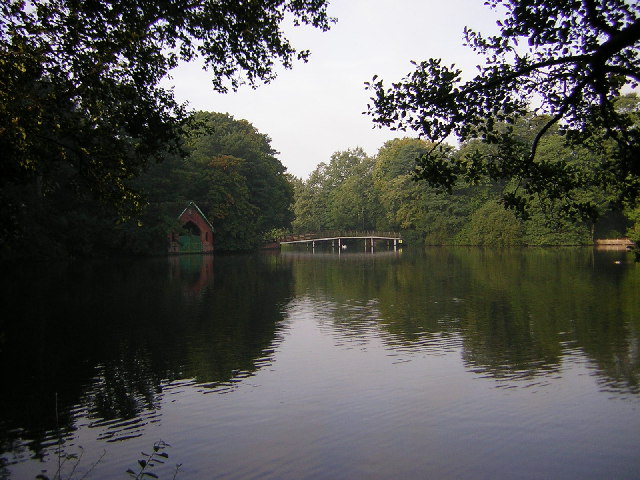
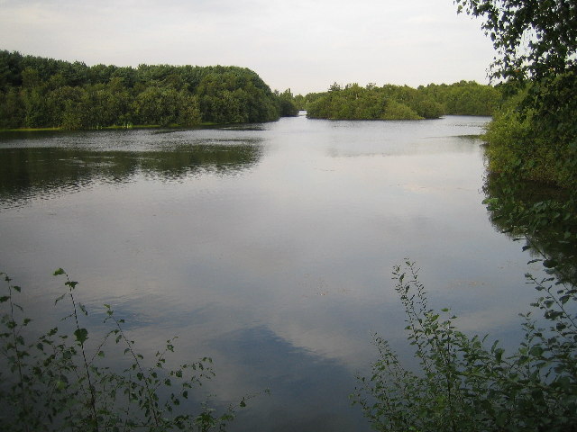
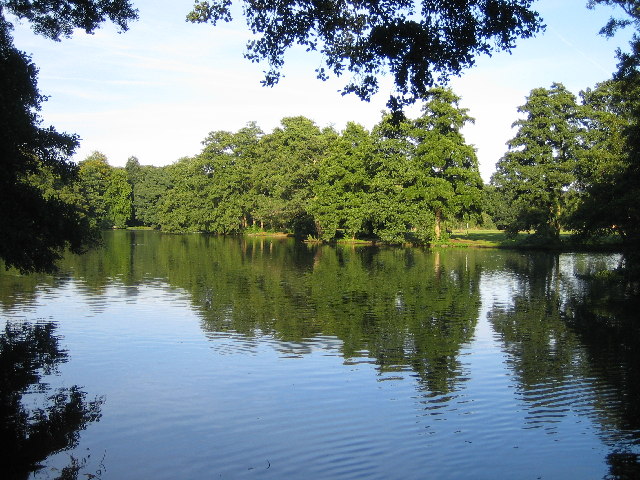
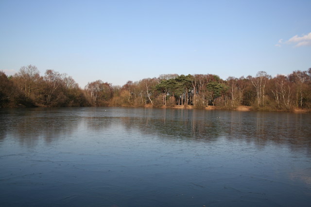
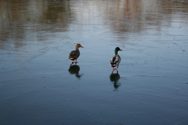
The centerpiece of Hartsholme is the stunning Hartsholme Country Park, a sprawling 200-acre green space that attracts both locals and visitors alike. The park features a large lake, woodland areas, and well-maintained walking trails, making it a haven for nature lovers and outdoor enthusiasts. Visitors can enjoy picnicking by the lake, birdwatching, fishing, or simply taking a leisurely stroll through the scenic surroundings.

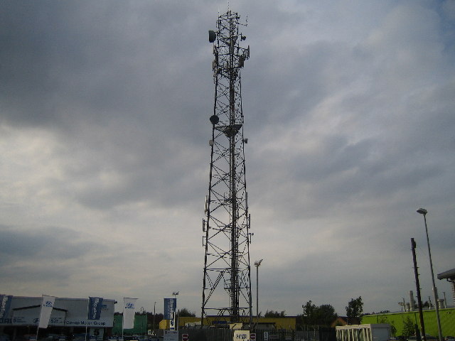
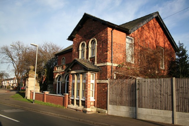
Hartsholme is primarily a residential area, characterized by a mix of modern housing developments and traditional properties. The community is well-served by local amenities, including a primary school, a medical center, and a range of shops and services. Additionally, the suburb benefits from excellent transport links, with regular bus services connecting it to Lincoln city center and the wider region.

Residents of Hartsholme enjoy a high quality of life, with easy access to both the tranquility of the countryside and the amenities of a nearby city. The area's close proximity to Lincoln means that residents can easily access its historic attractions, vibrant shopping districts, and cultural events. Overall, Hartsholme offers a balanced blend of natural beauty, convenience, and community spirit, making it an ideal place to live or visit.

If you have any feedback on the listing, please let us know in the comments section below.

Hartsholme Images

Images are sourced within 2km of 53.214461/-0.57928482 or Grid Reference SK9469. Thanks to Geograph Open Source API. All images are credited.

St. George's church, Swallow Beck Designed 1960 by Bond and Read.
St. George's church, Swallow Beck
Designed 1960 by Bond and Read.
River Witham north of Bracebridge, Lincoln A public footpath follows a bend of the River Witham, looking northeastwards towards a residential area approximately 2.5 kilometres south of Lincoln city centre and 600 metres north of Bracebridge bridge.

This photograph was taken on a humid afternoon in early May. Viewed from the largely undeveloped western bank of the Witham between Bracebridge and Dixon Street, the riverside homes on the corner of Fairfax Street and Park Lane can be seen (centre) with the white rear of the Aldi supermarket on Newark Road (A1434) extending into frame from the right.

Though much of this footpath is insulated from the noises of the city, here the sounds of ducks splashing and birds chirping are unfortunately drowned out by the constant hum of the local Walkers crisp factory, whose fenced yard of grimy container lorries lines the opposite bank just upstream (south) of this point.
River Witham north of Bracebridge, Lincoln
A public footpath follows a bend of the River Witham, looking northeastwards towards a residential area approximately 2.5 kilometres south of Lincoln city centre and 600 metres north of Bracebridge bridge. This photograph was taken on a humid afternoon in early May. Viewed from the largely undeveloped western bank of the Witham between Bracebridge and Dixon Street, the riverside homes on the corner of Fairfax Street and Park Lane can be seen (centre) with the white rear of the Aldi supermarket on Newark Road (A1434) extending into frame from the right. Though much of this footpath is insulated from the noises of the city, here the sounds of ducks splashing and birds chirping are unfortunately drowned out by the constant hum of the local Walkers crisp factory, whose fenced yard of grimy container lorries lines the opposite bank just upstream (south) of this point.
Hartsholme Lake The Boat House and White Bridge in Hartsholme Park. The lake was constructed by the Lincoln Waterworks Company in 1848 as a water supply for Lincoln. In 1868 local industrialist Joseph Shuttleworth built Hartsholme Hall overlooking the Lake. The hall was pulled down in 1951 and the park became a country park in 1978.
Hartsholme Lake
The Boat House and White Bridge in Hartsholme Park. The lake was constructed by the Lincoln Waterworks Company in 1848 as a water supply for Lincoln. In 1868 local industrialist Joseph Shuttleworth built Hartsholme Hall overlooking the Lake. The hall was pulled down in 1951 and the park became a country park in 1978.
Swanholme Lakes Gravel pits dug in the 1960's, now a nature reserve.
Swanholme Lakes
Gravel pits dug in the 1960's, now a nature reserve.
Radio Mast at Tritton Road / Skellingthorpe Road Junction Radio mast that used to be part of East Midlands Electricity Board depot. The area is now home to a dozen car showrooms.
Radio Mast at Tritton Road / Skellingthorpe Road Junction
Radio mast that used to be part of East Midlands Electricity Board depot. The area is now home to a dozen car showrooms.
The Lake in Boultham Park
St.Helens Boultham Parish Church Parts of the church date back to 1200AD.
St.Helens Boultham Parish Church
Parts of the church date back to 1200AD.
Pike Drain The Pike Drain between Newark Road and Hykeham Road.
Pike Drain
The Pike Drain between Newark Road and Hykeham Road.
Birchwood Leisure Centre Leisure centre in the heart of Lincolns biggest housing estate.
Birchwood Leisure Centre
Leisure centre in the heart of Lincolns biggest housing estate.
Moorland Avenue, Lincoln Moorland Avenue is the main road through the residential area that dominates this square. The trees on the left of the picture are part of a small wooded area called Boulthan Moor Wood. It is mainly used for fly-tipping and off road motorcycle activity.
Moorland Avenue, Lincoln
Moorland Avenue is the main road through the residential area that dominates this square. The trees on the left of the picture are part of a small wooded area called Boulthan Moor Wood. It is mainly used for fly-tipping and off road motorcycle activity.
Birchwood Avenue Birchwood Avenue is the main road through the largest housing estate in Lincoln. The estate was started in the early 1980's and is still being built today.
Birchwood Avenue
Birchwood Avenue is the main road through the largest housing estate in Lincoln. The estate was started in the early 1980's and is still being built today.
Whisby Road The area around Whisby Road contains light industrial factories and units and also houses the local landfill site.
Whisby Road
The area around Whisby Road contains light industrial factories and units and also houses the local landfill site.
Starmers Pit Fishing pond near Sainsbury's store
Starmers Pit
Fishing pond near Sainsbury's store
Walking on water A pair of ducks on a frozen fishing pond
Walking on water
A pair of ducks on a frozen fishing pond
New Housing Near the River Witham Lincoln Despite being close to the river, Lincolns excellent flood defence plan should keep these houses safe.
New Housing Near the River Witham Lincoln
Despite being close to the river, Lincolns excellent flood defence plan should keep these houses safe.
River Witham looking North The Witham heads towards Lincoln
River Witham looking North
The Witham heads towards Lincoln
Catchwater Drain Catchwater Drain and Altham Terrace looking east from Hall Drive
Catchwater Drain
Catchwater Drain and Altham Terrace looking east from Hall Drive
Boultham Park Lodge Presumably contemporary with Boultham Hall, built in 1874. The Hall was the home of the Ellison family, used as a convalescent home during the first world war and sold to the City Council in 1929. Unable to find a suitable use for the building, it was eventually demolished in 1959 and the grounds used as a public park. This lodge and solitary gatepier stand at the entrance to Hall Drive from Boultham Park Road.
Boultham Park Lodge
Presumably contemporary with Boultham Hall, built in 1874. The Hall was the home of the Ellison family, used as a convalescent home during the first world war and sold to the City Council in 1929. Unable to find a suitable use for the building, it was eventually demolished in 1959 and the grounds used as a public park. This lodge and solitary gatepier stand at the entrance to Hall Drive from Boultham Park Road.
Show me another place!

Hartsholme is located at Grid Ref: SK9469 (Lat: 53.214461, Lng: -0.57928482)

Division: Parts of Kesteven

Administrative County: Lincolnshire

District: Lincoln

Police Authority: Lincolnshire

What 3 Words

///frosted.acid.feeds. Near Lincoln, Lincolnshire

Related Wikis

Swanpool, Lincoln

Swanpool is a suburb of Lincoln, Lincolnshire, England. It was built in the interwar period as a garden suburb. == Archaeology == An industrial pottery...

The Priory City of Lincoln Academy

The Priory City of Lincoln Academy (abbreviated as Lincoln Academy and formerly The City of Lincoln Community College) is a co-educational secondary academy...

Ashby Avenue (stadium)

Ashby Avenue is a football stadium in Lincoln, Lincolnshire, England. It is the home ground of Lincoln United of the Northern Premier South east division...

Hartsholme Country Park

Hartsholme Country Park lies about 3 miles (5 km) southwest of the city centre of Lincoln in the East Midlands of England. Access is from the Skellingthorpe...

St Peter and St Paul's Catholic Voluntary Academy

St Peter and St Paul's Catholic Voluntary Academy (formerly St Peter and St Paul's Catholic High School) is a coeducational Roman Catholic secondary school...

Boultham Moor

Boultham Moor is a suburb (and former village) in the district of the City of Lincoln, Lincolnshire, England. == Geography == The suburb lies within the...

The Priory Witham Academy

The Priory Witham Academy is a mixed all-through school and sixth form located in Lincoln in the English county of Lincolnshire. The school educates pupils...

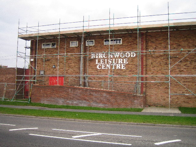
Birchwood, Lincolnshire

Birchwood is a housing estate in the south of Lincoln, Lincolnshire, England. The population of the Birchwood Ward of Lincoln City Council at the 2011...

Related Videos

Travel back in Time to Jolly Boating Weather in Boultham Park Lincoln

Boultham Park had been a large private estate, with the old hall being built in 1874. It became empty in 1909 when the owner died ...

Bert Holland's Waltzer Onride (Walking the Waltzer) @ Lincoln April Fair 22/04/2023

Onride Footage of Bert Holland's Waltzer Walking the waltzer and a thank you to Bert Holland and the gaff lad for the onride ...

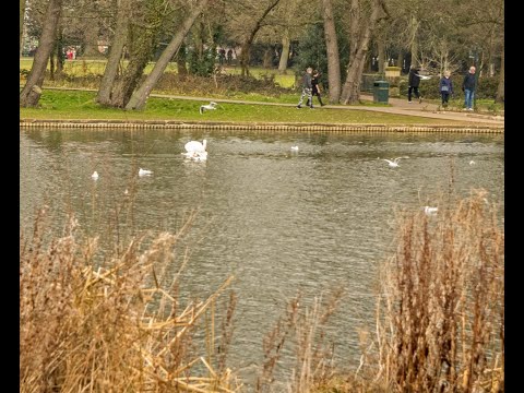
Walk Round Swanholme Lakes Nature Reserve With Me

Come on a stroll round this beautiful little Lincoln nature reserve with me. I initially went looking for mushrooms, you can find some ...

Time Travel in a Tritton Road Car Park!

This time shift will be a big surprise to many people. The scene in the car park outside the B&M store, is typical for a sunny Sunday ...

Nearby Amenities

Located within 500m of 53.214461,-0.57928482
Bus Stop
Park Avenue
Naptan AtcoCode: 2700LLAA2711
Naptan Bearing: NE
Naptan CommonName: Park Avenue
Naptan Indicator: adj
Naptan Landmark: Park Avenue
Naptan NaptanCode: linatmdp
Naptan PlusbusZoneRef: LINCLNC
Naptan Street: Ashby Avenue
Naptan Verified: no
Source: naptan_import
Lat/Long: 53.2145292/-0.5810795
Bus Stop
Park Avenue
Naptan AtcoCode: 2700LLAA2713
Naptan Bearing: SW
Naptan CommonName: Park Avenue
Naptan Indicator: opp
Naptan Landmark: Park Avenue
Naptan NaptanCode: linatmdt
Naptan PlusbusZoneRef: LINCLNC
Naptan Street: Ashby Avenue
Naptan Verified: no
Source: naptan_import
Lat/Long: 53.2141712/-0.5812112
Bus Stop
Jarvis House
Naptan AtcoCode: 2700LLAA2716
Naptan Bearing: NE
Naptan CommonName: Jarvis House
Naptan Indicator: adj
Naptan Landmark: Jarvis House
Naptan NaptanCode: linatmga
Naptan PlusbusZoneRef: LINCLNC
Naptan Street: Ashby Avenue
Naptan Verified: no
Source: naptan_import
Lat/Long: 53.2126407/-0.5825347
Bus Stop
Ashby Court Nursing Home
Naptan AtcoCode: 2700LLAA2721
Naptan Bearing: S
Naptan CommonName: Ashby Court Nursing Home
Naptan Indicator: o/s
Naptan Landmark: Ashby Court Nursing Home
Naptan NaptanCode: linatmgt
Naptan PlusbusZoneRef: LINCLNC
Naptan Street: Ashby Avenue
Naptan Verified: no
Source: naptan_import
Lat/Long: 53.2112785/-0.5828941
Bus Stop
City School
Naptan AtcoCode: 2700LLCS2736
Naptan Bearing: W
Naptan CommonName: City School
Naptan Indicator: opp
Naptan Landmark: City School
Naptan NaptanCode: linatmpj
Naptan PlusbusZoneRef: LINCLNC
Naptan Street: Skellingthorpe Road
Naptan Verified: no
Source: naptan_import
Lat/Long: 53.2126555/-0.5754806
Bus Stop
City School
Naptan AtcoCode: 2700LLCS2737
Naptan Bearing: E
Naptan CommonName: City School
Naptan Indicator: o/s
Naptan Landmark: City School
Naptan NaptanCode: linatmpm
Naptan PlusbusZoneRef: LINCLNC
Naptan Street: Skellingthorpe Road
Naptan Verified: no
Source: naptan_import
Lat/Long: 53.212363/-0.573587
Bus Stop
Spanby Drive
Naptan AtcoCode: 2700LLHA2733
Naptan Bearing: SW
Naptan CommonName: Spanby Drive
Naptan Indicator: adj
Naptan Landmark: Spanby Drive
Naptan NaptanCode: linatmpa
Naptan PlusbusZoneRef: LINCLNC
Naptan Street: Hemswell Avenue
Naptan Verified: no
Source: naptan_import
Lat/Long: 53.212101/-0.5764724
Bus Stop
Spanby Drive
Naptan AtcoCode: 2700LLHA2734
Naptan Bearing: NE
Naptan CommonName: Spanby Drive
Naptan Indicator: opp
Naptan Landmark: Spanby Drive
Naptan NaptanCode: linatmpd
Naptan PlusbusZoneRef: LINCLNC
Naptan Street: Hemswell Avenue
Naptan Verified: no
Source: naptan_import
Lat/Long: 53.2125039/-0.5763392
Bus Stop
Almond Avenue
Alt Name: Swanpool
Naptan AltCommonName: Swanpool
Naptan AltIndicator: opp
Naptan AltLandmark: Swanpool
Naptan AltStreet: Skellingthorpe Road
Naptan AtcoCode: 2700LLSA1390
Naptan Bearing: NW
Naptan CommonName: Almond Avenue
Naptan Indicator: opp
Naptan Landmark: Almond Avenue
Naptan NaptanCode: linajtgj
Naptan PlusbusZoneRef: LINCLNC
Naptan Street: Skellingthorpe Road
Naptan Verified: no
Source: naptan_import
Lat/Long: 53.2146201/-0.5796538
Bus Stop
City School
Naptan AtcoCode: 2700LLSR2735
Naptan Bearing: SE
Naptan CommonName: City School
Naptan Indicator: Car Park
Naptan Landmark: City School
Naptan NaptanCode: linatmpg
Naptan PlusbusZoneRef: LINCLNC
Naptan Street: Skellingthorpe Road
Naptan Verified: no
Source: naptan_import
Lat/Long: 53.212726/-0.5744404
Barrier: lift_gate
Lat/Long: 53.2124451/-0.5727966
Crossing
Bicycle: yes
Crossing: traffic_signals
Crossing Island: no
Crossing Ref: toucan
Kerb: lowered
Tactile Paving: yes
Lat/Long: 53.2155612/-0.5812539
Crossing
Bicycle: yes
Crossing: traffic_signals
Crossing Island: no
Crossing Ref: toucan
Kerb: lowered
Tactile Paving: yes
Lat/Long: 53.2141053/-0.5785701
Barrier: bollard
Lat/Long: 53.2151799/-0.5812802
Cafe
hartsholme cafe
Lat/Long: 53.2148031/-0.5835341
Hartsholme Campsite
Tourism: camp_site
Lat/Long: 53.2141341/-0.58337
Lincolnshire Co-op
Addr City: Lincoln
Addr Street: Skellingthorpe Road
Brand: Lincolnshire Co-op
Brand Wikidata: Q6551231
Fhrs Id: 329841
Operator: Lincolnshire Co-operative Society
Shop: supermarket
Lat/Long: 53.214004/-0.5786874
Bus Stop
Almond Avenue
Alt Name: Swanpool
Naptan AltCommonName: Swanpool
Naptan AltIndicator: adj
Naptan AltLandmark: Swanpool
Naptan AltStreet: Skellingthorpe Road
Naptan AtcoCode: 2700LLSA2121
Naptan Bearing: SE
Naptan CommonName: Almond Avenue
Naptan Indicator: adj
Naptan Landmark: Almond Avenue
Naptan NaptanCode: linapgjw
Naptan PlusbusZoneRef: LINCLNC
Naptan Street: Skellingthorpe Road
Naptan Verified: no
Source: naptan_import
Lat/Long: 53.2142494/-0.5787049
Swanpool Garden Suburb
Place: suburb
Source: Bing
Lat/Long: 53.21634/-0.5767652
Barrier: lift_gate
Bicycle: yes
Foot: yes
Horse: yes
Motor Vehicle: yes
Lat/Long: 53.2153759/-0.5820772
Tourism: picnic_site
Lat/Long: 53.2147621/-0.5844214
Generator Method: photovoltaic
Generator Output Electricity: yes
Generator Source: solar
Generator Type: solar_photovoltaic_panel
Location: roof
Power: generator
Lat/Long: 53.2126918/-0.5819889
Generator Method: photovoltaic
Generator Output Electricity: yes
Generator Source: solar
Generator Type: solar_photovoltaic_panel
Location: roof
Power: generator
Lat/Long: 53.2124589/-0.5822973
Generator Method: photovoltaic
Generator Output Electricity: yes
Generator Source: solar
Generator Type: solar_photovoltaic_panel
Location: roof
Power: generator
Lat/Long: 53.2109345/-0.5780675
Generator Method: photovoltaic
Generator Output Electricity: yes
Generator Source: solar
Generator Type: solar_photovoltaic_panel
Location: roof
Power: generator
Lat/Long: 53.2124589/-0.5751948
Generator Method: photovoltaic
Generator Output Electricity: yes
Generator Source: solar
Generator Type: solar_photovoltaic_panel
Location: roof
Power: generator
Source: Maxar imagery
Lat/Long: 53.216893/-0.577853
Generator Method: photovoltaic
Generator Output Electricity: yes
Generator Source: solar
Generator Type: solar_photovoltaic_panel
Location: roof
Power: generator
Source: Maxar imagery
Lat/Long: 53.2152028/-0.5761988
Noexit: yes
Lat/Long: 53.2144237/-0.5800452
Noexit: yes
Lat/Long: 53.2141208/-0.5805578
Bicycle Rental
Carrington Drive
Capacity: 8
Network: hirebikeLincoln
Operator: hirebikeLincoln
Lat/Long: 53.2141903/-0.57916
Noexit: yes
Lat/Long: 53.2167287/-0.5829241
Noexit: yes
Lat/Long: 53.2161336/-0.5818781
Noexit: yes
Lat/Long: 53.2144001/-0.5801161
Noexit: yes
Lat/Long: 53.2136515/-0.5799458
Noexit: yes
Lat/Long: 53.2135026/-0.5804706
Noexit: yes
Lat/Long: 53.2134789/-0.5805414
Noexit: yes
Lat/Long: 53.2133314/-0.5810758
Noexit: yes
Lat/Long: 53.2140972/-0.5806286
Noexit: yes
Lat/Long: 53.2136698/-0.5798718
Noexit: yes
Lat/Long: 53.2133092/-0.5811474
Crossing
Bicycle: no
Crossing: traffic_signals
Crossing Island: no
Crossing Ref: puffin
Tactile Paving: yes
Lat/Long: 53.2125634/-0.5748857
Speed Camera
Lat/Long: 53.2146666/-0.579473
Post Box
Collection Times: Mo-Fr 09:00; Sa 07:00
Operator: Royal Mail
Operator Wikidata: Q638098
Post Box Type: lamp
Ref: LN6 619D
Royal Cypher: EIIR
Royal Cypher Wikidata: Q33102113
Source: survey
Lat/Long: 53.2172011/-0.5747805
Post Box
Collection Times: Mo-Fr 09:00; Sa 07:00
Operator: Royal Mail
Operator Wikidata: Q638098
Post Box Type: pillar
Ref: LN6 318D
Royal Cypher: GR
Royal Cypher Wikidata: Q33102273
Source: survey
Lat/Long: 53.2141857/-0.5789385
Check Date: 2023-02-21
Disused Shop: yes
Lat/Long: 53.2140987/-0.578935
Fast Food
Lakeside Fish Bar
Cuisine: fish_and_chips
Fhrs Id: 329980
Source: survey
Lat/Long: 53.2139689/-0.5786281
Generator Method: photovoltaic
Generator Output Electricity: yes
Generator Source: solar
Generator Type: solar_photovoltaic_panel
Location: roof
Power: generator
Lat/Long: 53.2139654/-0.582734
Generator Method: photovoltaic
Generator Output Electricity: yes
Generator Source: solar
Generator Type: solar_photovoltaic_panel
Location: roof
Power: generator
Lat/Long: 53.2139702/-0.5826791
Generator Method: photovoltaic
Generator Output Electricity: yes
Generator Source: solar
Generator Type: solar_photovoltaic_panel
Location: roof
Power: generator
Lat/Long: 53.2150078/-0.578476
Generator Method: photovoltaic
Generator Output Electricity: yes
Generator Source: solar
Generator Type: solar_photovoltaic_panel
Location: roof
Power: generator
Lat/Long: 53.2149637/-0.5784667
Generator Method: photovoltaic
Generator Output Electricity: yes
Generator Source: solar
Generator Type: solar_photovoltaic_panel
Location: roof
Power: generator
Lat/Long: 53.2149669/-0.5784184
Generator Method: photovoltaic
Generator Output Electricity: yes
Generator Source: solar
Generator Type: solar_photovoltaic_panel
Location: roof
Power: generator
Lat/Long: 53.2164445/-0.5727831
Generator Method: photovoltaic
Generator Output Electricity: yes
Generator Source: solar
Generator Type: solar_photovoltaic_panel
Location: roof
Power: generator
Lat/Long: 53.2164622/-0.5727066
Generator Method: photovoltaic
Generator Output Electricity: yes
Generator Source: solar
Generator Type: solar_photovoltaic_panel
Location: roof
Power: generator
Lat/Long: 53.2165352/-0.5726999
Generator Method: photovoltaic
Generator Output Electricity: yes
Generator Source: solar
Generator Type: solar_photovoltaic_panel
Location: roof
Power: generator
Lat/Long: 53.2176804/-0.5767956
Generator Method: photovoltaic
Generator Output Electricity: yes
Generator Source: solar
Generator Type: solar_photovoltaic_panel
Location: roof
Power: generator
Lat/Long: 53.2176129/-0.5767594
Generator Method: photovoltaic
Generator Output Electricity: yes
Generator Source: solar
Generator Type: solar_photovoltaic_panel
Location: roof
Power: generator
Lat/Long: 53.2176442/-0.5767554
Generator Method: photovoltaic
Generator Output Electricity: yes
Generator Source: solar
Generator Type: solar_photovoltaic_panel
Location: roof
Power: generator
Lat/Long: 53.2169014/-0.5777639
Generator Method: photovoltaic
Generator Output Electricity: yes
Generator Source: solar
Generator Type: solar_photovoltaic_panel
Location: roof
Power: generator
Lat/Long: 53.2144208/-0.5772114
Generator Method: photovoltaic
Generator Output Electricity: yes
Generator Source: solar
Generator Type: solar_photovoltaic_panel
Location: roof
Power: generator
Lat/Long: 53.2127568/-0.5774903
Generator Method: photovoltaic
Generator Output Electricity: yes
Generator Source: solar
Generator Type: solar_photovoltaic_panel
Location: roof
Power: generator
Lat/Long: 53.2122428/-0.5748135
Generator Method: photovoltaic
Generator Output Electricity: yes
Generator Source: solar
Generator Type: solar_photovoltaic_panel
Location: roof
Power: generator
Lat/Long: 53.2132932/-0.5721205
The data included in this document is from www.openstreetmap.org. The data is made available under ODbL.

Have you been to Hartsholme?

Leave your review of Hartsholme below (or comments, questions and feedback).