Westend Common

Downs, Moorland in Surrey Surrey Heath

England

Westend Common

Woodland, Turf Hill
Woodland, Turf Hill Credit: JThomas

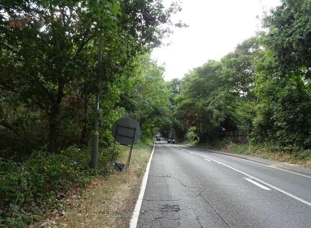
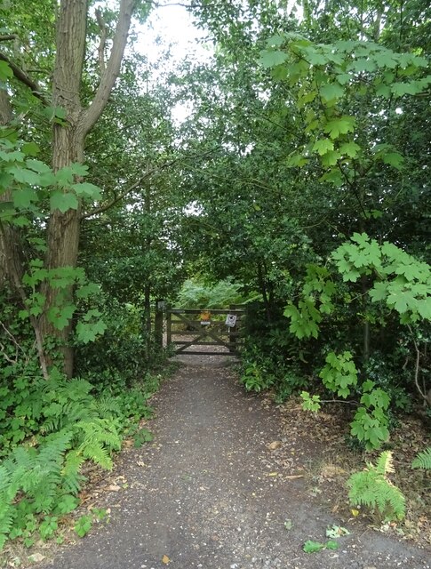
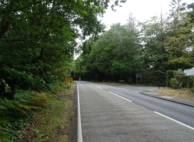
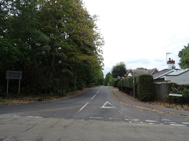
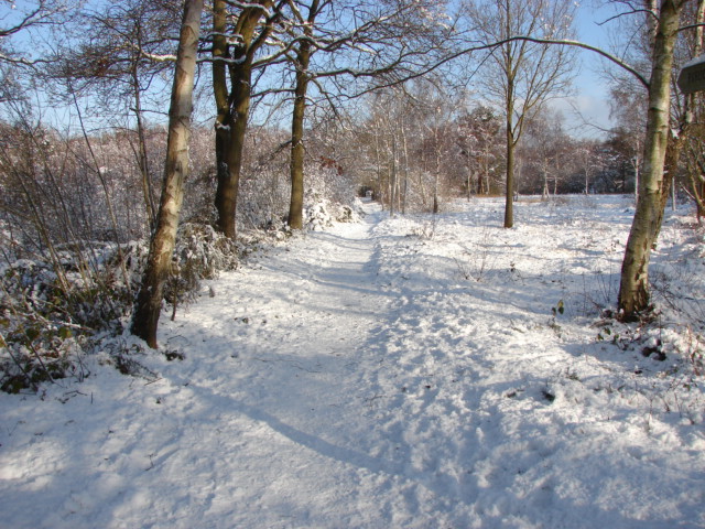
Westend Common, located in Surrey, England, is a picturesque area that encompasses both Downs and Moorland landscapes. Spanning approximately 500 acres, this common is a popular destination for nature lovers, walkers, and outdoor enthusiasts.

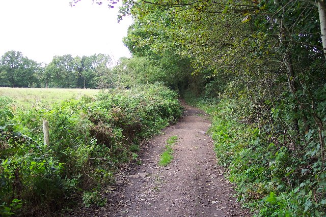
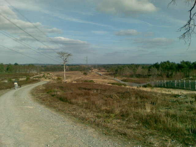
The Downs area of Westend Common is characterized by gently rolling hills covered in lush grasslands. Visitors can enjoy panoramic views of the surrounding countryside and take leisurely walks along well-maintained footpaths. The expansive open spaces provide ample opportunities for picnicking, kite flying, and other recreational activities.

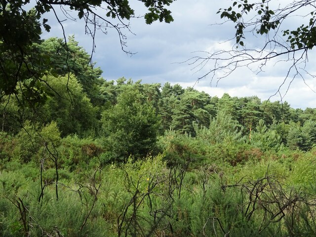
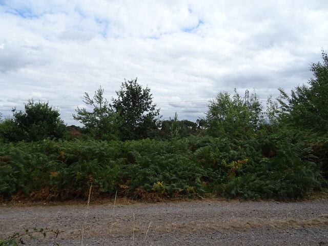
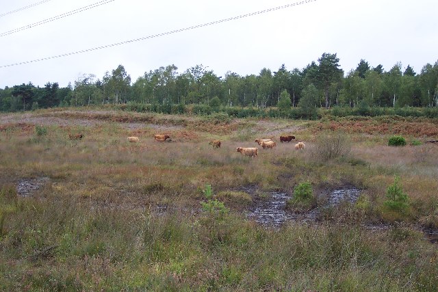
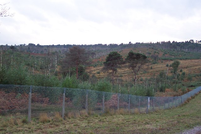
In contrast, the Moorland section of Westend Common offers a different landscape with its heathland and shrubbery. This area features a variety of plant species, including heather and gorse, creating a vibrant and colorful environment. Moorland birds, such as the skylark and stonechat, can also be spotted here, making it a haven for birdwatchers.

The common is home to an array of wildlife, including rabbits, deer, and various species of butterflies. It is also a designated area of Special Scientific Interest due to its ecological significance and diversity.

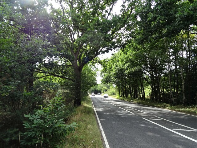
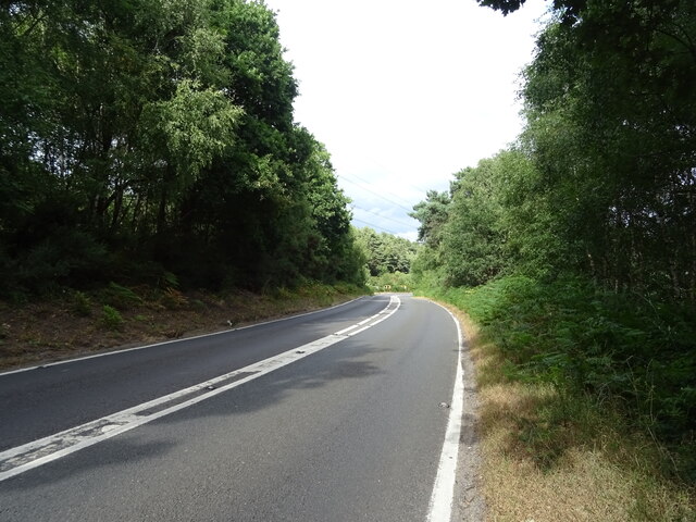
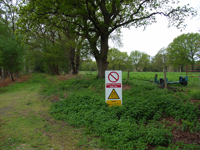
Westend Common is easily accessible, with ample parking facilities and well-marked trails for visitors to explore. The common is managed by local authorities to ensure its preservation and protection for future generations to enjoy.

Overall, Westend Common in Surrey offers a serene and tranquil setting, ideal for those seeking a peaceful retreat amidst nature's beauty.

If you have any feedback on the listing, please let us know in the comments section below.

Westend Common Images

Images are sourced within 2km of 51.330573/-0.6695307 or Grid Reference SU9259. Thanks to Geograph Open Source API. All images are credited.

Woodland, Turf Hill
Woodland, Turf Hill
Red Road (B311) Looking west.
Red Road (B311)
Looking west.
Westend Common South of Red Road.
Westend Common
South of Red Road.
Gateway on Red Road (B311)
Red Road (B311) Towards Frimley.
Red Road (B311)
Towards Frimley.
Path onto Westend Common From Red Road.
Path onto Westend Common
From Red Road.
Red Road (B311) Towards Frimley.
Red Road (B311)
Towards Frimley.
Macdonald Road Off Red Road (B311).
Macdonald Road
Off Red Road (B311).
Red Road (B311)
Red Road (B311)
Houses in West End This square contains several many semi-detached and terrace houses with pleasant gardens located in quiet cul-de-sacs.
Houses in West End
This square contains several many semi-detached and terrace houses with pleasant gardens located in quiet cul-de-sacs.
Priest Lane Priest Lane is, nowadays, a bridle path running along the edge of the army ranges and connecting Lucas Farm Road with the delightfully-named Donkeytown. Looking north.
Priest Lane
Priest Lane is, nowadays, a bridle path running along the edge of the army ranges and connecting Lucas Farm Road with the delightfully-named Donkeytown. Looking north.
Folly Bog Folly Bog is an area that lies between the northern edge of the Pirbright Ranges danger area and Red Road. Although owned by the MOD it is cared for by the Surrey Wildlife Trust. As an experiment and in order to help the boggy conditions to revive, the Trust has brought in a herd of Highland cattle to keep the invasive scrub under control. So far, according to the rangers, the experiment seems to be working well, tender birch shoots seeming to be very much to the cattle's liking. In order to prevent the cattle wandering it has been necessary to install fencing and cattle grids.
Folly Bog
Folly Bog is an area that lies between the northern edge of the Pirbright Ranges danger area and Red Road. Although owned by the MOD it is cared for by the Surrey Wildlife Trust. As an experiment and in order to help the boggy conditions to revive, the Trust has brought in a herd of Highland cattle to keep the invasive scrub under control. So far, according to the rangers, the experiment seems to be working well, tender birch shoots seeming to be very much to the cattle's liking. In order to prevent the cattle wandering it has been necessary to install fencing and cattle grids.
Highland cattle on Folly Bog Folly Bog is an area that lies between the northern edge of the Pirbright Ranges danger area and Red Road. Although owned by the MOD it is cared for by the Surrey Wildlife Trust. As an experiment and in order to help the boggy conditions to revive, the Trust has brought in a herd of Highland cattle to keep the invasive scrub under control. So far, according to the rangers, the experiment seems to be working well, tender birch shoots seeming to be very much to the cattle's liking. The boggy conditions can be seen in the foreground (and around the photographer's feet!). Pity about the overhead power lines.
Highland cattle on Folly Bog
Folly Bog is an area that lies between the northern edge of the Pirbright Ranges danger area and Red Road. Although owned by the MOD it is cared for by the Surrey Wildlife Trust. As an experiment and in order to help the boggy conditions to revive, the Trust has brought in a herd of Highland cattle to keep the invasive scrub under control. So far, according to the rangers, the experiment seems to be working well, tender birch shoots seeming to be very much to the cattle's liking. The boggy conditions can be seen in the foreground (and around the photographer's feet!). Pity about the overhead power lines.
Looking over the ranges Looking across the northwest corner of the Pirbright Ranges danger area from the range perimeter track. Chobham Ridges are in the distance and mark the western boundary of the ranges. Looking SW.
Looking over the ranges
Looking across the northwest corner of the Pirbright Ranges danger area from the range perimeter track. Chobham Ridges are in the distance and mark the western boundary of the ranges. Looking SW.
Pirbright Ranges Taken through the perimeter gate near Hagthorne Cottage. Access is just ordinarily possible this far.
Pirbright Ranges
Taken through the perimeter gate near Hagthorne Cottage. Access is just ordinarily possible this far.
Brentmoor Heath, Westend Common Track running parallel to Red Road, the B311.
Brentmoor Heath, Westend Common
Track running parallel to Red Road, the B311.
Woking over the Ranges The photo is a view over the Chobham Ranges, (Surrey Heath), from the Northern perimeter fence. In the distance the can be seen the town of Woking.
Woking over the Ranges
The photo is a view over the Chobham Ranges, (Surrey Heath), from the Northern perimeter fence. In the distance the can be seen the town of Woking.
The edge of Surrey Heath The photo shows the Northern perimeter fence of the Chobham, (Bisley), ranges which are located on Surrey Heathland. To the left of the photo is Red Road, which marks a change in the soil structure from Heathland to Woodland. The road in the photo is the inspection road for the razor wire protected fence, which extends around the 'overshoot' for the ranges.
The edge of Surrey Heath
The photo shows the Northern perimeter fence of the Chobham, (Bisley), ranges which are located on Surrey Heathland. To the left of the photo is Red Road, which marks a change in the soil structure from Heathland to Woodland. The road in the photo is the inspection road for the razor wire protected fence, which extends around the 'overshoot' for the ranges.
Show me another place!

Westend Common is located at Grid Ref: SU9259 (Lat: 51.330573, Lng: -0.6695307)

Administrative County: Surrey

District: Surrey Heath

Police Authority: Surrey

What 3 Words

///hardening.lotteries.casual. Near Lightwater, Surrey

Related Wikis

The Flashes

The Flashes is a 115.1-hectare (284-acre) Local Nature Reserve west of Godalming in Surrey. It is owned by the National Trust and managed by Waverley...

Bisley and West End Commons

Bisley and West End Commons is a 37.2-hectare (92-acre) Local Nature Reserve west of Woking in Surrey. It is part of the 46-hectare (110-acre) Bisley...

Brentmoor Heath

Brentmoor Heath is a 28.6-hectare (71-acre) Local Nature Reserve east of Camberley in Surrey. It is part of Brentmoor Heath and Folly Bog nature reserve...

West End, Surrey

West End is a village and civil parish in Surrey Heath, Surrey, England, approximately 25 miles (40 km) southwest of central London. It is midway between...

Bisley, Surrey

Bisley is a village and civil parish in the Borough of Surrey Heath in Surrey, England, approximately 25 miles (40 km) southwest of central London. It...

HM Prison Coldingley

HM Prison Coldingley is a Category C men's prison, located in the village of Bisley, in Surrey, England. The prison is operated by His Majesty's Prison...

National Shooting Centre

The National Shooting Centre is the UK's largest shooting sports complex, comprising several shooting ranges as well as the large "Bisley Camp" complex...

Gordon's School

Gordon's School is a secondary school with academy status in West End near Woking, Surrey, England. It was founded as the Gordon Boys' Home in 1885. It...

Nearby Amenities

Located within 500m of 51.330573,-0.6695307
Brock Hill
Natural: peak
Source: OS 1:25k
Lat/Long: 51.3286996/-0.6697615
Dog Hill
Natural: peak
Source: NLS 1933
Lat/Long: 51.3350404/-0.6687866
The data included in this document is from www.openstreetmap.org. The data is made available under ODbL.

Have you been to Westend Common?

Leave your review of Westend Common below (or comments, questions and feedback).