The Moors

Downs, Moorland in Yorkshire

England

The Moors

Old milestone A newer photograph of this 18/19C milestone in front of 37 Bevereley Road in South Cave.  More erosion of the surface has taken place.  There is an OS bench mark on the left hand side.
Old milestone Credit: Chris Minto

The Moors in Yorkshire, commonly referred to as the Yorkshire Moors or the North York Moors, is a vast expanse of upland moorland located in the northeast of England. Covering an area of approximately 554 square miles, it is renowned for its stunning natural beauty and rich biodiversity.

Characterized by its rolling hills, heather-covered moorland, and expansive open spaces, the Yorkshire Moors offer breathtaking panoramic views that attract visitors from all over the world. The area is also known for its picturesque villages and historic landmarks, including the famous Whitby Abbey and the charming village of Goathland, which served as the fictional village of Aidensfield in the television series Heartbeat.

The Moors are home to a diverse range of flora and fauna, with numerous species of birds, mammals, and plants thriving in this unique habitat. The moorland, in particular, is an important nesting ground for several species of birds, including the red grouse and the golden plover. The region also boasts a rich cultural heritage, with evidence of human settlement dating back thousands of years, as evidenced by the presence of ancient burial mounds and stone circles.

The Moors offer a variety of recreational opportunities for visitors, including hiking, cycling, and horseback riding. There are numerous well-marked trails and paths that crisscross the moorland, allowing visitors to explore its beauty at their own pace. Additionally, the Moors are dotted with charming tearooms and traditional pubs, where visitors can relax and enjoy a warm meal or a refreshing drink after a day of exploration.

Overall, the Yorkshire Moors are a remarkable natural landscape, offering a unique blend of stunning scenery, cultural heritage, and outdoor activities for visitors to enjoy.

If you have any feedback on the listing, please let us know in the comments section below.

The Moors Images

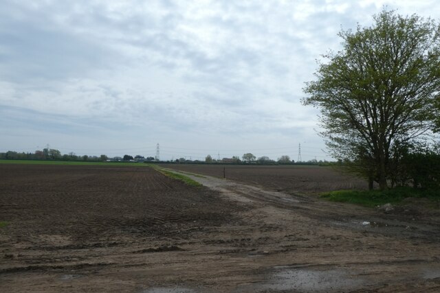
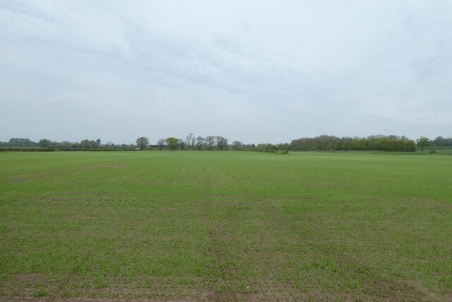
Images are sourced within 2km of 53.770203/-0.62173635 or Grid Reference SE9031. Thanks to Geograph Open Source API. All images are credited.

Old milestone A newer photograph of this 18/19C milestone in front of 37 Bevereley Road in South Cave.  More erosion of the surface has taken place.  There is an OS bench mark on the left hand side.
Old milestone
A newer photograph of this 18/19C milestone in front of 37 Bevereley Road in South Cave. More erosion of the surface has taken place. There is an OS bench mark on the left hand side.
Old milestone This weathered stone is on an old route from Howden towards Beverley and may predate the mounting-block type milestones set up later in this area of the East Riding.  There are remnants of an inscription. Bev and Miles can just be made out.   It is on a wide verge on High Road leading westwards into Everthorpe from the A1034.  A bench mark is incised at the top of the front face.
Old milestone
This weathered stone is on an old route from Howden towards Beverley and may predate the mounting-block type milestones set up later in this area of the East Riding. There are remnants of an inscription. Bev and Miles can just be made out. It is on a wide verge on High Road leading westwards into Everthorpe from the A1034. A bench mark is incised at the top of the front face.
South of the A63 at Willow Flats
Geldart  Avenue  from  Little  Wold  Lane A new development by Bellway, still building at the far end
Geldart Avenue from Little Wold Lane
A new development by Bellway, still building at the far end
Sales  Centre  and  showhouse  for  Bellway  development At the corner of Geldart Ave and Little Wold Lane
Sales Centre and showhouse for Bellway development
At the corner of Geldart Ave and Little Wold Lane
Little  Wold  Lane  South  Cave Route of the Yorkshire Wolds Way
Little Wold Lane South Cave
Route of the Yorkshire Wolds Way
Track  between  houses  to  fields  South  Cave A footpath rises through the field to the access road to Mount Airey Farm
Track between houses to fields South Cave
A footpath rises through the field to the access road to Mount Airey Farm
Old Milestone, Everthorpe Rd, 780m West of A1034 junction Located on the North side of road, on verge. Stone post (plate lost), Mounting Block - 2 step design, 19th century. Alternative view see <a title="https://www.geograph.org.uk/photo/827593" href="https://www.geograph.org.uk/photo/827593">Link</a> and there is an earlier milestone 124 m to the NE.

North Cave 1 / Hull 13

Milestone Society National ID: YE_HOBV11
Old Milestone, Everthorpe Rd, 780m West of A1034 junction
Located on the North side of road, on verge. Stone post (plate lost), Mounting Block - 2 step design, 19th century. Alternative view see Link and there is an earlier milestone 124 m to the NE. North Cave 1 / Hull 13 Milestone Society National ID: YE_HOBV11
Direction Sign – Signpost in South Cave Market Place Located on the east side of the junction of the A1034 Market Place and Church Street, outside number 32. South Cave parish. 3 arms and no finial. See also <a title="https://www.geograph.org.uk/photo/1025617" href="https://www.geograph.org.uk/photo/1025617">Link</a> and <a title="https://www.geograph.org.uk/photo/5220402" href="https://www.geograph.org.uk/photo/5220402">Link</a>.

Milestone Society National ID: YE_SE9231
Direction Sign – Signpost in South Cave Market Place
Located on the east side of the junction of the A1034 Market Place and Church Street, outside number 32. South Cave parish. 3 arms and no finial. See also Link and Link. Milestone Society National ID: YE_SE9231
Norfolk Bank Lane Passing Carrdales Nursery. The road forms part of National Cycle Network route 65.
Norfolk Bank Lane
Passing Carrdales Nursery. The road forms part of National Cycle Network route 65.
Track towards Ings Lane Nurseries Looking across empty fields from Norfolk Bank Lane.
Track towards Ings Lane Nurseries
Looking across empty fields from Norfolk Bank Lane.
Along Norfolk Bank Lane The road forms part of National Cycle Network route 65.
Along Norfolk Bank Lane
The road forms part of National Cycle Network route 65.
Greenhouses beside Norfolk Bank Lane The road forms part of National Cycle Network route 65. On the right is Cavegates Nursery.
Greenhouses beside Norfolk Bank Lane
The road forms part of National Cycle Network route 65. On the right is Cavegates Nursery.
Field north of Norfolk Bank Lane Looking across a field of young crops near Cavegates Nursery.
Field north of Norfolk Bank Lane
Looking across a field of young crops near Cavegates Nursery.
Field opposite Cavegates Nursery Looking across farmland from Cave Lane.
Field opposite Cavegates Nursery
Looking across farmland from Cave Lane.
North Cave Beck, looking upstream [east] In the distance is Church Bridge, on Church Lane.
North Cave Beck, looking upstream [east]
In the distance is Church Bridge, on Church Lane.
North Cave Beck, North Cave Looking downstream. Once this stream powered three watermills.
North Cave Beck, North Cave
Looking downstream. Once this stream powered three watermills.
River flow gauging station, North Cave Beck Installed by the Environment Agency, alongside Low Mill Lane.
River flow gauging station, North Cave Beck
Installed by the Environment Agency, alongside Low Mill Lane.
Show me another place!

The Moors is located at Grid Ref: SE9031 (Lat: 53.770203, Lng: -0.62173635)

Division: East Riding

Unitary Authority: East Riding of Yorkshire

Police Authority: Humberside

What 3 Words

///outsize.princely.shirt. Near South Cave, East Yorkshire

Related Wikis

Everthorpe

Everthorpe is a hamlet in the East Riding of Yorkshire, England. It is situated approximately 11 miles (18 km) west of Hull city centre and 10 miles...

HM Prison Everthorpe

HM Prison Everthorpe was a Category C men's prison, located to the south-west of Everthorpe, (near Brough) in the East Riding of Yorkshire, England. The...

HM Prison Wolds

HM Prison Wolds was a Category C men's prison, located south-west of Everthorpe, (near Brough) in the East Riding of Yorkshire, England. The prison was...

HM Prison Humber

HM Prison Humber is a Category C men's prison, located south-west of Everthorpe, (near Brough) in the East Riding of Yorkshire, England. The prison is...

Nearby Amenities

Located within 500m of 53.770203,-0.62173635
The data included in this document is from www.openstreetmap.org. The data is made available under ODbL.

Have you been to The Moors?

Leave your review of The Moors below (or comments, questions and feedback).