Goodmanham Wold

Downs, Moorland in Yorkshire

England

Goodmanham Wold

Hudson Way east of a road to Goodmanham The Hudson Way runs along the former York to Hull via Market Weighton railway line between Beverley and Market Weighton.
Hudson Way east of a road to Goodmanham Credit: DS Pugh

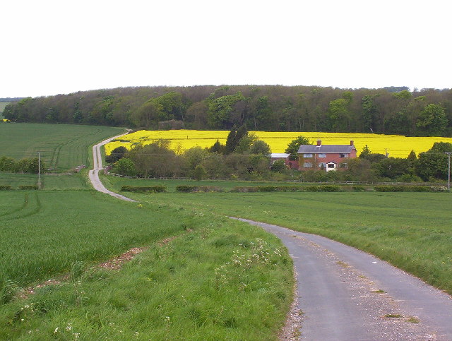
Goodmanham Wold is a scenic area situated in the East Riding of Yorkshire, England. It is a hilly region that encompasses both downs and moorland, offering visitors a diverse landscape to explore. With its picturesque views and tranquil atmosphere, Goodmanham Wold is a popular destination for nature enthusiasts and hikers.

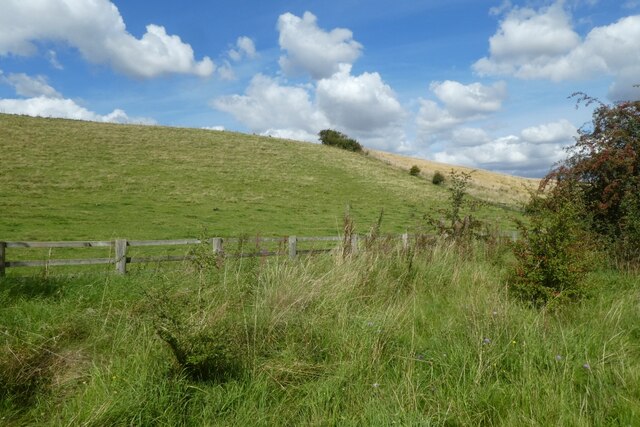
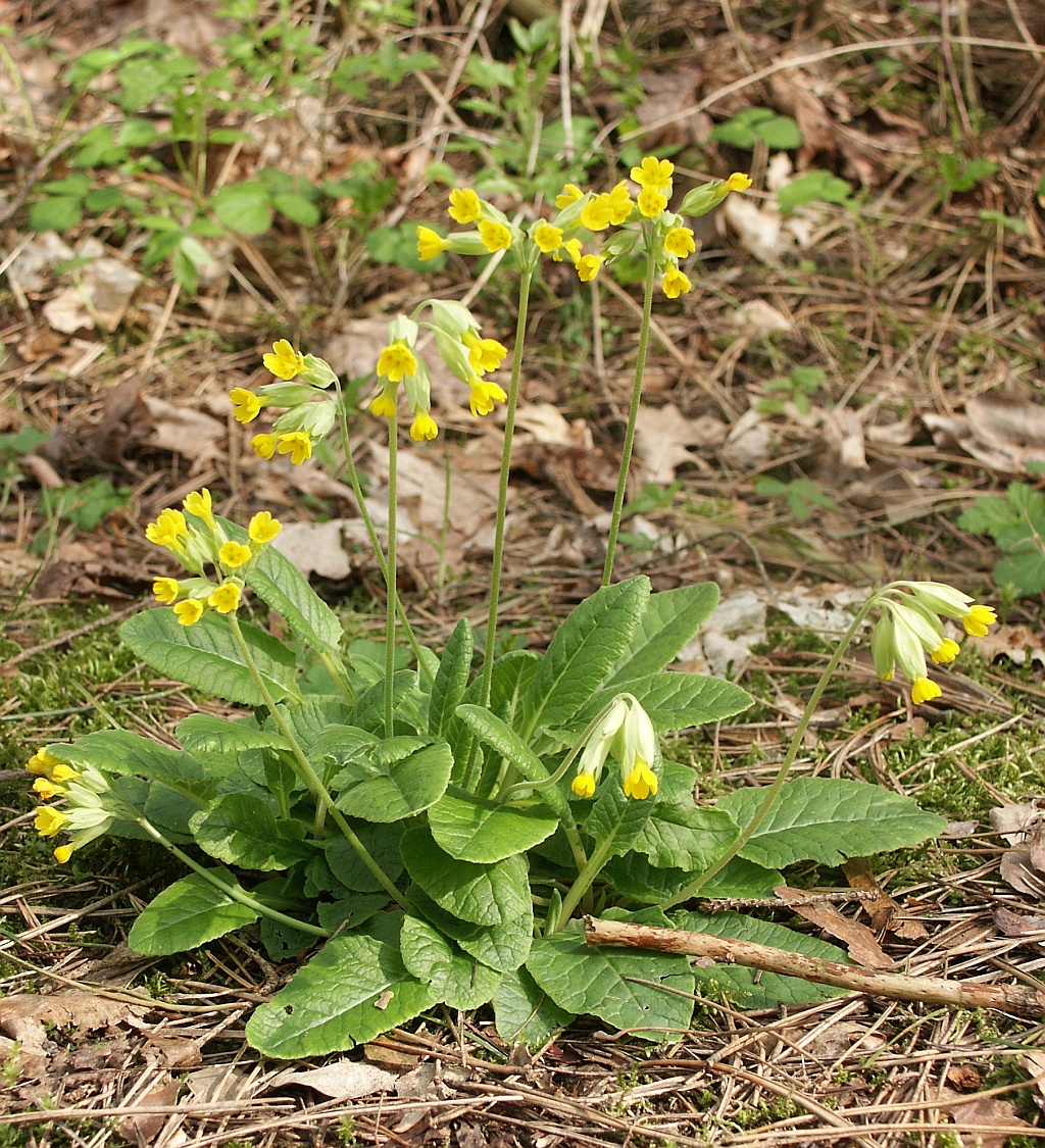
The downs in Goodmanham Wold are characterized by their gently rolling hills and expansive grasslands. These open spaces provide breathtaking panoramas, allowing visitors to immerse themselves in the beauty of the surrounding countryside. The downs are also home to an array of plant species, including wildflowers and grasses, creating a vibrant and colorful environment.

In contrast, the moorland in Goodmanham Wold offers a more rugged and untamed landscape. Here, visitors can find heather-covered hillsides and scattered trees, providing a habitat for various wildlife species. The moorland is a haven for birdwatchers, as it is home to a diverse range of bird species, such as curlews and lapwings.

Aside from its natural beauty, Goodmanham Wold also boasts a rich historical heritage. The area has been inhabited since ancient times and is dotted with archaeological sites. One notable site is the Goodmanham Roman villa, which dates back to the 2nd century AD. Visitors can explore the remains of the villa and gain insight into the lives of the Roman inhabitants.

Overall, Goodmanham Wold offers a unique blend of natural beauty and historical significance. Whether it is hiking through the downs, birdwatching on the moorland, or exploring ancient ruins, visitors to this area are sure to be captivated by its charm.

If you have any feedback on the listing, please let us know in the comments section below.

Goodmanham Wold Images

Images are sourced within 2km of 53.885975/-0.61841787 or Grid Reference SE9044. Thanks to Geograph Open Source API. All images are credited.

Hudson Way east of a road to Goodmanham The Hudson Way runs along the former York to Hull via Market Weighton railway line between Beverley and Market Weighton.
Hudson Way east of a road to Goodmanham
The Hudson Way runs along the former York to Hull via Market Weighton railway line between Beverley and Market Weighton.
Goat along the Hudson Way A friendly goat looking over a gate onto the Hudson Way.
Goat along the Hudson Way
A friendly goat looking over a gate onto the Hudson Way.
Cattle field beside the Hudson Way Looking over a gate into a field to the north of the Hudson Way.
Cattle field beside the Hudson Way
Looking over a gate into a field to the north of the Hudson Way.
Gate on the Hudson Way The Hudson Way runs along the former York to Hull via Market Weighton railway line between Beverley and Market Weighton.
Gate on the Hudson Way
The Hudson Way runs along the former York to Hull via Market Weighton railway line between Beverley and Market Weighton.
Field beside Spring Road Compare with <a href="https://www.geograph.org.uk/photo/32311">SE9042 : Near Goodmanham</a> from 19 years earlier.
Field beside Spring Road
Compare with SE9042 : Near Goodmanham from 19 years earlier.
Track crossing the Hudson Way A track connects Spring Road to a field crossing the Hudson Way cycle path.
Track crossing the Hudson Way
A track connects Spring Road to a field crossing the Hudson Way cycle path.
Hudson Way north of Spring Road The Hudson Way runs along the former York to Hull via Market Weighton railway line between Beverley and Market Weighton.
Hudson Way north of Spring Road
The Hudson Way runs along the former York to Hull via Market Weighton railway line between Beverley and Market Weighton.
Hudson Way near Spring Road The Hudson Way runs along the former York to Hull via Market Weighton railway line between Beverley and Market Weighton.
Hudson Way near Spring Road
The Hudson Way runs along the former York to Hull via Market Weighton railway line between Beverley and Market Weighton.
Slopes of Goodmanham Wold Looking across fields beside the Hudson Way.
Slopes of Goodmanham Wold
Looking across fields beside the Hudson Way.
Hudson Way near a car park on Spring Road The Hudson Way runs along the former York to Hull via Market Weighton railway line between Beverley and Market Weighton.
Hudson Way near a car park on Spring Road
The Hudson Way runs along the former York to Hull via Market Weighton railway line between Beverley and Market Weighton.
Hudson Way approaching Spring Road car park The Hudson Way runs along the former York to Hull via Market Weighton railway line between Beverley and Market Weighton.
Hudson Way approaching Spring Road car park
The Hudson Way runs along the former York to Hull via Market Weighton railway line between Beverley and Market Weighton.
Hudson Way near Spring Road car park The Hudson Way runs along the former York to Hull via Market Weighton railway line between Beverley and Market Weighton.
Hudson Way near Spring Road car park
The Hudson Way runs along the former York to Hull via Market Weighton railway line between Beverley and Market Weighton.
Entrance to Kiplingcotes Chalk Pit The entrance to the former quarry along the Hudson Way.
Entrance to Kiplingcotes Chalk Pit
The entrance to the former quarry along the Hudson Way.
Hudson Way in Goodmanham Dale The Hudson Way runs along the former York to Hull via Market Weighton railway line between Beverley and Market Weighton.
Hudson Way in Goodmanham Dale
The Hudson Way runs along the former York to Hull via Market Weighton railway line between Beverley and Market Weighton.
Hudson Way near Southwold Farm The Hudson Way runs along the former York to Hull via Market Weighton railway line between Beverley and Market Weighton.
Hudson Way near Southwold Farm
The Hudson Way runs along the former York to Hull via Market Weighton railway line between Beverley and Market Weighton.
Fields near Walk House Farm Viewed from the Hudson Way.
Fields near Walk House Farm
Viewed from the Hudson Way.
Viaduct above Spring Road The Hudson Way crossing Spring Road.
Viaduct above Spring Road
The Hudson Way crossing Spring Road.
Approaching Kiplingcotes Station The Hudson Way runs along the former York to Hull via Market Weighton railway line between Beverley and Market Weighton.
Approaching Kiplingcotes Station
The Hudson Way runs along the former York to Hull via Market Weighton railway line between Beverley and Market Weighton.
Show me another place!

Goodmanham Wold is located at Grid Ref: SE9044 (Lat: 53.885975, Lng: -0.61841787)

Division: East Riding

Unitary Authority: East Riding of Yorkshire

Police Authority: Humberside

What 3 Words

///steers.shelving.exists. Near Market Weighton, East Yorkshire

Nearby Locations

Goodmanham Wold

Related Wikis

Kiplingcotes railway station

Kiplingcotes railway station was a minor railway station on the York–Beverley line, in the East Riding of Yorkshire, England. It opened on 1 May 1865 and...

Rifle Butts Quarry

Rifle Butts Quarry is a Site of Special Scientific Interest (SSSI) in the East Riding of Yorkshire, England. The particular interest of this reserve is...

Enthorpe railway station

Enthorpe railway station was a station on the Selby to Driffield Line in the East Riding of Yorkshire, England. It opened on 1 May 1890 and closed on 20...

Kiplingcotes

Kiplingcotes is a hamlet in the East Riding of Yorkshire, England. It is situated approximately 3.5 miles (6 km) north-east of the market town of Market...

Nearby Amenities

Located within 500m of 53.885975,-0.61841787
The data included in this document is from www.openstreetmap.org. The data is made available under ODbL.

Have you been to Goodmanham Wold?

Leave your review of Goodmanham Wold below (or comments, questions and feedback).