The Groves

Downs, Moorland in Yorkshire

England

The Groves

End of Wallingfen Lane Looking towards the junction with Common Road.
End of Wallingfen Lane Credit: DS Pugh

The Groves is a picturesque region located in Yorkshire, encompassing the stunning landscape of the Downs and Moorland. Spanning over vast acres of land, this region is renowned for its natural beauty and diverse ecosystems.

The Downs in The Groves are characterized by rolling hills, lush meadows, and breathtaking panoramic views. The landscape is dotted with charming villages and quaint cottages, providing a sense of tranquility and serenity. The Downs are also home to a myriad of flora and fauna, with vibrant wildflowers and various bird species adding to the area's allure.

Moving towards the Moorland, visitors are greeted with vast expanses of heather-covered hills and rugged terrains. The Moorland exudes a wild and untamed beauty, with its contrasting colors and dramatic landscapes. It is a haven for nature enthusiasts, as it is home to a wide range of wildlife, including red grouse, curlews, and the iconic Yorkshire Dales sheep.

The Groves offers numerous recreational opportunities for visitors. Hiking and walking trails are abundant throughout the region, allowing adventurers to explore the natural wonders at their own pace. The area is also popular for birdwatching, cycling, and horseback riding.

In addition to its natural beauty, The Groves boasts a rich cultural heritage. Historic landmarks, such as ancient stone circles and medieval castles, can be found scattered across the region. The local communities are proud of their traditions and often organize festivals and events to showcase their heritage.

Overall, The Groves in Yorkshire is a captivating destination that combines stunning landscapes, abundant wildlife, and a vibrant cultural heritage, making it a must-visit for nature lovers and history enthusiasts alike.

If you have any feedback on the listing, please let us know in the comments section below.
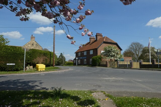
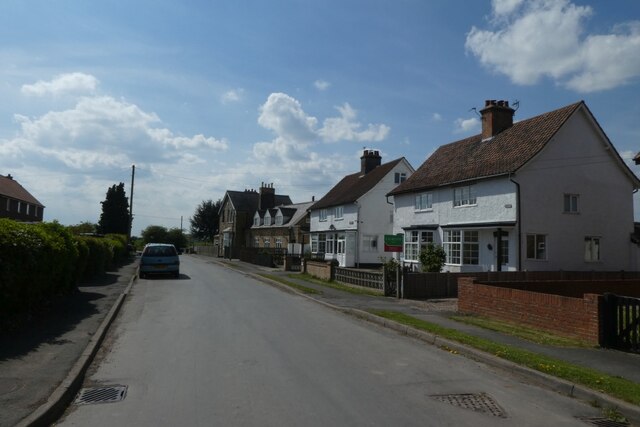
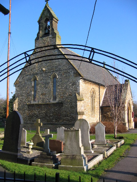
The Groves Images

Images are sourced within 2km of 53.739198/-0.64594861 or Grid Reference SE8927. Thanks to Geograph Open Source API. All images are credited.

End of Wallingfen Lane Looking towards the junction with Common Road.
End of Wallingfen Lane
Looking towards the junction with Common Road.
Dandelions along Wallingfen Lane Looking along Wallingfen Lane from the junction with Common Road.
Dandelions along Wallingfen Lane
Looking along Wallingfen Lane from the junction with Common Road.
Field beside Common Road Looking across a field from Wallingfen Lane near the junction with Common Road.
Field beside Common Road
Looking across a field from Wallingfen Lane near the junction with Common Road.
Electric cables crossing Common Road Looking along Common Road towards Broomfleet.
Electric cables crossing Common Road
Looking along Common Road towards Broomfleet.
Common Road Looking along Common Road leading towards South Cave.
Common Road
Looking along Common Road leading towards South Cave.
Along Carr Lane Looking towards the corner where the road meets Common Road.
Along Carr Lane
Looking towards the corner where the road meets Common Road.
Broomfleet Station Looking towards the station from Carr Lane as the 1335 Leeds to Hull (1K19) passes through non-stop. The train consists of 185141.
Broomfleet Station
Looking towards the station from Carr Lane as the 1335 Leeds to Hull (1K19) passes through non-stop. The train consists of 185141.
Train crossing Broomfleet Level Crossing The 1335 Leeds to Hull TransPennine Express service (1K19) is passing non-stop through the station consisting of 185141.
Train crossing Broomfleet Level Crossing
The 1335 Leeds to Hull TransPennine Express service (1K19) is passing non-stop through the station consisting of 185141.
Broomfleet Level Crossing and signal box The signal box closed a few years ago with the operation moving to a workstation in York ROC. A documentary on the working of this signal box prior to closure can be found at: <span class="nowrap"><a title="https://www.s-r-s.org.uk/videoPages/Gilberdyke.php" rel="nofollow ugc noopener" href="https://www.s-r-s.org.uk/videoPages/Gilberdyke.php">Link</a><img style="margin-left:2px;" alt="External link" title="External link - shift click to open in new window" src="https://s1.geograph.org.uk/img/external.png" width="10" height="10"/></span>
Broomfleet Level Crossing and signal box
The signal box closed a few years ago with the operation moving to a workstation in York ROC. A documentary on the working of this signal box prior to closure can be found at: LinkExternal link
Approach to the level crossing Looking along Carr Lane towards the level crossing and Broomfleet Station.
Approach to the level crossing
Looking along Carr Lane towards the level crossing and Broomfleet Station.
Broomfleet Carr Looking across a field of rape beside Carr Lane.
Broomfleet Carr
Looking across a field of rape beside Carr Lane.
Rape beside Carr Lane Looking along Carr Lane towards Broomfleet.
Rape beside Carr Lane
Looking along Carr Lane towards Broomfleet.
Rape on Broomfleet Carr Looking across farmland from Carr Lane. In the distance the 1353 Hull to Doncaster Northern service (2C64) is slowing down to stop in Broomfleet Station.
Rape on Broomfleet Carr
Looking across farmland from Carr Lane. In the distance the 1353 Hull to Doncaster Northern service (2C64) is slowing down to stop in Broomfleet Station.
Road to Broomfleet Station Looking along Carr Lane. In the distance the 1353 Hull to Doncaster Northern service (2C64) is slowing down to stop in Broomfleet Station. The train is formed of 158902.
Road to Broomfleet Station
Looking along Carr Lane. In the distance the 1353 Hull to Doncaster Northern service (2C64) is slowing down to stop in Broomfleet Station. The train is formed of 158902.
Blossom along Carr Lane Entering Broomfleet from the north.
Blossom along Carr Lane
Entering Broomfleet from the north.
Bend on Carr Lane Looking north from Broomfleet.
Bend on Carr Lane
Looking north from Broomfleet.
Centre of Broomfleet The junction of Main Street and Carr Lane from a bench.
Centre of Broomfleet
The junction of Main Street and Carr Lane from a bench.
Main Street, Broomfleet Looking along a street of houses in Broomfleet.
Main Street, Broomfleet
Looking along a street of houses in Broomfleet.
Show me another place!

The Groves is located at Grid Ref: SE8927 (Lat: 53.739198, Lng: -0.64594861)

Division: East Riding

Unitary Authority: East Riding of Yorkshire

Police Authority: Humberside

What 3 Words

///hazy.erupted.formless. Near Broomfleet, East Yorkshire

Nearby Locations

The Groves

Related Wikis

Broomfleet

Broomfleet is a village and civil parish in the East Riding of Yorkshire, England. It is situated on the Humber Estuary approximately 4 miles (6 km) west...

Broomfleet railway station

Broomfleet railway station serves the village of Broomfleet in the East Riding of Yorkshire, England. The station is on the Selby Line 14+1⁄2 miles (23...

Faxfleet Preceptory

The Faxfleet Preceptory is a former community of the Knights Templar located in what is now the East Riding of Yorkshire, England. It stood on lands which...

Ellerker

Ellerker is a village and civil parish in the East Riding of Yorkshire, England. It is situated approximately 10 miles (16 km) west of Hull city centre...

Nearby Amenities

Located within 500m of 53.739198,-0.64594861
Power: tower
Lat/Long: 53.7428015/-0.6471396
Power: tower
Lat/Long: 53.7414123/-0.6517349
BROOMFLEET1
Disused: yes
Man Made: petroleum_well
Ref GB Decc: L46/07-2
Source: DECC
Lat/Long: 53.7378611/-0.6456389
Providence Farm
Railway: level_crossing
Lat/Long: 53.7369296/-0.6465102
Providence Farm
Railway: level_crossing
Lat/Long: 53.7368875/-0.6464717
The data included in this document is from www.openstreetmap.org. The data is made available under ODbL.

Have you been to The Groves?

Leave your review of The Groves below (or comments, questions and feedback).