Grange Plantation

Downs, Moorland in Yorkshire

England

Grange Plantation

Track off Wallingfen Lane Looking along Lamb Lane, a track over a field over Walling Fen.
Track off Wallingfen Lane Credit: DS Pugh

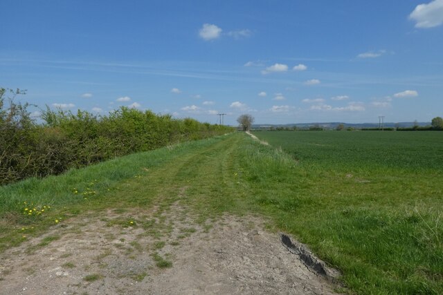
Grange Plantation, located in Yorkshire, is a picturesque estate that spans across the Downs and Moorland regions. The plantation covers a vast area of land, offering visitors breathtaking views of the surrounding countryside and diverse natural landscapes.

The Downs area of Grange Plantation is characterized by rolling hills and wide open spaces. It is home to an array of native flora and fauna, including wildflowers, grasses, and various bird species. Walking trails crisscross the Downs, allowing visitors to explore the area's beauty at their own pace. The peaceful and tranquil atmosphere makes it an ideal spot for nature enthusiasts and hikers.

In contrast, the Moorland region of Grange Plantation boasts a rugged and wild terrain. Here, visitors can witness the striking beauty of heather-covered hills, rocky outcrops, and meandering streams. This area is known for its unique ecosystem, supporting a variety of wildlife such as red grouse, curlews, and even the elusive hen harrier. The moorland offers a sense of adventure and exploration, with winding paths that lead to hidden valleys and breathtaking viewpoints.

Grange Plantation also offers facilities for visitors, including parking areas, picnic spots, and information boards detailing the local wildlife and history. It is a popular destination for families, nature lovers, and photography enthusiasts, providing ample opportunities to capture the beauty of the Yorkshire countryside.

Overall, Grange Plantation in Yorkshire showcases the diversity and natural splendor of the region, providing a peaceful retreat for those seeking a connection with nature and a chance to explore the breathtaking landscapes of the Downs and Moorland.

If you have any feedback on the listing, please let us know in the comments section below.

Grange Plantation Images

Images are sourced within 2km of 53.767989/-0.66759865 or Grid Reference SE8731. Thanks to Geograph Open Source API. All images are credited.

Track off Wallingfen Lane Looking along Lamb Lane, a track over a field over Walling Fen.
Track off Wallingfen Lane
Looking along Lamb Lane, a track over a field over Walling Fen.
Looking along Wallingfen Lane The road heads towards Broomfleet.
Looking along Wallingfen Lane
The road heads towards Broomfleet.
Junction with Fenland Lane Looking along Wallingfen Lane with Fenland Lane on the right.
Junction with Fenland Lane
Looking along Wallingfen Lane with Fenland Lane on the right.
Road near Skelton Grange Looking along Wallingfen Lane.
Road near Skelton Grange
Looking along Wallingfen Lane.
Old milestone A newer photograph of the milestone on the narrow pavement on Westgate in North Cave.  This was on the route of the 24 mile long Beverley, Skidby and Hessle turnpike, 1769 - 1878.  Originally only the metal plaque would have been painted but the paint on the stone will preserve it from splashes from passing vehicles.   It is Grade II listed 1346704.
Old milestone
A newer photograph of the milestone on the narrow pavement on Westgate in North Cave. This was on the route of the 24 mile long Beverley, Skidby and Hessle turnpike, 1769 - 1878. Originally only the metal plaque would have been painted but the paint on the stone will preserve it from splashes from passing vehicles. It is Grade II listed 1346704.
Muddy path by the M62 Plenty of Roe Deer locally but rarely seen on the road. They may have taken note of the warning even if the drivers have not!
Muddy path by the M62
Plenty of Roe Deer locally but rarely seen on the road. They may have taken note of the warning even if the drivers have not!
Spot height on Stony Lane, North Carr Depending which map you look at, 2 metres or 2.2 metres above sea level.
Spot height on Stony Lane, North Carr
Depending which map you look at, 2 metres or 2.2 metres above sea level.
Access track to Common Farm, North Carr Also a public bridleway that leads to Dryham Lane.
Access track to Common Farm, North Carr
Also a public bridleway that leads to Dryham Lane.
Seavy Carr Lane, North Carr Unlike most of the other nearby public bridleways, this one has not been surfaced for vehicles.
Seavy Carr Lane, North Carr
Unlike most of the other nearby public bridleways, this one has not been surfaced for vehicles.
Passing Milestone Farm Looking along the B1230 Main Road.
Passing Milestone Farm
Looking along the B1230 Main Road.
Road beside Milestone Farm Looking along the B1230 Main Road.
Road beside Milestone Farm
Looking along the B1230 Main Road.
Wallingfen Lane meets Main Road Looking onto the B1230 to the east of Newport.
Wallingfen Lane meets Main Road
Looking onto the B1230 to the east of Newport.
Wallingfen Lane near the B1230 Looking along Wallingfen Lane beside Wallingfen Business Park.
Wallingfen Lane near the B1230
Looking along Wallingfen Lane beside Wallingfen Business Park.
Glasshouses along Wallingfen Lane Looking along Wallingfen Lane with some large greenhouses alongside.
Glasshouses along Wallingfen Lane
Looking along Wallingfen Lane with some large greenhouses alongside.
Wallingfen Lane Looking along Wallingfen Lane leading towards Broomfleet.
Wallingfen Lane
Looking along Wallingfen Lane leading towards Broomfleet.
Along Wallingfen Lane Leading to the B1230 between Newport and North Cave.
Along Wallingfen Lane
Leading to the B1230 between Newport and North Cave.
Field beside Wallingfen Lane Looking across a farmland beside Saltmarsh Grange.
Field beside Wallingfen Lane
Looking across a farmland beside Saltmarsh Grange.
Quarrying and wetlands, North Cave This area to the south of the main North Cave Wetlands nature reserve site <span class="nowrap"><a title="https://www.ywt.org.uk/nature-reserves/north-cave-wetlands-nature-reserve" rel="nofollow ugc noopener" href="https://www.ywt.org.uk/nature-reserves/north-cave-wetlands-nature-reserve">Link</a><img style="margin-left:2px;" alt="External link" title="External link - shift click to open in new window" src="https://s1.geograph.org.uk/img/external.png" width="10" height="10"/></span> is being quarried, along with an area to the west, starting in 2008 and finishing 12 to 15 years later. This additional 100ha of land is being progressively restored with wildlife in mind before being gifted to Yorkshire Wildlife Trust. 

The works in the background are part of the Breedon Group's North Cave Quarry operation.
Quarrying and wetlands, North Cave
This area to the south of the main North Cave Wetlands nature reserve site LinkExternal link is being quarried, along with an area to the west, starting in 2008 and finishing 12 to 15 years later. This additional 100ha of land is being progressively restored with wildlife in mind before being gifted to Yorkshire Wildlife Trust. The works in the background are part of the Breedon Group's North Cave Quarry operation.
Show me another place!

Grange Plantation is located at Grid Ref: SE8731 (Lat: 53.767989, Lng: -0.66759865)

Division: East Riding

Unitary Authority: East Riding of Yorkshire

Police Authority: Humberside

What 3 Words

///cackling.foods.parsnip. Near North Cave, East Yorkshire

Nearby Locations

Grange Plantation

Related Wikis

Fairview Studios

Fairview Studios is an independent recording studio located in Willerby, East Riding of Yorkshire, England. Established by a local man Keith Herd in 1966...

HM Prison Wolds

HM Prison Wolds was a Category C men's prison, located south-west of Everthorpe, (near Brough) in the East Riding of Yorkshire, England. The prison was...

HM Prison Humber

HM Prison Humber is a Category C men's prison, located south-west of Everthorpe, (near Brough) in the East Riding of Yorkshire, England. The prison is...

North Cave railway station

North Cave railway station was a station on the Hull and Barnsley Railway, and served the village of North Cave in the East Riding of Yorkshire, England...

Nearby Amenities

Located within 500m of 53.767989,-0.66759865
Motorway Junction
North Cave Interchange
Ref: 38
Lat/Long: 53.7696144/-0.6676829
Bicycle: no
Foot: no
Horse: no
Maxspeed: 70 mph
Moped: no
Motor Vehicle: designated
Ref: M62
Traffic Sign: GB:2901
Traffic Sign Direction: forward
Lat/Long: 53.7700516/-0.6702863
Bicycle: yes
Traffic Sign: GB:2931
Traffic Sign Direction: forward
Lat/Long: 53.7705628/-0.6731723
Give Way
Lat/Long: 53.7683996/-0.6602185
The data included in this document is from www.openstreetmap.org. The data is made available under ODbL.

Have you been to Grange Plantation?

Leave your review of Grange Plantation below (or comments, questions and feedback).