Newgate Moor

Downs, Moorland in Yorkshire Ryedale

England

Newgate Moor

Blakey Topping from Old Wife's Way, Lockton
Blakey Topping from Old Wife's Way, Lockton Credit: Colin Park

Newgate Moor is a picturesque region located in Yorkshire, England. Nestled amidst the rolling hills and vast moorlands, it is a part of the stunning Yorkshire Downs. With its tranquil ambiance and breathtaking natural beauty, Newgate Moor has become a popular destination for nature enthusiasts and outdoor lovers.

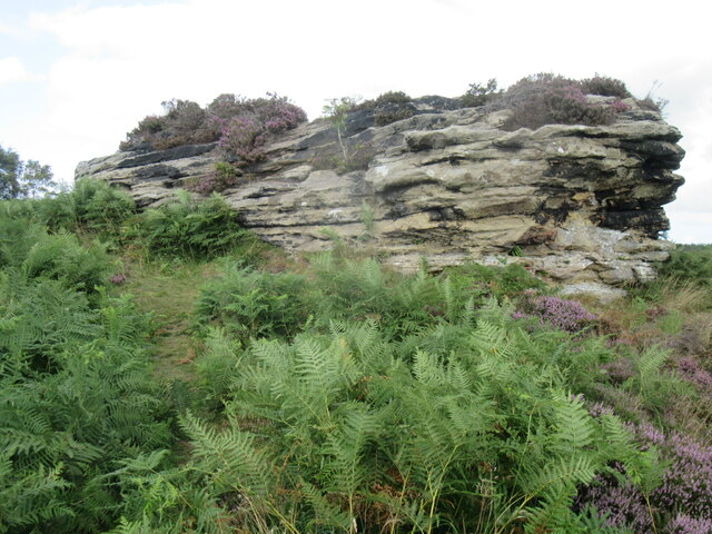
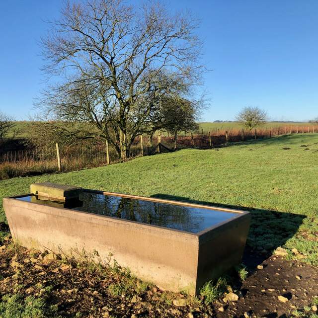
The region is characterized by its sweeping moorlands, covered in heather and dotted with scattered boulders. The landscape is truly captivating, evoking a sense of serenity and tranquility. The moors stretch as far as the eye can see, providing ample opportunities for hiking, walking, and exploring.

Newgate Moor is also home to a diverse range of wildlife. The moorlands serve as a habitat for various bird species, including the iconic red grouse and golden plover. Nature enthusiasts can spot these magnificent creatures soaring through the skies or nesting in the heathland. Additionally, the moorlands are known for their rich flora, with vibrant wildflowers adorning the landscape during the warmer months.

Apart from its natural splendor, Newgate Moor also boasts historical significance. The region has a long-standing association with ancient settlements and archaeological sites. Ruins of ancient stone circles and burial mounds can be found scattered across the moorlands, providing a glimpse into the area's rich history.

Visitors to Newgate Moor can indulge in a range of outdoor activities, such as hiking, birdwatching, and photography. The region offers numerous trails and paths, allowing visitors to explore its beauty at their own pace. Whether it's admiring the vast moorlands, capturing the beauty of nature, or immersing oneself in the region's history, Newgate Moor offers a truly unforgettable experience.

If you have any feedback on the listing, please let us know in the comments section below.

Newgate Moor Images

Images are sourced within 2km of 54.323081/-0.66433115 or Grid Reference SE8692. Thanks to Geograph Open Source API. All images are credited.

Blakey Topping from Old Wife's Way, Lockton
Blakey  Topping  showing  over  forestry From footpath through fields to Newgate Foot.
Blakey Topping showing over forestry
From footpath through fields to Newgate Foot.
Tilled  fields  in  moorland  valley Langdale Forest to the right, the green slope of Long Side going up to Whinney Nab. I am presuming that the farmer is reseeding all these meadows
Tilled fields in moorland valley
Langdale Forest to the right, the green slope of Long Side going up to Whinney Nab. I am presuming that the farmer is reseeding all these meadows
Stream  ford  in  gateway  between  fields  and  Adder Below the gatepost an adult Adder is heading into the grass for cover
Stream ford in gateway between fields and Adder
Below the gatepost an adult Adder is heading into the grass for cover
Closer  look  at  adult  Adder  leaving  our  presence At field gateway and stream ford
Closer look at adult Adder leaving our presence
At field gateway and stream ford
Toward  Malo  Cross  from  Newgate  Brow All fields being reseeded at the same time? They are all usually full of sheep, footpath to Malo Cross goes through the fields with Langdale Forest to the right and Long Side to the left
Toward Malo Cross from Newgate Brow
All fields being reseeded at the same time? They are all usually full of sheep, footpath to Malo Cross goes through the fields with Langdale Forest to the right and Long Side to the left
Near Newgate Farm Looking north from the bank above Newgate Farm.
Near Newgate Farm
Looking north from the bank above Newgate Farm.
Blakey Topping Looking towards Blakey Topping near Newgate Foot Farm.
Blakey Topping
Looking towards Blakey Topping near Newgate Foot Farm.
Blakey Topping view Looking NW from Blakey Topping towards Hazelhead Moor.
Blakey Topping view
Looking NW from Blakey Topping towards Hazelhead Moor.
Blakey Topping view 2 Looking south from Blakey Topping towards Newgate Foot Farm.
Blakey Topping view 2
Looking south from Blakey Topping towards Newgate Foot Farm.
Blakey Topping view 3 Looking NE across Langdale Forest from Blakey Topping.
Blakey Topping view 3
Looking NE across Langdale Forest from Blakey Topping.
Blakey Topping view 4 Looking east from the summit of Blakey Topping across the southern part of Langdale Forest.
Blakey Topping view 4
Looking east from the summit of Blakey Topping across the southern part of Langdale Forest.
Bell Heather Bell Heather on Grime Moor.
Bell Heather
Bell Heather on Grime Moor.
One of the High Bride Stones One of the High Bride Stones on Grime Moor.
One of the High Bride Stones
One of the High Bride Stones on Grime Moor.
'Pepper pot' Zoomed in view of the 'pepper pot'.
'Pepper pot'
Zoomed in view of the 'pepper pot'.
Overgrown pond, Newgate Moor
Trough, Newgate Moor
Bridestones Moor A day spent cutting self sown, mainly birch saplings from the Bridestones heather moorland under a glorious blue sky. A day also for twitchering in which murmuring fieldfare, perhaps getting impatient, itching to leave for the summer, and a skylark, first of the year.

If left the birch would gradually begin to dominate. Bridestones Moor is unique in that since it was left to the National Trust in 1943 it has not been intensively managed. Other moors are either burnt frequently for grouse or too heavily grazed.

It’s important therefore that the condition of the moor is maintained allowing a good diversity of dwarf shrubs to grow, including old heather with collapsing canopy and natural dwarf shrub regeneration in the gaps.

If left birch would takeover the moor. The aim is for a tree cover of no more than 5%.

Somewhere on this moor is buried a time capsule containing up to 100 items from shoe polish to theatre tickets, teabags and, a newspaper.

It was buried by the National Trust in 1995 to mark their centenary. I guess the actual burial site would have been closer to the stones themselves.

Also included in the capsule is a plaque made from a fallen oak tree on the moor which has been inscribed with a list of key events during that first 100 years of the Trust’s existence: the first powered flight, the two world wars, the Kennedy assassination, and England’s 1966 Word Cup victory.

For sources and references see <span class="nowrap"><a title="http://www.fhithich.uk/?p=27350" rel="nofollow ugc noopener" href="http://www.fhithich.uk/?p=27350">Link</a><img style="margin-left:2px;" alt="External link" title="External link - shift click to open in new window" src="https://s1.geograph.org.uk/img/external.png" width="10" height="10"/></span>
Bridestones Moor
A day spent cutting self sown, mainly birch saplings from the Bridestones heather moorland under a glorious blue sky. A day also for twitchering in which murmuring fieldfare, perhaps getting impatient, itching to leave for the summer, and a skylark, first of the year. If left the birch would gradually begin to dominate. Bridestones Moor is unique in that since it was left to the National Trust in 1943 it has not been intensively managed. Other moors are either burnt frequently for grouse or too heavily grazed. It’s important therefore that the condition of the moor is maintained allowing a good diversity of dwarf shrubs to grow, including old heather with collapsing canopy and natural dwarf shrub regeneration in the gaps. If left birch would takeover the moor. The aim is for a tree cover of no more than 5%. Somewhere on this moor is buried a time capsule containing up to 100 items from shoe polish to theatre tickets, teabags and, a newspaper. It was buried by the National Trust in 1995 to mark their centenary. I guess the actual burial site would have been closer to the stones themselves. Also included in the capsule is a plaque made from a fallen oak tree on the moor which has been inscribed with a list of key events during that first 100 years of the Trust’s existence: the first powered flight, the two world wars, the Kennedy assassination, and England’s 1966 Word Cup victory. For sources and references see LinkExternal link
Show me another place!

Newgate Moor is located at Grid Ref: SE8692 (Lat: 54.323081, Lng: -0.66433115)

Division: North Riding

Administrative County: North Yorkshire

District: Ryedale

Police Authority: North Yorkshire

What 3 Words

///slim.whimpered.cactus. Near Thornton Dale, North Yorkshire

Nearby Locations

Newgate Moor Grime Moor

Related Wikis

Blakey Topping standing stones

Blakey Topping standing stones is a small group of standing stones near the Hole of Horcum in the North York Moors. It sits at the foot of Blakey Topping...

Hole of Horcum

The Hole of Horcum is a section of the valley of the Levisham Beck, upstream of Levisham and Lockton, in the Tabular Hills of the North York Moors National...

Langdale Forest

Langdale Forest is an area of primarily coniferous woodland at the southern end of the North York Moors National Park, in North Yorkshire, England. The...

Lockton

Lockton is a small village and civil parish in North Yorkshire, England. It is situated in the North York Moors about 4 miles (6.4 km) north-east of Pickering...

RAF Fylingdales

Royal Air Force Fylingdales or more simply RAF Fylingdales is a Royal Air Force station on Snod Hill in the North York Moors, England. Its motto is "Vigilamus...

Newton Dale Halt railway station

Newton Dale Halt railway station is a request stop on the North Yorkshire Moors Railway and serves as a stopping off point for walkers around Newton Dale...

Levisham

Levisham is a small village and civil parish in North Yorkshire, England, located within the North York Moors National Park about 5 miles (8 km) north...

Newton Dale

Newton Dale is a narrow dale within the North York Moors National Park in North Yorkshire, England. It was created by meltwater from a glacier carving...

Nearby Amenities

Located within 500m of 54.323081,-0.66433115
Information: route_marker
Tourism: information
Lat/Long: 54.3207694/-0.6589088
Barrier: stile
Step Count: 2
Stile: stepover
Lat/Long: 54.31909/-0.6636443
The data included in this document is from www.openstreetmap.org. The data is made available under ODbL.

Have you been to Newgate Moor?

Leave your review of Newgate Moor below (or comments, questions and feedback).