Hazlehead

Settlement in Yorkshire

England

Hazlehead

Bullhouse Railway Bridge OS BM on old Railway Bridge west of Bullhouse 
SE 2059 0256
Bullhouse Railway Bridge Credit: mralrule

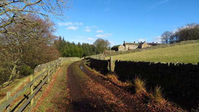
Hazlehead is a small village located in the county of Yorkshire, in the North of England. Situated on the edge of the scenic Yorkshire Dales, Hazlehead offers breathtaking views of rolling hills and lush green landscapes. The village is nestled in a valley, surrounded by picturesque countryside, making it a popular destination for nature lovers and those seeking tranquility.

With a population of around 500 residents, Hazlehead maintains a tight-knit and friendly community atmosphere. The village is characterized by its charming stone houses, some dating back several centuries, which add to its rustic charm. The local architecture is predominantly traditional English, with a scattering of small shops and amenities serving the community.

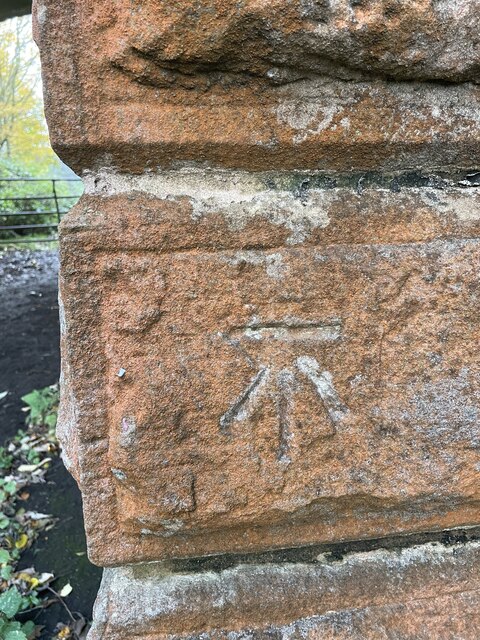
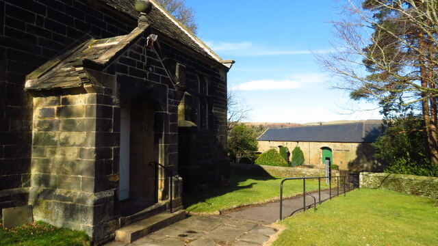
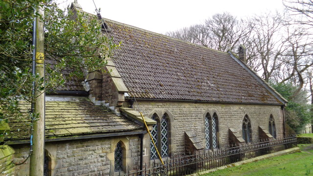
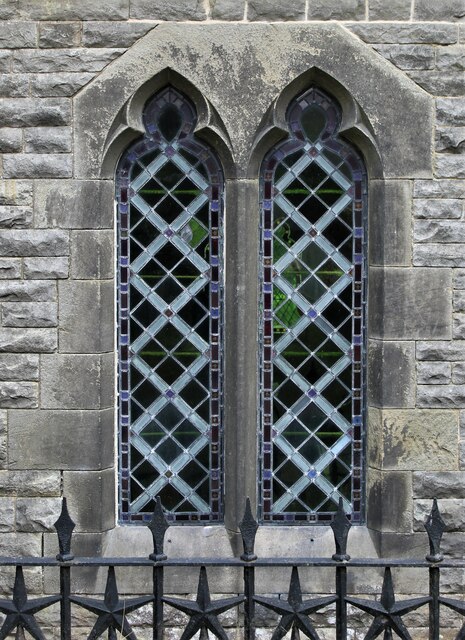
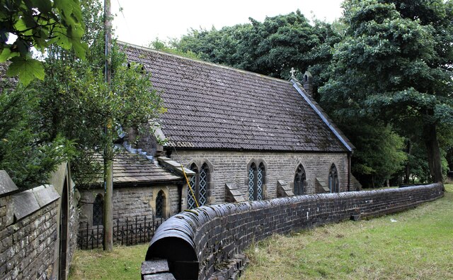
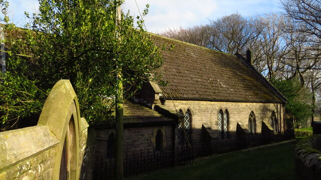
Hazlehead is known for its rich history, evident in the presence of historic landmarks and buildings. The village church, St. Mary's, is a prime example of medieval architecture and attracts visitors interested in its intricate stone carvings and stained glass windows.

The residents of Hazlehead enjoy a slower pace of life, far from the hustle and bustle of larger cities. The village offers a range of outdoor activities, such as hiking, cycling, and fishing, thanks to its close proximity to the Yorkshire Dales National Park. Additionally, Hazlehead hosts an annual summer fair, showcasing local crafts, produce, and traditional entertainment.

In conclusion, Hazlehead is a quaint and idyllic village in Yorkshire, offering a peaceful retreat amidst stunning natural surroundings. With its rich history, friendly community, and abundant outdoor opportunities, Hazlehead is a hidden gem for those seeking a genuine English countryside experience.

If you have any feedback on the listing, please let us know in the comments section below.
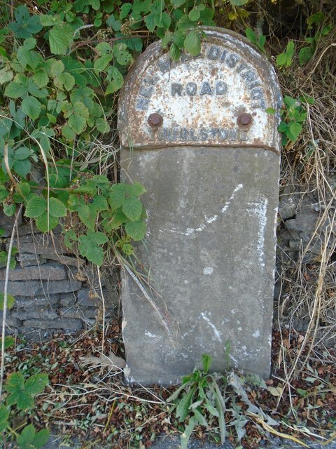
Hazlehead Images

Images are sourced within 2km of 53.522857/-1.709608 or Grid Reference SE1902. Thanks to Geograph Open Source API. All images are credited.

Bullhouse Railway Bridge OS BM on old Railway Bridge west of Bullhouse 
SE 2059 0256
Bullhouse Railway Bridge
OS BM on old Railway Bridge west of Bullhouse SE 2059 0256
Bullhouse Green Chapel near Millhouse Green
Track west of Bullhouse Hall near Millhouse Green
Old milestone I cleaned and repainted this milestone on the Doncaster Saltersbrook turnpike of 1740 in 2016.  It is on a piece of cut-off original road westwards from what was the Flouch Inn, now closed.  On a visit in 2021 the lettering was refreshed, always difficult on these old weathered stones.
Old milestone
I cleaned and repainted this milestone on the Doncaster Saltersbrook turnpike of 1740 in 2016. It is on a piece of cut-off original road westwards from what was the Flouch Inn, now closed. On a visit in 2021 the lettering was refreshed, always difficult on these old weathered stones.
Old milestone Just within the Barnsley boundary, in 2002 this West Riding CC milestone was without its backing stone and leaning <a href="https://www.geograph.org.uk/photo/6099189">SE1901 : Old Milestone by the A616, Whams Road, Dunford parish</a>. Later that year it was stolen. In 2021 it was seen on an auction site. Being 'listed' it was recovered and taken to Barnsley. I cleaned and repainted it, the Conservation Officer sourced a new stone and the Highways Department set it back by the roadside, just north of the last house on Whams Road, in July 2022. Grade II listed 1315028.
Old milestone
Just within the Barnsley boundary, in 2002 this West Riding CC milestone was without its backing stone and leaning SE1901 : Old Milestone by the A616, Whams Road, Dunford parish. Later that year it was stolen. In 2021 it was seen on an auction site. Being 'listed' it was recovered and taken to Barnsley. I cleaned and repainted it, the Conservation Officer sourced a new stone and the Highways Department set it back by the roadside, just north of the last house on Whams Road, in July 2022. Grade II listed 1315028.
Old milestone A view of the left side of the West Riding CC milestone dating from 1893/94 on Whams Road.   This shows the lovely piece of well shaped new stone to which the metal is attached by stainless steel bolts.
Old milestone
A view of the left side of the West Riding CC milestone dating from 1893/94 on Whams Road. This shows the lovely piece of well shaped new stone to which the metal is attached by stainless steel bolts.
Church of St Ann At Carlecotes Hall
Church of St Ann
At Carlecotes Hall
Old milestone This, once sad looking, sunken milestone at Crow Edge had, in 2017 been dug out and the wall behind it repaired.   It is one of the 615 milestones erected in 1893/94 by the family firm of Gill and Frank Stead of Mirfield for the newly-formed West Riding County Council.  Over half are still to be found by the roadside all over the old West Riding.   This one has been smartly painted in a similar pattern to several others in this part of Yorkshire.
Old milestone
This, once sad looking, sunken milestone at Crow Edge had, in 2017 been dug out and the wall behind it repaired. It is one of the 615 milestones erected in 1893/94 by the family firm of Gill and Frank Stead of Mirfield for the newly-formed West Riding County Council. Over half are still to be found by the roadside all over the old West Riding. This one has been smartly painted in a similar pattern to several others in this part of Yorkshire.
St Ann's Church, Carlecotes
Old milestone The remains of a West Riding CC milestone from 1893/94.   It lost its attachment sometime during the last quarter of the 20C.   Legends-lhs-HUDDERSFILD/10½ MILES/HOLMFIRTH/5 MILES.   Rhs-SHEFFIELD/16 MILES.   Top-NEW MILL DISTRICT/ROAD/THURLSTONE.   It is on the A616 just south of the crossroads with the B6106.   Although damaged it is Grade II listed 1151099.
Old milestone
The remains of a West Riding CC milestone from 1893/94. It lost its attachment sometime during the last quarter of the 20C. Legends-lhs-HUDDERSFILD/10½ MILES/HOLMFIRTH/5 MILES. Rhs-SHEFFIELD/16 MILES. Top-NEW MILL DISTRICT/ROAD/THURLSTONE. It is on the A616 just south of the crossroads with the B6106. Although damaged it is Grade II listed 1151099.
Becalmed No breeze this morning to turn the sails. This wind turbine at a works near Eckland, on the A628, has been here for many years-more than 30 to my recollection. Unlike it's neighbours on Spicer Hill in the distance, which are far more recent.
Becalmed
No breeze this morning to turn the sails. This wind turbine at a works near Eckland, on the A628, has been here for many years-more than 30 to my recollection. Unlike it's neighbours on Spicer Hill in the distance, which are far more recent.
Cottages at Catshaw Rural cottages on the cul-de-sac to Catshaw. View looking south-west.
Cottages at Catshaw
Rural cottages on the cul-de-sac to Catshaw. View looking south-west.
Bullhouse Mine water Remediation Scheme Ochreous discharge, caused by water building up inside the old Bullhouse colliery working (closed 1918), have long polluted the Upper Stretches of the Don. The minewater now passes over cascades to allow reaction with air prior to entering the lagoon, encouraging the ochre to drop out more quickly. After treatment in the lagoons, the water passes through a reedbed which  act as a further treatment level by trapping any remaining fine particles suspended in the water.
Bullhouse Mine water Remediation Scheme
Ochreous discharge, caused by water building up inside the old Bullhouse colliery working (closed 1918), have long polluted the Upper Stretches of the Don. The minewater now passes over cascades to allow reaction with air prior to entering the lagoon, encouraging the ochre to drop out more quickly. After treatment in the lagoons, the water passes through a reedbed which act as a further treatment level by trapping any remaining fine particles suspended in the water.
Wind Turbine Sunset View of wind turbine at Eckland with Spicer Hill in the distance.
Wind Turbine Sunset
View of wind turbine at Eckland with Spicer Hill in the distance.
A628 near Fullshaw Farm View along A628 towards Fullshaw Farm.
A628 near Fullshaw Farm
View along A628 towards Fullshaw Farm.
Bridleway near Catshaw With the wind farm on the horizon.
Bridleway near Catshaw
With the wind farm on the horizon.
Show me another place!

Hazlehead is located at Grid Ref: SE1902 (Lat: 53.522857, Lng: -1.709608)

Division: West Riding

Unitary Authority: Barnsley

Police Authority: South Yorkshire

What 3 Words

///juggled.celebrate.dogs. Near Penistone, South Yorkshire

Nearby Locations

Hazlehead Bracken Wood

Related Wikis

Hazlehead Bridge railway station

Hazlehead Bridge railway station was a railway station on the Sheffield, Ashton-under-Lyne and Manchester Railway's Woodhead Line. It served villages scattered...

Catshaw

Catshaw is a hamlet in the western parts of Penistone, in the Barnsley district, in the county of South Yorkshire, England. It lies about 0.9 miles (1...

Carlecotes

Carlecotes is a village in the metropolitan borough of Barnsley in South Yorkshire, England. Carlecotes is within Dunford civil parish. The village is...

Crow Edge

Crow Edge is a hamlet in Dunford civil parish, situated on the A616, two miles southeast of Hepworth, West Yorkshire in the metropolitan borough of Barnsley...

Royd Moor Wind Farm

The Royd Moor Wind Farm is located at Penistone, Barnsley, South Yorkshire, England, and consists of thirteen 450 kW turbines. The site is located approximately...

Millhouse Green

Millhouse Green is a village on the north banks of the River Don on the A628 road west of Penistone in the English county of South Yorkshire. Administratively...

Dunford

Dunford is a civil parish in the Metropolitan Borough of Barnsley, 14.5 miles (23.3 km) northwest of Sheffield in South Yorkshire, England. It lies in...

Dunford Bridge

Dunford Bridge is a remote hamlet in the civil parish of Dunford, lying northwest of Sheffield in South Yorkshire, England, 1.3 miles (2 km) from the...

Related Videos

UH OH COWS ! #outdoors #rucking #shortsvideo #hiking #walking #cowsmakemehappy #cowvideos #cattle

Out for a walk and we were challenged by cows . Not to worry we were at the other side of the wall.

Nobody's Business - Jim Darnill

Guitar arrangement Mississippi John Hurt (which I got from Keith Hinchcliffe) and I think the lyrics are traditional. Recorded near ...

1884 Bullhouse Railway Accident

Back in July 2023 I did a walking and droning video called "A Bridge Too Far" and you can find the link here.

Nearby Amenities

Located within 500m of 53.522857,-1.709608
Bus Stop
Whams Road/Hazlehead Bridge
Alt Name: Whams Road/Hazlehead Bridge
Naptan AltCommonName: Whams Road/Hazlehead Bridge
Naptan AtcoCode: 370055391
Naptan Bearing: N
Naptan CommonName: Whams Road/Hazlehead Bridge
Naptan Indicator: 55391
Naptan Landmark: Railway Bridge
Naptan PlusbusZoneRef: ROTHCEN
Naptan Street: Whams Road
Naptan Verified: no
Source: naptan_import
Lat/Long: 53.5234677/-1.708006
Bus Stop
Whams Road/Hazlehead Bridge
Alt Name: Whams Road/Hazlehead Bridge
Naptan AltCommonName: Whams Road/Hazlehead Bridge
Naptan AtcoCode: 370050976
Naptan Bearing: S
Naptan CommonName: Whams Road/Hazlehead Bridge
Naptan Indicator: 50976
Naptan Landmark: ABOVE RAILWAY BRIDGE
Naptan PlusbusZoneRef: ROTHCEN
Naptan Street: Whams Road
Naptan Verified: no
Source: naptan_import
Lat/Long: 53.5235661/-1.7078243
Design: barrel
Power: tower
Lat/Long: 53.52125/-1.7048828
Design: barrel
Power: tower
Lat/Long: 53.5209032/-1.7143151
Design: barrel
Power: tower
Lat/Long: 53.521513/-1.7094481
Barrier: stile
Lat/Long: 53.5211847/-1.7138462
Hazlehead
Place: hamlet
Lat/Long: 53.5224295/-1.7101076
Post Box
Collection Plate Date: 2017-07-20
Collection Times: Mo-Fr 16:00; Sa 09:00
Operator: Royal Mail
Post Box Type: lamp
Ref: S36 730
Royal Cypher: EIIR
Royal Cypher Wikidata: Q33102113
Source: survey
Lat/Long: 53.5228916/-1.7077154
Hazlehead Bridge
Disused Railway: station
Railway: site
Wikidata: Q5688304
Wikipedia: en:Hazlehead Bridge railway station
Lat/Long: 53.5221942/-1.7092245
Leisure: picnic_table
Lat/Long: 53.5218522/-1.7103377
Leisure: picnic_table
Lat/Long: 53.5218464/-1.7105193
Leisure: picnic_table
Lat/Long: 53.5216739/-1.7128964
Bench
Backrest: no
Lat/Long: 53.522143/-1.7100446
The data included in this document is from www.openstreetmap.org. The data is made available under ODbL.

Have you been to Hazlehead?

Leave your review of Hazlehead below (or comments, questions and feedback).