College Wold

Downs, Moorland in Yorkshire

England

College Wold

Road to New Grange Farm
Road to New Grange Farm Credit: David Brown

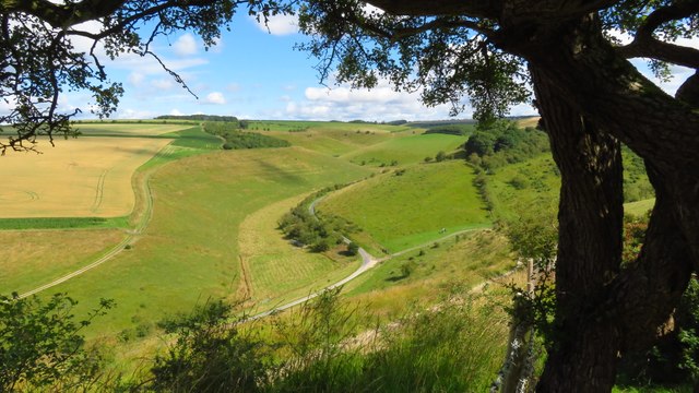
College Wold is a picturesque area located in the county of Yorkshire, England. Situated amidst the mesmerizing landscape of the Yorkshire Downs and Moorland, this region offers a diverse blend of natural beauty and historical significance.

The Yorkshire Downs dominate the eastern part of College Wold, characterized by rolling hills, expansive meadows, and breathtaking views. The area is renowned for its idyllic countryside, where visitors can enjoy leisurely walks, horseback riding, or simply immerse themselves in the tranquility of nature. The Downs are also home to a wide variety of wildlife, including hares, pheasants, and various bird species, making it an attractive destination for nature enthusiasts and birdwatchers.

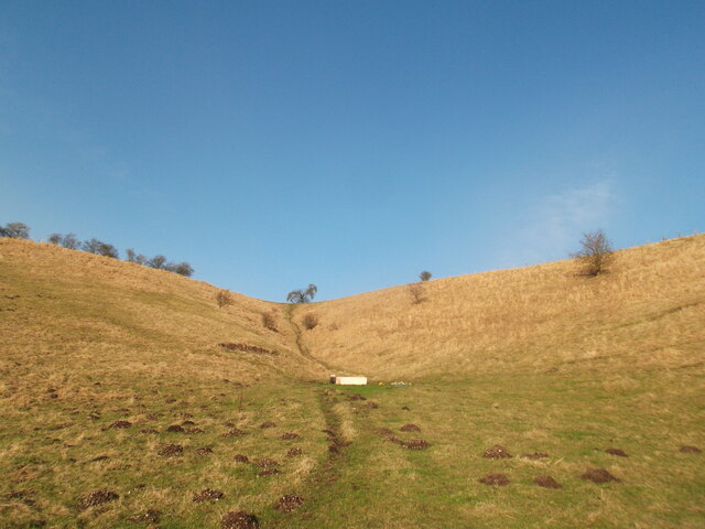
To the west lies the Moorland, a rugged and wild landscape that showcases the true essence of the Yorkshire countryside. This untamed region boasts vast expanses of heather-covered moors, interspersed with rocky outcrops and meandering streams. The Moorland is a haven for outdoor adventurers, offering opportunities for hiking, mountain biking, and even rock climbing.

College Wold is not only blessed with natural beauty but also boasts a rich historical heritage. The area is dotted with ancient ruins, medieval castles, and historic sites, providing glimpses into the region's fascinating past. Visitors can explore the ruins of old abbeys, such as Rievaulx Abbey, or immerse themselves in the history of Castle Howard, a magnificent stately home dating back to the 18th century.

In summary, College Wold in Yorkshire offers a captivating blend of natural wonders and historical charm. Whether seeking outdoor adventures, cultural exploration, or simply a peaceful retreat, this region has something to offer for all visitors.

If you have any feedback on the listing, please let us know in the comments section below.
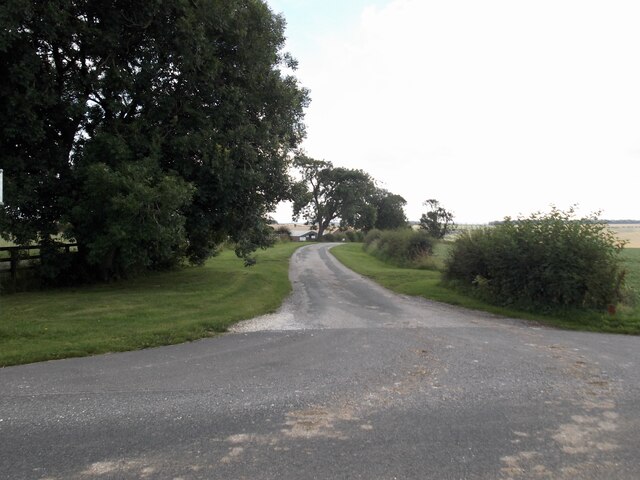
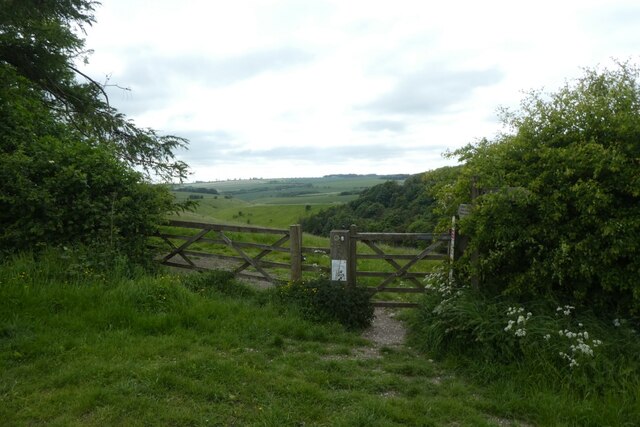
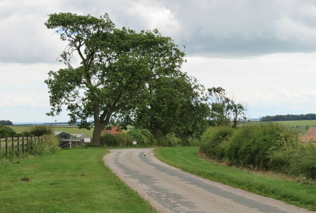
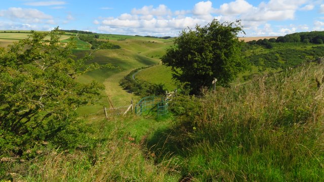
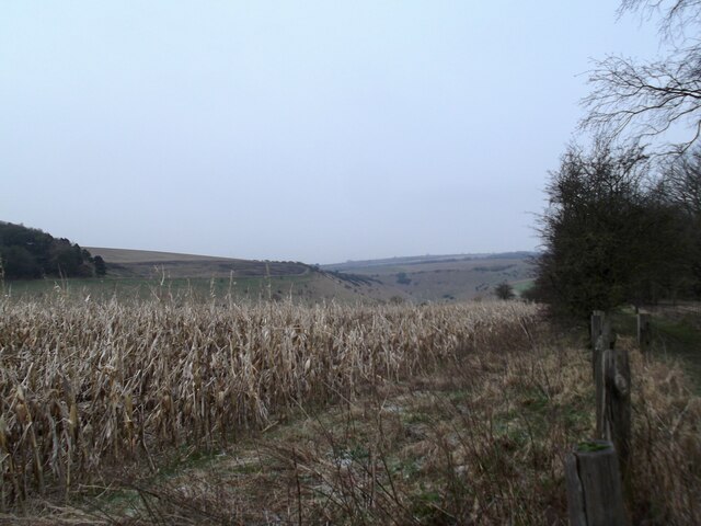
College Wold Images

Images are sourced within 2km of 53.987006/-0.71140615 or Grid Reference SE8455. Thanks to Geograph Open Source API. All images are credited.

Road to New Grange Farm
The Roman Road
The Roman Road
Sunset near Greenwick Farm Looking into the setting sun in the Wolds.
Sunset near Greenwick Farm
Looking into the setting sun in the Wolds.
Bridleway above Pasture Dale Looking towards a gate to access the bridleway above Pasture Dale heading towards Millington.
Bridleway above Pasture Dale
Looking towards a gate to access the bridleway above Pasture Dale heading towards Millington.
Track on Huggate Pasture Looking across farmland from a footpath between York Lane and Pocklington Lane.
Track on Huggate Pasture
Looking across farmland from a footpath between York Lane and Pocklington Lane.
Huggate Pasture in the setting sun Looking across the chalky farmland.
Huggate Pasture in the setting sun
Looking across the chalky farmland.
Bridleway to York Lane Looking along a path between Pocklington Lane and York Lane.
Bridleway to York Lane
Looking along a path between Pocklington Lane and York Lane.
Bridleway to Pocklington Lane Looking along a path from York Lane to Pocklington Lane.
Bridleway to Pocklington Lane
Looking along a path from York Lane to Pocklington Lane.
Sheep  at  the  head  of  Wayrham  Dale Through the gate beyond the sheep and up the track to the A166 and over to Wayrham Picnic Site
Sheep at the head of Wayrham Dale
Through the gate beyond the sheep and up the track to the A166 and over to Wayrham Picnic Site
Green Balk Green Balk is the name of this lane on old OS maps, but current editions show it as 'Roman Road', which appears likely, and was from somewhere on the Humber to Malton.
Green Balk
Green Balk is the name of this lane on old OS maps, but current editions show it as 'Roman Road', which appears likely, and was from somewhere on the Humber to Malton.
Road junction by Greenwick Cottage An almost identical shot to one taken by J Thomas in 2010. Here the minor road towards Huggate crosses the much busier Pockington to Fridaythorpe road.
Road junction by Greenwick Cottage
An almost identical shot to one taken by J Thomas in 2010. Here the minor road towards Huggate crosses the much busier Pockington to Fridaythorpe road.
Wayrham picnic site Useful parking area with picnic tables just off the busy A166, and a good place for starting a walk.
Wayrham picnic site
Useful parking area with picnic tables just off the busy A166, and a good place for starting a walk.
On the Minster Way - stile on path leading down to Millington Dale
On the Minster Way - interlocking spurs of Frendal Dale
A branch of Frendal Dale Kites above us in the sunshine. 20 minutes later it was snowing!
A branch of Frendal Dale
Kites above us in the sunshine. 20 minutes later it was snowing!
A cold day on the Wolds Way
Field by Jessop's Plantation Snow shower approaching
Field by Jessop's Plantation
Snow shower approaching
Wolds Way above Pasture Dale
Show me another place!

College Wold is located at Grid Ref: SE8455 (Lat: 53.987006, Lng: -0.71140615)

Division: East Riding

Unitary Authority: East Riding of Yorkshire

Police Authority: Humberside

What 3 Words

///selects.clef.afford. Near Millington, East Yorkshire

Related Wikis

Bishop Wilton Wold

Bishop Wilton Wold is the highest point of the Yorkshire Wolds in the East Riding of Yorkshire, England. The summit, known as Garrowby Hill, lies about...

Beckhead Plantation

Beckhead Plantation is a Site of Special Scientific Interest (SSSI) and nature reserve in the East Riding of Yorkshire, England. It is located close to...

Huggate

Huggate is a village and civil parish in the East Riding of Yorkshire, England. It is situated approximately 13 miles (21 km) north-west of Beverley town...

Great Givendale

Great Givendale is a hamlet in the East Riding of Yorkshire, England. It is situated approximately 3 miles (5 km) north of Pocklington. Great Givendale...

Nearby Amenities

Located within 500m of 53.987006,-0.71140615
Material: wood
Power: pole
Lat/Long: 53.9899871/-0.7161397
Material: wood
Power: pole
Lat/Long: 53.9891784/-0.7162647
Material: wood
Power: pole
Lat/Long: 53.988352/-0.7163805
Material: wood
Power: pole
Lat/Long: 53.9874929/-0.7165055
Material: wood
Power: pole
Lat/Long: 53.9869573/-0.7155377
Material: wood
Power: pole
Lat/Long: 53.9864265/-0.7145714
Material: wood
Power: pole
Lat/Long: 53.9858996/-0.7135984
Material: wood
Power: pole
Lat/Long: 53.9854027/-0.7126876
Generator Method: wind_turbine
Generator Source: wind
Power: generator
Lat/Long: 53.9848556/-0.7152327
Material: wood
Power: pole
Lat/Long: 53.9841392/-0.7115328
Material: wood
Power: pole
Lat/Long: 53.9848652/-0.711747
Material: wood
Power: pole
Lat/Long: 53.9833841/-0.7113117
Material: wood
Power: pole
Lat/Long: 53.9826427/-0.7111116
The data included in this document is from www.openstreetmap.org. The data is made available under ODbL.

Have you been to College Wold?

Leave your review of College Wold below (or comments, questions and feedback).