Blowpool Spinney

Downs, Moorland in Leicestershire Melton

England

Blowpool Spinney

B676 eastbound
B676 eastbound Credit: Alex McGregor

Blowpool Spinney is a picturesque woodland located in Leicestershire, England. Situated in the heart of the county, it covers an area of approximately 50 hectares. The spinney is characterized by its diverse range of habitats, including downs and moorland.

The site is known for its rich biodiversity and is home to a variety of flora and fauna. The woodland consists of a mix of native deciduous trees such as oak, birch, and hazel, interspersed with patches of open grassland. The downs provide a stunning panoramic view of the surrounding countryside, offering visitors a chance to appreciate the natural beauty of the area.

Blowpool Spinney is also home to a range of wildlife species. Birdwatchers can spot a wide array of species, including woodpeckers, owls, and various songbirds. The spinney also provides a habitat for small mammals like foxes, rabbits, and voles.

The site is popular among nature enthusiasts and walkers, who can explore the numerous trails that crisscross the spinney. These paths provide an opportunity to immerse oneself in the tranquil surroundings and enjoy the fresh air. In addition to its natural attractions, Blowpool Spinney also offers picnic areas and benches, making it an ideal spot for a family outing or a peaceful escape from the hustle and bustle of everyday life.

Overall, Blowpool Spinney in Leicestershire is a haven for nature lovers, offering a diverse range of habitats, stunning views, and a chance to encounter a variety of wildlife.

If you have any feedback on the listing, please let us know in the comments section below.

Blowpool Spinney Images

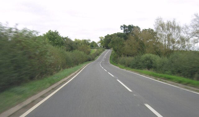
Images are sourced within 2km of 52.757345/-0.83003926 or Grid Reference SK7918. Thanks to Geograph Open Source API. All images are credited.

B676 eastbound
B676 eastbound
B676 eastbound
B676 eastbound
The Willow Pool If I wanted to dispose of Excalibur, at my Lord's command, this is the sort of place I would fling it.  Ancient, surviving, wrecked willows in a deep pool.

The pool is the remnant of recent rains, when the adjacent River Eye rose and met the torrents falling on the field.  This area is all low-lying wetland, and the Willow is the queen of the landscape.  

This is a stitch of 6 separate images of 6252x4164 pixels, stitched with Microsoft ICE to yield a panoramic shot of 13642x8203 pixels - subsequently downsized to suit Geograph.   The full stitch is available on request.
The Willow Pool
If I wanted to dispose of Excalibur, at my Lord's command, this is the sort of place I would fling it. Ancient, surviving, wrecked willows in a deep pool. The pool is the remnant of recent rains, when the adjacent River Eye rose and met the torrents falling on the field. This area is all low-lying wetland, and the Willow is the queen of the landscape. This is a stitch of 6 separate images of 6252x4164 pixels, stitched with Microsoft ICE to yield a panoramic shot of 13642x8203 pixels - subsequently downsized to suit Geograph. The full stitch is available on request.
Willow in the water One of the trees featured in <a href="https://www.geograph.org.uk/photo/7058886">SK8018 : The Willow Pool</a>.  It is very hard to dissuade a willow from growing, and they revel in wet feet.
Willow in the water
One of the trees featured in SK8018 : The Willow Pool. It is very hard to dissuade a willow from growing, and they revel in wet feet.
Wet enough for thee? One of the Willow trees seen in <a href="https://www.geograph.org.uk/photo/7058886">SK8018 : The Willow Pool</a>.  Broken, wrecked, drowned it still grows vigorously.  This won't be the first time it has stood in floodwater.
Wet enough for thee?
One of the Willow trees seen in SK8018 : The Willow Pool. Broken, wrecked, drowned it still grows vigorously. This won't be the first time it has stood in floodwater.
Ham Bridge  Ham Bridge, on the Eye River.
Ham Bridge
Ham Bridge, on the Eye River.
Downstream The river Eye at Ham Bridge, looking upstream
Downstream
The river Eye at Ham Bridge, looking upstream
Upstream The River Eye from the Ham Bridge
Upstream
The River Eye from the Ham Bridge
Gate lodges, Stapleford park
Thatched Lodge The gate lodge at Stapleford Park
Thatched Lodge
The gate lodge at Stapleford Park
Stapleford estate buildings "The School House" and "The Row"
Stapleford estate buildings
"The School House" and "The Row"
Woodland with cow parsley beside Woodfold Lane
Culvert for stream under Woodfold Lane Ordnance Survey documents indicate that a benchmark levelled at 96.238m above Newlyn Datum was verified in 1962 on the culvert
Culvert for stream under Woodfold Lane
Ordnance Survey documents indicate that a benchmark levelled at 96.238m above Newlyn Datum was verified in 1962 on the culvert
Cut Mark Cut mark on Ham bridge on road between Stapleford and Wyfordby, near Melton Mowbray.
Cut Mark
Cut mark on Ham bridge on road between Stapleford and Wyfordby, near Melton Mowbray.
Saxby Road
Saxby Road
Saxby Road
Saxby Road
B676 eastbound
B676 eastbound
B676 eastbound
B676 eastbound
Show me another place!

Blowpool Spinney is located at Grid Ref: SK7918 (Lat: 52.757345, Lng: -0.83003926)

Administrative County: Leicestershire

District: Melton

Police Authority: Leicestershire

What 3 Words

///takers.dispenser.onions. Near Melton Mowbray, Leicestershire

Related Wikis

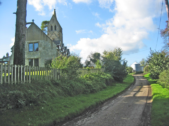
St Mary's Church, Brentingby

St Mary's Church is a redundant Anglican church in the village of Brentingby, Leicestershire, England. The walls of the church required renovation when...

Brentingby

Brentingby is a village in Leicestershire, England.The population is included in the civil parish of Freeby. The village's name means either 'farm/settlement...

River Eye SSSI

River Eye SSSI is a 6.0 hectares (15 acres) biological Site of Special Scientific Interest covering a stretch of the River Eye between Ham Bridge, north...

Stapleford Miniature Railway

Stapleford Miniature Railway is an historic steam locomotive-hauled 10+1⁄4 in (260 mm) gauge railway at Stapleford Park, Stapleford near Melton Mowbray...

Nearby Amenities

Located within 500m of 52.757345,-0.83003926
Railway: level_crossing
Lat/Long: 52.7603412/-0.8296066
Power: tower
Source: Bing
Lat/Long: 52.7531228/-0.8293648
Power: tower
Source: Bing
Lat/Long: 52.755602/-0.8306282
Power: tower
Source: Bing
Lat/Long: 52.7578523/-0.831862
Power: tower
Source: Bing
Lat/Long: 52.7600697/-0.8330408
Railway: level_crossing
Lat/Long: 52.7603805/-0.8296227
The data included in this document is from www.openstreetmap.org. The data is made available under ODbL.

Have you been to Blowpool Spinney?

Leave your review of Blowpool Spinney below (or comments, questions and feedback).