Broughton Moor

Downs, Moorland in Yorkshire Ryedale

England

Broughton Moor

Riverdene Farm
Riverdene Farm Credit: David Brown

Broughton Moor, located in Yorkshire, England, is a picturesque area known for its stunning downs and moorland landscapes. Situated in the county of North Yorkshire, Broughton Moor offers visitors a tranquil and serene environment to explore and appreciate the beauty of nature.

The downs in Broughton Moor are characterized by their gently rolling hills and wide open spaces. These grassy slopes offer breathtaking panoramic views of the surrounding countryside, making it a popular destination for hikers, nature enthusiasts, and photographers. The downs are also home to a diverse range of flora and fauna, including wildflowers, heather, and various species of birds.

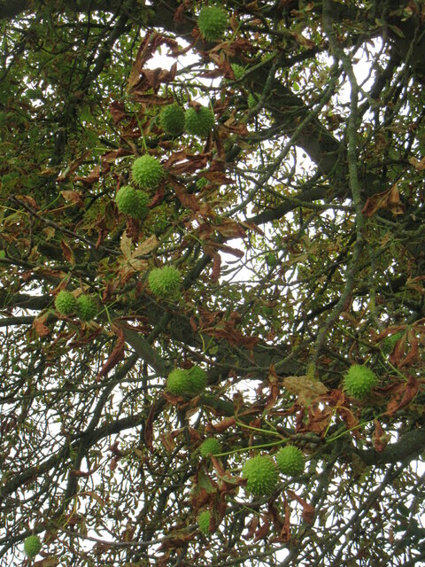
In addition to the downs, Broughton Moor boasts extensive moorland areas. Moorlands are characterized by their vast expanses of open, rugged terrain, covered in heather, grasses, and peat. These areas are rich in wildlife, with species such as red grouse, curlew, and golden plover thriving in this unique habitat. Moorland walks provide an opportunity to immerse oneself in the tranquil surroundings and experience the sense of solitude that comes with being in such a remote location.

Broughton Moor offers visitors a chance to escape the hustle and bustle of everyday life and immerse themselves in the natural beauty of the Yorkshire countryside. Whether it's exploring the rolling downs or venturing across the rugged moorland, visitors to Broughton Moor are sure to be captivated by its stunning landscapes and rich biodiversity.

If you have any feedback on the listing, please let us know in the comments section below.

Broughton Moor Images

Images are sourced within 2km of 54.157091/-0.82302065 or Grid Reference SE7674. Thanks to Geograph Open Source API. All images are credited.

Riverdene Farm
Riverdene Farm
Derelict cottage Only the for sale sign has gone
Derelict cottage
Only the for sale sign has gone
Near Swinton You could feel the heat coming from the straw on this warm (22°c) afternoon.
Near Swinton
You could feel the heat coming from the straw on this warm (22°c) afternoon.
Ryton Riggs Road Looking west along this minor road near Garforth Hall.
Ryton Riggs Road
Looking west along this minor road near Garforth Hall.
Farm buildings at Riverdene Looking west along the Ryton Riggs Road towards a series of large farm buildings and residences at Riverdene.
Farm buildings at Riverdene
Looking west along the Ryton Riggs Road towards a series of large farm buildings and residences at Riverdene.
Footpath to Swinton Looking onto the footpath from Amotherby Lane.
Footpath to Swinton
Looking onto the footpath from Amotherby Lane.
Amotherby Lane Looking along Amotherby Lane near a footpath leading to Swinton.
Amotherby Lane
Looking along Amotherby Lane near a footpath leading to Swinton.
The Queen's Head Looking toward the pub and Cantonese restaurant in Amotherby.
The Queen's Head
Looking toward the pub and Cantonese restaurant in Amotherby.
Passing the Queen's Head Looking through the village of Amotherby.
Passing the Queen's Head
Looking through the village of Amotherby.
Conkers on a tree Conkers on a Horse Chestnut tree near Swinton.
Conkers on a tree
Conkers on a Horse Chestnut tree near Swinton.
Broughton main street In fact, almost the only street in this little dead end village just off the B1257.
Broughton main street
In fact, almost the only street in this little dead end village just off the B1257.
Farm access road at Broughton The concrete surfaced road is here following the course of the old NER Thirsk and Malton Railway line.
Farm access road at Broughton
The concrete surfaced road is here following the course of the old NER Thirsk and Malton Railway line.
Swinton scrapyard This is the sort of scene that one might expect to see at somewhere like Swinton in Greater Manchester, but not here in rural North Yorkshire. As the old saying goes - 'where there's muck, there's brass.'
Swinton scrapyard
This is the sort of scene that one might expect to see at somewhere like Swinton in Greater Manchester, but not here in rural North Yorkshire. As the old saying goes - 'where there's muck, there's brass.'
Low Lane, Swinton A bridleway and farm track that heads across the low ground to the north of the village. Walking the whole length will bring you to the bank of the River Rye, where the right of way ends. What then, swim?
Low Lane, Swinton
A bridleway and farm track that heads across the low ground to the north of the village. Walking the whole length will bring you to the bank of the River Rye, where the right of way ends. What then, swim?
West Street, Swinton Swinton consists of West, East and Middle Streets, but the vast majority of motorists will see none of these as they journey along the Malton to Helmsley road that cuts across the top of the village.
West Street, Swinton
Swinton consists of West, East and Middle Streets, but the vast majority of motorists will see none of these as they journey along the Malton to Helmsley road that cuts across the top of the village.
Old Milestone, on the B1257, 60m E of East Street; opposite Cherry Tree Cottage, Next to Atkin Motor Engineers. Located on the North side of road, on high verge. Cast iron post, Bedale casting design, 19th century. 

Inscription reads: {hand to right} / MALTON / 2 / MILES // {hand to left} / HELMSLEY / 14 / KIRBYMOORSIDE / 11 // F. MATTISON & Co / BEDALE//. 

Grade II listed by Historic England <span class="nowrap"><a title="https://historicengland.org.uk/listing/the-list/list-entry/1149123" rel="nofollow ugc noopener" href="https://historicengland.org.uk/listing/the-list/list-entry/1149123">Link</a><img style="margin-left:2px;" alt="External link" title="External link - shift click to open in new window" src="https://s1.geograph.org.uk/img/external.png" width="10" height="10"/></span>

Milestone Society National ID: YN_MAHM02
Old Milestone, on the B1257, 60m E of East Street; opposite Cherry Tree Cottage,
Next to Atkin Motor Engineers. Located on the North side of road, on high verge. Cast iron post, Bedale casting design, 19th century. Inscription reads: {hand to right} / MALTON / 2 / MILES // {hand to left} / HELMSLEY / 14 / KIRBYMOORSIDE / 11 // F. MATTISON & Co / BEDALE//. Grade II listed by Historic England LinkExternal link Milestone Society National ID: YN_MAHM02
Old milepost On the B1257 in Swinton this neglected milepost made by F Mattison and Co., Bedale is 60m east of East Street.  On this autumn day surrounded by long grass and white yarrow plants.   Kirkbymoorside is now spelt with the extra K. 
 Grade II listed  1149123.
Old milepost
On the B1257 in Swinton this neglected milepost made by F Mattison and Co., Bedale is 60m east of East Street. On this autumn day surrounded by long grass and white yarrow plants. Kirkbymoorside is now spelt with the extra K. Grade II listed 1149123.
Old milepost Looking in the direction of Malton the yarrow covered banking surrounds the milepost.   This would have been forged at the Mattison foundry at the end of the 19thC or beginning of the 20thC.  Grade II listed 1149123.
Old milepost
Looking in the direction of Malton the yarrow covered banking surrounds the milepost. This would have been forged at the Mattison foundry at the end of the 19thC or beginning of the 20thC. Grade II listed 1149123.
Show me another place!

Broughton Moor is located at Grid Ref: SE7674 (Lat: 54.157091, Lng: -0.82302065)

Division: North Riding

Administrative County: North Yorkshire

District: Ryedale

Police Authority: North Yorkshire

What 3 Words

///nibbles.capillary.works. Near Malton, North Yorkshire

Related Wikis

Broughton, Ryedale

Broughton is a village and civil parish in North Yorkshire, England. Broughton is situated 1.5 miles (2.4 km) north-west of Malton. According to the 2011...

Swinton, Ryedale

Swinton is a village and civil parish in North Yorkshire, England. It is about 2 miles (3.2 km) west of Malton on the B1257 road, and is on the edge of...

Amotherby

Amotherby is a village and civil parish in North Yorkshire, England. It is about 3 miles (4.8 km) west of Malton. == Description == The village appears...

Amotherby railway station

Amotherby railway station served the village of Amotherby in the Northern English county of North Yorkshire. It was located on a local line which ran...

Habton

Habton is a civil parish in the Ryedale district of North Yorkshire, England. In 2011, it had a population of 321. == History == The name "Habton" means...

Great Habton

Great Habton is a village and former civil parish about 18 miles from York, now in the parish of Habton, in the Ryedale district, in the county of North...

Malton Community Hospital

Malton Community Hospital is a health facility in Middlecave Road, Malton, North Yorkshire, England. It is managed by York and Scarborough Teaching Hospitals...

Malton Town Hall

Malton Town Hall is a municipal building in the Market Place, Malton, North Yorkshire, England. The structure, which is used as a restaurant, is a grade...

Nearby Amenities

Located within 500m of 54.157091,-0.82302065
Power: tower
Lat/Long: 54.1568681/-0.8259918
Power: tower
Lat/Long: 54.1559383/-0.819018
Power: tower
Lat/Long: 54.1574586/-0.829661
Power: tower
Lat/Long: 54.1563604/-0.8224094
The data included in this document is from www.openstreetmap.org. The data is made available under ODbL.

Have you been to Broughton Moor?

Leave your review of Broughton Moor below (or comments, questions and feedback).