Eythrope Park

Downs, Moorland in Buckinghamshire

England

Eythrope Park

Farmland, Stone A bridleway beside wheat to the south of the River Thame.
Farmland, Stone Credit: Andrew Smith

Eythrope Park is a picturesque estate located in Buckinghamshire, England. Spanning over 1,000 acres, the park is known for its diverse landscape, featuring beautiful downs and moorland. The park is privately owned and has been for generations by the Rothschild family.

The downs in Eythrope Park are characterized by rolling hills covered in lush grasses and dotted with vibrant wildflowers. The park's downs provide a perfect habitat for a variety of wildlife, including rabbits, hares, and various bird species. Visitors can enjoy leisurely walks or picnics while taking in the stunning views of the surrounding countryside.

Moving towards the moorland, Eythrope Park offers a contrasting landscape with its heather-covered hills and open spaces. This unique habitat supports a range of wildlife, including birds of prey such as kestrels and buzzards. The moorland also provides a home for a variety of plant species, including heather, gorse, and bilberry.

Eythrope Park is not open to the public; however, it can be admired from afar, offering a peaceful and idyllic backdrop to the surrounding area. The park's natural beauty and tranquility make it a popular spot for nature enthusiasts and photographers.

Overall, Eythrope Park in Buckinghamshire is a captivating estate that showcases the splendor of the downs and moorland landscapes. Its diverse ecosystem, rich wildlife, and breathtaking views make it a hidden gem nestled in the heart of the English countryside.

If you have any feedback on the listing, please let us know in the comments section below.

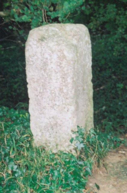
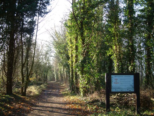
Eythrope Park Images

Images are sourced within 2km of 51.822955/-0.88813171 or Grid Reference SP7614. Thanks to Geograph Open Source API. All images are credited.

Farmland, Stone A bridleway beside wheat to the south of the River Thame.
Farmland, Stone
A bridleway beside wheat to the south of the River Thame.
The River Thame, Stone Beside a junction of a bridleway and footpath.  The Thame Valley Walk, Midshires Way and North Bucks Way all pass by.
The River Thame, Stone
Beside a junction of a bridleway and footpath. The Thame Valley Walk, Midshires Way and North Bucks Way all pass by.
Farmland, Waddesdon A cut silage field rises from the River Thame to Beachendon Farm.
Farmland, Waddesdon
A cut silage field rises from the River Thame to Beachendon Farm.
Farmland, Waddesdon A field of wheat on the hillside rising to Beachendon Farm.
Farmland, Waddesdon
A field of wheat on the hillside rising to Beachendon Farm.
Ruined farm building near Stone The land is owned by the Ernest Cook Trust, a charity which improves educational opportunities for young people, particularly in relation to agricultural land. The land is in the valley of the River Tame.
Ruined farm building near Stone
The land is owned by the Ernest Cook Trust, a charity which improves educational opportunities for young people, particularly in relation to agricultural land. The land is in the valley of the River Tame.
Field below The Nursery The Nursery is the woodland at the top. The hills form the southern side of the Tame Valley.
Field below The Nursery
The Nursery is the woodland at the top. The hills form the southern side of the Tame Valley.
Field entrance off Eythrope Road Some flooding of the River Tame can be seen ahead.
Field entrance off Eythrope Road
Some flooding of the River Tame can be seen ahead.
Eythrope Road A long private road mostly with high hedges, and part of the Waddesdon Estate.
Eythrope Road
A long private road mostly with high hedges, and part of the Waddesdon Estate.
Footpath to Upton Crossing farmland in the Tame Valley.
Footpath to Upton
Crossing farmland in the Tame Valley.
Eythrope Road A private road with high hedges in the Waddesdon Estate.
Eythrope Road
A private road with high hedges in the Waddesdon Estate.
Flooded field by Eythrope Road This is normal seasonal flooding in the Thame Valley.
Flooded field by Eythrope Road
This is normal seasonal flooding in the Thame Valley.
Part of the River Thame near Eythrope The river has more than one channel here. Seasonal flooding in nearby fields is also visible.
Part of the River Thame near Eythrope
The river has more than one channel here. Seasonal flooding in nearby fields is also visible.
Leafy track near Eythrope The track is used by several footpaths, the Thame Valley Walk, the North Buckinghamshire Way and the Midshires Way, as it proceeds up the Thame Valley.
Leafy track near Eythrope
The track is used by several footpaths, the Thame Valley Walk, the North Buckinghamshire Way and the Midshires Way, as it proceeds up the Thame Valley.
The Thame flood plain This bit is well drained and the track stays dry.
The Thame flood plain
This bit is well drained and the track stays dry.
The Thame Valley Walk near Weir Lodge The path is slightly higher than the flood plain making this a drier stretch.
The Thame Valley Walk near Weir Lodge
The path is slightly higher than the flood plain making this a drier stretch.
River Thame near Eythrope Showing moderate flooding at this point.
River Thame near Eythrope
Showing moderate flooding at this point.
The Thame Valley Walk A slightly higher and drier section.
The Thame Valley Walk
A slightly higher and drier section.
Old Milestone by bridleway north of Stone, Bucks Carved stone post by the UC road, in parish of Stone with Bishopstone and Hartwell (Aylesbury Vale District), Eythrope Lane; bridleway on a private road down to Eythrope Park from Stone, on hill, on the bank of the old road, now about 20m into the spinney alongside tarmac road, on East side of road. Erected by a private estate in the 18th century. 

Inscription reads:-
XLI( )
Miles from
London

Buckinghamshire HER.
HER Number: 1358700000 <span class="nowrap"><a title="https://www.heritagegateway.org.uk/Gateway/Results_Single.aspx?uid=MBC25742&resourceID=1024" rel="nofollow ugc noopener" href="https://www.heritagegateway.org.uk/Gateway/Results_Single.aspx?uid=MBC25742&resourceID=1024">Link</a><img style="margin-left:2px;" alt="External link" title="External link - shift click to open in new window" src="https://s1.geograph.org.uk/img/external.png" width="10" height="10"/></span>

Milestone Society National ID: BU_ZSTO44
Old Milestone by bridleway north of Stone, Bucks
Carved stone post by the UC road, in parish of Stone with Bishopstone and Hartwell (Aylesbury Vale District), Eythrope Lane; bridleway on a private road down to Eythrope Park from Stone, on hill, on the bank of the old road, now about 20m into the spinney alongside tarmac road, on East side of road. Erected by a private estate in the 18th century. Inscription reads:- XLI( ) Miles from London Buckinghamshire HER. HER Number: 1358700000 LinkExternal link Milestone Society National ID: BU_ZSTO44
Show me another place!

Eythrope Park is located at Grid Ref: SP7614 (Lat: 51.822955, Lng: -0.88813171)

Unitary Authority: Buckinghamshire

Police Authority: Thames Valley

What 3 Words

///speaking.remaking.compliant. Near Stone, Buckinghamshire

Related Wikis

Swan's Way (footpath)

Swan's Way is a long distance bridle route and footpath in Northamptonshire, Buckinghamshire and Oxfordshire, England. It runs 65 miles (105 km) from...

Eythrope

Eythrope (previously Ethorp) is a hamlet and country house in the parish of Waddesdon, in Buckinghamshire, England. It is located to the south east of...

Strict and Particular Baptist Chapel, Waddesdon

The Strict and Particular Baptist Chapel, is a former Strict Baptist chapel in Waddesdon Hill, near the village of Waddesdon, Buckinghamshire, England...

Thame Valley Viaduct

The Thame Valley Viaduct is a viaduct which will carry the High Speed 2 railway line in the United Kingdom. It traverses the River Thame near Aylesbury...

Nearby Amenities

Located within 500m of 51.822955,-0.88813171
Barrier: kissing_gate
Material: wood
Stile: stepover
Lat/Long: 51.8207909/-0.8934934
Barrier: stile
Lat/Long: 51.8219814/-0.8951177
The data included in this document is from www.openstreetmap.org. The data is made available under ODbL.

Have you been to Eythrope Park?

Leave your review of Eythrope Park below (or comments, questions and feedback).