Roxby Park

Downs, Moorland in Yorkshire Scarborough

England

Roxby Park

Borrowby Moor Looking east across Borrowby Moor from Moor Lane.
Borrowby Moor Credit: T Eyre

Roxby Park is a picturesque village located in the heart of Yorkshire, England. Situated amidst the stunning landscapes of the Yorkshire Downs and Moorland, the village offers a tranquil and idyllic setting for residents and visitors alike.

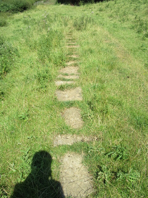
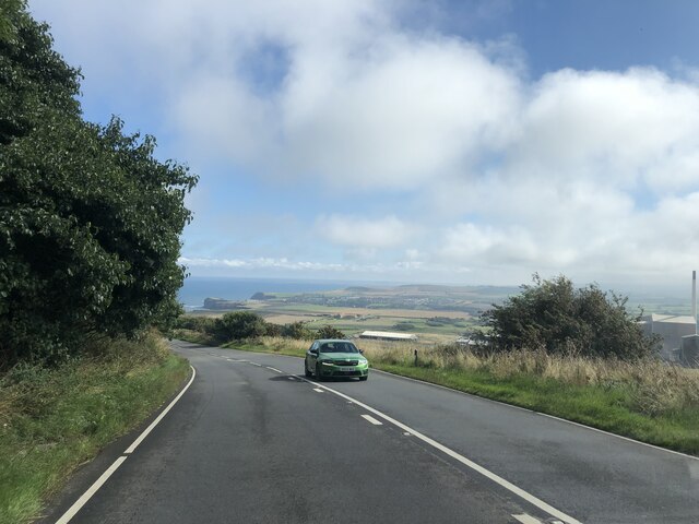
Surrounded by rolling hills and lush greenery, Roxby Park is renowned for its natural beauty. The Yorkshire Downs, with their sweeping vistas and expansive open spaces, provide ample opportunities for outdoor activities such as hiking, cycling, and horseback riding. The Moorland, characterized by its rugged terrain and heather-covered hills, offers a unique and captivating landscape for exploration.

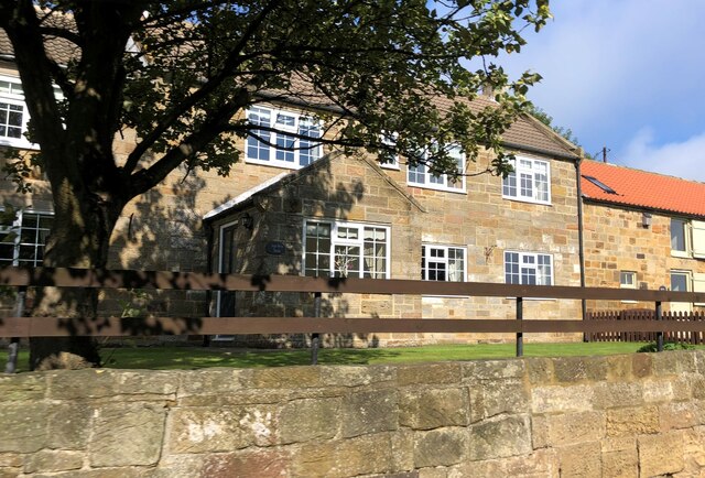
The village itself is a charming and close-knit community, with traditional stone cottages and well-maintained gardens lining its streets. The local pub, The Fox and Hound, is a popular gathering spot for residents and visitors, offering a warm and friendly atmosphere along with delicious traditional Yorkshire cuisine.

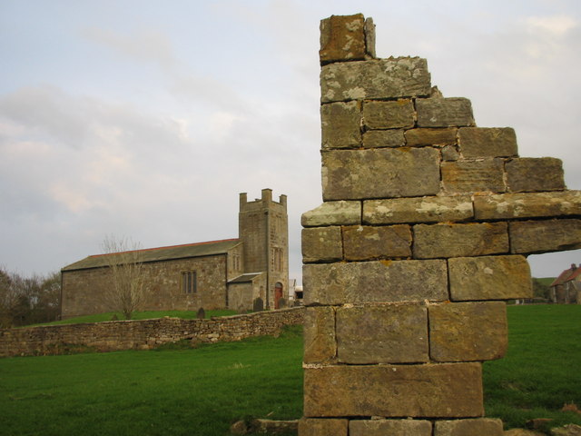
Roxby Park is also home to a number of historical landmarks and points of interest. The St. Mary's Church, a beautiful medieval building, stands as a testament to the village's rich history. The Roxby Hall, a magnificent stately home dating back to the 17th century, is another noteworthy attraction.

For those seeking a peaceful and scenic retreat, Roxby Park in Yorkshire is an ideal destination. Its combination of natural beauty, quaint village charm, and historical significance make it a truly remarkable place to visit or call home.

If you have any feedback on the listing, please let us know in the comments section below.
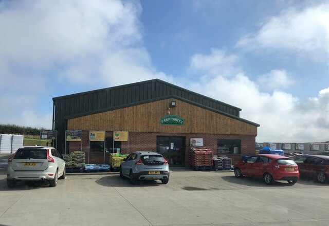
Roxby Park Images

Images are sourced within 2km of 54.540167/-0.8258896 or Grid Reference NZ7616. Thanks to Geograph Open Source API. All images are credited.

Borrowby Moor Looking east across Borrowby Moor from Moor Lane.
Borrowby Moor
Looking east across Borrowby Moor from Moor Lane.
Footpath near Roxby A footpath goes west here, there was a Wall Brown butterfly seen on a wall in this area.
Footpath near Roxby
A footpath goes west here, there was a Wall Brown butterfly seen on a wall in this area.
Boulby Potash Mine Boulby Potash Mine seen from just outside Roxby.
Boulby Potash Mine
Boulby Potash Mine seen from just outside Roxby.
Near Roxby Looking west from the top of the hill near Roxby.
Near Roxby
Looking west from the top of the hill near Roxby.
Keld Hill Looking north towards Staithes from the top of Keld Hill.
Keld Hill
Looking north towards Staithes from the top of Keld Hill.
Keld Hill view Looking east from Keld Hill.
Keld Hill view
Looking east from Keld Hill.
Stone trod near Plum Tree House A short stretch of flagstones south of Plum Tree House.
Stone trod near Plum Tree House
A short stretch of flagstones south of Plum Tree House.
Stone trod near Plum Tree House 2 More flagstone south of Plum Tree House.
Stone trod near Plum Tree House 2
More flagstone south of Plum Tree House.
Farm Direct Country Store
Holiday cottage at Ings Farm
Heading to the coast on Whitby Road The village of Staithes in the distance
Heading to the coast on Whitby Road
The village of Staithes in the distance
Cowbar, Red House Farm The OS Flush Bracket 10315 is embedded into the gable end of the farmhouse and is facing west.
Cowbar, Red House Farm
The OS Flush Bracket 10315 is embedded into the gable end of the farmhouse and is facing west.
Cowbar, Red House Farm The OS Flush Bracket 10315 is embedded into the gable end of the farmhouse and is located bottom left hand corner.
Cowbar, Red House Farm
The OS Flush Bracket 10315 is embedded into the gable end of the farmhouse and is located bottom left hand corner.
Boulby, A174 According to the OS benchmark database there was a roadside seat alongside this hedgerow. The concrete surround had a benchmark. It has been removed, and the benchmark destroyed.
Boulby, A174
According to the OS benchmark database there was a roadside seat alongside this hedgerow. The concrete surround had a benchmark. It has been removed, and the benchmark destroyed.
Old milepost This North Riding 'rose' milepost was cast by F Mattison & Co. Bedale.  Their name is cast inside the back left-hand side.   It is on the north side of the road near some derelict buildings at Red House Farm.  Boulby potash mine is across the A174 to the southwest.   Painted professionally several years ago.
Old milepost
This North Riding 'rose' milepost was cast by F Mattison & Co. Bedale. Their name is cast inside the back left-hand side. It is on the north side of the road near some derelict buildings at Red House Farm. Boulby potash mine is across the A174 to the southwest. Painted professionally several years ago.
Farm  Direct  Easington  on  A174  leaving village A large operation, Farm Shop. Tea Room. Country Store and Garden Centre. The post sticking up in the centre above the trees is a telecommunication mast
Farm Direct Easington on A174 leaving village
A large operation, Farm Shop. Tea Room. Country Store and Garden Centre. The post sticking up in the centre above the trees is a telecommunication mast
Old milepost This view along the A174 shows the buildings of Red House Farm just beyond the milepost.
Old milepost
This view along the A174 shows the buildings of Red House Farm just beyond the milepost.
Boulby Mine from the A174
Show me another place!

Roxby Park is located at Grid Ref: NZ7616 (Lat: 54.540167, Lng: -0.8258896)

Division: North Riding

Administrative County: North Yorkshire

District: Scarborough

Police Authority: North Yorkshire

What 3 Words

///they.retain.states. Near Loftus, North Yorkshire

Nearby Locations

The Oaks Roxby Park

Related Wikis

Roxby Hall

Roxby Hall (or Rousby Hall) is a former manor house or castle in the town of Roxby, North Yorkshire, England. Only one ruined corner and earthworks of...

Roxby, North Yorkshire

Roxby (formerly Rousby) is a village and civil parish in the Scarborough district of North Yorkshire, England. It is located near Staithes. The population...

Grinkle Mine

Grinkle Mine, was an ironstone mine working the main Cleveland Seam near to Roxby in North Yorkshire, England. Initially, the ironstone was mined specifically...

ZEPLIN-III

The ZEPLIN-III dark matter experiment attempted to detect galactic WIMPs using a 12 kg liquid xenon target. It operated from 2006 to 2011 at the Boulby...

Related Videos

STAITHES | Full tour of Staithes North Yorkshire England | Virtual Walking Tour filmed in 4K

STAITHES | Full tour of Staithes North Yorkshire England | Virtual Walking Tour filmed in 4K Full village tour of Staithes including ...

Kettleness to Staithes | HIKING the Cleveland Way | UK

The UK Hidden East Coast! #staithes #yorkshiremoors #kettleness #yorkshire #clevelandway #hiking #vanlife A beautiful 15km ...

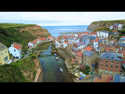
Staithes and Whitby - a Walking Tour

A first ever visit to the charming fishing village of Staithes on the North Yorkshire Coast. Home to the famous explorer Captain ...

Staithes Village Walk, English Countryside 4k

https://www.buymeacoffee.com/Daveswalks All support is hugely appreciated and it helps me keep the channel going! No talking ...

Nearby Amenities

Located within 500m of 54.540167,-0.8258896
Power: pole
Lat/Long: 54.5362239/-0.8289962
Power: pole
Lat/Long: 54.5367101/-0.8300537
Power: pole
Lat/Long: 54.5372235/-0.8311703
Access: no
Barrier: stile
Foot: designated
Stile: stepover
Lat/Long: 54.542852/-0.8251573
Manor Farm
Place: farm
Source Name: OS_OpenData_StreetView
Lat/Long: 54.5360315/-0.8250824
The data included in this document is from www.openstreetmap.org. The data is made available under ODbL.

Have you been to Roxby Park?

Leave your review of Roxby Park below (or comments, questions and feedback).