Redman Plain

Downs, Moorland in Yorkshire Ryedale

England

Redman Plain

Ironstone  kilns  at  Rosedale  Bank  Top A decent footpath runs from the car park past here to the old railway track
Ironstone kilns at Rosedale Bank Top Credit: Martin Dawes

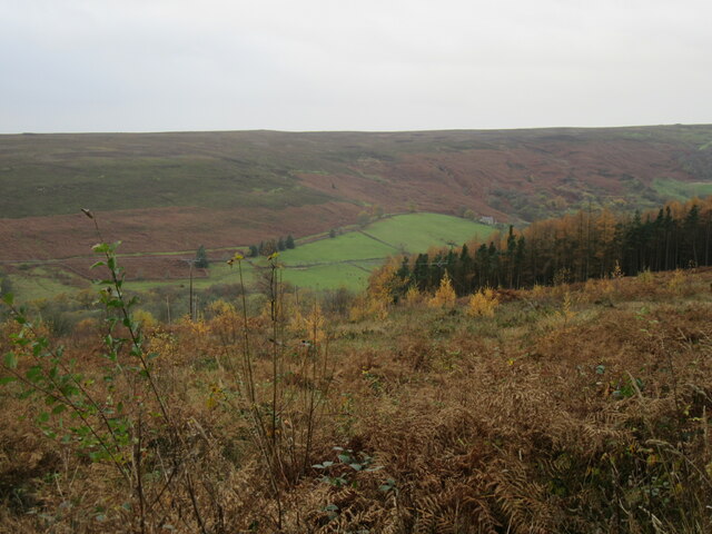
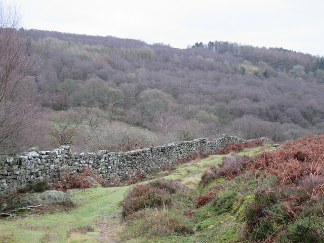
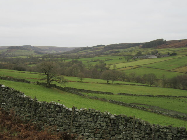
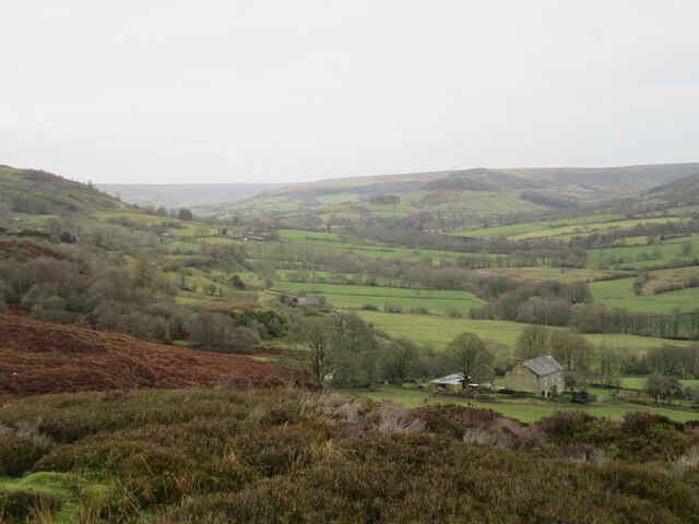
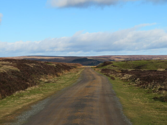
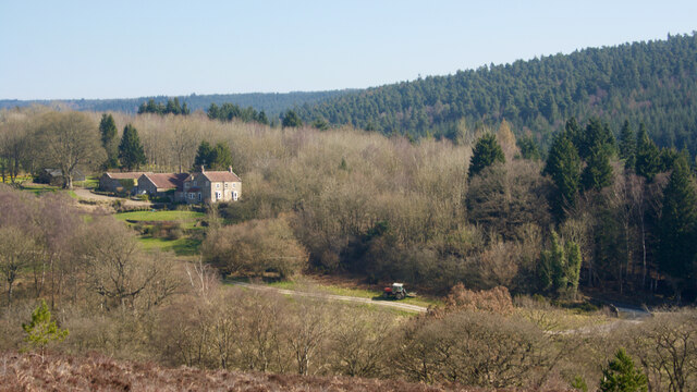
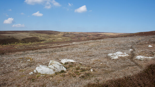
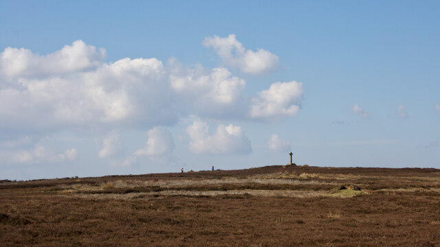
Redman Plain is a picturesque area located in Yorkshire, England. Situated amidst the stunning countryside of the Yorkshire Downs and Moorland, it covers a vast expanse of rolling hills, moors, and meadows. The landscape is characterized by its rugged beauty, with gentle slopes, heather-covered moorland, and scattered patches of woodland.

The plain is renowned for its breathtaking panoramic views, offering visitors a stunning vista of the surrounding countryside. The area is a haven for outdoor enthusiasts, offering a plethora of activities such as hiking, cycling, and birdwatching. The Yorkshire Downs, with their well-maintained footpaths, provide excellent opportunities for exploration, allowing visitors to immerse themselves in the natural beauty of the area.

Redman Plain is also home to a diverse range of flora and fauna. The moorland is adorned with vibrant purple heather during the summer months, creating a captivating sight. The area is a sanctuary for various bird species, including skylarks, curlews, and golden plovers, making it a paradise for birdwatchers.

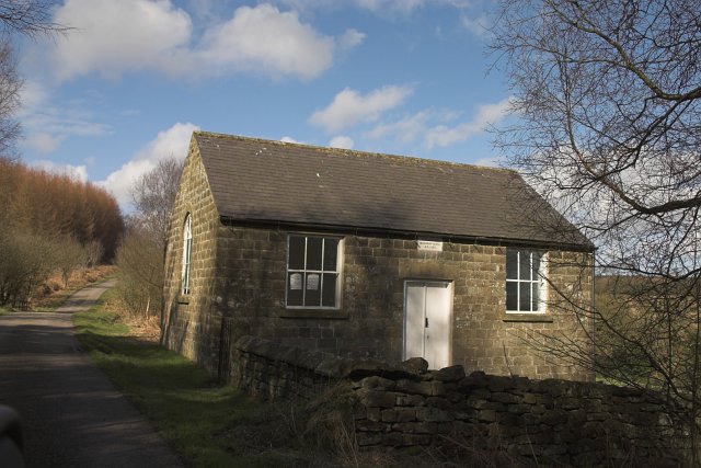
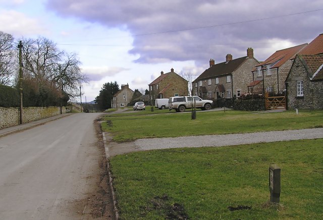
The tranquility and solitude offered by Redman Plain make it an ideal destination for those seeking respite from the hustle and bustle of city life. The area is dotted with charming villages and hamlets, where visitors can indulge in traditional Yorkshire hospitality and explore local attractions. The nearby market towns offer a variety of amenities, including cozy pubs, quaint shops, and historic landmarks.

Redman Plain, with its stunning natural scenery and rich biodiversity, is a must-visit destination for nature lovers and adventurers alike.

If you have any feedback on the listing, please let us know in the comments section below.

Redman Plain Images

Images are sourced within 2km of 54.332307/-0.87741652 or Grid Reference SE7393. Thanks to Geograph Open Source API. All images are credited.
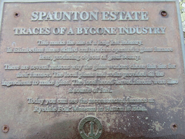
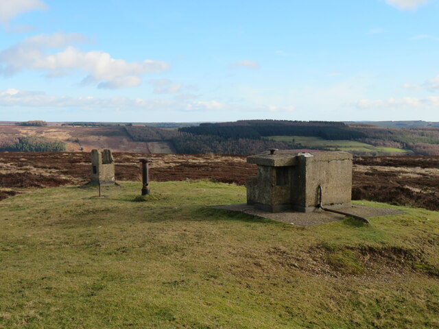
Ironstone  kilns  at  Rosedale  Bank  Top A decent footpath runs from the car park past here to the old railway track
Ironstone kilns at Rosedale Bank Top
A decent footpath runs from the car park past here to the old railway track
Path  to  Rosedale  Bank  Top  Ironstone  Kilns Rosedale Chimney stood above them until it was demolished in 1972
Path to Rosedale Bank Top Ironstone Kilns
Rosedale Chimney stood above them until it was demolished in 1972
Information  Board  at  Bank  Top  Kilns
Information Board at Bank Top Kilns
View from Hartoft Woods Looking west into Rosedale from the access road to Allotment Farm.
View from Hartoft Woods
Looking west into Rosedale from the access road to Allotment Farm.
Rosedale glassworks Information sign at the site of the Rosedale glassworks.
Rosedale glassworks
Information sign at the site of the Rosedale glassworks.
Lower Rosedale The bottom part of Rosedale near the site of the glassworks.
Lower Rosedale
The bottom part of Rosedale near the site of the glassworks.
Near Hollins Farm Rosedale near Hollins Farm.
Near Hollins Farm
Rosedale near Hollins Farm.
Above Hollins Farm Looking north into Rosedale.
Above Hollins Farm
Looking north into Rosedale.
Old reservoir on the moor A remnant of a past industrial age. This small reservoir is fed by a leat that runs across the moor, whilst the reservoir provided water for the winding engine that hauled trucks up from Hollins Mine in the valley bottom. Down the moorside from here is rough grassland, but with a few old lumps of concrete and bricks sticking out of the ground on the site of the former winding engine house.
Old reservoir on the moor
A remnant of a past industrial age. This small reservoir is fed by a leat that runs across the moor, whilst the reservoir provided water for the winding engine that hauled trucks up from Hollins Mine in the valley bottom. Down the moorside from here is rough grassland, but with a few old lumps of concrete and bricks sticking out of the ground on the site of the former winding engine house.
Track to cottages at Bank Top A wide, smooth track which follows the course of the former Rosedale railway which terminated here with sidings and a coal depot.
Track to cottages at Bank Top
A wide, smooth track which follows the course of the former Rosedale railway which terminated here with sidings and a coal depot.
Remains of old calcining kilns The calcining kilns at bank Top were built to purify the iron ore that was being mined near the bottom of the hill at Hollins Mines. Ore was hauled up to this level on a tramway and the kilns were to extract some of the waste material from the ore before it was transported by rail towards the Teesside ironworks, the idea being that removing waste materials here would save on weight being transported by rail. The kilns may have had a relatively short life as the incline from the mie opened in 1861, but the mines ceased working in 1885.
Remains of old calcining kilns
The calcining kilns at bank Top were built to purify the iron ore that was being mined near the bottom of the hill at Hollins Mines. Ore was hauled up to this level on a tramway and the kilns were to extract some of the waste material from the ore before it was transported by rail towards the Teesside ironworks, the idea being that removing waste materials here would save on weight being transported by rail. The kilns may have had a relatively short life as the incline from the mie opened in 1861, but the mines ceased working in 1885.
Cold war relic Old Royal Observer Corps nuclear bunker at the top of Rosedale Chimney Bank.
Cold war relic
Old Royal Observer Corps nuclear bunker at the top of Rosedale Chimney Bank.
Spaunton Moor Yellowed grasses contrast with dark heather on the moor in this late winter scene. To the left is the shallow bowl that is the developing valley of Hole Beck which runs down to Lastingham. That village is hidden, but beyond it are the steep wooded slopes that mark the northern edge of the Tabular Hills, whilst in the far distance is the outline of the Wolds.
Spaunton Moor
Yellowed grasses contrast with dark heather on the moor in this late winter scene. To the left is the shallow bowl that is the developing valley of Hole Beck which runs down to Lastingham. That village is hidden, but beyond it are the steep wooded slopes that mark the northern edge of the Tabular Hills, whilst in the far distance is the outline of the Wolds.
Looking west across the moor West from Spaunton Moor across heather clad slopes of acidic Jurassic sandstones. In the distance are the dramatic profiles of the northern scarp edges of the limestone Tabular Hills, the one nearest to the camera being Boonhill Common above Gillamoor, beyond which is the long prow of Rollgate Bank, with probably a small section of Helmsley Bank in the far distance.
Looking west across the moor
West from Spaunton Moor across heather clad slopes of acidic Jurassic sandstones. In the distance are the dramatic profiles of the northern scarp edges of the limestone Tabular Hills, the one nearest to the camera being Boonhill Common above Gillamoor, beyond which is the long prow of Rollgate Bank, with probably a small section of Helmsley Bank in the far distance.
Hartoft Bridge Farm
Hartoft Bridge Farm
Quarry, Spaunton Moor North York Moors National Park HER Map. RUINED BUILDING and QUARRY. HER Nos: 1261/7833 [online] Available at: <span class="nowrap"><a title="https://www.northyorkmoors.org.uk/discover/archaeology/her-map" rel="nofollow ugc noopener" href="https://www.northyorkmoors.org.uk/discover/archaeology/her-map">Link</a><img style="margin-left:2px;" alt="External link" title="External link - shift click to open in new window" src="https://s1.geograph.org.uk/img/external.png" width="10" height="10"/></span> [Accessed 26 Mar. 2022].
Quarry, Spaunton Moor
North York Moors National Park HER Map. RUINED BUILDING and QUARRY. HER Nos: 1261/7833 [online] Available at: LinkExternal link [Accessed 26 Mar. 2022].
Spaunton Moor
Spaunton Moor
Ana Cross
Ana Cross
Show me another place!

Redman Plain is located at Grid Ref: SE7393 (Lat: 54.332307, Lng: -0.87741652)

Division: North Riding

Administrative County: North Yorkshire

District: Ryedale

Police Authority: North Yorkshire

What 3 Words

///firebird.investor.circles. Near Kirkbymoorside, North Yorkshire

Related Wikis

Rosedale Chimney Bank

Rosedale Chimney Bank or just Chimney Bank is a hill pass that carries a minor road between Rosedale Abbey and Hutton-le-Hole in the Ryedale district of...

Rosedale Abbey

Rosedale Abbey is a village in the Ryedale district of North Yorkshire, England. It is approximately 8 miles (13 km) north-west of Pickering, 8 miles south...

Rosedale, North Yorkshire

Rosedale is a valley located almost in the centre of the North York Moors national park in North Yorkshire, England. The nearest town is Kirkbymoorside...

Rosedale Priory

Rosedale Priory was a priory in Rosedale Abbey, North Yorkshire, England that was founded c. 1150–1199. By the time the priory was suppressed in 1535,...

Church of St Mary, Lastingham

The Church of St Mary, Lastingham, is the Anglican parish church for the village of Lastingham in North Yorkshire, England. The parish is part of Ryedale...

Lastingham

Lastingham is a village and civil parish which lies in the Ryedale district of North Yorkshire, England. It is on the southern fringe of the North York...

Hartoft

Hartoft is a hamlet in the Ryedale district of North Yorkshire, England. It is situated approximately 7 miles (11 km) north-northwest from Pickering. The...

Spaunton

Spaunton is a hamlet and civil parish in North Yorkshire, England. At the 2011 the civil parish had a population of less than 100. Details are included...

Nearby Amenities

Located within 500m of 54.332307,-0.87741652
Man Made: cairn
Lat/Long: 54.3309361/-0.8751202
The data included in this document is from www.openstreetmap.org. The data is made available under ODbL.

Have you been to Redman Plain?

Leave your review of Redman Plain below (or comments, questions and feedback).