Haylett

Settlement in Pembrokeshire

Wales

Haylett

Haverfordwest - Albert Street Wide residential street with colourfully painted houses in central Haverfordwest.
<span class="nowrap"><a title="www.haverfordwest.org" rel="nofollow ugc noopener" href="http://www.haverfordwest.org">Link</a><img style="margin-left:2px;" alt="External link" title="External link - shift click to open in new window" src="https://s1.geograph.org.uk/img/external.png" width="10" height="10"/></span>
Haverfordwest - Albert Street Credit: Colin Smith

Haylett is a small village located in the county of Pembrokeshire, Wales. Situated in the southwestern part of the country, it lies approximately 4 miles northeast of the popular seaside town of Tenby. The village is nestled within a rural landscape characterized by rolling hills, meadows, and farmland, providing a tranquil and picturesque setting.

Haylett is known for its rich history, with evidence of human habitation dating back to prehistoric times. The surrounding area is home to several ancient burial sites and archaeological remains, offering a glimpse into the village's past. Today, the village retains its traditional charm, with a collection of old stone houses and buildings that add to its character.

Although small in size, Haylett offers a few amenities for its residents and visitors. There is a local pub that serves as a social hub, providing a friendly atmosphere and a place to enjoy a drink or a meal. The village also has a small primary school, which caters to the educational needs of the local children.

Haylett's location is one of its main draws, as it provides easy access to the stunning Pembrokeshire Coast National Park. This national park is renowned for its breathtaking coastal scenery, rugged cliffs, and beautiful sandy beaches. Outdoor enthusiasts can partake in a variety of activities, including hiking, birdwatching, and water sports, making Haylett an ideal base for exploring the natural wonders of the area.

In summary, Haylett is a charming village in Pembrokeshire, Wales, offering a peaceful rural setting, a rich history, and proximity to the stunning Pembrokeshire Coast National Park.

If you have any feedback on the listing, please let us know in the comments section below.
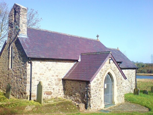
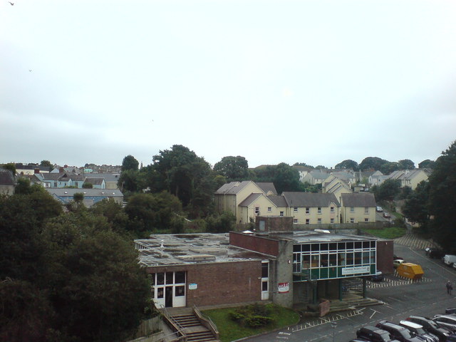
Haylett Images

Images are sourced within 2km of 51.781238/-4.979614 or Grid Reference SM9413. Thanks to Geograph Open Source API. All images are credited.

Haverfordwest - Albert Street Wide residential street with colourfully painted houses in central Haverfordwest.
<span class="nowrap"><a title="www.haverfordwest.org" rel="nofollow ugc noopener" href="http://www.haverfordwest.org">Link</a><img style="margin-left:2px;" alt="External link" title="External link - shift click to open in new window" src="https://s1.geograph.org.uk/img/external.png" width="10" height="10"/></span>
Haverfordwest - Albert Street
Wide residential street with colourfully painted houses in central Haverfordwest. LinkExternal link
Ordnance Survey Rivet This OS rivet can be found on the drain cover NW side of the path. It marks a point 42.881m above mean sea level.
Ordnance Survey Rivet
This OS rivet can be found on the drain cover NW side of the path. It marks a point 42.881m above mean sea level.
Ordnance Survey Cut Mark This OS cut mark can be found on the wall SE side of the Merlins Hill. It marks a point 37.869m above mean sea level.
Ordnance Survey Cut Mark
This OS cut mark can be found on the wall SE side of the Merlins Hill. It marks a point 37.869m above mean sea level.
Ordnance Survey Cut Mark This OS cut mark can be found on the gatepost of Winch House. It marks a point 39.404m above mean sea level.
Ordnance Survey Cut Mark
This OS cut mark can be found on the gatepost of Winch House. It marks a point 39.404m above mean sea level.
Haroldston Cottage
Haroldston Cottage
Tesco car park
Tesco car park
Croeso i Hwlffordd Welcoming sign on the western outskirts of Haverfordwest
Croeso i Hwlffordd
Welcoming sign on the western outskirts of Haverfordwest
Milford Road, Haverfordwest Two cars with their bonnets up blocking the road at the traffic lights
Milford Road, Haverfordwest
Two cars with their bonnets up blocking the road at the traffic lights
Fields behind cafe at lay-by, Pope Hill View from lay-by off A4076.
Fields behind cafe at lay-by, Pope Hill
View from lay-by off A4076.
Field east of lay-by, Pope Hill, A4076
Cafe, lay-by, Pope Hill, A4076 Cafe closed - weekday outside the peak holiday sesson.
Cafe, lay-by, Pope Hill, A4076
Cafe closed - weekday outside the peak holiday sesson.
Buildings at Little Cranham
A field entrance near Pencaer With bits of discarded rock, cable and a fence post.
A field entrance near Pencaer
With bits of discarded rock, cable and a fence post.
The bridleway near Pencaer
Sheds and machinery at Pencaer
Housing at Lower Freystrop
Houses at Little Milford
Haverfordwest Rugby Club
Show me another place!

Haylett is located at Grid Ref: SM9413 (Lat: 51.781238, Lng: -4.979614)

Unitary Authority: Pembrokeshire

Police Authority: Dyfed Powys

What 3 Words

///cricket.scream.limes. Near Haverfordwest, Pembrokeshire

Nearby Locations

Merlin's Bridge Haylett

Related Wikis

Haroldston St. Issell's

Haroldston St Issells is a former parish in Pembrokeshire, Wales, on the upper reaches of the Western Cleddau, 1 mile (1.6 km) southeast of Haverfordwest...

Merlin's Bridge

Merlin's Bridge (Welsh: Bont Myrddin or Pont Fadlen) is a village and a community south of, and contiguous with, Haverfordwest, Pembrokeshire, on the A4076...

Pembrokeshire College

Pembrokeshire College is a further education college with a campus in Haverfordwest, Pembrokeshire, in Wales.The College provides full-time vocational...

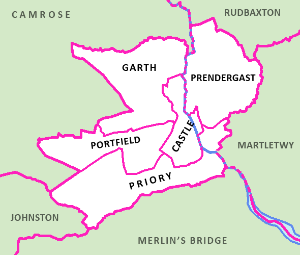
Haverfordwest Priory (electoral ward)

Haverfordwest Priory is the name of an electoral ward in Pembrokeshire, Wales. It covers the southern edge of the town of Haverfordwest, mostly west of...

Nearby Amenities

Located within 500m of 51.781238,-4.979614
Defibrillator
Access: permissive
Defibrillator Location: North side of pavilion at main entrance Haverfordwest Rugby Club
Emergency: defibrillator
Indoor: no
Opening Hours: 24/7
Source: survey
Survey Date: 2023-08-19
Lat/Long: 51.7835671/-4.9750883
The data included in this document is from www.openstreetmap.org. The data is made available under ODbL.

Have you been to Haylett?

Leave your review of Haylett below (or comments, questions and feedback).