Babworth Park
Downs, Moorland in Nottinghamshire Bassetlaw
England
Babworth Park

Babworth Park is a picturesque green space located in Nottinghamshire, England. Covering an area of approximately 100 acres, the park is known for its beautiful downs and moorland, which provide a diverse and stunning landscape for visitors.
The park is characterized by its rolling hills and open grasslands, which are perfect for leisurely walks, picnics, and outdoor activities. The downs offer breathtaking views of the surrounding countryside, with vast stretches of greenery that change with the seasons. Visitors can often spot a variety of wildlife, including rabbits, hares, and various bird species, making it a popular spot for nature enthusiasts.
The moorland area of Babworth Park adds another dimension to its natural beauty. With its heather-covered hills and rocky outcrops, the moorland provides a unique and rugged atmosphere. Visitors can explore the winding paths that lead through the moorland, immersing themselves in its tranquil and untouched surroundings.
In addition to its natural wonders, Babworth Park offers several amenities to enhance visitors' experiences. There are well-maintained walking paths, picnic areas, and seating areas throughout the park, providing ample opportunities for relaxation and enjoyment. The park also has a small café where visitors can grab a snack or beverage, as well as restroom facilities for convenience.
Overall, Babworth Park is a hidden gem in Nottinghamshire, offering a perfect blend of downs, moorland, and tranquility. Whether you are seeking a peaceful stroll or a place to connect with nature, this park provides an idyllic setting for visitors of all ages to enjoy.
If you have any feedback on the listing, please let us know in the comments section below.
Babworth Park Images
Images are sourced within 2km of 53.322804/-0.9707713 or Grid Reference SK6881. Thanks to Geograph Open Source API. All images are credited.


Babworth Park is located at Grid Ref: SK6881 (Lat: 53.322804, Lng: -0.9707713)
Administrative County: Nottinghamshire
District: Bassetlaw
Police Authority: Nottinghamshire
What 3 Words
///warblers.puzzled.ahead. Near Babworth, Nottinghamshire
Nearby Locations
Related Wikis
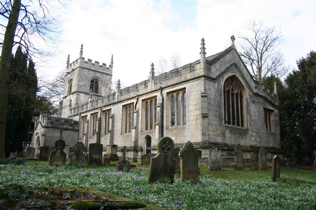
All Saints' Church, Babworth
All Saints' Church, is a Grade I listed parish church in the Church of England in Babworth, Nottinghamshire. == History == The church was built in the...

Ordsall Hall School
Ordsall Hall Comprehensive School was a comprehensive school situated on Ordsall Road in the market town of East Retford in the district of Bassetlaw,...
Retford F.C.
Retford Football Club is an English football club based in Retford, Nottinghamshire. They currently play in the Northern Counties East League Division...
Retford Oaks Academy
Retford Oaks Academy is a coeducational secondary school and sixth form located in the market town of Retford, Nottinghamshire, England, situated in the...

West Retford Hotel
West Retford Hotel in Nottinghamshire is a building of historical significance and is Grade II listed on the English Heritage Register. It was built in...

St Michael the Archangel's Church, Retford
St Michael the Archangel's Church is a Grade II* listed parish church in the Church of England in Retford, Nottinghamshire, England. == History == The...
Babworth
Babworth is a village and civil parish in the Bassetlaw district of Nottinghamshire, England, about 1½ miles west of Retford. According to the 2001 census...

Retford railway station
Retford railway station is on the East Coast Main Line serving the town of Retford, Nottinghamshire, England. It is 138 miles 49 chains (223.1 km) down...
Nearby Amenities
Located within 500m of 53.322804,-0.9707713Have you been to Babworth Park?
Leave your review of Babworth Park below (or comments, questions and feedback).