Roseberry Common
Downs, Moorland in Yorkshire
England
Roseberry Common

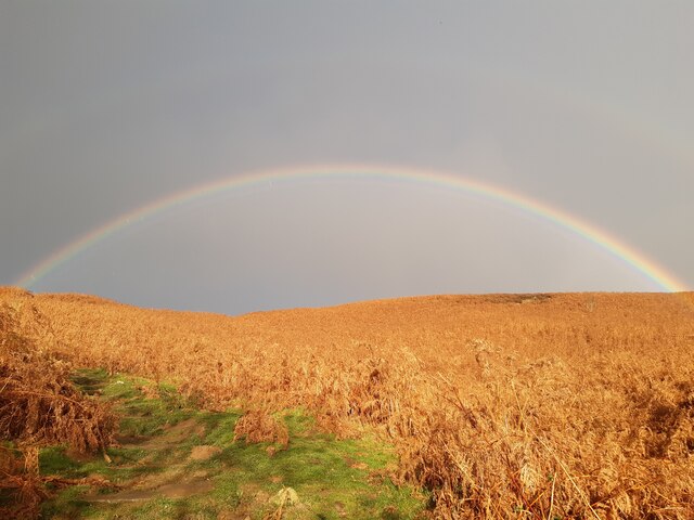
Roseberry Common is a picturesque area located in North Yorkshire, England. Situated on the edge of the North York Moors National Park, it encompasses both downs and moorland landscapes, offering diverse natural beauty and recreational opportunities.
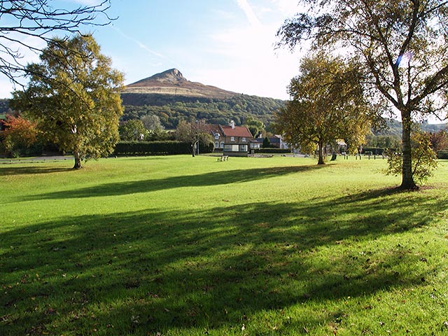
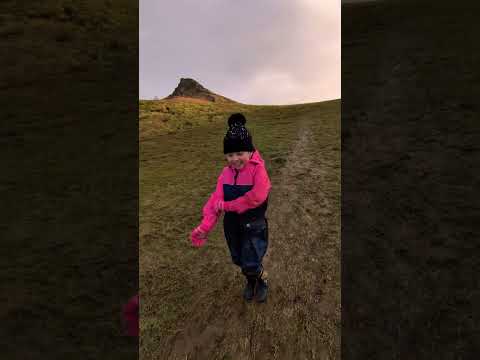
The common is primarily known for its iconic landmark, the Roseberry Topping. This distinct hill, standing at 1,049 feet, is often referred to as the "Yorkshire Matterhorn" due to its resemblance to the famous Swiss mountain. It attracts hikers and climbers from far and wide, providing stunning panoramic views from its summit.
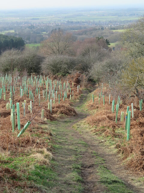
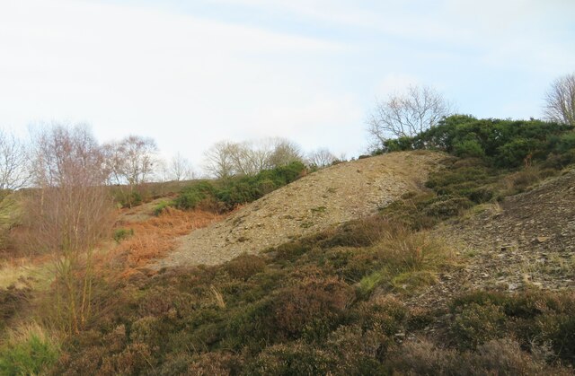
Aside from the Roseberry Topping, the common boasts an array of rolling hills, heather-clad moorlands, and lush grasslands. These landscapes are home to a variety of wildlife, including birds, rabbits, and deer, making it a popular destination for nature enthusiasts and photographers.
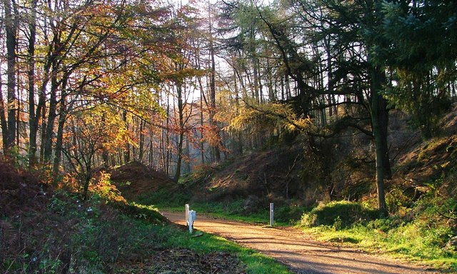
For outdoor enthusiasts, Roseberry Common offers an extensive network of walking trails and bridleways, allowing visitors to explore the area at their own pace. These trails cater to all abilities, from gentle strolls to challenging hikes, providing something for everyone.
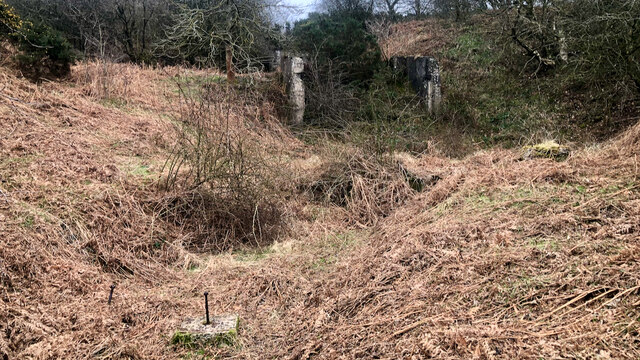
The common is also steeped in history, with remnants of Iron Age settlements and ancient burial mounds scattered throughout the landscape. These archaeological sites add an intriguing dimension to the area, offering a glimpse into its rich past.
Roseberry Common is easily accessible, with nearby parking facilities and public transport links. It has become a beloved destination for locals and tourists alike, offering a tranquil escape from the hustle and bustle of everyday life and a chance to immerse oneself in the natural beauty of Yorkshire's downs and moorland.
If you have any feedback on the listing, please let us know in the comments section below.
Roseberry Common Images
Images are sourced within 2km of 54.507422/-1.1025116 or Grid Reference NZ5812. Thanks to Geograph Open Source API. All images are credited.


Roseberry Common is located at Grid Ref: NZ5812 (Lat: 54.507422, Lng: -1.1025116)
Division: North Riding
Unitary Authority: Redcar and Cleveland
Police Authority: Cleveland
What 3 Words
///overt.detonated.iteration. Near Great Ayton, North Yorkshire
Nearby Locations
Related Wikis

Roseberry Topping
Roseberry Topping is a distinctive hill in North Yorkshire, England. It is situated near Great Ayton and Newton under Roseberry. Its summit has a distinctive...

Roseberry Mine
Roseberry Mine was an ironstone mine in the North Riding of Yorkshire, England, which operated between 1883 and 1924, with a break of 24 years. Both periods...
Newton under Roseberry
Newton under Roseberry is a village in the borough of Redcar and Cleveland and the ceremonial county of North Yorkshire, England. It is on the A173, between...

Great Ayton railway station
Great Ayton is a railway station on the Esk Valley Line, which runs between Middlesbrough and Whitby via Nunthorpe. The station, situated 8 miles 37 chains...

Langbaurgh Ridge
Langbaurgh Ridge (grid reference NZ560121) is an 8.0 hectare geological Site of Special Scientific Interest near the hamlet of Langbaurgh in North Yorkshire...
Hutton Village
Hutton Village is a settlement in the Hutton Lowcross area of Guisborough in North Yorkshire, England. Whilst the area itself is mentioned in the Domesday...

Cleveland, Yorkshire
Cleveland is a land of hills and dales from the River Tees to Vale of Pickering, England. The name means “cliff-land”. The area corresponds to the former...

Hutton Hall, Guisborough
Hutton Hall is a grade II listed country house in the Hutton Lowcross area to the south west of Guisborough, North Yorkshire, England. == History == The...
Related Videos

Roseberry Topping | North Yorkshire Hiking
Hi and welcome back to the channel. This video is a rewarding short Hike up the superb North Yorkshire hill - Roseberry Topping!

Scaling the Iconic Roseberry Topping: A Thrilling Hiking Adventure in North Yorkshire. | 4K
https://www.youtube.com/watch?v=x9legL2H4Ng Click above to watch previous video. Click SUBSCRIBE to see more of my ...

Climbing Roseberry Topping - Hiking the UK
Please feel free to subscribe to my channel and also check our my socials below. website: www.expeditiondean.co.uk Instagram: ...
Nearby Amenities
Located within 500m of 54.507422,-1.1025116Have you been to Roseberry Common?
Leave your review of Roseberry Common below (or comments, questions and feedback).