Papplewick Moor

Downs, Moorland in Nottinghamshire Gedling

England

Papplewick Moor

The outflow from Papplewick Dam Built to feed water to power a number of cotton mills along this section of the Leen valley.
The outflow from Papplewick Dam Credit: David Lally

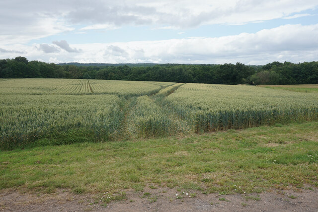
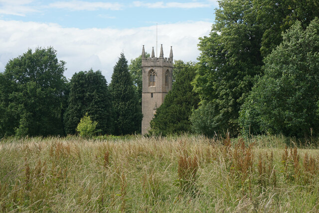
Papplewick Moor, located in Nottinghamshire, England, is a beautiful downs and moorland area that covers approximately 200 hectares. Situated just north of the village of Papplewick, it is a popular destination for nature enthusiasts and offers a peaceful retreat from the bustling city life of Nottingham, which is only a few miles away.

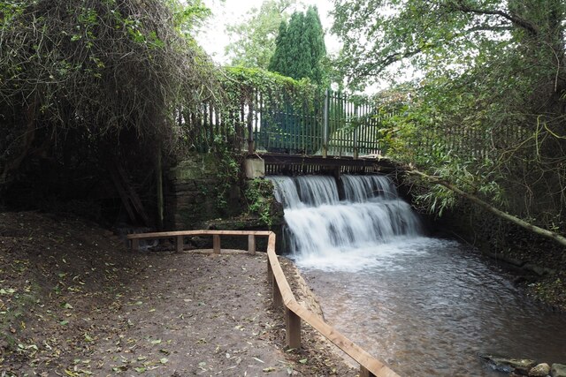
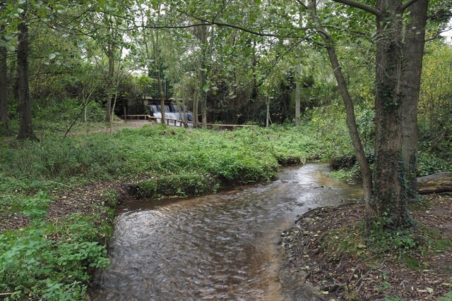
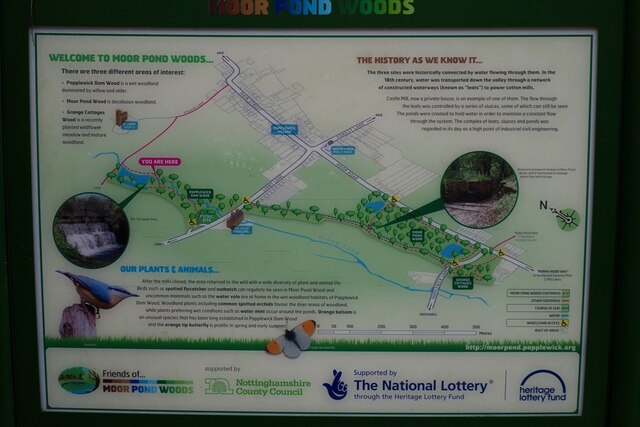
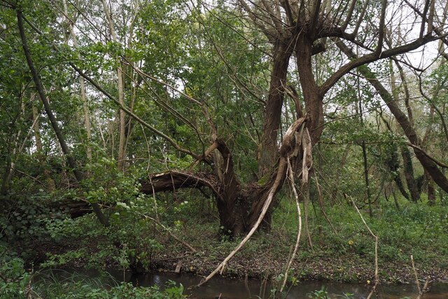
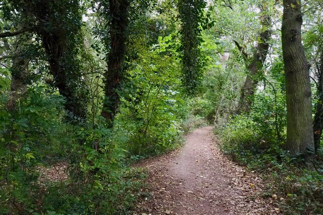
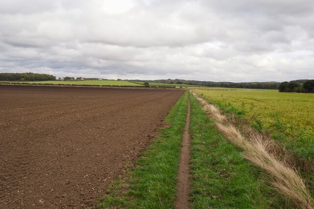
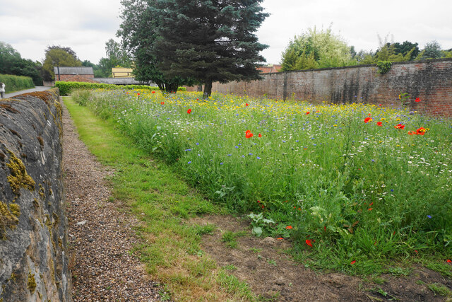
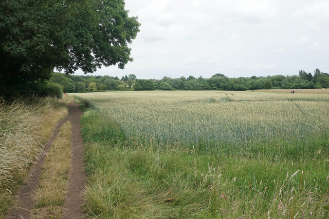
The moorland landscape of Papplewick Moor is characterized by its undulating terrain, dominated by heather and grasses, and interspersed with patches of woodland. It is home to a rich array of flora and fauna, including rare species of birds, insects, and plants. The moorland provides an ideal habitat for breeding birds such as curlew, lapwing, and skylark, making it a haven for birdwatchers.

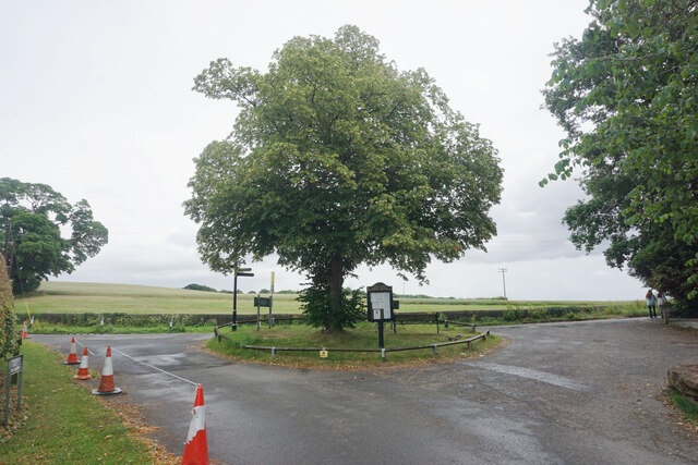
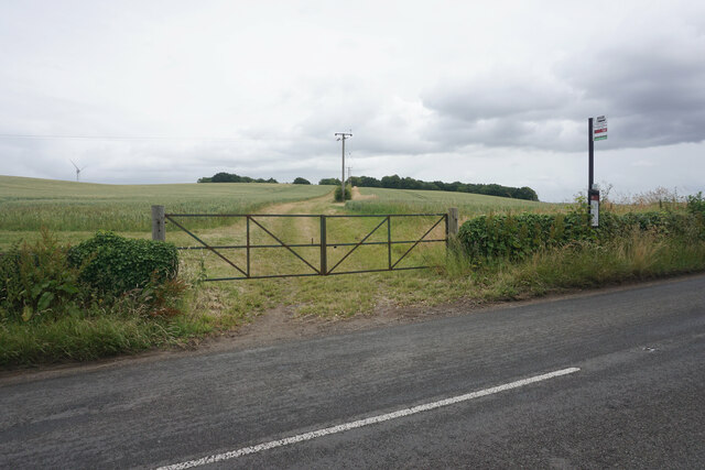
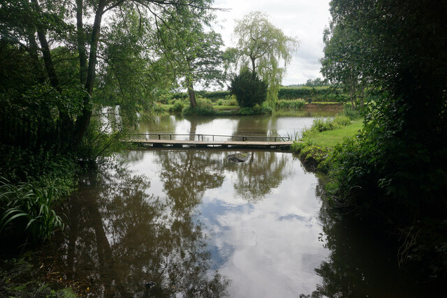
The area is crisscrossed by footpaths and bridleways, making it a popular spot for walking, hiking, and horse riding. The network of trails allows visitors to explore the moorland and take in the stunning views of the surrounding countryside. The peaceful atmosphere and breathtaking vistas make Papplewick Moor a perfect place for picnics or simply enjoying nature.

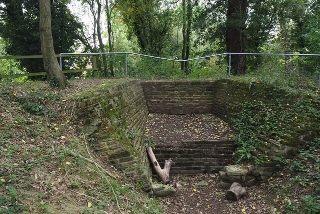
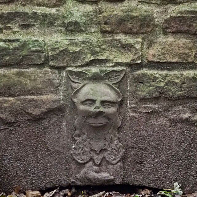
Papplewick Moor is also of historical significance, as it was once part of the Sherwood Forest, famously associated with the legendary figure of Robin Hood. The remnants of ancient woodlands and the presence of historic landmarks add a touch of mystique to the area.

Overall, Papplewick Moor is a hidden gem in Nottinghamshire, offering a tranquil escape into nature, rich biodiversity, and a glimpse into the region's past.

If you have any feedback on the listing, please let us know in the comments section below.

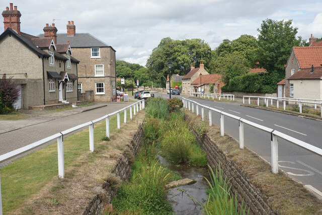
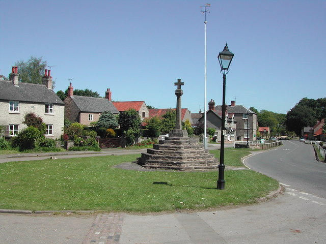
Papplewick Moor Images

Images are sourced within 2km of 53.050449/-1.1793392 or Grid Reference SK5550. Thanks to Geograph Open Source API. All images are credited.

The outflow from Papplewick Dam Built to feed water to power a number of cotton mills along this section of the Leen valley.
The outflow from Papplewick Dam
Built to feed water to power a number of cotton mills along this section of the Leen valley.
The River Leen With the outflow from Papplewick dam just upstream
The River Leen
With the outflow from Papplewick dam just upstream
Information board for Moor Pond Woods
A well-cracked crack willow On the banks of the River Leen in Papplewick Dam Wood.
A well-cracked crack willow
On the banks of the River Leen in Papplewick Dam Wood.
Wooded path near Castle Mill Part of the Papplewick Trail.
Wooded path near Castle Mill
Part of the Papplewick Trail.
Footpath on Papplewick Moor
Blocked culvert At the southern end of the Papplewick Trail, this excavated culvert entrance presumably would have carried the mill races under Moor Road?
Blocked culvert
At the southern end of the Papplewick Trail, this excavated culvert entrance presumably would have carried the mill races under Moor Road?
An interesting keystone In the arch of <a href="https://www.geograph.org.uk/photo/7005278">SK5450 : Blocked culvert</a>.  Possibly a Green Man representation?
An interesting keystone
In the arch of SK5450 : Blocked culvert. Possibly a Green Man representation?
Robin Hood Way, west of Seven Mile Wood, Papplewick
Wheat field near Papplewick Part of the farmland attached to Newstead Grange.
Wheat field near Papplewick
Part of the farmland attached to Newstead Grange.
Wild flower display in Papplewick My camera does not really pick up the vibrancy of such a display.
Wild flower display in Papplewick
My camera does not really pick up the vibrancy of such a display.
Small island in Papplewick At the southern end of the south drive from Newstead Abbey.
Small island in Papplewick
At the southern end of the south drive from Newstead Abbey.
Bus stop in Papplewick The farm track behind leads up to King Edward's Plantation.
Bus stop in Papplewick
The farm track behind leads up to King Edward's Plantation.
St James' Church, Papplewick As viewed from a footpath which passes to the south.
St James' Church, Papplewick
As viewed from a footpath which passes to the south.
Pond on the River Leen
Footpath to Papplewick The path crosses a wheat field which is edged by Church Plantation.
Footpath to Papplewick
The path crosses a wheat field which is edged by Church Plantation.
Main Street, Linby Preserving some of its historical aspect.
Main Street, Linby
Preserving some of its historical aspect.
Linby Docks One of two streams on each side of Main Street. They were restored in 2015. I don't think they ever had any navigable function.
Linby Docks
One of two streams on each side of Main Street. They were restored in 2015. I don't think they ever had any navigable function.
Show me another place!

Papplewick Moor is located at Grid Ref: SK5550 (Lat: 53.050449, Lng: -1.1793392)

Administrative County: Nottinghamshire

District: Gedling

Police Authority: Nottinghamshire

What 3 Words

///fixated.thousands.chimp. Near Hucknall, Nottinghamshire

Nearby Locations

Papplewick Moor

Related Wikis

Papplewick

Papplewick is a village and civil parish in Nottinghamshire, England, 7.5 miles (12 km) north of Nottingham and 6 miles (10 km) south of Mansfield. It...

Papplewick Hall

Papplewick Hall is a Grade I listed English country house in Papplewick, Nottinghamshire. == History == It was completed around 1787 for the Hon. Frederick...

Linby

Linby is a small village and civil parish in Nottinghamshire, England. The nearest town is Hucknall which is immediately to the south-west. The village...

Hidden Valleys

Hidden Valleys is a name, coined in 2004, used to describe an area of interesting historical and scenic value between the city of Nottingham and the town...

Hucknall station

Hucknall station, also formerly known as Hucknall Byron station, is a railway station and tram stop in Hucknall, Nottinghamshire, England. It is located...

Linby (Great Northern Railway) railway station

Linby (Great Northern Railway) was a railway station on the Great Northern Railway's Nottingham to Shirebrook line. == History == == Present day == No...

Linby railway station

Linby railway station was a station on what is now the Robin Hood Line. It was used predominantly to serve Linby Colliery. It shut in 1964. When the line...

Hucknall Town railway station

Hucknall Town railway station was a railway station on the Great Northern Railway's Nottingham to Shirebrook line. It served the market town of Hucknall...

Nearby Amenities

Located within 500m of 53.050449,-1.1793392
Papplewick
Is In: Nottinghamshire, United Kingdom
Place: village
Wikidata: Q2037177
Wikipedia: en:Papplewick
Lat/Long: 53.0548487/-1.1805396
Bus Stop
Papplewick Lane End
Bench: no
Bin: no
Bus: yes
Lit: no
Naptan AtcoCode: 3300GE0013
Naptan Bearing: S
Naptan CommonName: Papplewick Lane End
Naptan Crossing: Papplewick Lane End
Naptan Indicator: opp
Naptan NaptanCode: ntsdapgm
Naptan Notes: none
Naptan Street: Moor Road
Naptan Verified: yes
Public Transport: platform
Shelter: no
Source: naptan_import
Tactile Paving: no
Lat/Long: 53.0481083/-1.1816539
Bus Stop
Grangemoor
Bus: yes
Local Ref: GE0037
Naptan AtcoCode: 3300GE0037
Naptan Bearing: S
Naptan CommonName: Grangemoor
Naptan Crossing: Grangemoor
Naptan Indicator: opp
Naptan NaptanCode: ntsdmgdw
Naptan Notes: none
Naptan Street: Moor Road
Naptan Verified: yes
Public Transport: platform
Shelter: no
Source: naptan_import
Lat/Long: 53.0462286/-1.1815254
Bus Stop
Papplewick Lane End
Bench: yes
Bin: no
Bus: yes
Lit: no
Local Ref: GE0039
Naptan AtcoCode: 3300GE0039
Naptan Bearing: N
Naptan CommonName: Papplewick Lane End
Naptan Crossing: Papplewick Lane End
Naptan Indicator: adj
Naptan NaptanCode: ntsatpdp
Naptan Notes: none
Naptan Street: Moor Road
Naptan Verified: yes
Public Transport: platform
Shelter: yes
Source: naptan_import
Tactile Paving: no
Lat/Long: 53.047731/-1.1816908
Bus Stop
Blacksmiths Court
Both Ways: yes
Local Ref: GE0076
Naptan AtcoCode: 3300GE0076
Naptan Bearing: W
Naptan CommonName: Blacksmiths Court
Naptan Crossing: Blacksmiths Court
Naptan Indicator: opp
Naptan NaptanCode: ntsatgda
Naptan Notes: BW
Naptan Street: Linby Lane
Naptan Verified: yes
Public Transport: platform
Shelter: yes
Source: naptan_import
Lat/Long: 53.0540722/-1.1835103
Post Box
Collection Times: Mo-Fr 09:00; Sa 07:00
Post Box Type: lamp
Ref: NG15 31D
Royal Cypher: EIIR
Royal Cypher Wikidata: Q33102113
Source: survey
Lat/Long: 53.0489201/-1.1821205
Bench
Backrest: yes
Ele: 65.0144043
Lat/Long: 53.0477037/-1.1816992
Board Type: notice
Ele: 66.2160645
Information: board
Tourism: information
Lat/Long: 53.0485071/-1.1817513
Ele: 66.9370117
Lat/Long: 53.0485692/-1.1817557
Check Date: 2022-11-28
Description: Papplewick Trail information board
Information: board
Tourism: information
Lat/Long: 53.0514693/-1.1828951
Parking
Description: Patch of dirt at side of road
Ele: 68.8596191
Parking: street_side
Lat/Long: 53.0504592/-1.1823215
Papplewick Trail
Board Type: history
Check Date: 2022-12-15
Information: board
Source: survey
Tourism: information
Lat/Long: 53.0482144/-1.1819553
Leisure: fitness_station
Source: survey
Lat/Long: 53.0531124/-1.1846442
Access: yes
Leisure: playground
Operator: Papplewick Parish Council
Lat/Long: 53.0531498/-1.1849569
Bench
Backrest: yes
Source: survey
Lat/Long: 53.0541192/-1.1828493
Bench
Backrest: yes
Lat/Long: 53.0487331/-1.1829004
Bench
Lat/Long: 53.0489194/-1.1822126
Bench
Lat/Long: 53.0522353/-1.1853143
Direction: S
Generator Method: photovoltaic
Generator Output Electricity: yes
Generator Solar Modules: 7
Generator Source: solar
Generator Type: solar_photovoltaic_panel
Location: roof
Power: generator
Lat/Long: 53.053579/-1.1772218
Direction: 190
Generator Method: photovoltaic
Generator Output Electricity: yes
Generator Solar Modules: 4
Generator Source: solar
Generator Type: solar_photovoltaic_panel
Location: roof
Power: generator
Lat/Long: 53.0482296/-1.1814466
Direction: S
Generator Method: photovoltaic
Generator Output Electricity: yes
Generator Solar Modules: 12
Generator Source: solar
Generator Type: solar_photovoltaic_panel
Location: roof
Power: generator
Lat/Long: 53.0536425/-1.1789849
Direction: 170
Generator Method: photovoltaic
Generator Output Electricity: yes
Generator Solar Modules: 4
Generator Source: solar
Generator Type: solar_photovoltaic_panel
Location: roof
Power: generator
Lat/Long: 53.051511/-1.1822695
Direction: 170
Generator Method: photovoltaic
Generator Output Electricity: yes
Generator Solar Modules: 4
Generator Source: solar
Generator Type: solar_photovoltaic_panel
Location: roof
Power: generator
Lat/Long: 53.0522123/-1.182252
Direction: S
Generator Method: photovoltaic
Generator Output Electricity: yes
Generator Solar Modules: 7
Generator Source: solar
Generator Type: solar_photovoltaic_panel
Location: roof
Power: generator
Lat/Long: 53.0535424/-1.1770365
Power: pole
Lat/Long: 53.0523849/-1.1733377
Power: pole
Lat/Long: 53.0526622/-1.1745273
Power: pole
Lat/Long: 53.0529387/-1.1757208
Power: pole
Lat/Long: 53.051033/-1.1857697
Power: pole
Lat/Long: 53.0520334/-1.1841993
Power: pole
Lat/Long: 53.0524655/-1.1834992
Power: pole
Lat/Long: 53.0525364/-1.1825497
Power: pole
Lat/Long: 53.0524945/-1.1817169
Power: pole
Lat/Long: 53.0524203/-1.1805595
Power: pole
Lat/Long: 53.0525896/-1.1789824
Power: pole
Lat/Long: 53.052775/-1.1772953
Power: pole
Lat/Long: 53.0467796/-1.1785546
Power: pole
Lat/Long: 53.0464538/-1.1772966
Direction: 10
Man Made: surveillance
Surveillance: public
Surveillance Type: ALPR
Surveillance Zone: traffic
Lat/Long: 53.0532946/-1.1828223
The data included in this document is from www.openstreetmap.org. The data is made available under ODbL.

Have you been to Papplewick Moor?

Leave your review of Papplewick Moor below (or comments, questions and feedback).