Murton Common

Downs, Moorland in Yorkshire Ryedale

England

Murton Common

Fig Rolls Unusual fungi that look like Fig Rolls in Boltby Forest.
Fig Rolls Credit: T Eyre

Murton Common is a picturesque expanse of land located in the county of Yorkshire, England. Nestled amidst the Yorkshire Downs and Moorland, this area is renowned for its natural beauty and diverse ecosystem. Covering an area of approximately 100 acres, Murton Common is a haven for nature enthusiasts and offers a tranquil escape from the hustle and bustle of city life.

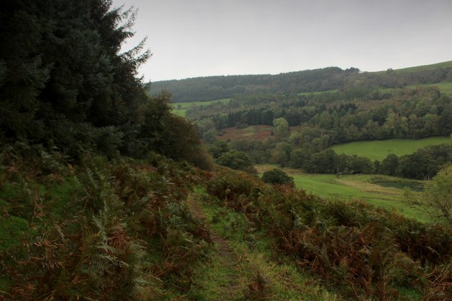
The common is characterized by its rolling hills, heather-covered moorland, and scattered woodland areas. It is home to a variety of plant and animal species, including rare bird species like curlews and lapwings, as well as a multitude of wildflowers and mosses. The area is also known for its unique geological features, such as limestone outcrops and glacial valleys, which add to its scenic charm.

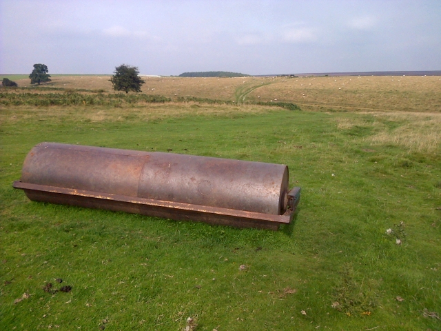
Visitors to Murton Common can enjoy a range of outdoor activities, including walking, hiking, and birdwatching. The common is intersected by a network of well-maintained footpaths and bridleways, providing opportunities for exploration and discovery. The panoramic views from the higher points of the common are particularly breathtaking, offering sweeping vistas of the surrounding countryside.

In addition to its natural attractions, Murton Common also holds historical significance. The remains of ancient settlements and burial mounds can be found within its boundaries, providing insight into the area's rich cultural heritage.

Overall, Murton Common is a captivating destination for nature lovers, history enthusiasts, and those seeking a peaceful retreat in the heart of Yorkshire's stunning landscape.

If you have any feedback on the listing, please let us know in the comments section below.

Murton Common Images

Images are sourced within 2km of 54.290085/-1.2195898 or Grid Reference SE5088. Thanks to Geograph Open Source API. All images are credited.

Fig Rolls Unusual fungi that look like Fig Rolls in Boltby Forest.
Fig Rolls
Unusual fungi that look like Fig Rolls in Boltby Forest.
Path in Boltby Forest The path forms part of the Cleveland Way.
Path in Boltby Forest
The path forms part of the Cleveland Way.
Path in Boltby Forest The path forms part of the Cleveland Way.
Path in Boltby Forest
The path forms part of the Cleveland Way.
Eastern edge of Boltby Forest The path forms part of the Cleveland Way.
Eastern edge of Boltby Forest
The path forms part of the Cleveland Way.
Path in North Woods The path forms part of the Cleveland Way.
Path in North Woods
The path forms part of the Cleveland Way.
Footpath leading down towards Lunshaw Beck The path from Boltby descends to cross Lunshaw Beck, before climbing steeply up the North York Moors escarpment to High Paradise
Footpath leading down towards Lunshaw Beck
The path from Boltby descends to cross Lunshaw Beck, before climbing steeply up the North York Moors escarpment to High Paradise
Footpath heading South towards Boltby
Track in Boltby Forest
Tree Felling Aftermath in Boltby Forest Scene of desolation after the chainsaws have vacated this area of Boltby Forest
Tree Felling Aftermath in Boltby Forest
Scene of desolation after the chainsaws have vacated this area of Boltby Forest
Cleveland Way in Boltby Forest (1) The National Trail clips the eastern edge of Boltby Forest as it heads northwards along the line of an ancient track - once used as a drovers road.
Cleveland Way in Boltby Forest (1)
The National Trail clips the eastern edge of Boltby Forest as it heads northwards along the line of an ancient track - once used as a drovers road.
Cleveland Way in Boltby Forest (2) The National Trail clips the eastern edge of Boltby Forest, as it follows the former drovers road along the western escarpment of the North York Moors
Cleveland Way in Boltby Forest (2)
The National Trail clips the eastern edge of Boltby Forest, as it follows the former drovers road along the western escarpment of the North York Moors
Track junction Boltby Forest Tracks in the forest used more by mountain bikers than walkers.
Track junction Boltby Forest
Tracks in the forest used more by mountain bikers than walkers.
Miles of forest The view westwards across Boltby Forest towards the distant smudge of the Pennines on the horizon.
Miles of forest
The view westwards across Boltby Forest towards the distant smudge of the Pennines on the horizon.
North Woods view A section of Boltby Forest near its eastern edge. Here some of the steep slopes have been clear felled between mature conifers to either side. Somewhere beyond the upper lines of trees lurks High Paradise Farm and cafe.
North Woods view
A section of Boltby Forest near its eastern edge. Here some of the steep slopes have been clear felled between mature conifers to either side. Somewhere beyond the upper lines of trees lurks High Paradise Farm and cafe.
Hilltop pasture above Stoney Gill Hole Near level pasture on the hilltop, but the fence to the left is just above a very steep drop into the narrow little valley that is Stoney Gill Hole. The three ridges of Hawnby Hill, Easterside and Roppa Edge in the distance.
Hilltop pasture above Stoney Gill Hole
Near level pasture on the hilltop, but the fence to the left is just above a very steep drop into the narrow little valley that is Stoney Gill Hole. The three ridges of Hawnby Hill, Easterside and Roppa Edge in the distance.
Groove with grouse butts From Steeple Cross at the northern end of coniferous plantations a groove heads north of east crossing moorland. The groove has been adapted to grouse shooting use as a line of butts has been built there, possibly using stone from a dry stone wall which might have run beside the groove. The butts are simple walls set into the banks of the groove and enable the 'guns' to receive 'drives' from two directions.
Groove with grouse butts
From Steeple Cross at the northern end of coniferous plantations a groove heads north of east crossing moorland. The groove has been adapted to grouse shooting use as a line of butts has been built there, possibly using stone from a dry stone wall which might have run beside the groove. The butts are simple walls set into the banks of the groove and enable the 'guns' to receive 'drives' from two directions.
Shooting Butt in Earthwork A modern shooting butt in a late Bronze Age earthwork. 

The earthwork is a cross ridge dyke and would have comprised a rampart 14-16ft wide and 3-6ft high with a shallow ditch on the north side. Only the ditch remains. See <span class="nowrap"><a title="http://www.pastscape.org.uk/hob.aspx?hob_id=57672#aD" rel="nofollow ugc noopener" href="http://www.pastscape.org.uk/hob.aspx?hob_id=57672#aD">Link</a><img style="margin-left:2px;" alt="External link" title="External link - shift click to open in new window" src="https://s1.geograph.org.uk/img/external.png" width="10" height="10"/></span> for more info.
Shooting Butt in Earthwork
A modern shooting butt in a late Bronze Age earthwork. The earthwork is a cross ridge dyke and would have comprised a rampart 14-16ft wide and 3-6ft high with a shallow ditch on the north side. Only the ditch remains. See LinkExternal link for more info.
Public Bridleway near Stoney Gill Hole
Show me another place!

Murton Common is located at Grid Ref: SE5088 (Lat: 54.290085, Lng: -1.2195898)

Division: North Riding

Administrative County: North Yorkshire

District: Ryedale

Police Authority: North Yorkshire

What 3 Words

///guesswork.lilac.paramedic. Near Thirsk, North Yorkshire

Related Wikis

Holy Trinity Church, Boltby

Holy Trinity Church, Boltby is a parish church in the Church of England: 81  in Boltby. == History == The first chapel was founded in 1409 and was rebuilt...

Boltby

Boltby is a village and civil parish in the Hambleton District of North Yorkshire, England. It is on the edge of the North York Moors National Park at...

Hawnby

Hawnby is a small crossroads village and civil parish in Ryedale in the North York Moors National Park, North Yorkshire, England. The village is about...

Kirby Knowle

Kirby Knowle is a village and civil parish in Hambleton District of North Yorkshire, England, on the border of the North Yorkshire Moors and near Upsall...

Nearby Amenities

Located within 500m of 54.290085,-1.2195898
Source: View from path
Lat/Long: 54.2870783/-1.2252098
Murton Common
Place: locality
Lat/Long: 54.2909097/-1.2191993
The data included in this document is from www.openstreetmap.org. The data is made available under ODbL.

Have you been to Murton Common?

Leave your review of Murton Common below (or comments, questions and feedback).