Pan Down

Downs, Moorland in Hampshire

England

Pan Down

High Street, Carisbrooke
High Street, Carisbrooke Credit: Roger Cornfoot

Pan Down is a picturesque area located in Hampshire, England. It is characterized by its serene and expansive landscape, encompassing downs, moorland, and open fields. The area is a popular destination for nature enthusiasts, hikers, and photographers due to its breathtaking views and diverse wildlife.

The downs in Pan Down offer vast rolling hills covered in lush green grass, which provide a perfect setting for leisurely walks or picnics. The area's moorland is a unique feature, with its heathlands and gorse bushes creating a striking contrast against the blue skies. Visitors can enjoy the peaceful atmosphere while exploring the moorland trails and spotting rare species of birds, such as the Dartford warbler or the nightjar.

Pan Down is also home to a variety of wildlife, including deer, rabbits, and numerous bird species. The open fields in the area are often filled with grazing sheep or cows, creating a traditional countryside scene. Additionally, the downland areas are known for their rich biodiversity, with an abundance of wildflowers and insects.

The tranquil ambiance, combined with the stunning natural beauty, makes Pan Down a haven for those seeking a peaceful escape from city life. The area is easily accessible by foot or bike, with numerous trails and pathways crisscrossing through the downs and moorland. Whether it's a leisurely stroll, a challenging hike, or simply taking in the breathtaking views, Pan Down offers something for everyone to enjoy.

If you have any feedback on the listing, please let us know in the comments section below.

Pan Down Images

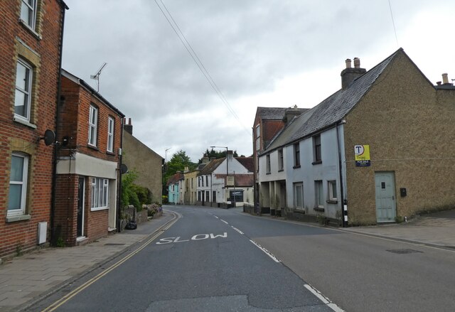
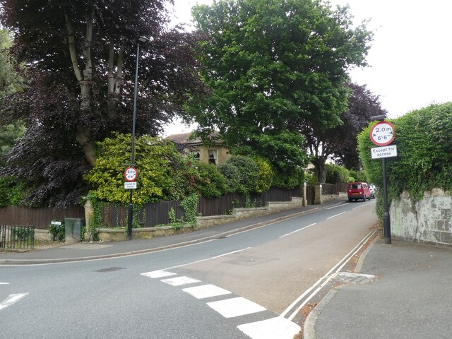
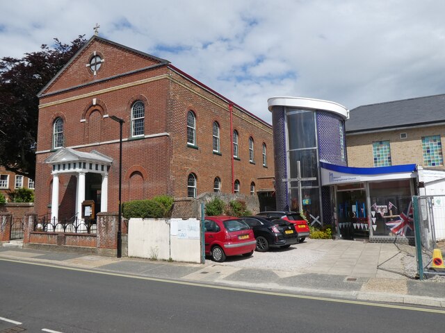
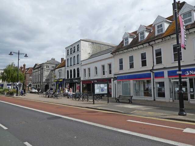
Images are sourced within 2km of 50.688587/-1.285239 or Grid Reference SZ5087. Thanks to Geograph Open Source API. All images are credited.

High Street, Carisbrooke
Castle walls and moat, Carisbrooke
Turning for Watergate Road
Newport Congregational Church
St James Square, Newport
High Street, Newport
Newport Minster
Newport Minster
Newport Conservative Club
The Wheatsheaf, Newport
Former newspaper office, Newport
Former world famed shop, Newport
My one day of holiday ... ...and it rains!
(Newport town centre)
My one day of holiday ...
...and it rains! (Newport town centre)
Toe nails? I thought, that's a very specific shop- Newport town centre
Toe nails?
I thought, that's a very specific shop- Newport town centre
Lovely old fashioned shop front High Street, Newport
Lovely old fashioned shop front
High Street, Newport
Post boxes, Newport High Street
Correo Lounge, High Street
Old Boundary Marker on New Street, Newport Parish Boundary Marker on the east side of New Street, Newport, between the junctions with the B3323 Pyle Street and Scarrots Lane. Formerly on the boundary of Newport and Carisbrooke parishes but in Newport parish from 1894. Now in Newport and Carisbrooke parish.

Milestone Society National ID: IW_NEWCAR03pb
Old Boundary Marker on New Street, Newport
Parish Boundary Marker on the east side of New Street, Newport, between the junctions with the B3323 Pyle Street and Scarrots Lane. Formerly on the boundary of Newport and Carisbrooke parishes but in Newport parish from 1894. Now in Newport and Carisbrooke parish. Milestone Society National ID: IW_NEWCAR03pb
Whitcombe Road, Carisbrooke Looking south from a number 6 bus (Newport - Ventnor).
Whitcombe Road, Carisbrooke
Looking south from a number 6 bus (Newport - Ventnor).
Show me another place!

Pan Down is located at Grid Ref: SZ5087 (Lat: 50.688587, Lng: -1.285239)

Unitary Authority: Isle of Wight

Police Authority: Hampshire

What 3 Words

///manicured.breakfast.secondly. Near Newport, Isle of Wight

Nearby Locations

Pan Down

Related Wikis

Shide railway station

Shide railway station was at Shide, on the southern fringes of Newport, Isle of Wight, off the south coast of England. It was an intermediate station on...

Isle of Wight National Landscape

The Isle of Wight National Landscape is an Area of Outstanding Natural Beauty (AONB) on the Isle of Wight, England's largest offshore island. The AONB...

Shide, Isle of Wight

Shide is a small settlement on the Isle of Wight, some of which is considered to be in the Newport conurbation. Shide Hill House, which was demolished...

St Georges Park (Newport)

St Georges Park was an association football stadium in Newport on the Isle of Wight. It was home to Newport (IOW) F.C. and the Isle of Wight official football...

Nearby Amenities

Located within 500m of 50.688587,-1.285239
Traffic Signals
Traffic Signals: signal
Traffic Signals Direction: forward
Lat/Long: 50.690153/-1.2879863
Source: Bing
Lat/Long: 50.6907863/-1.2867513
Restaurant
Bengal Palace
Addr City: Newport
Addr Country: GB
Addr Housenumber: 57
Addr Postcode: PO30 1HS
Addr Street: Shide Road
Cuisine: indian
Diet Vegetarian: yes
Fhrs Id: 541024
Outdoor Seating: yes
Source Addr: FHRS Open Data
Survey Date: 2020-01-13
Lat/Long: 50.6907616/-1.2885584
Crossing
Crossing: unmarked
Crossing Island: yes
Crossing Markings: no
Kerb: lowered
Tactile Paving: yes
Lat/Long: 50.6916064/-1.2875921
Barrier: cycle_barrier
Lat/Long: 50.6910265/-1.2883106
Bus Stop
West Standen
Bench: no
Bin: no
Bus: yes
Check Date Bin: 2022-11-19
Contact Website: https://www.islandbuses.info/stops/230000007730
Naptan AtcoCode: 230000007730
Naptan Bearing: S
Naptan CommonName: West Standen
Naptan Indicator: adj
Naptan NaptanCode: iowgjgm
Naptan Street: Blackwater Road
Public Transport: platform
Shelter: no
Lat/Long: 50.6859042/-1.2886681
Bus Stop
West Standen
Bench: no
Bin: no
Bus: yes
Contact Website: https://www.islandbuses.info/stops/230000007720
Lit: no
Naptan AtcoCode: 230000007720
Naptan Bearing: N
Naptan CommonName: West Standen
Naptan Indicator: opp
Naptan NaptanCode: iowgjgj
Naptan Street: Blackwater Road
Public Transport: platform
Shelter: no
Tactile Paving: no
Lat/Long: 50.6863683/-1.2887228
Post Box
Check Date Collection Times: 2021-04-09
Collection Times: Mo-Fr 09:00; Sa 07:00; Su off
Operator: Royal Mail
Operator Wikidata: Q638098
Ref: PO30 78
Ref GB Uprn: 10015333376
Royal Cypher: GVIR
Royal Cypher Wikidata: Q33102169
Website: https://www.royalmail.com/services-near-you/postbox/medina-avenue-po30-1ae/0000PO3078
Lat/Long: 50.6922966/-1.2892273
Crossing: informal
Lat/Long: 50.6903175/-1.2818403
Bus Stop
Shide Road
Bench: yes
Bin: no
Bus: yes
Contact Website: https://www.islandbuses.info/stops/230000007670
Naptan AtcoCode: 230000007670
Naptan Bearing: N
Naptan CommonName: Barley Mow
Naptan Indicator: towards Newport
Naptan NaptanCode: iowgjdp
Naptan Street: Blackwater Road
Public Transport: platform
Shelter: no
Lat/Long: 50.6898187/-1.2882097
Bus Stop
Shide Road
Bench: no
Bus: yes
Contact Website: https://www.islandbuses.info/stops/230000007680
Naptan AtcoCode: 230000007680
Naptan Bearing: S
Naptan CommonName: Barley Mow
Naptan Indicator: towards Shanklin
Naptan NaptanCode: iowgjdt
Naptan Street: Blackwater Road
Public Transport: platform
Shelter: no
Lat/Long: 50.6898753/-1.28797
Shide Path
Historic Highway: bus_stop
Naptan AtcoCode: 2300463
Naptan Bearing: S
Naptan CommonName: Shide Path
Naptan Indicator: adj
Naptan NaptanCode: iowmjdm
Naptan Street: Medina Avenue
Lat/Long: 50.6920734/-1.2892463
Source: Bing
Lat/Long: 50.6917379/-1.2872249
Source: Bing
Lat/Long: 50.691135/-1.2866139
Power: pole
Lat/Long: 50.6872559/-1.2913965
Power: pole
Source: Bing
Lat/Long: 50.6866415/-1.2912692
Power: pole
Source: Bing
Lat/Long: 50.6892126/-1.2894264
Power: pole
Source: Bing
Lat/Long: 50.6874538/-1.2906831
Power: pole
Lat/Long: 50.6882353/-1.2912013
Power: pole
Lat/Long: 50.6894199/-1.2905583
Tourism: viewpoint
Lat/Long: 50.6892984/-1.2838414
Traffic Signals
Traffic Signals: signal
Traffic Signals Direction: backward
Lat/Long: 50.6905899/-1.287815
Waterway: weir
Lat/Long: 50.6917867/-1.2883516
Power: pole
Source: Bing
Lat/Long: 50.6882518/-1.2900913
Red Squirrel Trail
Tourism: information
Lat/Long: 50.6903819/-1.2886296
Dentist
Medina Dental Laboratory
Addr Housenumber: 119B
Addr Street: Medina Avenue
Contact Phone: +44 1983 529568
Healthcare: dentist
Lat/Long: 50.6923233/-1.2890725
Entrance: yes
Lat/Long: 50.6909232/-1.2901048
Entrance: yes
Lat/Long: 50.6911128/-1.2899511
Bench
Lat/Long: 50.6876866/-1.2896343
Bench
Lat/Long: 50.68862/-1.2891997
Information: board
Tourism: information
Lat/Long: 50.690459/-1.288499
Bicycle: yes
Hiking: yes
Information: guidepost
Tourism: information
Lat/Long: 50.6904751/-1.2885037
Bench
Lat/Long: 50.6910609/-1.2883072
Bicycle: yes
Hiking: yes
Information: guidepost
Tourism: information
Lat/Long: 50.6918583/-1.2883294
Addr Housename: Fig Tree Cottage
Addr Street: St Georges Lane
Lat/Long: 50.6889193/-1.2870184
Addr Housename: Miln House
Addr Street: St Georges Lane
Lat/Long: 50.6888047/-1.28706
Addr City: Newport
Addr Country: GB
Addr Housename: Ponders End
Addr Street: Burn House Lane
Lat/Long: 50.6905277/-1.2873613
Addr City: Newport
Addr Country: GB
Addr Housename: Somerton
Addr Street: St Georges Lane
Lat/Long: 50.6897032/-1.287361
Addr City: Newport
Addr Country: GB
Addr Housename: Woodbury
Addr Street: Burn House Lane
Lat/Long: 50.6906641/-1.2872268
Hiking: yes
Information: guidepost
Tourism: information
Lat/Long: 50.6870005/-1.2842951
Crossing
Bicycle: dismount
Button Operated: yes
Crossing: traffic_signals
Crossing Island: yes
Crossing Ref: pelican
Kerb: lowered
Tactile Paving: yes
Lat/Long: 50.6901856/-1.2879776
Atm
Brand: Barclays
Brand Wikidata: Q245343
Capacity: 2
Check Date: 2022-08-19
Fee: no
Indoor: no
Level: 0
Opening Hours: 24/7
Operator: Barclays
Operator Wikidata: Q245343
Wheelchair: yes
Lat/Long: 50.6930796/-1.2850033
Chalk Ridge Extreme
Information: guidepost
Note Name: These are small signs with IWight logo and arrow.
Tourism: information
Lat/Long: 50.6904471/-1.2885217
Information: board
Tourism: information
Lat/Long: 50.6918659/-1.2881738
Hiking: yes
Information: guidepost
Tourism: information
Lat/Long: 50.6916671/-1.2877071
Crossing
Crossing: unmarked
Crossing Island: no
Crossing Markings: no
Kerb: lowered
Tactile Paving: yes
Lat/Long: 50.6917794/-1.2873803
Hiking: yes
Information: guidepost
Tourism: information
Lat/Long: 50.6903409/-1.2817606
Hiking: yes
Information: guidepost
Tourism: information
Lat/Long: 50.6895286/-1.2805603
Crossing
Lat/Long: 50.6927574/-1.2852678
Crossing
Lat/Long: 50.6929446/-1.2852078
Information: board
Tourism: information
Lat/Long: 50.6901166/-1.2878291
National Tyres and Autocare
Brand: National Tyres and Autocare
Brand Wikidata: Q6979055
Contact Website: https://www.national.co.uk/branch/468/newport-isle-of-wight/
Shop: car_repair
Short Name: National Tyres
Lat/Long: 50.6907181/-1.2880987
Barrier: bollard
Lat/Long: 50.690145/-1.2877513
Addr City: Newport
Addr Housenumber: 1
Addr Street: Chestnut Close
Lat/Long: 50.6906657/-1.2904281
Addr City: Newport
Addr Housenumber: 14
Addr Street: Chestnut Close
Lat/Long: 50.691046/-1.2905808
Barrier: bollard
Lat/Long: 50.6905968/-1.2884293
Barrier: bollard
Lat/Long: 50.690571/-1.2884253
Barrier: bollard
Lat/Long: 50.6905635/-1.2884035
Cafe
Coffee Shop
Addr City: Newport
Addr Country: GB
Addr Postcode: PO30 2QH
Addr Street: St Georges Way
Brand: Asda
Brand Wikidata: Q297410
Brand Wikipedia: en:Asda
Contact Phone: +44 1983 640246
Contact Website: https://storelocator.asda.com/south-east/newport/st-georges-way/cafe
Cuisine: coffee_shop
Drinking Water Refill: yes
Drinking Water Refill Network: Refill
Fhrs Id: 1223792
Indoor Seating: yes
Internet Access: wlan
Internet Access Fee: no
Opening Hours: Mo-Sa 08:30-18:00; Su 10:00-16:00
Opening Hours Covid19: Mo-Su off
Operator: Asda Stores Ltd
Outdoor Seating: no
Takeaway: yes
Lat/Long: 50.6926441/-1.28482
Defibrillator
Defibrillator Location: On Asda security desk, near the entrance
Emergency: defibrillator
Indoor: yes
Level: 0
Wheelchair: yes
Lat/Long: 50.6928947/-1.2847486
Shide
Operator: Scottish and Southern Electricity Networks
Operator Phone: +44 8000 727282
Operator Wikidata: Q43080530
Power: substation
Ref: 3514784
Lat/Long: 50.6907396/-1.2891748
Crossing
Lat/Long: 50.6902921/-1.2909254
Crossing
Lat/Long: 50.6902687/-1.2909834
Timpson
Brand: Timpson
Brand Wikidata: Q7807658
Contact Website: https://www.timpson.co.uk/stores/isle-of-wight-asda-newport
Opening Hours: Mo-Sa 09:00-18:00; Su 10:00-16:00
Shop: locksmith
Lat/Long: 50.6925842/-1.2848135
Toilets
Access: customers
Operator: Asda Stores Ltd
Operator Wikidata: Q297410
Lat/Long: 50.6925094/-1.2848055
Shide
Historic Railway: station
Railway: site
Wikidata: Q7496129
Wikipedia: en:Shide railway station
Lat/Long: 50.6906531/-1.2882254
Give Way
Direction: forward
Lat/Long: 50.6912884/-1.2862905
Give Way
Direction: backward
Lat/Long: 50.6917875/-1.287493
Barrier: kerb
Kerb: lowered
Source: Bing
Tactile Paving: yes
Lat/Long: 50.6901618/-1.287872
Traffic Signals
Traffic Signals: signal
Traffic Signals Direction: forward
Lat/Long: 50.6904012/-1.2881288
Barrier: kerb
Kerb: lowered
Source: Bing
Tactile Paving: yes
Lat/Long: 50.6902035/-1.288057
Give Way
Source: Bing
Lat/Long: 50.6913233/-1.2900594
Give Way
Source: Bing
Lat/Long: 50.6911958/-1.2895586
Barrier: kerb
Kerb: lowered
Source: Bing
Tactile Paving: yes
Lat/Long: 50.6916098/-1.2876743
Barrier: kerb
Kerb: lowered
Source: Bing
Tactile Paving: yes
Lat/Long: 50.6916028/-1.2875042
Barrier: kerb
Kerb: lowered
Source: Bing
Tactile Paving: yes
Lat/Long: 50.6916055/-1.2875705
Barrier: kerb
Kerb: lowered
Source: Bing
Tactile Paving: yes
Lat/Long: 50.6916074/-1.2876152
Barrier: kerb
Kerb: lowered
Source: Bing
Tactile Paving: yes
Lat/Long: 50.6918253/-1.287376
Barrier: kerb
Kerb: lowered
Source: Bing
Tactile Paving: yes
Lat/Long: 50.6917486/-1.2873822
Crossing
Crossing: unmarked
Crossing Island: yes
Crossing Markings: no
Kerb: lowered
Tactile Paving: yes
Lat/Long: 50.6926078/-1.2869644
Crossing
Crossing: unmarked
Crossing Island: yes
Crossing Markings: no
Kerb: lowered
Tactile Paving: yes
Lat/Long: 50.6926828/-1.2868759
Barrier: kerb
Kerb: lowered
Source: Bing
Tactile Paving: yes
Lat/Long: 50.6925662/-1.2870134
Barrier: kerb
Kerb: lowered
Source: Bing
Tactile Paving: yes
Lat/Long: 50.6926256/-1.2869433
Barrier: kerb
Kerb: lowered
Source: Bing
Tactile Paving: yes
Lat/Long: 50.6926506/-1.2869139
Barrier: kerb
Kerb: lowered
Source: Bing
Tactile Paving: yes
Lat/Long: 50.6927131/-1.2868402
Parking Space
Parking Space: parent
Lat/Long: 50.6928639/-1.2854567
Parking Space
Parking Space: parent
Lat/Long: 50.6928392/-1.2854526
Parking Space
Parking Space: parent
Lat/Long: 50.6928116/-1.2854479
Parking Space
Parking Space: parent
Lat/Long: 50.6927883/-1.285444
Parking Space
Parking Space: parent
Lat/Long: 50.6927368/-1.2854354
Parking Space
Parking Space: parent
Lat/Long: 50.692712/-1.2854312
Parking Space
Parking Space: parent
Lat/Long: 50.6926915/-1.2854278
Parking Space
Parking Space: parent
Lat/Long: 50.6926666/-1.2854236
Parking Space
Parking Space: parent
Lat/Long: 50.6926413/-1.2854194
Parking Space
Parking Space: parent
Lat/Long: 50.6926147/-1.2854149
Parking Space
Parking Space: parent
Lat/Long: 50.6925887/-1.2854105
Parking Space
Parking Space: parent
Lat/Long: 50.6925602/-1.2854058
Parking Space
Parking Space: parent
Lat/Long: 50.6925931/-1.2853173
Parking Space
Parking Space: parent
Lat/Long: 50.6926192/-1.2853217
Parking Space
Parking Space: parent
Lat/Long: 50.6926458/-1.2853262
Parking Space
Parking Space: parent
Lat/Long: 50.6926711/-1.2853304
Parking Space
Parking Space: parent
Lat/Long: 50.692696/-1.2853346
Parking Space
Parking Space: parent
Lat/Long: 50.6927165/-1.285338
Parking Space
Parking Space: parent
Lat/Long: 50.6927413/-1.2853422
Parking Space
Parking Space: parent
Lat/Long: 50.6927927/-1.2853508
Parking Space
Parking Space: parent
Lat/Long: 50.6928161/-1.2853547
Parking Space
Parking Space: parent
Lat/Long: 50.6928437/-1.2853594
Parking Space
Parking Space: parent
Lat/Long: 50.6928684/-1.2853635
Parking Space
Parking Space: parent
Lat/Long: 50.6925647/-1.2853125
Parking Space
Parking Space: disabled
Lat/Long: 50.6925629/-1.2851387
Parking Space
Parking Space: disabled
Lat/Long: 50.6925948/-1.2851442
Parking Space
Parking Space: disabled
Lat/Long: 50.6926273/-1.2851497
Parking Space
Parking Space: disabled
Lat/Long: 50.6926619/-1.2851556
Parking Space
Parking Space: disabled
Lat/Long: 50.692691/-1.2851606
Parking Space
Parking Space: disabled
Lat/Long: 50.692726/-1.2851666
Parking Space
Parking Space: disabled
Lat/Long: 50.6927527/-1.2851712
Parking Space
Parking Space: disabled
Lat/Long: 50.6928094/-1.2851808
Parking Space
Parking Space: disabled
Lat/Long: 50.6928441/-1.2851868
Parking Space
Parking Space: disabled
Lat/Long: 50.6928777/-1.2851925
Parking Space
Parking Space: disabled
Lat/Long: 50.6925324/-1.2851335
The data included in this document is from www.openstreetmap.org. The data is made available under ODbL.

Have you been to Pan Down?

Leave your review of Pan Down below (or comments, questions and feedback).