Locker Low Moor

Downs, Moorland in Yorkshire Ryedale

England

Locker Low Moor

Shadowed moorland at edge of Arden Great Moor A view from the estate road at the northern rim of Arden Great Moor. Beyond the immediate heather is the valley of the River Rye.
Cringle Moor is part of the distant high ground.
Shadowed moorland at edge of Arden Great Moor Credit: Trevor Littlewood

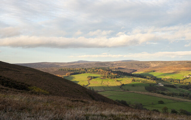
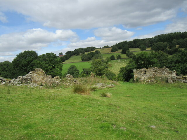
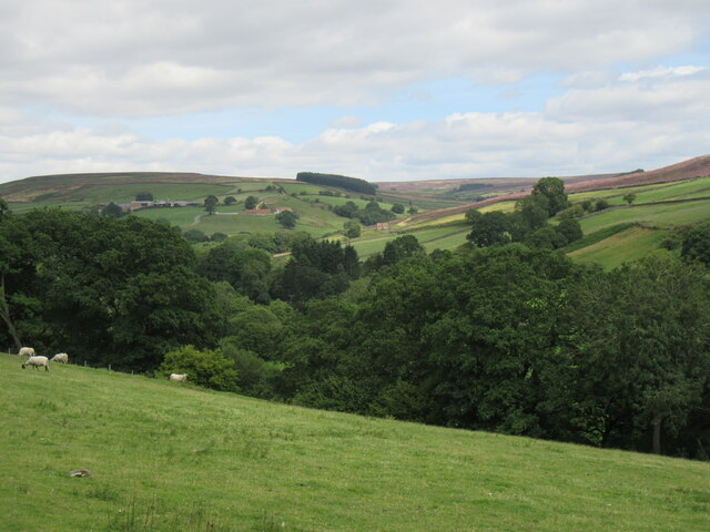
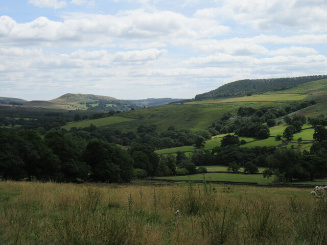
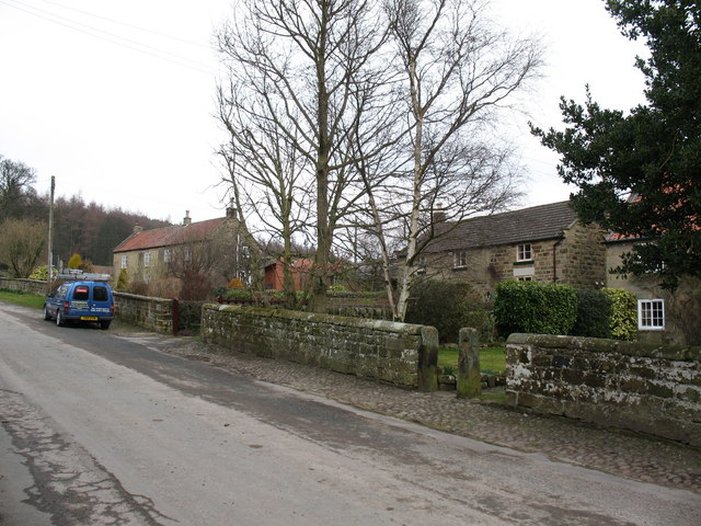
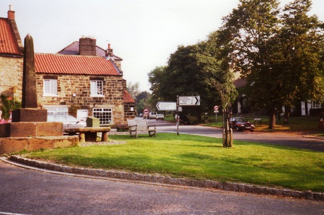
Locker Low Moor is a picturesque village located in the county of Yorkshire, England. Situated amidst the stunning Downs and Moorland landscapes, it offers a tranquil and idyllic setting for residents and visitors alike. Nestled within the Bradford Metropolitan District, the village is known for its natural beauty and charm.

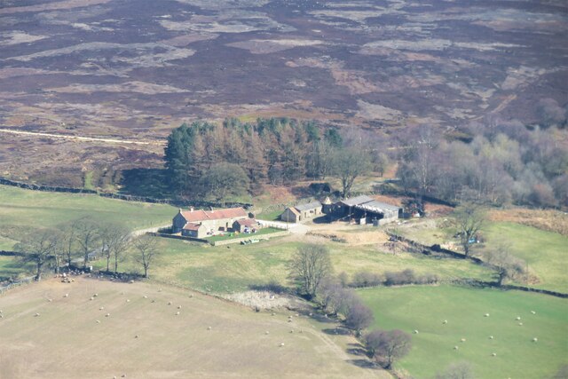
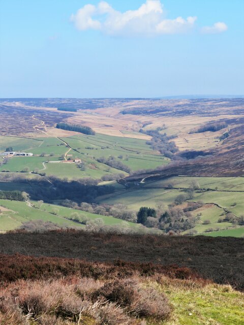
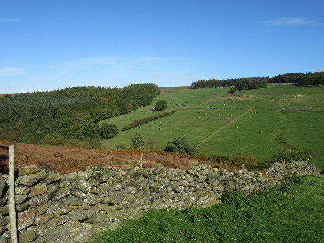
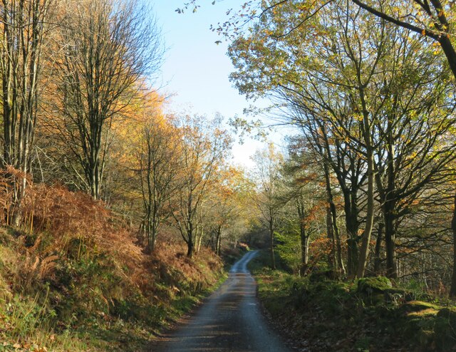
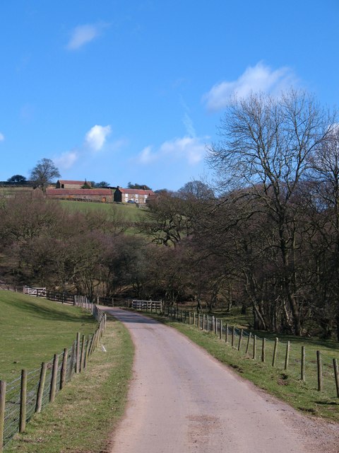
The village itself is small yet vibrant, with a tight-knit community that takes great pride in its surroundings. The traditional stone cottages and buildings add to the village's character, creating a sense of history and heritage. The surrounding countryside is dotted with lush green fields and rolling hills, providing ample opportunities for outdoor activities such as hiking, cycling, and horseback riding.

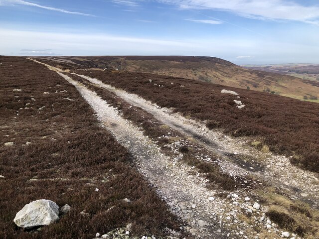
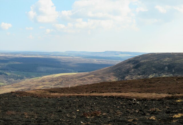
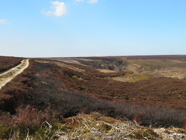
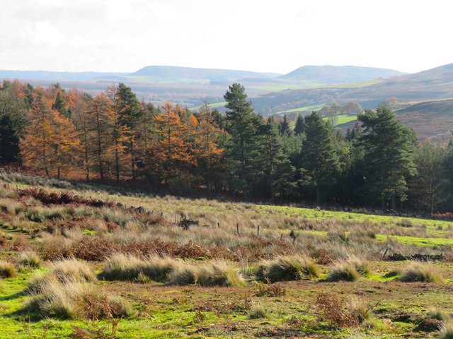
The Downs and Moorland that envelop Locker Low Moor are home to a diverse range of wildlife and flora, making it an ideal destination for nature enthusiasts. Visitors can spot various species of birds, including the elusive curlew and red grouse, as well as rabbits, hares, and occasionally deer.

The village is well-connected to nearby towns and cities, with good transport links providing easy access for both residents and tourists. The local amenities are limited but sufficient, including a small convenience store, a village hall, and a charming pub serving delicious local cuisine.

In summary, Locker Low Moor is a delightful village in Yorkshire, surrounded by breathtaking Downs and Moorland landscapes. Its peaceful atmosphere, natural beauty, and close-knit community make it an ideal destination for those seeking a tranquil retreat amidst the stunning Yorkshire countryside.

If you have any feedback on the listing, please let us know in the comments section below.

Locker Low Moor Images

Images are sourced within 2km of 54.342287/-1.2327069 or Grid Reference SE4994. Thanks to Geograph Open Source API. All images are credited.
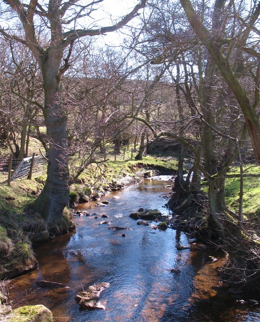
Shadowed moorland at edge of Arden Great Moor A view from the estate road at the northern rim of Arden Great Moor. Beyond the immediate heather is the valley of the River Rye.
Cringle Moor is part of the distant high ground.
Shadowed moorland at edge of Arden Great Moor
A view from the estate road at the northern rim of Arden Great Moor. Beyond the immediate heather is the valley of the River Rye. Cringle Moor is part of the distant high ground.
An isolated property known as the Old School
Track Along The Edge Of Arden Great Moor
Plane Tree Farm A distant view of the farm taken from the top of Locker Bank just over a mile away. The old roadside lime kiln can be seen above the buildings to the right of the farmhouse. Improved pastures around the farm in the dale bottom, but heather moorland on the slopes beyond.
Plane Tree Farm
A distant view of the farm taken from the top of Locker Bank just over a mile away. The old roadside lime kiln can be seen above the buildings to the right of the farmhouse. Improved pastures around the farm in the dale bottom, but heather moorland on the slopes beyond.
View from Locker Bank Looking east of north from the plateau edge. Some recently burnt heather in the foreground, and with a view across upper Ryedale towards the headwaters of that little river.
View from Locker Bank
Looking east of north from the plateau edge. Some recently burnt heather in the foreground, and with a view across upper Ryedale towards the headwaters of that little river.
Eastward view from Locker Bank Along the curve of Arden Great Moor towards the distant scarp edges of Roppa Edge and beyond. The small white post, left of centre, is one of many scattered across the moor and marks the site of a grit tray for grouse.
Eastward view from Locker Bank
Along the curve of Arden Great Moor towards the distant scarp edges of Roppa Edge and beyond. The small white post, left of centre, is one of many scattered across the moor and marks the site of a grit tray for grouse.
Curious landform at the moor edge The moor edge track is to the left and the head of Locker Gill is ahead, but along the edge of the moor here is a distinct dip and bank immediately above the very steep drop to Locker Wood.  There's another example of this nearby and similar landforms around Rosedale and elsewhere on the moors. I suspect that this is an example of a rotational landslip due to unstable underlying Oxford Clays further down the hillside where there are a series of springs.
Curious landform at the moor edge
The moor edge track is to the left and the head of Locker Gill is ahead, but along the edge of the moor here is a distinct dip and bank immediately above the very steep drop to Locker Wood. There's another example of this nearby and similar landforms around Rosedale and elsewhere on the moors. I suspect that this is an example of a rotational landslip due to unstable underlying Oxford Clays further down the hillside where there are a series of springs.
Tractor at rest This isn't some 40 year old rusting machine, but a relatively modern tractor with an attachment for cutting heather, something that it has been used for recently for trimming areas around patches of heather that were to be burnt off as part of the grouse moor management.
Tractor at rest
This isn't some 40 year old rusting machine, but a relatively modern tractor with an attachment for cutting heather, something that it has been used for recently for trimming areas around patches of heather that were to be burnt off as part of the grouse moor management.
Ruins of Far House The ruined Far House and barns.
Ruins of Far House
The ruined Far House and barns.
Far House farmyard What would have been the yard at Far House.
Far House farmyard
What would have been the yard at Far House.
Near Locker Low Wood Looking NE.
Near Locker Low Wood
Looking NE.
Hall Lane view Looking across the valley towards Far House.
Hall Lane view
Looking across the valley towards Far House.
Locker Low Moor Looking NW.
Locker Low Moor
Looking NW.
Hillside above Wheat Beck Some rather ill-drained rough grassland leads down towards a forestry plantation which appears to be mostly conifers. In the distance are the familiar outlines of Easterside and Hawnby Hill.
Hillside above Wheat Beck
Some rather ill-drained rough grassland leads down towards a forestry plantation which appears to be mostly conifers. In the distance are the familiar outlines of Easterside and Hawnby Hill.
Road through Birk Wood Birk Wood is an appropriate name as there are plenty of birches along this section where the autumn colours make for an attractive scene.
Road through Birk Wood
Birk Wood is an appropriate name as there are plenty of birches along this section where the autumn colours make for an attractive scene.
Road to Hill End Farm road and bridleway leading towards Hill End Farm which is seen on the hillside.
Road to Hill End
Farm road and bridleway leading towards Hill End Farm which is seen on the hillside.
Arns Gill Beck Small hill stream at the point where it joins the infant River Rye [obscured left].
Arns Gill Beck
Small hill stream at the point where it joins the infant River Rye [obscured left].
The River Rye The infant Rye only two or three miles below its source.
The River Rye
The infant Rye only two or three miles below its source.
Show me another place!

Locker Low Moor is located at Grid Ref: SE4994 (Lat: 54.342287, Lng: -1.2327069)

Division: North Riding

Administrative County: North Yorkshire

District: Ryedale

Police Authority: North Yorkshire

What 3 Words

///shatters.pink.dark. Near Bilsdale, North Yorkshire

Related Wikis

Kepwick

Kepwick is a village and civil parish in the Hambleton district of North Yorkshire, England, on the North York Moors and near the A19. The population according...

Nether Silton

Nether Silton is a village and civil parish in the Hambleton District of North Yorkshire, England. It lies 6 miles (9.7 km) east of Northallerton, on...

Over Silton Manor

Over Silton Manor is in the middle of the village of Over Silton in North Yorkshire, England. "The village of Over silton, 1994;39" == History == There...

Over Silton

Over Silton is a village and civil parish in the Hambleton district of North Yorkshire, England, about 6 miles (9.7 km) east of Northallerton and on the...

Osmotherley, North Yorkshire

Osmotherley is a village and civil parish in the Hambleton hills in North Yorkshire, six miles north-east of Northallerton. The village is at the western...

Thimbleby, North Yorkshire

Thimbleby is a small village and civil parish in the Hambleton District of North Yorkshire, England, it is in the North Yorks Moors and close to the village...

Osmotherley Friends Meeting House

Osmotherley Friends Meeting House is a Friends Meeting House of the Religious Society of Friends (Quakers), situated in the village of Osmotherley in North...

Cod Beck Reservoir

Cod Beck Reservoir is a man-made lake situated within the North York Moors National Park and near the village of Osmotherley in the English county of North...

Nearby Amenities

Located within 500m of 54.342287,-1.2327069
Hunting Stand
Source: View from north; extrapolation of line from east
Lat/Long: 54.3430102/-1.2283921
Hunting Stand
Source: View from north; extrapolation of line from east
Lat/Long: 54.3429555/-1.2274694
Hunting Stand
Lat/Long: 54.3428523/-1.225549
Hunting Stand
Source: View from north
Lat/Long: 54.342896/-1.2261736
Hunting Stand
Source: View from north; extrapolation of line from east
Lat/Long: 54.3429163/-1.2267908
The data included in this document is from www.openstreetmap.org. The data is made available under ODbL.

Have you been to Locker Low Moor?

Leave your review of Locker Low Moor below (or comments, questions and feedback).