Balderstone

Settlement in Lancashire

England

Balderstone

OS Cut Mark - Royton, Puckersley Inn <span class="nowrap"><a title="https://www.bench-marks.org.uk/bm61295" rel="nofollow ugc noopener" href="https://www.bench-marks.org.uk/bm61295">Link</a><img style="margin-left:2px;" alt="External link" title="External link - shift click to open in new window" src="https://s1.geograph.org.uk/img/external.png" width="10" height="10"/></span>
OS Cut Mark - Royton, Puckersley Inn Credit: thejackrustles

Balderstone is a small village located in the county of Lancashire, in the North West of England. Situated just 4 miles northwest of the town of Blackburn, it falls within the borough of Ribble Valley. The village is surrounded by picturesque countryside, offering stunning views and a peaceful atmosphere.

With a population of around 1,200 residents, Balderstone maintains a close-knit community feel. The village is predominantly residential, with a mix of traditional stone-built cottages and modern houses. The architecture reflects the area's rich history and rural charm.

Despite its small size, Balderstone boasts a few essential amenities. It has a village hall, which serves as a hub for local events and activities. There is also a primary school, providing education for children in the area. For shopping and other amenities, residents can easily access nearby towns like Blackburn or Clitheroe.

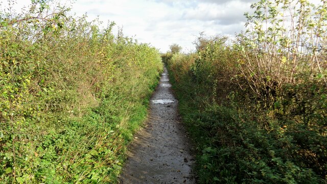
The village is a haven for nature lovers and outdoor enthusiasts. The surrounding countryside offers plenty of opportunities for walking, cycling, and exploring the scenic landscapes. The nearby River Ribble provides fishing and boating activities for those who enjoy water-based pursuits.

Overall, Balderstone offers a tranquil and idyllic lifestyle, with its peaceful setting and strong sense of community. The village's close proximity to larger towns ensures that residents can enjoy the benefits of rural living without sacrificing access to essential services.

If you have any feedback on the listing, please let us know in the comments section below.
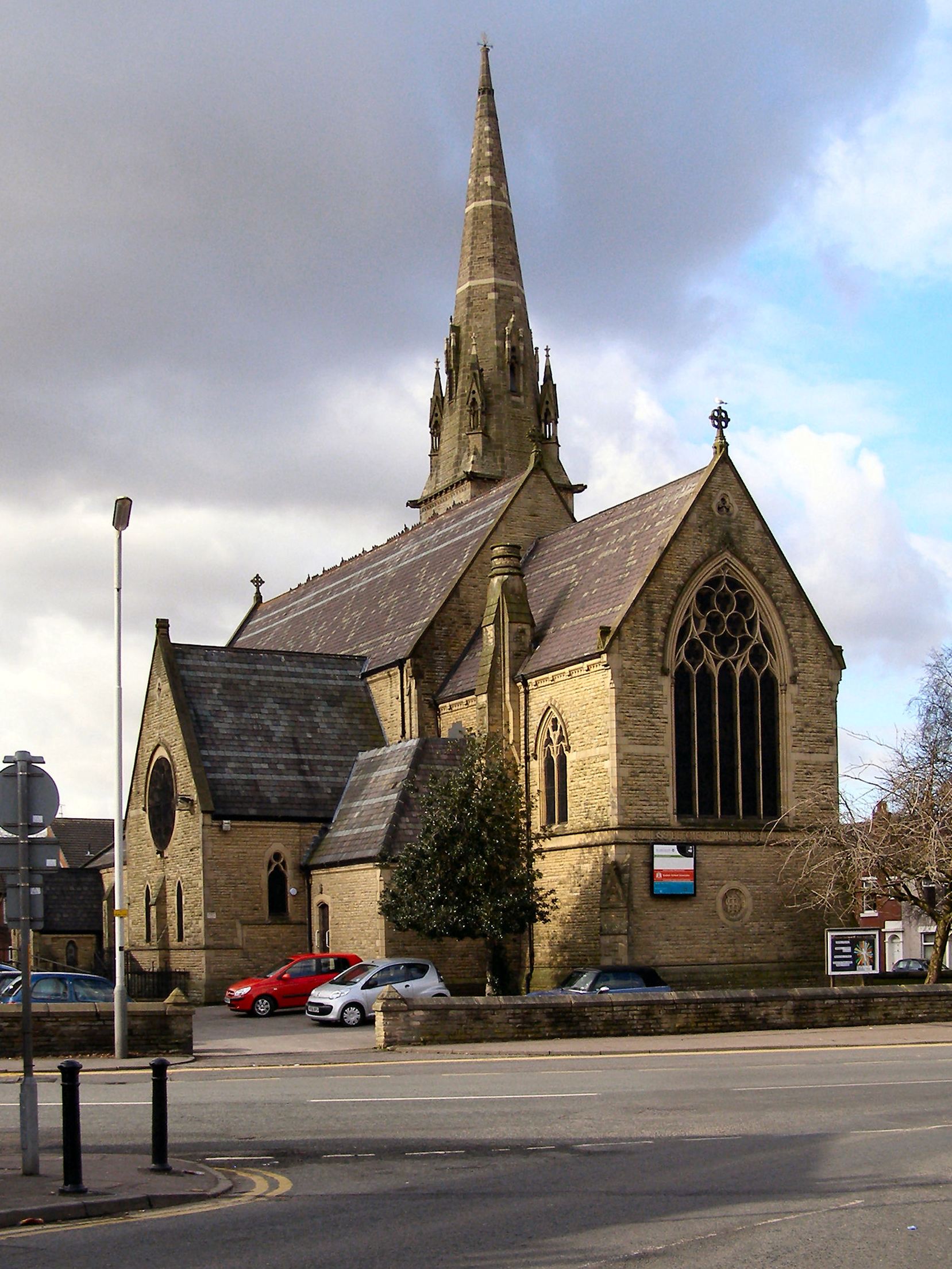
Balderstone Images

Images are sourced within 2km of 53.595933/-2.141241 or Grid Reference SD9011. Thanks to Geograph Open Source API. All images are credited.

OS Cut Mark - Royton, Puckersley Inn <span class="nowrap"><a title="https://www.bench-marks.org.uk/bm61295" rel="nofollow ugc noopener" href="https://www.bench-marks.org.uk/bm61295">Link</a><img style="margin-left:2px;" alt="External link" title="External link - shift click to open in new window" src="https://s1.geograph.org.uk/img/external.png" width="10" height="10"/></span>
OS Cut Mark - Royton, Puckersley Inn
Royton, Puckersley Inn
Oldham Way north of Tandle Hill An enclosed section of the trail before entering open fields towards Hanging Chadder
Oldham Way north of Tandle Hill
An enclosed section of the trail before entering open fields towards Hanging Chadder
Pit Lane at Gravel Hole Pit Lane from Gravel Hole to the former Burnedge Colliery was the route of a tramway and is a straight section of track
Pit Lane at Gravel Hole
Pit Lane from Gravel Hole to the former Burnedge Colliery was the route of a tramway and is a straight section of track
Oldham Way on Samuel Lane Approaching High Crompton on an old lane that is more field than lane at this point
Oldham Way on Samuel Lane
Approaching High Crompton on an old lane that is more field than lane at this point
Rochdale Metro station and Mosque in Maclure Road
A627(M) View of a bridge crossing the A627(M) seen from Tandle Hill.
A627(M)
View of a bridge crossing the A627(M) seen from Tandle Hill.
The Old Fire Station (Fireground Museum) The old Fire Brigade Station on Maclure Road dates from 1933 (<a href="https://www.geograph.org.uk/photo/3693544">SD8912 : Fire Brigade Station Detail</a>). It became redundant when new premises were built near Halifax Road. (<span class="nowrap"><a title="http://web.archive.org/web/20130716033038/http://www.manchesterfire.gov.uk/my_area/rochdale/rochdale_new_build.aspx" rel="nofollow ugc noopener" href="http://web.archive.org/web/20130716033038/http://www.manchesterfire.gov.uk/my_area/rochdale/rochdale_new_build.aspx">Archive Link</a><img style="margin-left:2px;" alt="External link" title="External link - shift click to open in new window" src="https://s1.geograph.org.uk/img/external.png" width="10" height="10"/></span>  Greater Manchester Fire and Rescue Services)

It is now the home of the Fireground museum <span class="nowrap"><a title="https://www.fireground.org.uk/" rel="nofollow ugc noopener" href="https://www.fireground.org.uk/">Link</a><img style="margin-left:2px;" alt="External link" title="External link - shift click to open in new window" src="https://s1.geograph.org.uk/img/external.png" width="10" height="10"/></span>
The Old Fire Station (Fireground Museum)
The old Fire Brigade Station on Maclure Road dates from 1933 (SD8912 : Fire Brigade Station Detail). It became redundant when new premises were built near Halifax Road. (Archive LinkExternal link Greater Manchester Fire and Rescue Services) It is now the home of the Fireground museum LinkExternal link
Rochdale Fire Station Hose Drying Tower The original tower at the fire station was built, not for practising but, for drying the hoses which would have rotted if put away wet.
Rochdale Fire Station Hose Drying Tower
The original tower at the fire station was built, not for practising but, for drying the hoses which would have rotted if put away wet.
Rochdale Fireground Museum The Fireground Museum is housed in the former fire station on Maclure Road in Rochdale. Twenty-five larger exhibits make up the museum’s appliance fleet, and this is supported by other items of firefighting equipment, uniforms, models, medals and insignia, paintings, curios and other objects. 

See the museum’s website (<span class="nowrap"><a title="https://www.fireground.org.uk/" rel="nofollow ugc noopener" href="https://www.fireground.org.uk/">Link</a><img style="margin-left:2px;" alt="External link" title="External link - shift click to open in new window" src="https://s1.geograph.org.uk/img/external.png" width="10" height="10"/></span> ) for more information.
Rochdale Fireground Museum
The Fireground Museum is housed in the former fire station on Maclure Road in Rochdale. Twenty-five larger exhibits make up the museum’s appliance fleet, and this is supported by other items of firefighting equipment, uniforms, models, medals and insignia, paintings, curios and other objects. See the museum’s website (LinkExternal link ) for more information.
Rochdale Fireground, Pump Street As well as the ‘appliance room’ with six full-size fire engines lined up, many of the museum’s objects are displayed in Pump Street, a recreated Victorian street complete with houses, shops, a police station and a fire station.
Rochdale Fireground, Pump Street
As well as the ‘appliance room’ with six full-size fire engines lined up, many of the museum’s objects are displayed in Pump Street, a recreated Victorian street complete with houses, shops, a police station and a fire station.
Fire Marks at Rochdale Fireground A small selection of insurance companies' fire marks <span class="nowrap"><a title="https://en.wikipedia.org/wiki/Fire_insurance_mark" rel="nofollow ugc noopener" href="https://en.wikipedia.org/wiki/Fire_insurance_mark">Link</a><img style="margin-left:2px;" alt="External link" title="External link - shift click to open in new window" src="https://s1.geograph.org.uk/img/external.png" width="10" height="10"/></span> displayed at the fireground museum inside the old Rochdale Fire Station.
Fire Marks at Rochdale Fireground
A small selection of insurance companies' fire marks LinkExternal link displayed at the fireground museum inside the old Rochdale Fire Station.
Cranberry Street, Rochdale Fireground As well as the Victorian Street (<a href="https://www.geograph.org.uk/photo/7143189">SD8912 : Rochdale Fireground, Pump Street</a>), the Fireground museum also contains this recreation of a war-time scene, "Cranberry Street" displaying objects relating to the Manchester Blitz <span class="nowrap"><a title="https://en.wikipedia.org/wiki/Manchester_Blitz" rel="nofollow ugc noopener" href="https://en.wikipedia.org/wiki/Manchester_Blitz">Link</a><img style="margin-left:2px;" alt="External link" title="External link - shift click to open in new window" src="https://s1.geograph.org.uk/img/external.png" width="10" height="10"/></span> of December 1940.
Cranberry Street, Rochdale Fireground
As well as the Victorian Street (SD8912 : Rochdale Fireground, Pump Street), the Fireground museum also contains this recreation of a war-time scene, "Cranberry Street" displaying objects relating to the Manchester Blitz LinkExternal link of December 1940.
Rochdale Fireground, The Appliance Room The Fireground Museum is housed in the former fire station on Maclure Road in Rochdale. Twenty-five larger exhibits make up the museum’s appliance fleet, and this is supported by other items of firefighting equipment, uniforms, models, medals and insignia, paintings, curios and other objects. 

See the museum’s website (<span class="nowrap"><a title="https://www.fireground.org.uk/" rel="nofollow ugc noopener" href="https://www.fireground.org.uk/">Link</a><img style="margin-left:2px;" alt="External link" title="External link - shift click to open in new window" src="https://s1.geograph.org.uk/img/external.png" width="10" height="10"/></span> ) for more information.
Rochdale Fireground, The Appliance Room
The Fireground Museum is housed in the former fire station on Maclure Road in Rochdale. Twenty-five larger exhibits make up the museum’s appliance fleet, and this is supported by other items of firefighting equipment, uniforms, models, medals and insignia, paintings, curios and other objects. See the museum’s website (LinkExternal link ) for more information.
The Appliance Room, Rochdale Fireground The Fireground Museum is housed in the former fire station on Maclure Road in Rochdale. Twenty-five larger exhibits make up the museum’s appliance fleet, and this is supported by other items of firefighting equipment, uniforms, models, medals and insignia, paintings, curios and other objects. 

See the museum’s website (<span class="nowrap"><a title="https://www.fireground.org.uk/" rel="nofollow ugc noopener" href="https://www.fireground.org.uk/">Link</a><img style="margin-left:2px;" alt="External link" title="External link - shift click to open in new window" src="https://s1.geograph.org.uk/img/external.png" width="10" height="10"/></span> ) for more information.
The Appliance Room, Rochdale Fireground
The Fireground Museum is housed in the former fire station on Maclure Road in Rochdale. Twenty-five larger exhibits make up the museum’s appliance fleet, and this is supported by other items of firefighting equipment, uniforms, models, medals and insignia, paintings, curios and other objects. See the museum’s website (LinkExternal link ) for more information.
Rochdale Canal Deviation To re-open the Rochdale Canal a deviation was required around the A627(M) motorway  and the A664 Edinburgh Way. This is the view of the new stretch from the Gorrels Way bridge
Rochdale Canal Deviation
To re-open the Rochdale Canal a deviation was required around the A627(M) motorway and the A664 Edinburgh Way. This is the view of the new stretch from the Gorrels Way bridge
Rochdale Railway Station Metrolink Tram Stop 
The tram stop for Rochdale Railway Station is on a reserved tramway the west side of Maclure Road, a short walk from the actual railway station. The tram stop is in the form of an island platform with ramps at both ends. It  opened in 2013 before the line was extended to Rochdale Town Centre in 2014.

On the left is St John the Baptist Roman Catholic Church. It was founded in 1839 but rebuilt    in a Byzantine style with a large dome in the manner of Hagia Sophia to a design by Oswald Hill (pre 1917) and executed in 1925-7 by Ernest Bower Norris. It is Grade II* listed <span class="nowrap"><a title="https://historicengland.org.uk/listing/the-list/list-entry/1376506?section=official-list-entry" rel="nofollow ugc noopener" href="https://historicengland.org.uk/listing/the-list/list-entry/1376506?section=official-list-entry">Link</a><img style="margin-left:2px;" alt="External link" title="External link - shift click to open in new window" src="https://s1.geograph.org.uk/img/external.png" width="10" height="10"/></span>

On the right is the tower of the former Fire Station. The old Fire Brigade Station on Maclure Road dates from 1933 but closed in 2013. At the rear is the Greater Manchester Fire Service Museum <span class="nowrap"><a title="http://gmfsmuseum.org.uk/visiting-museum" rel="nofollow ugc noopener" href="http://gmfsmuseum.org.uk/visiting-museum">Link</a><img style="margin-left:2px;" alt="External link" title="External link - shift click to open in new window" src="https://s1.geograph.org.uk/img/external.png" width="10" height="10"/></span>
Rochdale Railway Station Metrolink Tram Stop
The tram stop for Rochdale Railway Station is on a reserved tramway the west side of Maclure Road, a short walk from the actual railway station. The tram stop is in the form of an island platform with ramps at both ends. It opened in 2013 before the line was extended to Rochdale Town Centre in 2014. On the left is St John the Baptist Roman Catholic Church. It was founded in 1839 but rebuilt in a Byzantine style with a large dome in the manner of Hagia Sophia to a design by Oswald Hill (pre 1917) and executed in 1925-7 by Ernest Bower Norris. It is Grade II* listed LinkExternal link On the right is the tower of the former Fire Station. The old Fire Brigade Station on Maclure Road dates from 1933 but closed in 2013. At the rear is the Greater Manchester Fire Service Museum LinkExternal link
Rochdale Railway Station 

The original Rochdale Station was opened in 1839 adjacent to Moss Lane. It was replaced by the present station in 1889. As well as being on the Lancashire & Yorkshire main line between Manchester Victoria and Leeds there were branches to Bury (1848 - 1970), Bacup (1881 - 1947) and Oldham (1863 - 2009). The latter line was converted into the Metrolink tram line. Trams pass over the main Calderdale line on a flyover before descending to street level, en route to the new stop <a href="https://www.geograph.org.uk/photo/7356286">SD8912 : Rochdale Railway Station Metrolink Tram Stop</a> on Maclure Road.
Rochdale Railway Station
The original Rochdale Station was opened in 1839 adjacent to Moss Lane. It was replaced by the present station in 1889. As well as being on the Lancashire & Yorkshire main line between Manchester Victoria and Leeds there were branches to Bury (1848 - 1970), Bacup (1881 - 1947) and Oldham (1863 - 2009). The latter line was converted into the Metrolink tram line. Trams pass over the main Calderdale line on a flyover before descending to street level, en route to the new stop SD8912 : Rochdale Railway Station Metrolink Tram Stop on Maclure Road.
Show me another place!

Balderstone is located at Grid Ref: SD9011 (Lat: 53.595933, Lng: -2.141241)

Unitary Authority: Rochdale

Police Authority: Greater Manchester

What 3 Words

///strike.club.visa. Near Rochdale, Manchester

Related Wikis

Balderstone, Greater Manchester

Balderstone is a district and an electoral ward of the wider Metropolitan Borough of Rochdale in the county of Greater Manchester, England. According to...

St Cuthbert's RC High School

St Cuthbert's Roman Catholic High School is a coeducational secondary school located in the Thornham area of Rochdale in Greater Manchester, England....

Balderstone Technology College

Balderstone Technology College was a school in the Balderstone district of the Metropolitan Borough of Rochdale in Greater Manchester, England. ��2�...

Kingsway Park High School

Kingsway Park High School is an 11–16 mixed secondary School that opened in September 2010. The school is located in the Kingsway area of the Metropolitan...

Springhill High School, Rochdale

Springhill High School was a co-educational secondary school on Turf Hill Road in Rochdale, Greater Manchester, England. The catchment area consists of...

Kingsway Business Park

Kingsway Business Park is a 0.66-square-mile (1.7 km2) business park in the Metropolitan Borough of Rochdale, in Greater Manchester, England.JD Sports...

Rochdale Branch Canal

The Rochdale Branch Canal was a branch of the Rochdale Canal in north-west England which led close to Rochdale Town Centre. It was in use from 1794, and...

Zen Internet

Zen Internet is an Internet service provider (ISP) based in Rochdale, England. == History == Zen was founded in 1995 by Richard Tang (then Managing Director...

Related Videos

Walking Tour of Rochdale Old Town | Visiting To Rochdale Old Town | 2023 | Part 1

Visiting To Rochdale Old Town | Walking Tour of Rochdale Old Town | 2023 | Part 1 We visited to Rochdale Old Town. Its gone ...

Brown Wardle Hill Hike

24th Aug 2023 | Hike from popular camping spot in Syke to Brown Wardle Hill in Rochdale, North West, England.

Hollingworth Lake / New Hey Hike Highlights

26th June 2023 | Exploring nature and walking trails in North West of England.

Rochdale

Lets See What Rochdale Has Got To Offer.

Nearby Amenities

Located within 500m of 53.595933,-2.141241
Buersil
Is In: Rochdale, Greater Manchester, England, UK
Place: suburb
Source: npe
Lat/Long: 53.5978883/-2.142085
Balderstone
Is In: Rochdale, Greater Manchester, England, UK
Place: suburb
Source: npe
Lat/Long: 53.5956662/-2.1412588
Crossing
Crossing: zebra
Kerb: lowered
Tactile Paving: yes
Lat/Long: 53.5987937/-2.1426833
Mini Roundabout
Direction: clockwise
Lat/Long: 53.5998013/-2.1391412
Bus Stop
Balderstone Road/Hill Top Drive
Bus: yes
Naptan AtcoCode: 1800NE03831
Naptan Bearing: W
Naptan CommonName: Balderstone Road/Hill Top Drive
Naptan Indicator: Nr Open Land
Naptan Landmark: NR OPEN LAND
Naptan NaptanCode: mantdtwg
Naptan PlusbusZoneRef: MNCRPIC
Naptan ShortCommonName: Hill Top Drive
Naptan Street: Balderstone Road
Naptan Verified: no
Network: TfGM
Public Transport: platform
Source: naptan_import
Lat/Long: 53.5965003/-2.1472992
Bus Stop
New Broad Lane/Badger Close
Bus: yes
Naptan AtcoCode: 1800NE35901
Naptan Bearing: S
Naptan CommonName: New Broad Lane/Badger Close
Naptan Indicator: Spring Inn
Naptan Landmark: SPRING INN
Naptan NaptanCode: mangdpag
Naptan PlusbusZoneRef: MNCRPIC
Naptan ShortCommonName: Badger Close
Naptan Street: New Broad Lane
Naptan Verified: no
Network: TfGM
Public Transport: platform
Source: naptan_import
Lat/Long: 53.598512/-2.1376424
Bus Stop
Turf Hill Road/Broad Lane
Bus: yes
Naptan AtcoCode: 1800NE32601
Naptan Bearing: SW
Naptan CommonName: Turf Hill Road/Broad Lane
Naptan Indicator: O/s House 2
Naptan Landmark: HOUSE 2
Naptan NaptanCode: mangdgmj
Naptan PlusbusZoneRef: MNCRPIC
Naptan ShortCommonName: Broad Lane
Naptan Street: TURF HILL ROAD
Naptan Verified: no
Network: TfGM
Public Transport: platform
Source: naptan_import
Lat/Long: 53.6000661/-2.1384333
Bus Stop
Broad Lane/Spring Hill
Bus: yes
Naptan AtcoCode: 1800NE32611
Naptan Bearing: W
Naptan CommonName: Broad Lane/Spring Hill
Naptan Indicator: Bungalows
Naptan Landmark: RESOURCE CENTRE
Naptan NaptanCode: mangdgmp
Naptan PlusbusZoneRef: MNCRPIC
Naptan ShortCommonName: Spring Hill
Naptan Street: BROAD LANE
Naptan Verified: no
Network: TfGM
Public Transport: platform
Source: naptan_import
Lat/Long: 53.5994161/-2.1407885
Bus Stop
Charlotte Street/Broad Lane
Bus: yes
Naptan AtcoCode: 1800NE32621
Naptan Bearing: SE
Naptan CommonName: Charlotte Street/Broad Lane
Naptan Indicator: O/s House 93
Naptan Landmark: HOUSE 93
Naptan NaptanCode: mangdgmt
Naptan PlusbusZoneRef: MNCRPIC
Naptan ShortCommonName: Broad Lane
Naptan Street: Charlotte Street
Naptan Verified: no
Network: TfGM
Public Transport: platform
Source: naptan_import
Lat/Long: 53.5991711/-2.1427369
Bus Stop
Balderstone, Oldham Road / near Broad Lane
Bus: yes
Naptan AtcoCode: 1800NE32671
Naptan Bearing: S
Naptan CommonName: Oldham Road/Broad Lane
Naptan Indicator: House 621
Naptan Landmark: HOUSE 621
Naptan NaptanCode: mangdgpg
Naptan Notes: LOCATION AMENDED
Naptan PlusbusZoneRef: MNCRPIC
Naptan ShortCommonName: Broad Lane
Naptan Street: OLDHAM ROAD
Naptan Verified: no
Network: TfGM
Operator: TfGM
Public Transport: platform
Source: naptan_import
Lat/Long: 53.5980896/-2.1451963
Bus Stop
Balderstone, Oldham Road / opposite Broad Lane
Bus: yes
Naptan AtcoCode: 1800NE32681
Naptan Bearing: N
Naptan CommonName: Oldham Road/Broad Lane
Naptan Indicator: O/s House 334
Naptan Landmark: HOUSE 334
Naptan NaptanCode: mangdgpj
Naptan Notes: LOCATION AMENDED
Naptan PlusbusZoneRef: MNCRPIC
Naptan ShortCommonName: Broad Lane
Naptan Street: OLDHAM ROAD
Naptan Verified: no
Network: TfGM
Operator: TfGM
Public Transport: platform
Source: naptan_import
Lat/Long: 53.5978468/-2.145271
Bus Stop
Balderstone, Oldham Road / near Connaught Avenue
Bus: yes
Naptan AtcoCode: 1800NE32691
Naptan Bearing: S
Naptan CommonName: Oldham Road/Connaught Avenue
Naptan Indicator: House 661
Naptan Landmark: HOUSE 661
Naptan NaptanCode: mangdgpm
Naptan PlusbusZoneRef: MNCRPIC
Naptan ShortCommonName: Connaught Avenue
Naptan Street: OLDHAM ROAD
Naptan Verified: no
Network: TfGM
Operator: TfGM
Public Transport: platform
Source: naptan_import
Lat/Long: 53.5957085/-2.144478
Bus Stop
Balderstone, Oldham Road / opposite Connaught Avenue
Bus: yes
Naptan AtcoCode: 1800NE32701
Naptan Bearing: N
Naptan CommonName: Oldham Road/Connaught Avenue
Naptan Indicator: Balderstne Mill
Naptan Landmark: FLATS
Naptan NaptanCode: mangdgpt
Naptan PlusbusZoneRef: MNCRPIC
Naptan ShortCommonName: Connaught Avenue
Naptan Street: OLDHAM ROAD
Naptan Verified: no
Network: TfGM
Operator: TfGM
Public Transport: platform
Source: naptan_import
Lat/Long: 53.5957172/-2.1446744
Bus Stop
Buersil, Oldham Road / opposite Holly Street
Bus: yes
Naptan AtcoCode: 1800NE32711
Naptan Bearing: N
Naptan CommonName: Oldham Road/Melbourne Road
Naptan Indicator: O/s House 414
Naptan Landmark: HOUSE 414
Naptan NaptanCode: mangdgpw
Naptan PlusbusZoneRef: MNCRPIC
Naptan ShortCommonName: Melbourne Road
Naptan Street: OLDHAM ROAD
Naptan Verified: no
Network: TfGM
Operator: TfGM
Public Transport: platform
Source: naptan_import
Lat/Long: 53.5943157/-2.1440653
Bus Stop
Buersil, Oldham Road / near Holly Street
Bus: yes
Naptan AtcoCode: 1800NE32721
Naptan Bearing: S
Naptan CommonName: Oldham Road/Melbourne Road
Naptan Indicator: Shops
Naptan Landmark: HOUSE 713
Naptan NaptanCode: mangdgta
Naptan PlusbusZoneRef: MNCRPIC
Naptan ShortCommonName: Melbourne Road
Naptan Street: OLDHAM ROAD
Naptan Verified: no
Network: TfGM
Operator: TfGM
Public Transport: platform
Source: naptan_import
Lat/Long: 53.5935076/-2.1433826
Bus Stop
Buersil, Oldham Road / opposite Gilbrook Way
Bus: yes
Naptan AtcoCode: 1800NE32731
Naptan Bearing: N
Naptan CommonName: Oldham Road/Gilbrook Way
Naptan Indicator: O/s House 472
Naptan Landmark: HOUSE 472
Naptan NaptanCode: mangdgtd
Naptan Notes: INDICATOR AMENDED
Naptan PlusbusZoneRef: MNCRPIC
Naptan ShortCommonName: Gilbrook Way
Naptan Street: OLDHAM ROAD
Naptan Verified: no
Network: TfGM
Operator: TfGM
Public Transport: platform
Source: naptan_import
Lat/Long: 53.5924838/-2.1426691
Bus Stop
Buersil, Oldham Road / near Gilbrook Way
Bus: yes
Naptan AtcoCode: 1800NE32741
Naptan Bearing: S
Naptan CommonName: Oldham Road/Gilbrook Way
Naptan Indicator: Opp House 484
Naptan Landmark: HOUSE 4
Naptan NaptanCode: mangdgtg
Naptan PlusbusZoneRef: MNCRPIC
Naptan ShortCommonName: Gilbrook Way
Naptan Street: OLDHAM ROAD
Naptan Verified: no
Network: TfGM
Operator: TfGM
Public Transport: platform
Source: naptan_import
Lat/Long: 53.5922685/-2.1422906
Bus Stop
Hill Top Drive/Melbourne Road
Bus: yes
Naptan AtcoCode: 1800NE49621
Naptan Bearing: S
Naptan CommonName: Hill Top Drive/Melbourne Road
Naptan Indicator: Nr House 280
Naptan Landmark: HOUSE 280
Naptan NaptanCode: mangjdam
Naptan PlusbusZoneRef: MNCRPIC
Naptan ShortCommonName: Melbourne Road
Naptan Street: HILL TOP DRIVE
Naptan Verified: no
Network: TfGM
Public Transport: platform
Source: naptan_import
Lat/Long: 53.5943845/-2.1466945
Bus Stop
Hill Top Drive/Melbourne Road
Bus: yes
Naptan AtcoCode: 1800NE49631
Naptan Bearing: N
Naptan CommonName: Hill Top Drive/Melbourne Road
Naptan Indicator: Bungalows
Naptan Landmark: HOUSE 293
Naptan NaptanCode: mangjdap
Naptan PlusbusZoneRef: MNCRPIC
Naptan ShortCommonName: Melbourne Road
Naptan Street: HILL TOP DRIVE
Naptan Verified: no
Network: TfGM
Public Transport: platform
Source: naptan_import
Lat/Long: 53.5948248/-2.1467867
Bus Stop
Hill Top Drive/Balderstone Road
Bus: yes
Naptan AtcoCode: 1800NE49641
Naptan Bearing: N
Naptan CommonName: Hill Top Drive/Balderstone Road
Naptan Indicator: Opp House 352
Naptan Landmark: HOUSE 323
Naptan NaptanCode: mangjdat
Naptan PlusbusZoneRef: MNCRPIC
Naptan ShortCommonName: Balderstone Road
Naptan Street: HILL TOP DRIVE
Naptan Verified: no
Network: TfGM
Public Transport: platform
Source: naptan_import
Lat/Long: 53.5960741/-2.1468364
Bus Stop
Balderstone Road/Oldham Road
Bus: yes
Naptan AtcoCode: 1800NE49651
Naptan Bearing: W
Naptan CommonName: Balderstone Road/Oldham Road
Naptan Indicator: Os Flats 1 To 7
Naptan Landmark: FLATS 1-7
Naptan NaptanCode: mangjdaw
Naptan Notes: INDICATOR AMENDED
Naptan PlusbusZoneRef: MNCRPIC
Naptan ShortCommonName: Oldham Road
Naptan Street: Balderstone Road
Naptan Verified: no
Network: TfGM
Public Transport: platform
Source: naptan_import
Lat/Long: 53.5966151/-2.1454632
Bus Stop
Balderstone Road/Oldham Road
Bus: yes
Naptan AtcoCode: 1800NE49661
Naptan Bearing: E
Naptan CommonName: Balderstone Road/Oldham Road
Naptan Indicator: Hornet Close
Naptan Landmark: HORNET CLOSE
Naptan NaptanCode: mangjdga
Naptan PlusbusZoneRef: MNCRPIC
Naptan ShortCommonName: Oldham Road
Naptan Street: Balderstone Road
Naptan Verified: no
Network: TfGM
Public Transport: platform
Source: naptan_import
Lat/Long: 53.5967495/-2.1458263
Bus Stop
Baldestone Road/Hill Top Drive
Bus: yes
Naptan AtcoCode: 1800NE49671
Naptan Bearing: E
Naptan CommonName: Baldestone Road/Hill Top Drive
Naptan Indicator: Nr Open Land
Naptan Landmark: NR OPEN LAND
Naptan NaptanCode: mangjdgd
Naptan PlusbusZoneRef: MNCRPIC
Naptan ShortCommonName: Hill Top Drive
Naptan Street: Balderstone Road
Naptan Verified: no
Network: TfGM
Public Transport: platform
Source: naptan_import
Lat/Long: 53.5966395/-2.1475787
Pub
Spring Inn
Wheelchair: yes
Lat/Long: 53.5985291/-2.137059
Turning Circle
Lat/Long: 53.5960616/-2.1381891
Turning Circle
Lat/Long: 53.5961489/-2.1381787
Balderstone Park
Leisure: playground
Lat/Long: 53.5977762/-2.1471741
Post Box
Lat/Long: 53.5966715/-2.1471687
Restaurant
Lat/Long: 53.598658/-2.1370568
Barrier: cycle_barrier
Lat/Long: 53.594894/-2.140728
Barrier: cycle_barrier
Lat/Long: 53.5949373/-2.1388129
Crossing
Crossing: marked
Lat/Long: 53.5939442/-2.1437808
Barrier: bollard
Bicycle: yes
Foot: yes
Horse: yes
Motor Vehicle: no
Lat/Long: 53.5984672/-2.1472888
Generator Method: photovoltaic
Generator Output Electricity: yes
Generator Source: solar
Generator Type: solar_photovoltaic_panel
Location: roof
Power: generator
Lat/Long: 53.5965041/-2.1398499
Generator Method: photovoltaic
Generator Output Electricity: yes
Generator Source: solar
Generator Type: solar_photovoltaic_panel
Location: roof
Power: generator
Lat/Long: 53.5946253/-2.1372311
Generator Method: photovoltaic
Generator Output Electricity: yes
Generator Source: solar
Generator Type: solar_photovoltaic_panel
Location: roof
Power: generator
Lat/Long: 53.5958665/-2.1370793
Generator Method: photovoltaic
Generator Output Electricity: yes
Generator Source: solar
Generator Type: solar_photovoltaic_panel
Location: roof
Power: generator
Lat/Long: 53.5958325/-2.1372486
Generator Method: photovoltaic
Generator Output Electricity: yes
Generator Source: solar
Generator Type: solar_photovoltaic_panel
Location: roof
Power: generator
Lat/Long: 53.5958886/-2.1369169
Generator Method: photovoltaic
Generator Output Electricity: yes
Generator Source: solar
Generator Type: solar_photovoltaic_panel
Location: roof
Power: generator
Lat/Long: 53.5947046/-2.136716
Generator Method: photovoltaic
Generator Output Electricity: yes
Generator Source: solar
Generator Type: solar_photovoltaic_panel
Location: roof
Power: generator
Lat/Long: 53.5995732/-2.137101
Generator Method: photovoltaic
Generator Output Electricity: yes
Generator Source: solar
Generator Type: solar_photovoltaic_panel
Location: roof
Power: generator
Lat/Long: 53.5948496/-2.135816
Generator Method: photovoltaic
Generator Output Electricity: yes
Generator Source: solar
Generator Type: solar_photovoltaic_panel
Location: roof
Power: generator
Lat/Long: 53.5951975/-2.137655
Generator Method: photovoltaic
Generator Output Electricity: yes
Generator Source: solar
Generator Type: solar_photovoltaic_panel
Location: roof
Power: generator
Lat/Long: 53.5993262/-2.1368364
Generator Method: photovoltaic
Generator Output Electricity: yes
Generator Source: solar
Generator Type: solar_photovoltaic_panel
Location: roof
Power: generator
Lat/Long: 53.5951566/-2.1345452
Generator Method: photovoltaic
Generator Output Electricity: yes
Generator Source: solar
Generator Type: solar_photovoltaic_panel
Location: roof
Power: generator
Lat/Long: 53.5959191/-2.1367838
Generator Method: photovoltaic
Generator Output Electricity: yes
Generator Source: solar
Generator Type: solar_photovoltaic_panel
Location: roof
Power: generator
Lat/Long: 53.5937516/-2.1405308
Generator Method: photovoltaic
Generator Output Electricity: yes
Generator Source: solar
Generator Type: solar_photovoltaic_panel
Location: roof
Power: generator
Lat/Long: 53.5954345/-2.1360364
Generator Method: photovoltaic
Generator Output Electricity: yes
Generator Source: solar
Generator Type: solar_photovoltaic_panel
Location: roof
Power: generator
Lat/Long: 53.5947122/-2.1365688
Generator Method: photovoltaic
Generator Output Electricity: yes
Generator Source: solar
Generator Type: solar_photovoltaic_panel
Location: roof
Power: generator
Lat/Long: 53.5959337/-2.1366565
Generator Method: photovoltaic
Generator Output Electricity: yes
Generator Source: solar
Generator Type: solar_photovoltaic_panel
Location: roof
Power: generator
Lat/Long: 53.5954026/-2.1362231
Generator Method: photovoltaic
Generator Output Electricity: yes
Generator Source: solar
Generator Type: solar_photovoltaic_panel
Location: roof
Power: generator
Lat/Long: 53.5946893/-2.1368771
Generator Method: photovoltaic
Generator Output Electricity: yes
Generator Source: solar
Generator Type: solar_photovoltaic_panel
Location: roof
Power: generator
Lat/Long: 53.5946075/-2.13737
Barrier: bollard
Lat/Long: 53.5933253/-2.1406969
Bus Stop
Broad Lane/The Craven
Bus: yes
Naptan AtcoCode: 1800NE10201
Naptan Bearing: E
Naptan Landmark: SPRINGHILL
Naptan NaptanCode: MANTWAWP
Naptan Street: Broad Lane
Naptan Verified: no
Network: TfGM
Public Transport: platform
Source: naptan_import
Lat/Long: 53.5987213/-2.1445951
The data included in this document is from www.openstreetmap.org. The data is made available under ODbL.

Have you been to Balderstone?

Leave your review of Balderstone below (or comments, questions and feedback).