Laga Brune

Downs, Moorland in Shetland

Scotland

Laga Brune

Sand Water, near West Sandwick, at dusk
Sand Water, near West Sandwick, at dusk Credit: Mike Pennington

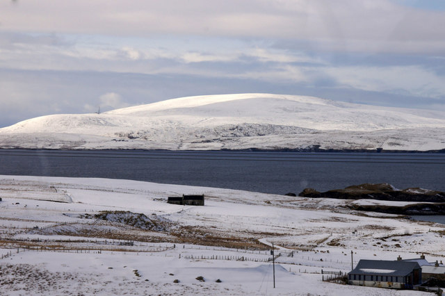
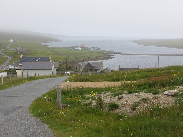
Laga Brune, located in Shetland, is a diverse and picturesque landscape that encompasses downs and moorland. Situated in the northernmost part of Scotland, Shetland is an archipelago known for its stunning natural beauty, and Laga Brune is no exception.

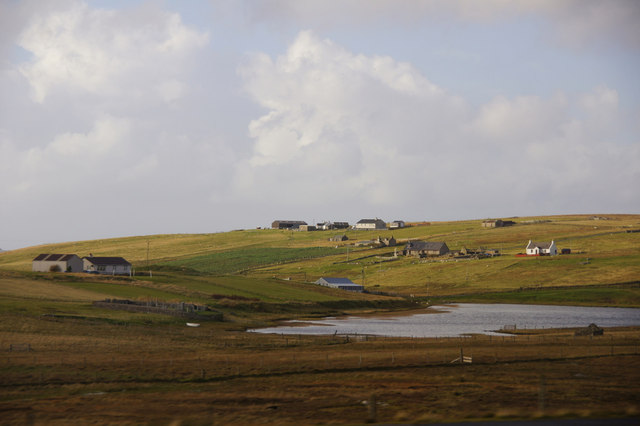
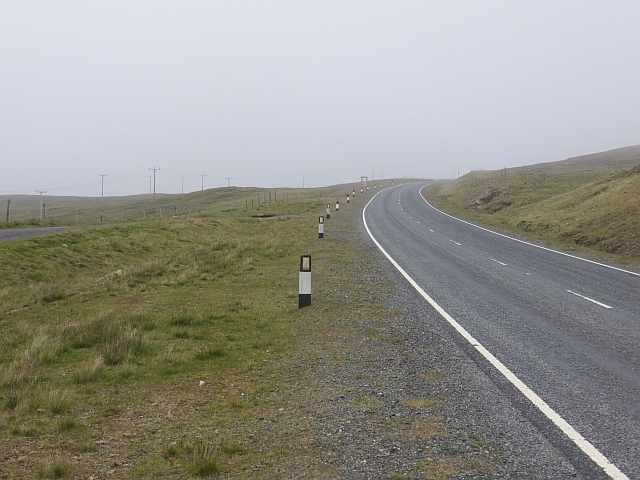
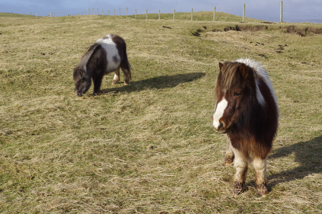
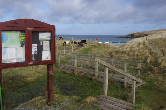
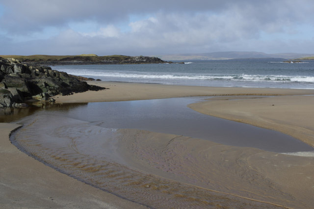
Laga Brune is characterized by its rolling downs, which are grassy meadows with gentle slopes. These downs provide a habitat for a variety of plant species, including wildflowers such as heather and cotton grass. The area is also home to numerous bird species, including the iconic Shetland ponies that roam freely across the downs, adding to the charm of the landscape.

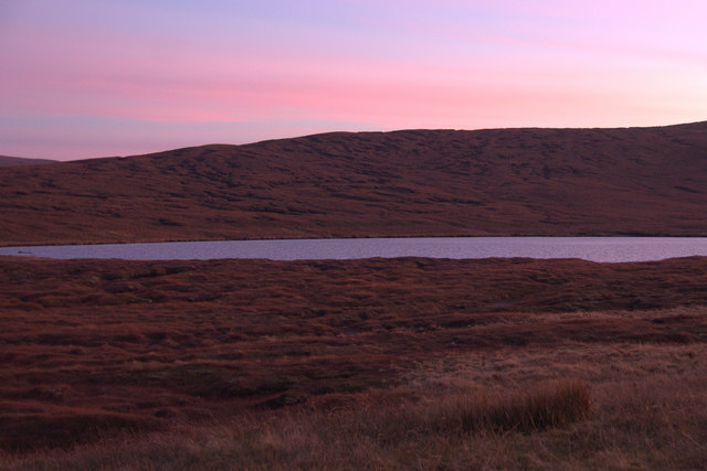
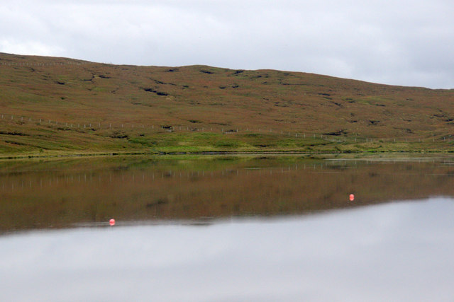
The moorland in Laga Brune is a vast expanse of heathland, characterized by its wet and boggy terrain. Moorland plants, such as sphagnum moss and bog myrtle, thrive in this environment. The moorland is an important habitat for various bird species, including golden plovers and merlins.

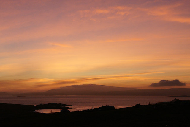
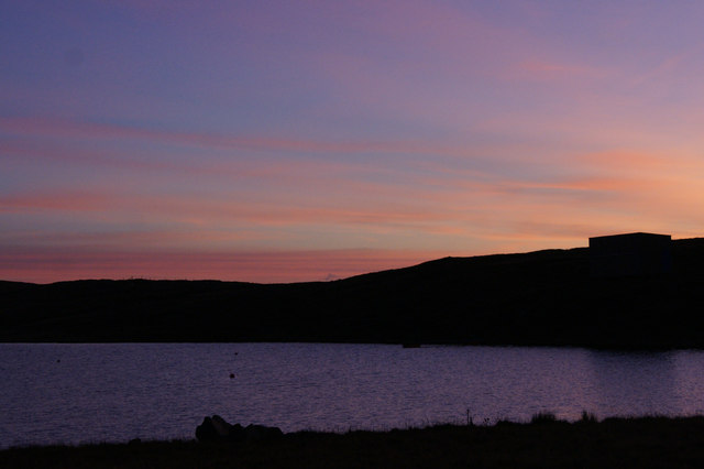
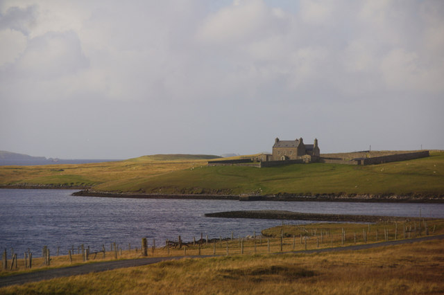
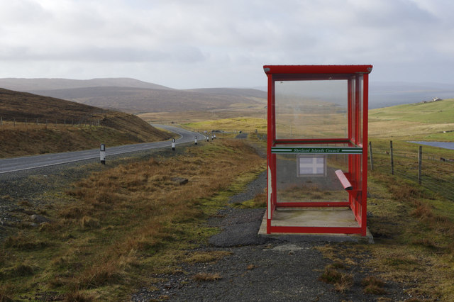
Laga Brune offers visitors the opportunity to immerse themselves in the natural beauty of Shetland. It is a popular spot for hiking and nature walks, providing breathtaking views of the surrounding countryside and coastline. The area is also rich in archaeological sites, with ancient ruins and standing stones scattered throughout the landscape.

Overall, Laga Brune in Shetland is a stunning example of downs and moorland, offering a unique and diverse ecosystem that is home to an array of plant and bird species. Its natural beauty and cultural significance make it a must-visit destination for nature enthusiasts and history buffs alike.

If you have any feedback on the listing, please let us know in the comments section below.

Laga Brune Images

Images are sourced within 2km of 60.585212/-1.1819617 or Grid Reference HU4489. Thanks to Geograph Open Source API. All images are credited.

Sand Water, near West Sandwick, at dusk
Yell Sound at dusk from above West Sandwick Across the sound, after a lovely sunny day, Ronas Hill is wreathed in mist, an unusual sight in late autumn in Shetland.
Yell Sound at dusk from above West Sandwick
Across the sound, after a lovely sunny day, Ronas Hill is wreathed in mist, an unusual sight in late autumn in Shetland.
Lunga Water, near West Sandwick, at dusk
North Haa, West Sandwick At the head of Southladie Voe.
North Haa, West Sandwick
At the head of Southladie Voe.
Loch of Scattlands, West Sandwick
View from West Sandwick across Yell Sound to Ronas Hill
Hjarkland: postbox № ZE2 28 This postbox stands on the main A968, on the corner of the road to West Sandwick and the hamlet to the north marked as Harkland on the 1:50,000 and 1:25,000 maps but spelt Hjarkland on larger scale maps and on local signage.
Hjarkland: postbox № ZE2 28
This postbox stands on the main A968, on the corner of the road to West Sandwick and the hamlet to the north marked as Harkland on the 1:50,000 and 1:25,000 maps but spelt Hjarkland on larger scale maps and on local signage.
West Sandwick: postbox № ZE2 96 A standard postbox on a metal pole, emptied each morning except Sunday at 10:15.
West Sandwick: postbox № ZE2 96
A standard postbox on a metal pole, emptied each morning except Sunday at 10:15.
West Sandwick: red telephone box A traditional K6 phone box in the centre of the village.
West Sandwick: red telephone box
A traditional K6 phone box in the centre of the village.
Lunga Water, near West Sandwick
A968 The main road between the ferry terminals on Yell.
A968
The main road between the ferry terminals on Yell.
Descent to Southladie Voe West Sandwick.
Descent to Southladie Voe
West Sandwick.
Southladie Voe View along the shore to North Ha. (two gable ends, end on - not a ruin).
Southladie Voe
View along the shore to North Ha. (two gable ends, end on - not a ruin).
Burn of Dalamut, West Sandwick
Bus shelter at the West Sandwick turn These simple red bus shelters, provided by the Islands Council, are ubiquitous across Shetland. This one stands on what appears to be the old road alignment by the A968 - the main route across Yell. In common with most main roads in Shetland it is well-maintained, fast and generally empty.
Bus shelter at the West Sandwick turn
These simple red bus shelters, provided by the Islands Council, are ubiquitous across Shetland. This one stands on what appears to be the old road alignment by the A968 - the main route across Yell. In common with most main roads in Shetland it is well-maintained, fast and generally empty.
Shetland ponies on Yell These small ponies originated in Shetland and are a common sight around the islands; the tradition of small horses here stretches back at least to the bronze age. They are noted for being hardy, strong, intelligent and, of course, irresistibly loveable. These two seemed content in their field by the sea, the nearest one clearly hoping for a sugar lump from the photographer - sadly it was to be disappointed.
Shetland ponies on Yell
These small ponies originated in Shetland and are a common sight around the islands; the tradition of small horses here stretches back at least to the bronze age. They are noted for being hardy, strong, intelligent and, of course, irresistibly loveable. These two seemed content in their field by the sea, the nearest one clearly hoping for a sugar lump from the photographer - sadly it was to be disappointed.
West Sandwick A track from West Sandwick village leads to a small car park from where a short path gives access to a glorious stretch of golden sand. Apart from this neatly maintained notice case there are no other facilities.
West Sandwick
A track from West Sandwick village leads to a small car park from where a short path gives access to a glorious stretch of golden sand. Apart from this neatly maintained notice case there are no other facilities.
West Sandwick Beach The southern end of this Yell beach.
West Sandwick Beach
The southern end of this Yell beach.
Show me another place!

Laga Brune is located at Grid Ref: HU4489 (Lat: 60.585212, Lng: -1.1819617)

Unitary Authority: Shetland Islands

Police Authority: Highlands and Islands

What 3 Words

///pouting.worth.salmon. Near Ulsta, Shetland Islands

Related Wikis

West Sandwick

West Sandwick is a settlement on the island of Yell, Shetland Islands, Scotland. It is one of the few settlements in the west of the island. West Sandwick...

Yell Sound

Yell Sound is the strait running between Yell and Mainland, Shetland, Scotland. It is the boundary between the Mainland and the North Isles and it contains...

Muckle Holm, Yell Sound

Muckle Holm is a small island in Shetland. It is in Yell Sound, near the Northmavine. It is 23 metres (75 ft) at its highest point. There is a lighthouse...

Little Holm, Yell Sound

Little Holm is a small island in Yell Sound, in Shetland, Scotland. It lies between Northmavine and the island of Yell. There is a lighthouse here. In...

Nearby Amenities

Located within 500m of 60.585212,-1.1819617
Passing Place
Lat/Long: 60.5857534/-1.1794937
Passing Place
Lat/Long: 60.584697/-1.1812267
Barrier: cattle_grid
Lat/Long: 60.5839638/-1.1731637
Quam B&B
Addr City: Shetland
Addr Postcode: ZE2 9BH
Fhrs Id: 505824
Name En: Quam B&B
Source Addr Postcode: FHRS Open Data
Tourism: guest_house
Lat/Long: 60.5840446/-1.1743842
Power: pole
Lat/Long: 60.5847803/-1.174123
Power: pole
Lat/Long: 60.5822228/-1.1784719
Power: pole
Lat/Long: 60.5822913/-1.1790271
Passing Place
Lat/Long: 60.5812626/-1.1841615
Passing Place
Lat/Long: 60.5810923/-1.18281
Power: pole
Lat/Long: 60.5840803/-1.1770021
Power: pole
Lat/Long: 60.5848951/-1.1788313
Barrier: cattle_grid
Lat/Long: 60.5846527/-1.1813809
Barrier: cattle_grid
Lat/Long: 60.5856927/-1.1810417
Power: pole
Lat/Long: 60.5861173/-1.1858312
Power: pole
Lat/Long: 60.5859144/-1.1853337
Power: pole
Lat/Long: 60.5814643/-1.1786724
Power: pole
Lat/Long: 60.5829412/-1.1791418
Power: pole
Lat/Long: 60.5834668/-1.1796326
Power: pole
Lat/Long: 60.5839898/-1.1801154
Power: pole
Lat/Long: 60.5842954/-1.1799304
Power: pole
Lat/Long: 60.5842638/-1.1821056
Power: pole
Lat/Long: 60.5846498/-1.1831115
Power: pole
Lat/Long: 60.5850898/-1.1842487
Power: pole
Lat/Long: 60.5854494/-1.1842326
Power: pole
Lat/Long: 60.5856957/-1.1848093
Power: pole
Lat/Long: 60.5852294/-1.1836854
Power: pole
Lat/Long: 60.5854323/-1.178726
Power: pole
Lat/Long: 60.5846195/-1.1782137
Power: pole
Lat/Long: 60.584327/-1.177562
Barrier: cattle_grid
Lat/Long: 60.5859825/-1.1749013
Generator Method: wind_turbine
Generator Source: wind
Power: generator
Lat/Long: 60.5841772/-1.1739489
Power: pole
Lat/Long: 60.5838645/-1.1810864
Power: pole
Lat/Long: 60.584555/-1.175838
Power: pole
Lat/Long: 60.5841683/-1.1788241
The data included in this document is from www.openstreetmap.org. The data is made available under ODbL.

Have you been to Laga Brune?

Leave your review of Laga Brune below (or comments, questions and feedback).