Burton Moor

Downs, Moorland in Yorkshire Harrogate

England

Burton Moor

Ploughed fields and pylons near Treble Sykes Farm.
Ploughed fields and pylons near Treble Sykes Farm. Credit: Gordon Hatton

Burton Moor, located in the county of Yorkshire, is a picturesque area known for its rolling downs and vast moorlands. The moor covers an extensive area, stretching for miles, and is characterized by its rugged beauty and diverse wildlife.

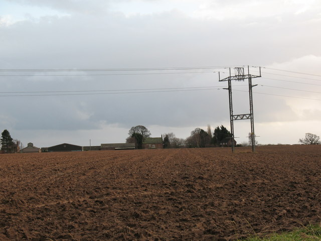
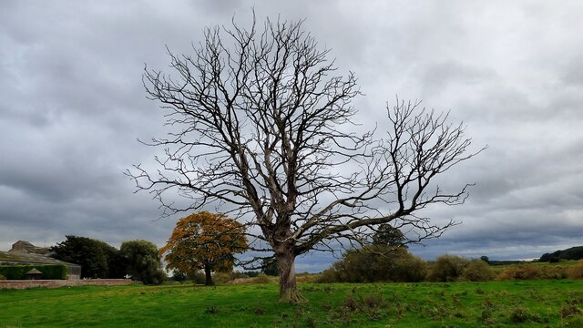
The landscape of Burton Moor is dominated by open grasslands, heather-covered hills, and scattered woodland areas. The downs provide a stunning panoramic view of the surrounding countryside, with their gently sloping hills and patches of vibrant wildflowers. The moorland, on the other hand, offers a more untamed and wild environment, with its vast expanses of open space and occasional rocky outcrops.

The area is home to a rich variety of flora and fauna. On the downs, visitors can expect to see grazing sheep and cows, as well as an array of bird species such as skylarks and peregrine falcons. The moorland, with its heather and peat bogs, attracts a different range of wildlife including red grouse, curlews, and adders.

Burton Moor is a popular destination for outdoor enthusiasts, offering ample opportunities for walking, hiking, and birdwatching. There are well-marked trails that crisscross the moor, allowing visitors to explore its beauty at their own pace. Additionally, the area is rich in archaeological sites, with ancient burial mounds and stone circles scattered throughout the landscape, providing a glimpse into the region's fascinating history.

In conclusion, Burton Moor in Yorkshire is a captivating blend of downs and moorland, offering breathtaking scenery, diverse wildlife, and a wealth of outdoor activities. It is a haven for nature lovers and history enthusiasts alike.

If you have any feedback on the listing, please let us know in the comments section below.

Burton Moor Images

Images are sourced within 2km of 54.117334/-1.3647473 or Grid Reference SE4169. Thanks to Geograph Open Source API. All images are credited.

Ploughed fields and pylons near Treble Sykes Farm.
River Swale Looking upstream on the Swale from Brafferton bridge.
River Swale
Looking upstream on the Swale from Brafferton bridge.
Road to Boroughbridge The road to Boroughbridge from Brafferton on a wet august day.
Road to Boroughbridge
The road to Boroughbridge from Brafferton on a wet august day.
Crossing cables Two sets of cables cross in the middle of this field off the Boroughbridge road.
Crossing cables
Two sets of cables cross in the middle of this field off the Boroughbridge road.
Hedge at the end of the farm track A track leads down from Thornton Manor Farm into the fields to the west, and ends near this hedgeline which runs down towards Nanny Wan; the fields are planted mainly with wheat.
Hedge at the end of the farm track
A track leads down from Thornton Manor Farm into the fields to the west, and ends near this hedgeline which runs down towards Nanny Wan; the fields are planted mainly with wheat.
Field and hedge near Thornton Manor
Track from Thornton Manor
Thornton Manor farm track
Farmland off Burton Lane
Burton Lane heading north
Beside Main Goit Farmland and fields to the east of Norton-le-Clay
Beside Main Goit
Farmland and fields to the east of Norton-le-Clay
Fields East of Norton-le-Clay
Field Corner near Norton-le-Clay Drainage channels mark the boundary of this particular field
Field Corner near Norton-le-Clay
Drainage channels mark the boundary of this particular field
Main Goit Drainage channel that serves fields to the east of Norton-le-Clay
Main Goit
Drainage channel that serves fields to the east of Norton-le-Clay
The track to Treble Sykes Farm Running east from the Milby - Thornton Bridge road.The distant church is in Brafferton, on the opposite bank of the River Swale.
The track to Treble Sykes Farm
Running east from the Milby - Thornton Bridge road.The distant church is in Brafferton, on the opposite bank of the River Swale.
Winter hedge along the road to Thornton Bridge Looking north-east, towards the distant Kilburn White Horse.
Winter hedge along the road to Thornton Bridge
Looking north-east, towards the distant Kilburn White Horse.
Dead tree at Ellenthorpe Hall
Milby, Grange Farm There is the remains of a very faint benchmark on the right hand edge of the roadside farm building of Grange Farm.
Milby, Grange Farm
There is the remains of a very faint benchmark on the right hand edge of the roadside farm building of Grange Farm.
Show me another place!

Burton Moor is located at Grid Ref: SE4169 (Lat: 54.117334, Lng: -1.3647473)

Division: North Riding

Administrative County: North Yorkshire

District: Harrogate

Police Authority: North Yorkshire

What 3 Words

///pelted.visits.otherwise. Near Boroughbridge, North Yorkshire

Nearby Locations

Milby Moor Burton Moor

Related Wikis

Humberton

Humberton is a hamlet and civil parish in the Harrogate district of North Yorkshire, England. It is situated 2 miles (3.2 km) east from Boroughbridge and...

Ellenthorpe

Ellenthorpe is a civil parish in the Borough of Harrogate of North Yorkshire, England. In 2001, the civil parish had 34 inhabitants. It was mentioned in...

Milby, North Yorkshire

Milby is a hamlet and civil parish in North Yorkshire, England. It is situated to the immediate north of Boroughbridge. == History == The Roman road,...

Thornton Bridge

Thornton Bridge is a civil parish in North Yorkshire, England, situated between Boroughbridge to the south-west, and Thirsk to the north-east. The parish...

Nearby Amenities

Located within 500m of 54.117334,-1.3647473
Power: tower
Lat/Long: 54.116069/-1.3692651
Power: tower
Lat/Long: 54.1168173/-1.3673553
Power: tower
Lat/Long: 54.1177857/-1.3647268
Power: tower
Lat/Long: 54.118388/-1.3630299
Power: tower
Lat/Long: 54.1194154/-1.360322
The data included in this document is from www.openstreetmap.org. The data is made available under ODbL.

Have you been to Burton Moor?

Leave your review of Burton Moor below (or comments, questions and feedback).