Cover Beggar Field
Downs, Moorland in Yorkshire Harrogate
England
Cover Beggar Field
Cover Beggar Field is a picturesque location situated in Yorkshire, England. Nestled amidst the breathtaking surroundings of the Yorkshire Downs and Moorland, this area offers visitors a unique blend of natural beauty and tranquility.
The field itself is characterized by its vast expanse of lush greenery, dotted with vibrant wildflowers that create a stunning tapestry of colors. The undulating terrain adds an element of intrigue and variety to the landscape, making it an ideal spot for explorers and nature enthusiasts.
Cover Beggar Field is renowned for its diverse range of flora and fauna, attracting numerous species of birds and other wildlife. Visitors may catch a glimpse of captivating creatures such as red grouse, curlews, and kestrels, among others. The field also boasts a rich history, with evidence of ancient settlements and archaeological discoveries scattered throughout the area.
The surrounding Yorkshire Downs provide a breathtaking backdrop to the field, with its rolling hills and expansive vistas. The moorland, on the other hand, offers a rugged yet captivating beauty with its wild and windswept terrain. These contrasting landscapes create a unique and unforgettable experience for visitors.
Cover Beggar Field is a haven for outdoor activities such as hiking, birdwatching, and photography. Its peaceful atmosphere and unspoiled surroundings make it an ideal destination for those seeking solace and a connection with nature. Whether exploring the vast open spaces or simply soaking in the tranquil ambiance, a visit to Cover Beggar Field is sure to leave a lasting impression on any nature lover.
If you have any feedback on the listing, please let us know in the comments section below.
Cover Beggar Field Images
Images are sourced within 2km of 54.104562/-1.4086828 or Grid Reference SE3867. Thanks to Geograph Open Source API. All images are credited.

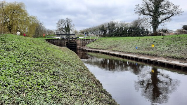


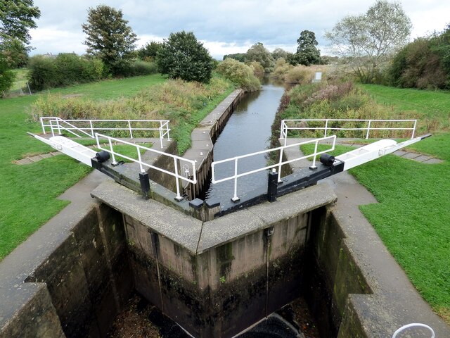
![Barge at entrance to Milby Cut The point where Milby Cut diverges from the Ure [left]to avoid the weir at Boroughbridge.](https://s0.geograph.org.uk/photos/32/99/329968_e3bd68d4.jpg)


Cover Beggar Field is located at Grid Ref: SE3867 (Lat: 54.104562, Lng: -1.4086828)
Division: North Riding
Administrative County: North Yorkshire
District: Harrogate
Police Authority: North Yorkshire
What 3 Words
///panel.alley.commuted. Near Boroughbridge, North Yorkshire
Nearby Locations
Related Wikis

Langthorpe
Langthorpe is a village and civil parish in the Harrogate district of North Yorkshire, England. The population of the civil parish taken at the 2011 Census...

Kirby-on-the-Moor
Kirby-on-the-Moor, also called Kirby, is a village in the Kirby Hill civil parish about 1 mile (1.6 km) north of the market town of Boroughbridge, in...

Boroughbridge railway station
Boroughbridge railway station served the town of Boroughbridge, North Yorkshire, England from 1847 to 1964 on the Pilmoor, Boroughbridge and Knaresborough...

Battle of Boroughbridge
The Battle of Boroughbridge was fought on 16 March 1322 in England between a group of rebellious barons and the forces of King Edward II, near Boroughbridge...
River Tutt
The River Tutt is a 8.7-mile (14 km) long tributary of the River Ure in North Yorkshire, England. The river rises near to the villages of Nidd and Scotton...
Boroughbridge
Boroughbridge ( BURR-ə-brij) is a town and civil parish in North Yorkshire, England. Historically part of the West Riding of Yorkshire, it is 16 miles...

Devil's Arrows
The Devil's Arrows are four standing stones or menhirs in an alignment approximately 660 feet (200 m) to the east of the A1(M), adjacent to Roecliffe Lane...

Vale of York services
The Vale of York services (also known as Kirby Hill services) is a future motorway service area (MSA) on the A1(M) in North Yorkshire, England. The MSA...
Nearby Amenities
Located within 500m of 54.104562,-1.4086828Have you been to Cover Beggar Field?
Leave your review of Cover Beggar Field below (or comments, questions and feedback).