Langthorpe Moor
Downs, Moorland in Yorkshire Harrogate
England
Langthorpe Moor

Langthorpe Moor is a picturesque area located in the county of Yorkshire, England. Situated on the outskirts of the charming village of Langthorpe, the moorland offers breathtaking views of the surrounding countryside and is a haven for outdoor enthusiasts.
Covering an area of approximately 500 acres, Langthorpe Moor is characterized by its rolling hills, heather-covered plains, and scattered woodlands. It is part of the wider Nidderdale Area of Outstanding Natural Beauty, renowned for its rich biodiversity and unspoiled landscapes. The moorland is predominantly composed of acidic peat soils, providing a unique habitat for a variety of plant and animal species.
Visitors to Langthorpe Moor can enjoy a range of activities, including hiking, birdwatching, and nature photography. The moorland is home to a diverse array of bird species, such as curlews, lapwings, and red grouse, making it an ideal spot for birdwatchers. Additionally, the area is crisscrossed by numerous walking trails, allowing visitors to explore the moorland at their own pace and take in the stunning panoramic views.
Langthorpe Moor is also of historical significance, with traces of ancient settlements and burial sites dating back to the Bronze Age. Archaeological excavations have uncovered evidence of human activity in the area, providing valuable insights into the region's past.
Overall, Langthorpe Moor is a captivating destination that showcases the natural beauty and cultural heritage of Yorkshire. Whether visitors are seeking tranquility, outdoor adventures, or a glimpse into the past, this moorland offers a memorable experience for all who explore its captivating landscapes.
If you have any feedback on the listing, please let us know in the comments section below.
Langthorpe Moor Images
Images are sourced within 2km of 54.11267/-1.4201318 or Grid Reference SE3868. Thanks to Geograph Open Source API. All images are credited.


Langthorpe Moor is located at Grid Ref: SE3868 (Lat: 54.11267, Lng: -1.4201318)
Division: North Riding
Administrative County: North Yorkshire
District: Harrogate
Police Authority: North Yorkshire
What 3 Words
///cemented.typist.protests. Near Boroughbridge, North Yorkshire
Nearby Locations
Related Wikis

Vale of York services
The Vale of York services (also known as Kirby Hill services) is a future motorway service area (MSA) on the A1(M) in North Yorkshire, England. The MSA...

Kirby-on-the-Moor
Kirby-on-the-Moor, also called Kirby, is a village in the Kirby Hill civil parish about 1 mile (1.6 km) north of the market town of Boroughbridge, in...

Langthorpe
Langthorpe is a village and civil parish in the Harrogate district of North Yorkshire, England. The population of the civil parish taken at the 2011 Census...

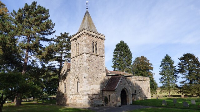
Church of Christ the Consoler
The Church of Christ the Consoler is a Victorian Gothic Revival church built in the Early English style by William Burges. It is located in the grounds...
Nearby Amenities
Located within 500m of 54.11267,-1.4201318Have you been to Langthorpe Moor?
Leave your review of Langthorpe Moor below (or comments, questions and feedback).