Harehill Moor

Downs, Moorland in Durham

England

Harehill Moor

Children's park / play area, Haswell Plough
Children's park / play area, Haswell Plough Credit: David Robinson

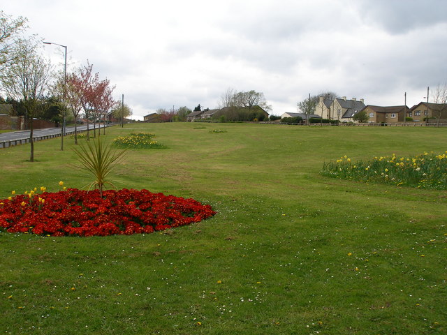
Harehill Moor, located in County Durham, England, is a picturesque area of downs and moorland that covers a vast expanse of approximately 300 acres. Situated just a few miles south of the historic city of Durham, Harehill Moor is a popular destination for nature enthusiasts, hikers, and wildlife observers.

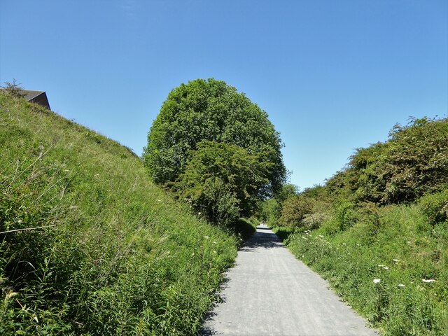
Characterized by rolling hills, heather-covered moors, and breathtaking panoramic views, Harehill Moor offers visitors a unique opportunity to immerse themselves in the natural beauty of the region. The area is rich in biodiversity, with an abundance of plant and animal species. Visitors can expect to encounter a variety of bird species, including curlews, lapwings, and golden plovers, as well as mammals such as hares and roe deer.

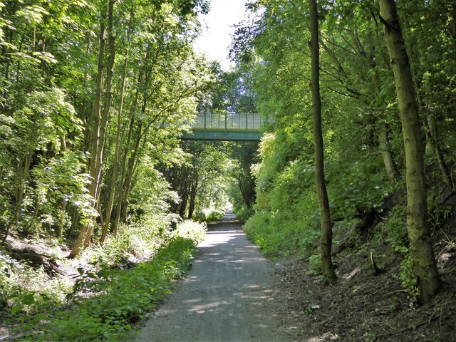
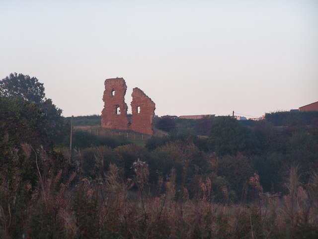
The landscape of Harehill Moor is punctuated by ancient stone boundaries and remnants of historical structures, providing glimpses into the area's past. The moorland is crisscrossed by well-maintained footpaths and trails, making it an ideal location for leisurely walks or more challenging hikes.

In addition to its natural beauty, Harehill Moor offers visitors a tranquil and peaceful atmosphere, making it a perfect escape from the hustle and bustle of urban life. Whether it's admiring the stunning vistas, observing the local wildlife, or simply enjoying a picnic amidst the rolling hills, Harehill Moor offers a serene and idyllic experience for all who visit.

If you have any feedback on the listing, please let us know in the comments section below.

Harehill Moor Images

Images are sourced within 2km of 54.762716/-1.4213869 or Grid Reference NZ3741. Thanks to Geograph Open Source API. All images are credited.

Children's park / play area, Haswell Plough
North View, Margaret Street, Ludworth The same view as <a href="https://www.geograph.org.uk/photo/2512799">NZ3641 : Main street in Ludworth</a> taken in 2011. What was then the post office has become a private house, but the wall letter box remains in the same place. The shop next door is now also the post office. When Ludworth Colliery was active this terrace had three pubs and a post office. The community centre is seen on the left.
North View, Margaret Street, Ludworth
The same view as NZ3641 : Main street in Ludworth taken in 2011. What was then the post office has become a private house, but the wall letter box remains in the same place. The shop next door is now also the post office. When Ludworth Colliery was active this terrace had three pubs and a post office. The community centre is seen on the left.
Ludworth playing field, formerly miners' housing area On the 25 inch OS map published 1919 it has rows of miners' houses on Victoria, Albert, Alexandra, Mary, Edward and George Streets. This area has a fenced basketball court on site of Alexandra Street, another basketball hoop on site of George Street, and off to the right a football field.
Ludworth playing field, formerly miners' housing area
On the 25 inch OS map published 1919 it has rows of miners' houses on Victoria, Albert, Alexandra, Mary, Edward and George Streets. This area has a fenced basketball court on site of Alexandra Street, another basketball hoop on site of George Street, and off to the right a football field.
Ludworth community centre In the former pit village.
Ludworth community centre
In the former pit village.
GR wall letter box, Ludworth It is in the wall of the former post office, next door to the present post office.
GR wall letter box, Ludworth
It is in the wall of the former post office, next door to the present post office.
Football field, Ludworth It is in the area of former miners' houses for Ludworth Colliery. The far goal posts are on the line of former Albert Street, the viewpoint is near former Coronation Street. The street names, all royal connections, are show on a 25 inch OS map published 1919, available on National Library of Scotland website <span class="nowrap"><a title="https://maps.nls.uk/view/120936696#zoom=6&lat=9323&lon=4376&layers=BT" rel="nofollow ugc noopener" href="https://maps.nls.uk/view/120936696#zoom=6&lat=9323&lon=4376&layers=BT">Link</a><img style="margin-left:2px;" alt="External link" title="External link - shift click to open in new window" src="https://s1.geograph.org.uk/img/external.png" width="10" height="10"/></span>.
Football field, Ludworth
It is in the area of former miners' houses for Ludworth Colliery. The far goal posts are on the line of former Albert Street, the viewpoint is near former Coronation Street. The street names, all royal connections, are show on a 25 inch OS map published 1919, available on National Library of Scotland website LinkExternal link.
Commercial printing works, Ludworth The premises of Whitesprint.
Commercial printing works, Ludworth
The premises of Whitesprint.
Public footpath into woods, Ludworth Ludworth school was near here.
Public footpath into woods, Ludworth
Ludworth school was near here.
Path in pine woods, Ludworth Woods planted after the colliery closed.
Path in pine woods, Ludworth
Woods planted after the colliery closed.
Mumbai Restaurant at Haswell Plough The Mumbai Restaurant at Haswell Plough was formerly the Plough Inn public house.
The original Plough Inn was located about half a mile to the east of the Mumbai at Haswell Terrace (near to the junction of Mazine Terrace and Front Street).
<a href="https://www.geograph.org.uk/photo/7342945">NZ3642 : Mumbai Restaurant at Haswell Plough</a>
Mumbai Restaurant at Haswell Plough
The Mumbai Restaurant at Haswell Plough was formerly the Plough Inn public house. The original Plough Inn was located about half a mile to the east of the Mumbai at Haswell Terrace (near to the junction of Mazine Terrace and Front Street). NZ3642 : Mumbai Restaurant at Haswell Plough
Mumbai Restaurant at Haswell Plough The Mumbai Restaurant at Haswell Plough was formerly the Plough Inn public house.
The original Plough Inn was located about half a mile to the east of the Mumbai at Haswell Terrace (near to the junction of Mazine Terrace and Front Street).
<a href="https://www.geograph.org.uk/photo/7342939">NZ3642 : Mumbai Restaurant at Haswell Plough</a>
Mumbai Restaurant at Haswell Plough
The Mumbai Restaurant at Haswell Plough was formerly the Plough Inn public house. The original Plough Inn was located about half a mile to the east of the Mumbai at Haswell Terrace (near to the junction of Mazine Terrace and Front Street). NZ3642 : Mumbai Restaurant at Haswell Plough
Shotton Recreation Ground Off Station Road
Shotton Recreation Ground
Off Station Road
Cycle path following route of former railway About to leave the last of the housing estates above the cutting at Shotton Colliery on the Hart to Haswell route
Cycle path following route of former railway
About to leave the last of the housing estates above the cutting at Shotton Colliery on the Hart to Haswell route
Cycle path following route of former railway North of Tuthill Bridge the former trackbed of the railway appears to be a stream and the path has these railings. A view on the Hart to Haswell route.
Cycle path following route of former railway
North of Tuthill Bridge the former trackbed of the railway appears to be a stream and the path has these railings. A view on the Hart to Haswell route.
Cycle path following route of former railway Approaching a high level footbridge that is the only link between two housing estates bisected by the former Hart to Haswell railway route
Cycle path following route of former railway
Approaching a high level footbridge that is the only link between two housing estates bisected by the former Hart to Haswell railway route
Informal basketball, Ludworth recreation ground The recreation ground has two sets of basketball hoops. This court doubles as a five-a-side all weather football pitch. In the photo visitors from the U.S.A. to a nearby house are playing informally against local lads.
Informal basketball, Ludworth recreation ground
The recreation ground has two sets of basketball hoops. This court doubles as a five-a-side all weather football pitch. In the photo visitors from the U.S.A. to a nearby house are playing informally against local lads.
Durham Lane, Haswell Plough
Road from Hare Hills Farm
Show me another place!

Harehill Moor is located at Grid Ref: NZ3741 (Lat: 54.762716, Lng: -1.4213869)

Unitary Authority: County Durham

Police Authority: Durham

What 3 Words

///buns.condense.emeralds. Near Thornley, Co. Durham

Nearby Locations

Hare Hill Harehill Moor

Related Wikis

Ludworth, County Durham

Ludworth is a pit village in County Durham, England situated between Durham and Peterlee. Ludworth is 6.2 miles from Durham City Centre and 5.4 miles from...

Haswell Plough

Haswell Plough is a village in County Durham, England. It is situated between Durham and Peterlee, south of Haswell. Haswell Plough was first mentioned...

Fleming Field (England)

Fleming Field is a small village in County Durham, in England. It is situated between Peterlee and Durham, next to Shotton Colliery. == References ==

Haswell Moor

Haswell Moor is a small village in County Durham, England. It is situated between Haswell and Shotton Colliery. A wind farm opened at Haswell Moor Farm...

Thornley, Durham

See also Thornley in Weardale.Thornley is a village in County Durham, in England. It is situated about 5 miles (9 km) to the east of Durham and 5 miles...

Wheatley Hill Stadium

Wheatley Hill Stadium is a greyhound racing stadium in Wheatley Hill, County Durham. It is situated to the west of Peterlee, near Thornley and Wingate...

Shotton Colliery

Shotton Colliery is a village in County Durham, England, situated north west of Peterlee. The two villages in the parish of Shotton are Old Shotton, a...

Shotton Bridge railway station

Shotton Bridge railway station was a railway station built by the North Eastern Railway (NER) on the route of the Hartlepool Dock & Railway (HD&R) as part...

Nearby Amenities

Located within 500m of 54.762716,-1.4213869
Barrier: stile
Lat/Long: 54.7658935/-1.4209767
Generator Method: wind_turbine
Generator Output Electricity: yes
Generator Source: wind
Generator Type: horizontal_axis
Power: generator
Lat/Long: 54.7628843/-1.4164854
The data included in this document is from www.openstreetmap.org. The data is made available under ODbL.

Have you been to Harehill Moor?

Leave your review of Harehill Moor below (or comments, questions and feedback).