Balcombe Lane

Settlement in Sussex Mid Sussex

England

Balcombe Lane

Junction of Crawley Lane and High Street, Near Balcombe, West Sussex The only road junction in the grid square. High Street is a rural road that runs along the top of a wide ridge (not the more common urban type of High Street). View taken from the East side. Crawley Lane is on the left, with the entrance drive to Green Trees farm opposite it.
Junction of Crawley Lane and High Street, Near Balcombe, West Sussex Credit: Pete Chapman

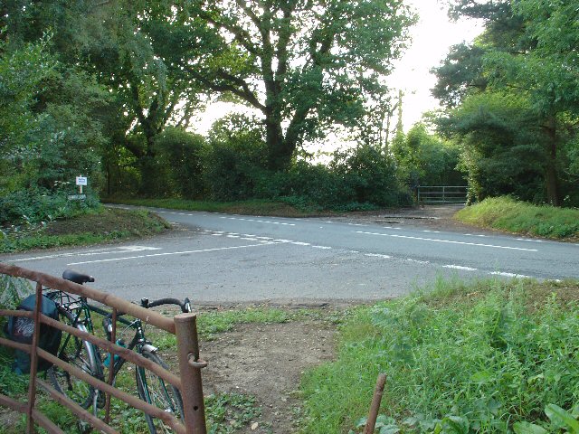
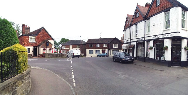
Balcombe Lane is a picturesque rural road located in the county of Sussex, England. Nestled amidst the scenic countryside, this lane is renowned for its tranquil and idyllic setting. The lane stretches for approximately 2 miles, meandering through the charming village of Balcombe.

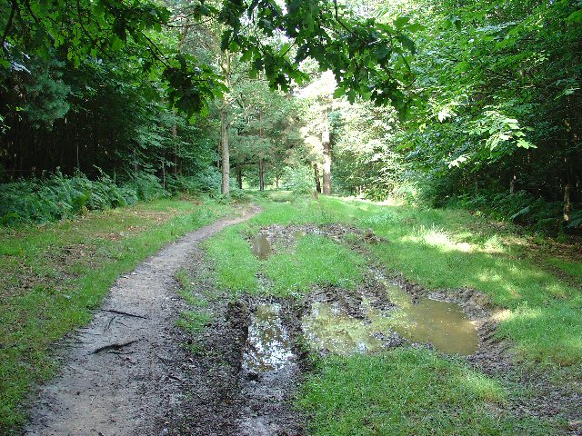
Lined with ancient trees and bordered by lush green fields, Balcombe Lane offers breathtaking views of the surrounding landscape. It is a popular destination for nature enthusiasts, walkers, and cyclists who appreciate the beauty of the English countryside.

The lane is characterized by its narrow width, which adds to its charm and gives it a sense of intimacy. Along the route, there are several quaint cottages and traditional farmhouses, showcasing the architectural heritage of the area. The presence of these historic buildings adds to the lane's character and gives visitors a glimpse into the region's past.

Balcombe Lane is also known for its rich biodiversity. The hedgerows that line the road are teeming with a variety of native plants and wildflowers, creating a vibrant and colorful display throughout the seasons. Wildlife such as birds, butterflies, and small mammals can often be spotted along the lane, making it a haven for nature lovers and photographers.

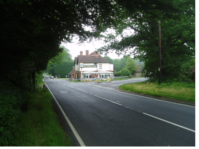
The lane connects to other roads and pathways, providing access to nearby attractions and amenities. It is within easy reach of Balcombe village, where visitors can find charming pubs, local shops, and a sense of community. Overall, Balcombe Lane offers a peaceful and picturesque escape from the hustle and bustle of everyday life, allowing visitors to immerse themselves in the natural beauty of Sussex.

If you have any feedback on the listing, please let us know in the comments section below.

Balcombe Lane Images

Images are sourced within 2km of 51.075095/-0.131103 or Grid Reference TQ3132. Thanks to Geograph Open Source API. All images are credited.

Junction of Crawley Lane and High Street, Near Balcombe, West Sussex The only road junction in the grid square. High Street is a rural road that runs along the top of a wide ridge (not the more common urban type of High Street). View taken from the East side. Crawley Lane is on the left, with the entrance drive to Green Trees farm opposite it.
Junction of Crawley Lane and High Street, Near Balcombe, West Sussex
The only road junction in the grid square. High Street is a rural road that runs along the top of a wide ridge (not the more common urban type of High Street). View taken from the East side. Crawley Lane is on the left, with the entrance drive to Green Trees farm opposite it.
Bridleway through Oldhouse Warren, Near Crawley, West Sussex. A wide (and muddy, in places) bridle route through this otherwise private area of woodland. Links Pease Pottage (via Parish Lane) to Whitely Hill.
Bridleway through Oldhouse Warren, Near Crawley, West Sussex.
A wide (and muddy, in places) bridle route through this otherwise private area of woodland. Links Pease Pottage (via Parish Lane) to Whitely Hill.
Cowdray Arms This popular pub serves food and is close to the extensive Worth Forest
Cowdray Arms
This popular pub serves food and is close to the extensive Worth Forest
Balcombe centre with the pub Balcombe is a country village with the bonus of a railway station that links it to the coast and London. Thameslink makes several stops during the day. There is a nice 'Tea Rooms' just close to this spot (closes at 5 !)
Balcombe centre with the pub
Balcombe is a country village with the bonus of a railway station that links it to the coast and London. Thameslink makes several stops during the day. There is a nice 'Tea Rooms' just close to this spot (closes at 5 !)
View to the East from Paddockhurst Lane This view is from the public footpath that runs from Balcombe to West Hoathly past Wakehurst.
View to the East from Paddockhurst Lane
This view is from the public footpath that runs from Balcombe to West Hoathly past Wakehurst.
The 'mini roundabout' To the left is the narrow twisting 'back' lane to Ardingly. Alright in the days of the horse. the corner shop is now under new ownership.
The 'mini roundabout'
To the left is the narrow twisting 'back' lane to Ardingly. Alright in the days of the horse. the corner shop is now under new ownership.
Ardingly Reservoir Next to the old Balcombe mill pond, the stream used to meander through the woods. Now the reservoir makes an inlet and the herons can search for fish.
Ardingly Reservoir
Next to the old Balcombe mill pond, the stream used to meander through the woods. Now the reservoir makes an inlet and the herons can search for fish.
Farm building 1901 The footpath passes Little Strudgate Farm building 1901.
Farm building 1901
The footpath passes Little Strudgate Farm building 1901.
Monks Forest, Near Crawley, West Sussex View taken from the B2110, looking S. This is an area of mixed woodland, with broadleaved trees (including sweet chestnut) and coniferous plantations.
Monks Forest, Near Crawley, West Sussex
View taken from the B2110, looking S. This is an area of mixed woodland, with broadleaved trees (including sweet chestnut) and coniferous plantations.
Busy rural commuter road (B2110), near Crawley, West Sussex This rural B road gets lots of morning and evening commuter traffic, due to its proximity to Crawley and the alternative that it offers to travelling through built up areas. View taken looking SW towards a double bend from adjacent to Monks Forest (on the left) The woodland to the right is Cowdray Forest.
Busy rural commuter road (B2110), near Crawley, West Sussex
This rural B road gets lots of morning and evening commuter traffic, due to its proximity to Crawley and the alternative that it offers to travelling through built up areas. View taken looking SW towards a double bend from adjacent to Monks Forest (on the left) The woodland to the right is Cowdray Forest.
Tree Tunnel on Balcombe Lane
Chalybeate Spring, Balcombe The wonderful chalybeate (mineral) spring in the woods near Balcombe village.  No matter the time of year, or how wet or dry, the spring always flows constantly. The water tastes strongly of iron.  Two ancient yew trees standing astride the path on the way down to the spring makes one wonder whether the locals long ago attributed some spiritual significance to this site?
Chalybeate Spring, Balcombe
The wonderful chalybeate (mineral) spring in the woods near Balcombe village. No matter the time of year, or how wet or dry, the spring always flows constantly. The water tastes strongly of iron. Two ancient yew trees standing astride the path on the way down to the spring makes one wonder whether the locals long ago attributed some spiritual significance to this site?
Balcombe Lake Balcombe Lake, one of the many "hammer ponds" that were created in the Weald of Sussex some 3 - 400 years ago to harness water power for the local iron industry.  Now a haven for wildlife.
Balcombe Lake
Balcombe Lake, one of the many "hammer ponds" that were created in the Weald of Sussex some 3 - 400 years ago to harness water power for the local iron industry. Now a haven for wildlife.
Cottage Drive in Balcombe This is the driveway to an ancient timber framed house located just north of St Margaret’s Church in Balcombe West Sussex
Cottage Drive in Balcombe
This is the driveway to an ancient timber framed house located just north of St Margaret’s Church in Balcombe West Sussex
Crawley Lane This is the junction of the B2036 and Crawley Lane in Balcombe West Sussex. Today seemed to be a rest day for water main replacement.
Crawley Lane
This is the junction of the B2036 and Crawley Lane in Balcombe West Sussex. Today seemed to be a rest day for water main replacement.
Car park in Cowdray Forest Just outside Crawley and away from the crowds you get in Tilgate Park <a href="https://www.geograph.org.uk/gridref/TQ2734">TQ2734</a> you can walk through the forestry plantations on the broad fire breaks.
Car park in Cowdray Forest
Just outside Crawley and away from the crowds you get in Tilgate Park TQ2734 you can walk through the forestry plantations on the broad fire breaks.
A walk in Oldhouse Warren Footpath 79W approaches Woodside on the B2110 past logging equipment on the Paddockhurst Estate. The footpath crosses the road (becoming footpath 78W) and follows Whitely Hill (road) to Whitely Hill Lodge.
A walk in Oldhouse Warren
Footpath 79W approaches Woodside on the B2110 past logging equipment on the Paddockhurst Estate. The footpath crosses the road (becoming footpath 78W) and follows Whitely Hill (road) to Whitely Hill Lodge.
Cut timber awaiting transportation Or maybe it's seasoning(?) Seen from <a href="https://www.geograph.org.uk/photo/420389">TQ3033 : Car park in Cowdray Forest</a>.
Cut timber awaiting transportation
Or maybe it's seasoning(?) Seen from TQ3033 : Car park in Cowdray Forest.
Show me another place!

Balcombe Lane is located at Grid Ref: TQ3132 (Lat: 51.075095, Lng: -0.131103)

Administrative County: West Sussex

District: Mid Sussex

Police Authority: Sussex

What 3 Words

///monopoly.proudest.pebble. Near Balcombe, West Sussex

Related Wikis

Worth Forest (electoral division)

Worth Forest is an electoral division of West Sussex in the United Kingdom, and returns one member to sit on West Sussex County Council. == Extent == The...
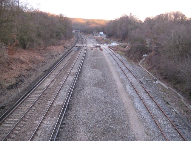
Balcombe tunnel

Balcombe tunnel is a railway tunnel on the Brighton Main Line through the Sussex Weald between Three Bridges and Balcombe. It is 1,034 metres (1,131 yards...

Worth Forest

Worth Forest is a 43.8-hectare (108-acre) biological Site of Special Scientific Interest south of Crawley in West Sussex. It is in the High Weald Area...

Worth School

Worth School is a private co-educational Roman Catholic boarding and day school for pupils from 11 to 18 years of age near Worth, West Sussex, England...

Balcombe

Balcombe is a village and civil parish in the Mid Sussex District of West Sussex, England. It lies 31 miles (50 km) south of London, 16 miles (26 km) north...

Worth Abbey

The Abbey of Our Lady, Help of Christians, commonly known as Worth Abbey, is a community of Roman Catholic monks who follow the Rule of St Benedict near...

Balcombe railway station

Balcombe railway station is on the Brighton Main Line in England, serving the village of Balcombe, West Sussex. It is 33 miles 64 chains (54.4 km) down...

Burgess Hill East (electoral division)

Burgess Hill East is an electoral division of West Sussex in the United Kingdom, and returns one member to sit on West Sussex County Council. == Extent... ==

Nearby Amenities

Located within 500m of 51.075095,-0.131103
Bus Stop
Stoney Lane
Bus: yes
Naptan AtcoCode: 4400HR0523
Naptan Bearing: S
Naptan BusStopType: CUS
Naptan CommonName: Stoney Lane
Naptan Indicator: adj
Naptan Landmark: Stoney Lane
Naptan NaptanCode: wsxawpdg
Naptan Street: London Road B2036
Naptan Verified: no
Public Transport: platform
Source: naptan_import
Lat/Long: 51.0754286/-0.1309789
Bus Stop
Yewtree Farm
Bus: yes
Naptan AtcoCode: 4400HR0879
Naptan Bearing: N
Naptan BusStopType: CUS
Naptan CommonName: Yewtree Farm
Naptan Indicator: opp
Naptan Landmark: Hail & Ride
Naptan NaptanCode: wsxdwpma
Naptan Street: London Road B2036
Naptan Verified: no
Public Transport: platform
Source: naptan_import
Lat/Long: 51.0708754/-0.1308198
Bus Stop
Yewtree Farm
Bus: yes
Naptan AtcoCode: 4400HR0880
Naptan Bearing: S
Naptan BusStopType: CUS
Naptan CommonName: Yewtree Farm
Naptan Indicator: adj
Naptan Landmark: Hail & Ride
Naptan NaptanCode: wsxdwpmd
Naptan Street: London Road B2036
Naptan Verified: no
Public Transport: platform
Source: naptan_import
Lat/Long: 51.0708648/-0.1307203
Bus Stop
Stoney Lane
Bus: yes
Naptan AtcoCode: 4400HR1153
Naptan Bearing: N
Naptan BusStopType: CUS
Naptan CommonName: Stoney Lane
Naptan Indicator: opp
Naptan Landmark: Stoney Lane
Naptan NaptanCode: wsxgdwja
Naptan ShortCommonName: Stoney Lane
Naptan Street: London Road B2036
Naptan Verified: no
Public Transport: platform
Source: naptan_import
Lat/Long: 51.0754403/-0.1311498
Post Box
Operator: Royal Mail
Post Box Type: wall
Ref: RH17 8
Royal Cypher: VR
Royal Cypher Wikidata: Q33102356
Lat/Long: 51.0736951/-0.1310653
Noexit: yes
Lat/Long: 51.073454/-0.1305538
Noexit: yes
Lat/Long: 51.0737405/-0.1316879
Noexit: yes
Lat/Long: 51.0738147/-0.1306778
Noexit: yes
Lat/Long: 51.0784623/-0.1316632
The data included in this document is from www.openstreetmap.org. The data is made available under ODbL.

Have you been to Balcombe Lane?

Leave your review of Balcombe Lane below (or comments, questions and feedback).