Broomside Field
Downs, Moorland in Yorkshire Harrogate
England
Broomside Field
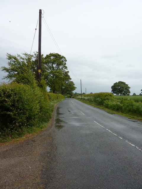
Broomside Field is a picturesque area located in Yorkshire, England, specifically on the outskirts of the North York Moors National Park. This stunning landscape is characterized by rolling hills, verdant downs, and vast stretches of moorland, offering visitors a captivating mix of natural beauty and tranquility.
Covering an expansive area of several square miles, Broomside Field is renowned for its diverse flora and fauna. The downs are adorned with a rich tapestry of wildflowers, including heather, gorse, and vibrant orchids, which create a riot of colors during the summer months. The moorland, on the other hand, is punctuated by scattered clumps of heather and bracken, providing a stark yet enchanting contrast to the surrounding scenery.
The area is a haven for wildlife enthusiasts and nature lovers alike. Visitors may spot a range of bird species, such as curlews, lapwings, and skylarks, soaring above the open fields. Additionally, the moorland is home to various mammals, including rabbits, hares, and occasionally, red deer.
Outdoor activities are plentiful in Broomside Field, attracting adventurers and walkers from far and wide. The downs offer excellent opportunities for hiking and horseback riding, with well-maintained trails that wind through the undulating landscape. The moorland, on the other hand, invites intrepid explorers to embark on exhilarating treks, providing breathtaking panoramic views of the surrounding countryside.
Broomside Field truly epitomizes the natural charm of the Yorkshire countryside, offering visitors a chance to immerse themselves in the region's stunning landscapes and abundant wildlife. Whether to seek solitude, experience outdoor activities, or simply revel in the beauty of nature, this idyllic location is a must-visit for all who appreciate the allure of the great outdoors.
If you have any feedback on the listing, please let us know in the comments section below.
Broomside Field Images
Images are sourced within 2km of 54.176425/-1.4462657 or Grid Reference SE3675. Thanks to Geograph Open Source API. All images are credited.


![Work in progress [6] In the four months since the last photo taken from this point, the road has assumed a nearly finished look with three lanes of tarmac to each side, a concrete barrier down the centre and new signs [one of which now obscures the view] in position. On this day traffic was confined to 2 lanes each way on the northbound carriageway, but a few days later both sides were open with two lanes in each direction. The short section from J49 at Dishforth to J50 [A61] is virtually complete, but sections further north still have much to be done.](https://s3.geograph.org.uk/geophotos/02/56/09/2560907_55e87bf0.jpg)
![Upgrading the A1[3] The view south from Rainton bridge showing the almost completed motorway carriageways. On this day all traffic was using the northbound lanes, but a few days later both sides of the road were open, but with two lanes in each direction and with a 50mph limit.](https://s3.geograph.org.uk/geophotos/02/56/23/2562363_b47f160d.jpg)


![Work in Progress [7] - work complete Work on the section of A1[M] between junctions 49 [Dishforth] and 50 [Rainton]was completed in mid October 2011 ahead of schedule. North of the A61 junction work was still underway to complete the service road on the west side of the motorway, with traffic still using contraflows and observing a 50mph limit. The current OS map indicates a blue dashed line for the motorway along the west side of the old A1, but this is incorrect as the general line is a few metres to the east of the old road. An excellent job done with minimum disruption to traffic.](https://s2.geograph.org.uk/geophotos/02/68/25/2682550_a3b3a4a0.jpg)
![Upgrading the A1[4] The old A1 has been transformed into a motorway and the section between junctions 49 and 50 is complete [October 2011]. Strangely, the old fast food restaurant which can be seen on the far side of the road is still there, boarded up and with no access apart from a farm track. One wonders what its fate will be.](https://s2.geograph.org.uk/geophotos/02/68/25/2682578_57d25a0e.jpg)


Broomside Field is located at Grid Ref: SE3675 (Lat: 54.176425, Lng: -1.4462657)
Division: North Riding
Administrative County: North Yorkshire
District: Harrogate
Police Authority: North Yorkshire
What 3 Words
///push.ratio.tramps. Near Ripon, North Yorkshire
Nearby Locations
Related Wikis

Rainton
Rainton is a village in the Harrogate borough of North Yorkshire, England. It is situated about 6 miles (9.7 km) north of Boroughbridge, 5 miles (8 km...

Baldersby St James
Baldersby St James is a village in the Harrogate district of North Yorkshire, England. Several notable buildings in the village were commissioned by Viscount...

Catton, North Yorkshire
Catton is a village and civil parish in the Hambleton District of North Yorkshire, England. It is situated between Thirsk and Ripon, on the River Swale...

Baldersby railway station
Baldersby railway station was a railway station serving the village of Baldersby in North Yorkshire, England. It was located on a line from Melmerby, north...

Queen Mary's School
Queen Mary's School is a private day and boarding school for girls in Baldersby Park near Topcliffe, between Ripon and Thirsk in North Yorkshire, England...
Melmerby, Harrogate
Melmerby is a village and civil parish in North Yorkshire, England, that lies 3.7 miles (6 km) north of Ripon and 0.6 miles (1 km) west of the A1(M) motorway...
Baldersby
Baldersby is a village and civil parish in North Yorkshire, England, about 6 miles (10 km) west of Thirsk and 5 miles (8 km) north-east of Ripon on the...

Melmerby railway station
Melmerby railway station was a railway station and junction in North Yorkshire, England. It had one main line going south to Ripon and Harrogate and one...
Have you been to Broomside Field?
Leave your review of Broomside Field below (or comments, questions and feedback).